
Ah, nostalgia! Thank you, I have just spent a happy ten minutes on Memory Lane!
I think you are right that, in many ways it was more complicated, but simpler in others.
The standouts for me were:
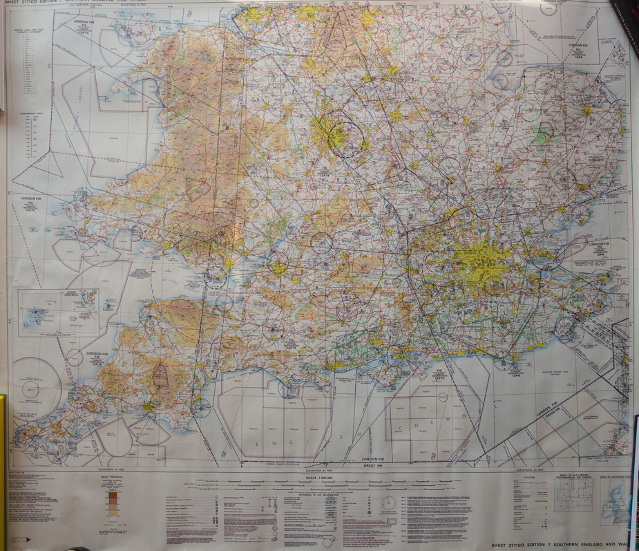
A lot of long lost airfields on that map. Ford, Leavesden, Ipswich, etc etc. On the Military side it’s been decimated; Wethersfield, Coltishall, Bentwaters, Woodbridge, the list is long.
I suspect the controlled airspace is bigger because it was designed to keep a fully loaded DC3 departing on one engine within controlled airspace.
It’s not all got worse. Turweston is marked disused on that chart.
And Spanhoe isn’t even charted (it’s where my LAA inspector is).
I’d love to see a northern England and a Scottish chart from a similar time period.
Spanhoe is ex military too AFAIK.
I went there c. 2006 and it still had the original debris covering the runway from WW2 
I have landed at Coltishall, with permission, after it closed but before the military moved out.
Peter wrote:
I went there c. 2006 and it still had the original debris covering the runway from WW2
It doesn’t any more. It has a nice grass runway and the hard surfaced runway is a part of the old peritrack and periodically swept for FOD.
I look at that chart and sigh. It reminds me of some of the airspace mess that exists today came out of that.


