Today:

(unretouched)
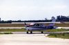
That was at 2400ft, skimming the base of the London TMA. Funny how the clouds know exactly where the base of CAS is…
Very nice piccie. On your way back from Biggin? 
Indeed – to be told I can’t fly the GPS approach because the NDB is INOP (got blown over by the wind). The DME is INOP too (got blown over by the wind). The anemometer was INOP too earlier (got blown off by the wind).
I wonder why Lydd’s (EGMD) GPS approach doesn’t need the NDB for the missed approach but Shoreham’s (EGKA) one does?
Of course one could just fly the GPS approach and report “long final” but you can’t tell that to ATC over the radio – nor can they clear you for it.
Peter, isn’t that called self positioning for a long final?
Yes. However – as with most IAPs away from mountains – the published procedure doesn’t give you anything that you would not get by simply intercepting an OBS radial representing the published final approach track and flying down it.
What you do get with a formal cleared IAP is separation from “known traffic” but in Class G that is an illusion anyway. I’ve had a number of close misses while flying IAPs in VMC. One would just rely on TCAS and hope that anybody flying in IMC without Mode C/S is a rare idiot.
Yes I guess i would prefer to intercept and fly the VTF track of the approach than an OBS radial as it will take you right to threshold but I take your point.
I’m confused (I only fly IFR in the States)…why would you need the NDB to fly a GPS approach!?
I’m confused (I only fly IFR in the States)…why would you need the NDB to fly a GPS approach!?
Because the British just won’t let them die.
I wonder why Lydd’s (EGMD) GPS approach doesn’t need the NDB for the missed approach but Shoreham’s (EGKA) one does?
The Lydd GPS approach(es) use a GPS waypoint for the missed approach hold. It looks as though there isn’t a convenient one to use at Shoreham. What’s the procedure for establishing a new GPS waypoint? Is it hard/expensive? Simply co-locating a waypoint with the SHM NDB for use with the GPS approach(es) would be a good start, so that ATC wouldn’t have to tell you the approach is unavailable despite the location of the beacon being in everybody’s GPS.