Even older: the first(?) civil chart, published by Blondel-La Rougery in the early 1920s. One of their road/tourist maps overprinted in red:

1933 Fédération Nationale Aéronatique (FNA, now FFA) map and airfield guide, still overprinted.

From a history of light aviation 1920-1942 which is good so far
I have these but travelling right now

2019 is the most recent I could find. The same section:
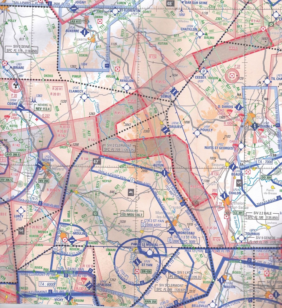
The current French VFR map is available on Geoportail
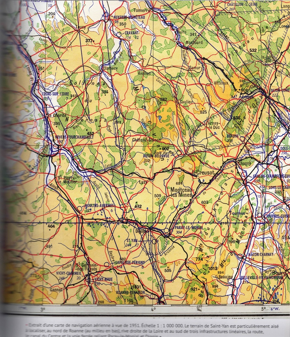
1:1,000,000 from 1951. It’s very topographical, roads-rivers-railways-forests, from when navigation was almost purely looking out of the window at surface features. Towns are just shown as dots, but they were far smaller then. Population of France in 1951 was 42 million, compared to 68 million in 2021.
Airfield and hill elevations are in metres, not feet.
Airfields aren’t easy to find, and could benefit from more contrast. Auxerre and St Yan have a star next to them – maybe radio, or tarmac, or lit runway? No radio frequencies listed. Dijon has a double circle symbol, probably denoting it as military.
Airspace isn’t clear either: a circle around St Yan (bottom middle); a semi-octangle and two teardrops centring on Dijon (top right); there’s also a y-shaped corridor running bottom middle to top left.
Edit: I’ll scan a modern 1:1,000,000 for camparison.
That appears to be an airways/TMA class A chart only.
After a closer look, I think it is not. The title neatly states “radio facilities chart”. As far as I can interpret that, it does not claim to be complete nor even accurate on aeronautical data such as airspace boundaries.
That appears to be an airways/TMA class A chart only. (or as it then was, Rule 21 airspace.)
The half mil chart would still have been recognised by modern day standards (albeit with different airspace nomenclature)
And alas as Timothy says, many more airfields present then which are no longer with us.
I started flying in 1971 and the half mil was much more complex than that.
Apart from anything else, there were many, many more MATZ and ATZ than there are now
If anybody needs more detailed data than the chart alone can provide, I can supply it