Peter wrote:
Am I right that these are printed only i.e. no electronic version?
I recall that PocketFMS has these available as an option.
I cant see an option like that on my PocketFms.
ICAO raster charts including AirMillion are available in EasyVFR by PocketFMS, but they are an additional purchase. When starting EV, on the “Agree” screen, tap “Download data”. in here you can selection “Optional basemaps” and choose which you wish to purchase and then download them.
Then on the main map, if you call up the menu, on the second page there is an option to “Set Basemap”. Here you select which basemap you want; EasyVFRs built in map or an ICAO chart that you downloaded. (Automatic setting select an ICAO chart where one has been downloaded an EV’s built in one outside the coverage of the ICAO chart).
Colm
I cant see an option like that on my PocketFms.
Posts moved here from another thread
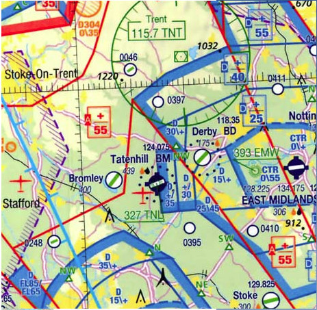
There is no 1:1M UK chart in common use but Air Million have done one, which you can find e.g. here
This is a small piece of it:
I recall that PocketFMS has these available as an option. However I don’t know anyone who uses it.
The problem with the Greek Aviation Map is the price. We tried selling it in the shop and customers drop it once we mention the price :(
Thank you. At first glance one thing that looks “missing” (quotations are on purpose, see below) are the VFR routes/alts of the Military TMAs, TANAGRA in this case. Since these are not depicted in any AIP chart this is not a problem (they are in the Military AIP though, which isn’t online but is distributed to airclubs, schools, pilots and ATCOs in Greece). Of course since they are not “public” they are not to be known by a VFR pilot, but they are almost always used by the Greek pilots (who have access to the MAIP) as they make the life of the military ATCOs easier. Greece has a lot and large Military TMAs and they have their VFR routes, not only for OAT, but for everyone else, too. Actually the VFR points are more important than the leg altitudes, as you can always request for a direct or another altitude, depending on possible military traffic. But the points themselves help with keeping VFR traffic organized, as they all speak the same language. On the other hand I can see that the VFR points of TANAGRA MTMA that correspond to towns are included as a town – Mantoudi, Psachna, Eretria).
These points are included in the Greek Aviation Map and some other apps have them, too (eg they’re in mine, too, if you click the “VFR Point” layer).
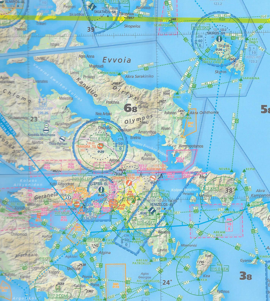
If anyone has the Greek part of the map I’d like to see a very small part of it, low resolution etc, just to see the quality.
I guess it depends on how you fly.
Purely VFR pilots like the integrated nav+map system (PFMS, SD, Jepp FD-VFR, Garmin Pilot) and it is likely that VFR is of the order of 99% of the GA community especially certain sectors.
But I fly mostly IFR when flying outside the UK. Yet, VFR charts are required for
and I am not going to pay upwards of £100/year (3x that in some cases) for that. Especially with IMHO confusing presentations in some cases, and especially knowing that I am probably about the only pilot who ventured to that country with that product this year. I just want a georeferenced VFR map, running on a tablet.
Peter wrote:
Nowadays that’s much more useful.
Why ? my experience is that most (read 99% ) of people want a fully functioning navigation system rather than a stand alone map