Peter wrote:
which would be the opposite in this caseThe opposite works as well. Over the flat sea there is less friction, the BL gets thinner, the airmass can descend and warm up, disolving the clouds.
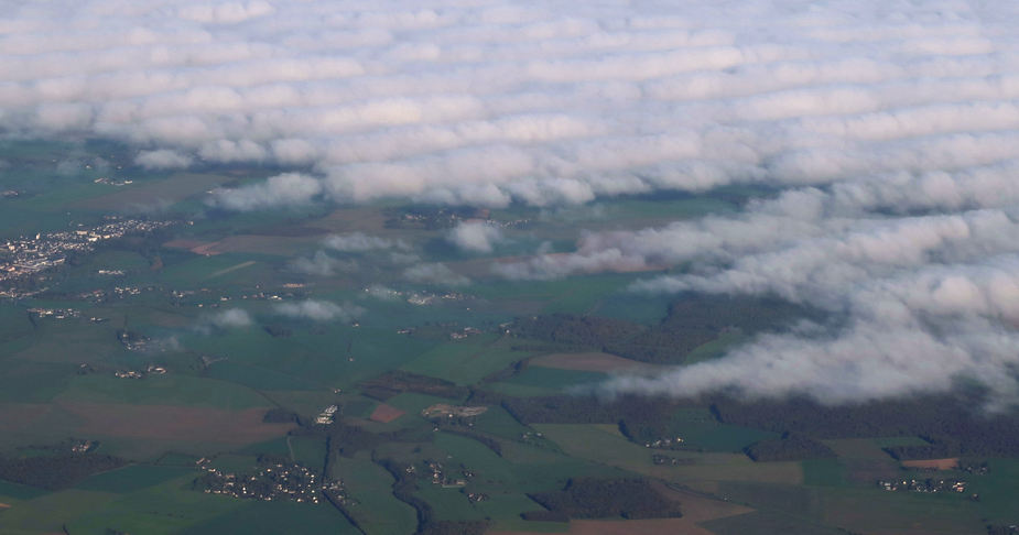
Is simply the land being warmer than the sea, so the air over the land is rising causing it to cool and clouds form?
I’ve often seen this flying over the Irish Sea. I can often first tell where the UK land mass is from the line of cloud, well before I can actually make out any land.
I’ve often flown down the UK coast, tracking along the coast line, as I didn’t want to descent yet, but over the land was a solid overcast and the sea was clear and gave an easy opportunity to descent when I need to.
If there’s a cliff at the coast, mechanical lifting of the airmass coming from the ocean. Air goes up, cools down, water condenses to clouds.
The wind direction in my OP above

which would be the opposite in this case.
2 typical effects mainly:
1.a. If there’s a cliff at the coast, mechanical lifting of the airmass coming from the ocean. Air goes up, cools down, water condenses to clouds.
1.b. even if it’s a flat coast, land creates increased friction, the boundary layer (which is a lack of flow) thickens. The airmass keeps coming from the ocean, has no place to go but up. Air goes up, cools down, water condenses to clouds.
2. The ocean surface is dark, does not heat up the airmass. The land surface is still warm, especially this fall. Classic convection somewhat inland.
Lifted fog needs an “entry point”, or it will keep the sun away and the ground will not heat to lift it. Typical fall OVC002.
Yes; could be. This was prob99 fog which just earlier lifted off to something like OVC001
Exactly. Looks like lifted fog. It can be also artificial fog to show everyone how cool is to be seaplane pilot ;)
Peter wrote:
Does anyone know the mechanism?
I don’t know the weather situation, but if I may guess. The night before was clear and cooling of the land caused radiation fog and an inversion to form. During the day the fog lifted to make a thin layer of stratus. Do you know the cloud base?
It’s not that temp over ground is cooler after night and moist air is reaching dev point then ?
@Peter all cumuliform clouds need (or make themselves) upwards directed movement in the air in order that water condenses. This is typically obtained from obstacles on ground, such as the shoreline or hills. On water there is no such obstacle.
However obstacles such as hills/mountains close to the sea may shift the position where air starts to lift far out to the sea. On the northern coast of Spain, for example, I observe this practically every time I fly there. There are mountains close to the coast, so when winds are strong, the stratocumulus may extend several 10 miles or even more than 100 miles out over the sea, but often enough clouds stop at the shoreline. So I just fly over the sea to descent there.