A lot of stuff cannot be worked out by looking at the VFR chart.
I have two candidates from the UK:
A plane crossing the boundary (as the one shows is about to do) needs to change its altimeter from QNH to 1013 and descend promptly to avoid a CAS bust.
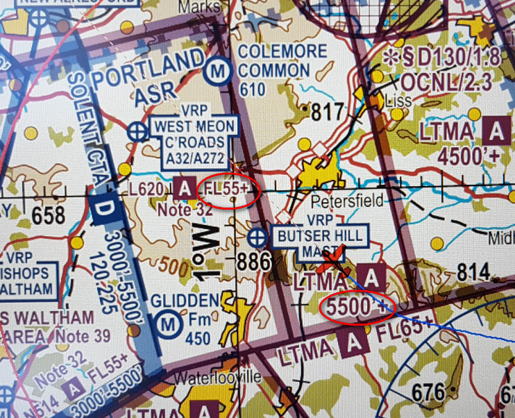
This I believe is UK’s only airspace which nobody can work out no matter how long they stare at the map 
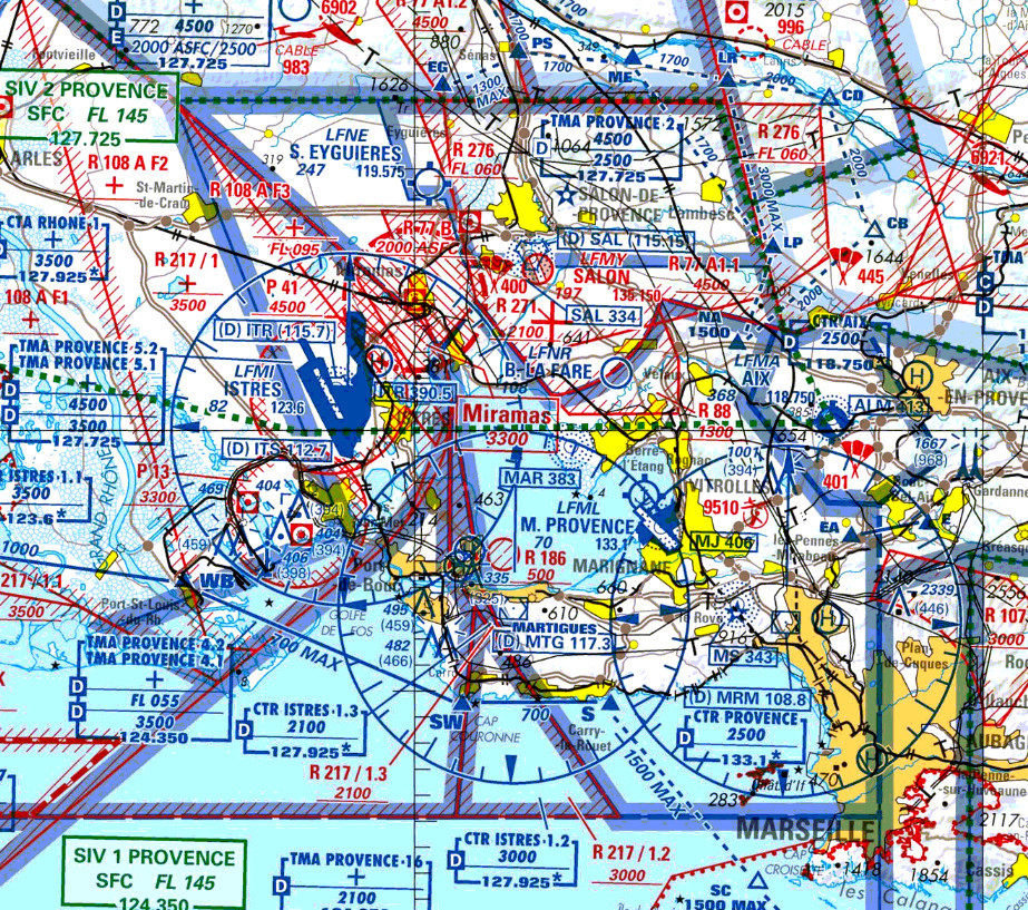
Other countries have plenty of that, especially France:
Here’s one for you

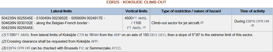
I have got a restricted zone for which the vertical boundaries are not very obvious… (cfr footnote 1)
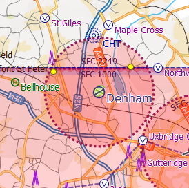
I am often amused by the area west of Chalfont St Peter, northeast of the railway line:
I mean, how often do you see an A380 in there? If only they would give Denham that fillet, to would make westerly departures a whole lot easier and safer.
For the uninitiated, the above, Denham, is a GA field within the Heathrow CTR

Timothy would i be correct in thinking that such a change has been suggested to the powers that be. Is it a well known bust spot.
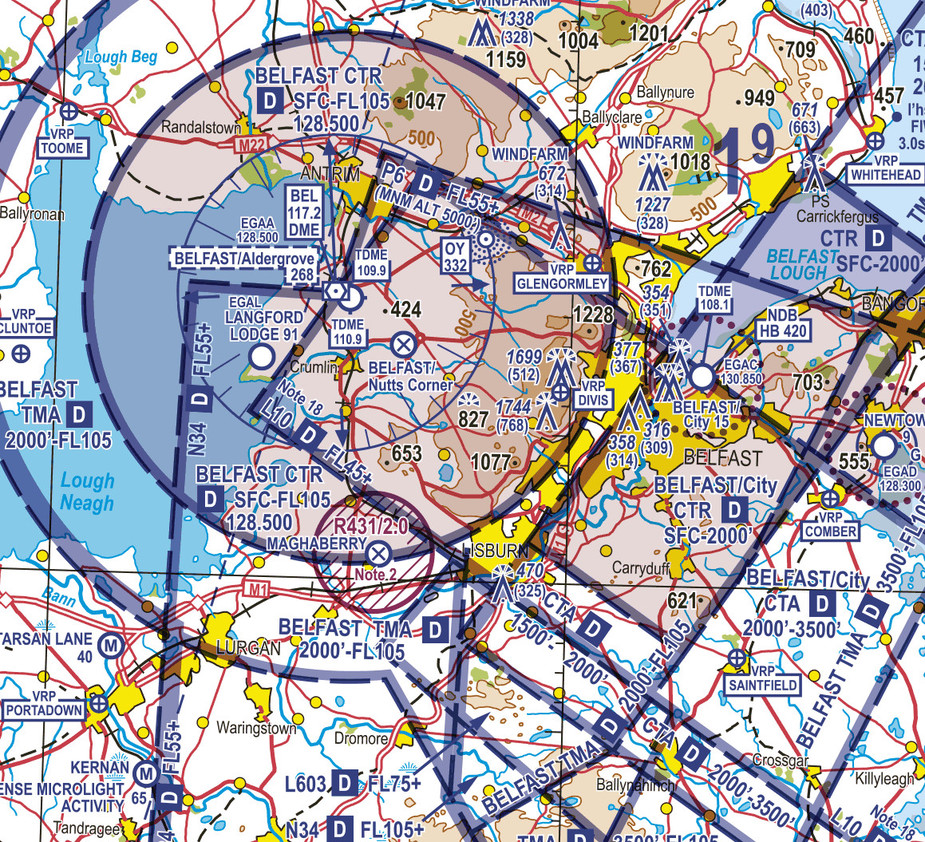
And although I’m not certain I can figure out the Belfast disaster I can have a go. The map for Provence in France I have to say I am clueless at.
I’ve said for years that EASA should introduce a standard map for the whole of Europe. No wonder 15% of all UK bust are none G reg aircraft. The maps are totally different.
Airspace like this worries me. More needs to be done to reduce infringements and examples like above really don’t help.
As to the map designs across Europe:
One of the advantages of SD. Maps look more familiar, even the funky ones.
And SD usually gets the pancaking of airspaces properly displayed as a neat stack.
Only bad if you want to cross reference against a paper map (had that last week).
That said, some of the French maps look horrible are totally irrelevant when in contact with the regional FIS / APP controller, who can give you transit clearance for almost everything: I flew right through the mess around Marseille in your first post. Got all transits on a nice coastal routing from LFMP to LFMD from Montepellier and Marseille. At the desired medium levels. Same a few days later from LFMD to EDTF – direct routing incl through an activated military zone.
The French have a complex system to scare you, but my impression so far (as a VFR flyer) is that it is fairly easy in actual use.
The problem with this being that you can’t be certain you’ll get a transit, and for some of these places there is no plan B, no matter how low you go or how much of a detour you take. That’s why in the end I always end up going IFR when I’m going to e.g. Cuers or La Mole. I realise 99.9% of the Cuers traffic is VFR so I’m just being a bit lazy.
I couldn’t agree more with there being absolutely no Plan B with these airspaces.
So why design them that way? One explanation put forward is here (the chart is not meant for flying a plane; it is just a graphical representation of the AIP) but that just shifts the question. Was there some political battle between the civiliant and the military?