
Posts moved from the Foreflight thread
Peter wrote:
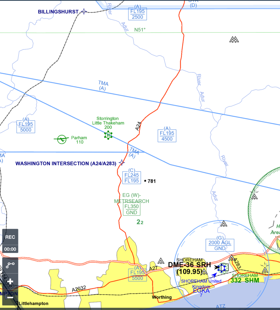
IMHO this needs to include spot elevations but I have no idea where you get that kind of data from. Of the modern products only Jepp MFDVFR has that
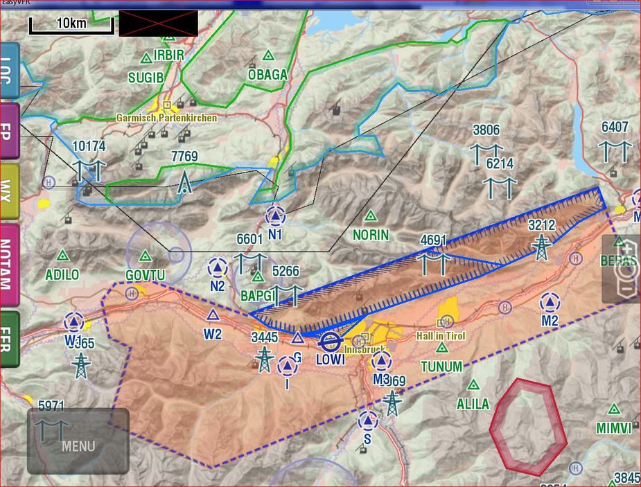
SkyDemon has spot elevations. You have to enable it in the map features as “Surface Features” → “Maximum Elevations”.
IMHO insufficient.
Peter wrote:
In terms of VFR mapdata, Foreflight seems to be around where Navbox was 15 years ago. To be competitive for VFR, they will need to show fully usable VFR charts. IMHO this needs to include spot elevations but I have no idea where you get that kind of data from. Of the modern products only Jepp MFDVFR has that and that is about 2x the price of EVFR and SD. OTOH, EVFR and SD find plenty of customers who presumably don’t need this, but it could simply be that their market is in areas of Europe where terrain is not a huge issue (perhaps Swiss etc pilots use other software?). One simply doesn’t know the customer distribution.
FF uses Jepp data for its VFR mode. It seems to have the spot elevations in it.
Vic
Sure; for VFR flight you don’t need any of this because you are VFR i.e. VMC 
However the VFR planning approach I was taught is that you plan the cruise altitude to be at MSA plus 1000ft (the MSA being the highest object within 5nm of the track). For this you need plenty of spot elevations.
achimha wrote:
SkyDemon has spot elevations.
Peter wrote:
IMHO insufficient.
First SkyDemon doesn’t have spot elevations and now that it has, they are insufficient? Can you elaborate? I know you don’t like SkyDemon but I don’t think there is much missing.
I know you don’t like SkyDemon
That’s one way of ensuring the other person isn’t going to bother to respond.
However the VFR planning approach I was taught is that you plan the cruise altitude to be at MSA plus 1000ft (the MSA being the highest object within 5nm of the track)
That’s surely for IFR. VFR allows you to fly through valleys, which do not need to be 10 miles wide.
Indeed – that is the other point of view.
Mine would be that a flight – even VFR – should be planned for a safe altitude.
So no valley flying on a nice CAVOK day?
I think I was taught (UK school) 500 ft above max elevation for route planning


