Yep FF and Google Earth work well. That CloudAhoy thing allows for a more detailed analysis of the data. Then again, it costs money…
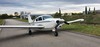
when I bought my PA28 Arrow, I spent a whole day testing it with a few friends of mine on board as “ballast” to simulate max weight.
Instead of using GPS, we attached a go pro camera to the tail tie down ring and visually checked the take off point down the runway against the known distances on the runway. Results were very accurate. It is difficult to measure take off distance using gps/software because the data points are not frequent enough to precisely know where you lift off the runway. When you film the whole thing with an external cam strapped to the underside, you get very precise measurements by watching the video and noting your location on the runway from a known point where you started to roll. We then carried on with landing distance measurements the same way. I used GPS data though to calculate best climb, best glide performance.
datapoints should be of the order of 5 per second – good enough for me.
5 per sec? that’s really good. is that with cloudahoy? That’d work though I am 100% sure not as much fun as filming it :)