LFQQ 080500Z 0806/0912 14003KT CAVOK PROB30 TEMPO 0816/0820 VRB15G25KT SHRA BKN100CB PROB30 TEMPO 0903/0909 07013KT SHRA BKN100CB
That is really high. I wonder how they arrived at that TAF. Will be interesting to see what develops.
It seems they weren’t wrong – this is the metar:
LFQQ 090500Z AUTO 00000KT CAVOK 23/14 Q1017 TEMPO VRB15G25KT SCT100CB
and a new taf with the same:
LFQQ 082300Z 0900/1006 06006KT CAVOK TEMPO 0900/0906 VRB15G25KT SCT100CB TEMPO 0915/1006 VRB15G25KT SHRA SCT100CB
Is it possible to get a lightning strike between a FL100 CB base, and ground? According to e.g. this it is clearly possible.
Peter wrote:
Is it possible to get a lightning strike between a FL100 CB base, and ground?
Absolutely.
BTW, this is not a FL100 base, this is a 10’000 ft AGL base, so potentially even higher than 10’000 ft AMSL. In the case of LFQQ that difference is marginal however with aprx 150 ft Elevation.
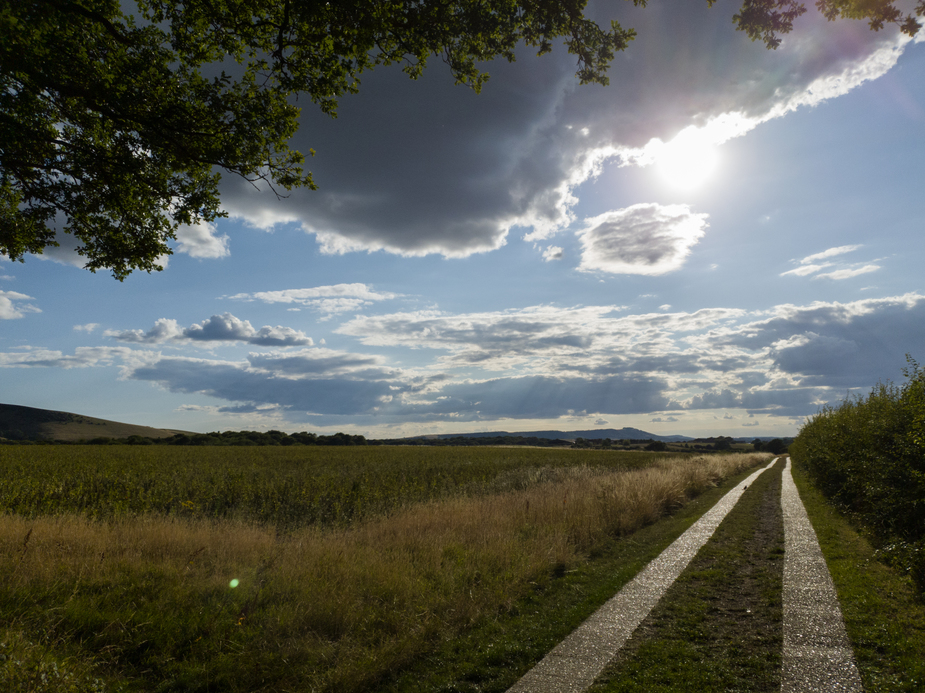
I flew past this earlier from LFAT to LFQA. The sky was CAVOK except about a 30nm stretch where you could clearly see a CB buildup from about 10000ft. A bit of deviation to the right worked out well, before clearing it and turning back on course. At one point I was getting a bit close to the Paris class A but it worked out ok. Was really odd to see a cloud like that so high.
These kind over Ile de Ré this evening (sh..t can’t upload from Android…)
Works here, S10e, Chrome
What I think doesn’t work with Android is multiple image upload in one go, although as with all these things it is likely to be browser and OS dependent.
These ones:
I’d say those are at best TCUs, no?
I don’t think there is much lightning or rain in those high altitude build outs but you will get load of turbulence and windheer, saw one last 2 weeks not a single strike on the stormscope and don’t think it got wet anywhere along, flying nearby under (slowly) was almost a non-event as long as you keep some blue above