A 61.75 Private Pilot Certificate is a FAA pilot’s certificate just like any other, except that is linked to the foreign license… but only in as much as the foreign licence needs to exist, which I understand is the case indefinitely for an existing EASA licence. No foreign license ratings currency needs to be maintained, no EASA medical needs to be maintained, and ratings can be added independently to the FAA cert. However the EASA medical is considered valid if you have one currently, as a way to help flying tourists.
Borrow an iPad Mini and use Foreflight, it is universal in the US for a reason. Or fly in an area where airspace is simple. There are plenty of places where no avionics or radios at all works fine, as well as those where you’d need better situational awareness.
FredPilote wrote:
Unfortunately, I don’t have an iPad so I’ll carry my Skydemon tablet with me and seek advice there. They must have all that is necessary for a VFR flight either on paper or in the airplane. At least for the couple of flights I will be doing.
I used Skydemon for my visit to the Los Angeles area a few years ago. It worked fine, but I was very careful double-checking TFRs with the FAA NOTAM website.
Silvaire wrote:
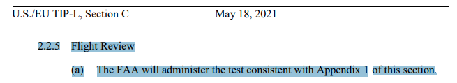
it’s probably worth noting that the FAA Flight Review is not a test
We know that, cf post 69 (4 Dec 2020) in the EASA-FAA bilateral pilot licensing treaty thread. But does the FAA?
Silvaire wrote:
A 61.75 Private Pilot Certificate is a FAA pilot’s certificate just like any other, except that is linked to the foreign license…
Yes, this is exactly what I am doing, the paperwork is on its way and it should all be done by June.
Silvaire wrote:
Borrow an iPad Mini and use Foreflight, it is universal in the US for a reason. Or fly in an area where airspace is simple.
I will take the second option, as I have found a flight school near Boston and this seems to be a quite area. I can fly near the sea but not too close to any busy airport or area.
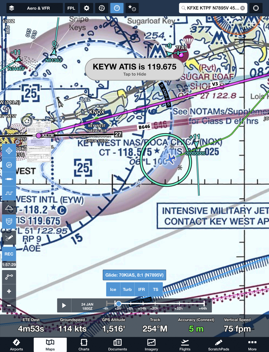
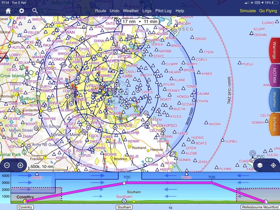
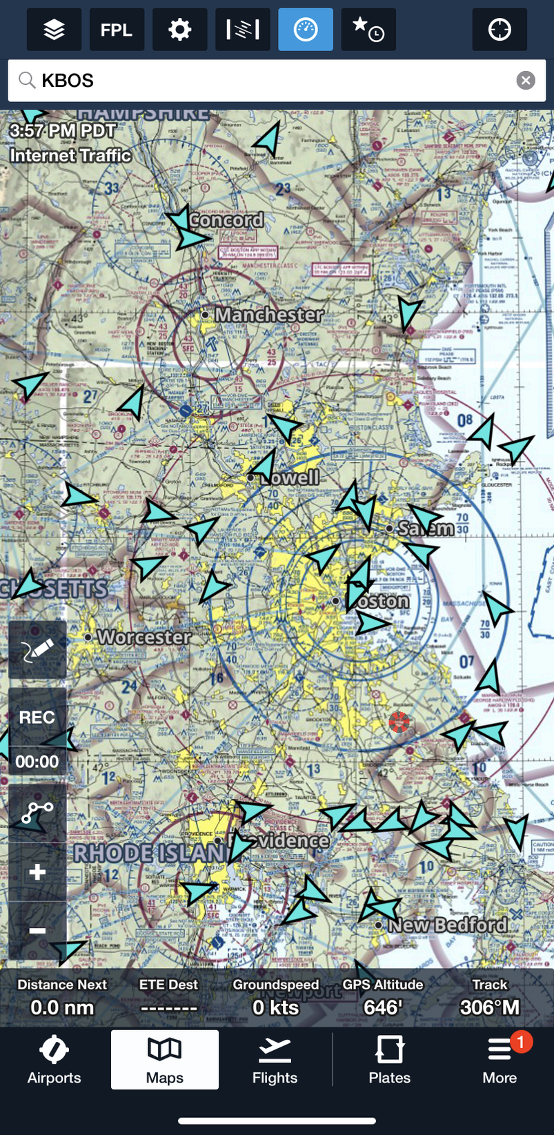
Here’s the Boston area in a) Skydemon and b) Foreflight.
The FF view shows the actual Sectional, which is what you will be expected to be familiar with. BTW, I’m not sure there are many ‘quiet’ areas around Boston!

Thanks for the charts, the SD chart seems to be easier to read, but that’s just something to get used to.
What do you mean by Sectional ? I’m not sure what is on the FF map and not on the SD map, appart from the blue lines coming from BOS and going around.
I have contacted a Norwood flight school so I might go there.
The official name for an FAA aeronautical map is ‘sectional chart’, because they cover a relatively small section of the country, and because real navigators use charts not maps 
One display option in FF is to display the actual sectional, not a vector map, and many people like it because that’s that they were trained on. They also contain a lot of useful airport and geographical info, and have been developed for a given area over many, many revisions and years. The main downside is that unless you prefer ‘north up’ (as I do) the text on the map turns with the plane and can be difficult to read.
The circular blue lines are of course Class B airspace delineations for KBOS, with altitudes shown in e.g. 70/30 format, meaning 3000 ft floor and 7000 ft top. Flight levels do not exist in the US below 18,000 ft. The Burgundy (red) lines at to the northwest and southwest are airspace delineations for nearby Class C airports.
This view from my phone shows internet traffic a moment ago, with more details if you zoom in, but airborne traffic from ADS-B is similar
One option in FF is to display the actual sectional, not a vector map
I think you can put a scanned “US sectional” (“la carte VFR”) on top of ForeFlight vectorial layer
It’s just the zoom that is messy
I’m not sure what is on FF map and not on SD map
Plenty of stuff, things like frequencies, parachute jumpers and jet fighters
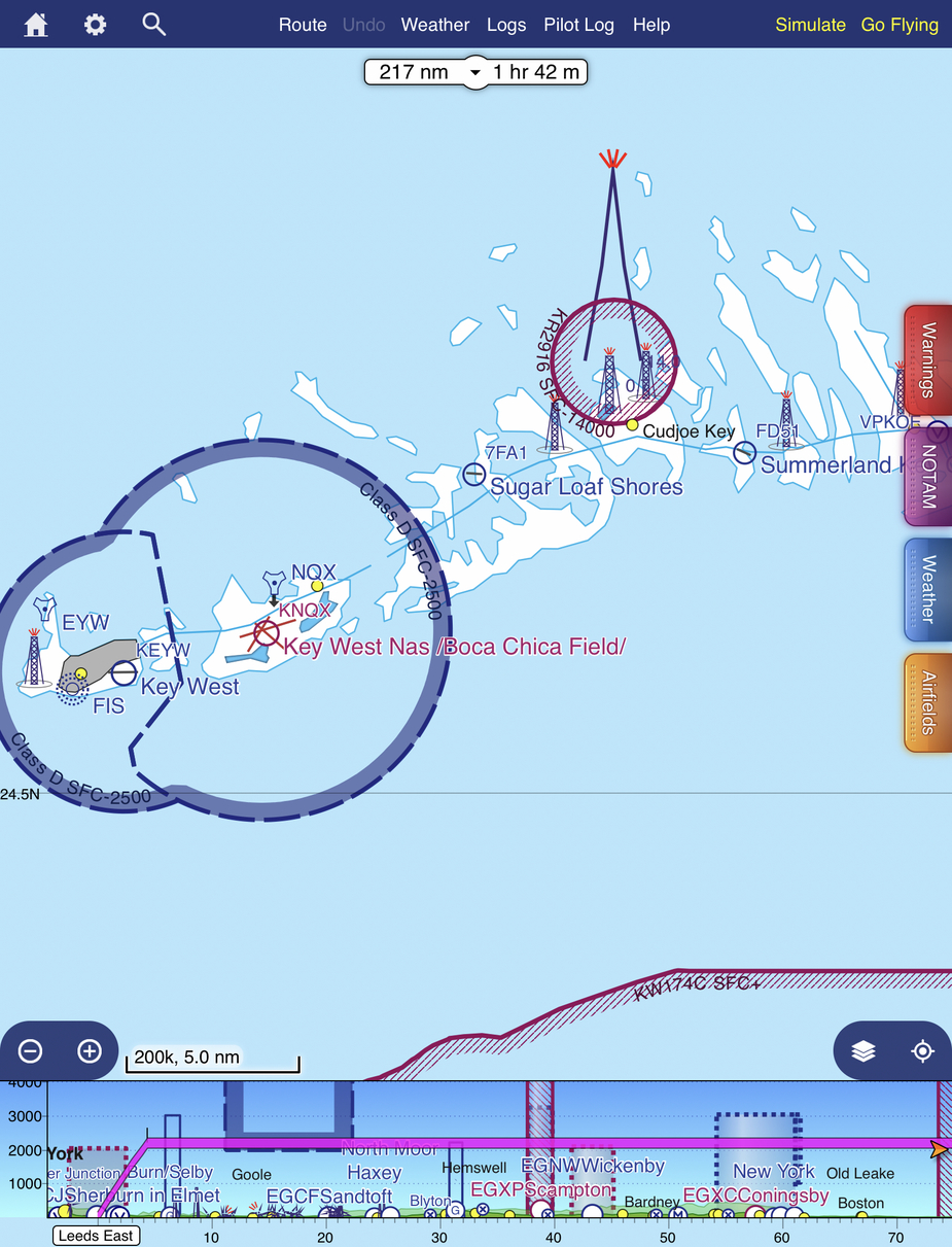
This is a comparaison near KeyWest