
According to this, AVINOR have stopped issuing paper charts ICAO 500k. It’s online exclusively. It can be found pushing the correct link here. (in the middle)
I have never used these ICAO charts, only the (much) better military M517 charts. Nowadays always never though, only SD (when it works  )
)
Anyway, I had a look at these online ICSO charts web site, and it’s not so bad. Excellent quality and one can print out sections, in chosen quality and size. A bit slow though. It can also be used online in the air on a phone through the GPS as a moving map (it seems). Of course on the PC in the evening, on a big screen, studying the map its excellent.
Many thanks for this helpful information.
Michel
LeSving wrote:
the (much) better military M517 charts
Speaking ow which These are also (exclusively) available online now, only a day or two ago. Meaning both the official for civil aviation ICAO-maps and the military M517 AIR maps are freely available in electronic version.
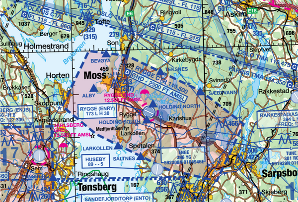
The ICAO map is obvious, it’s the official aviation map according to ICAO. The M517 is different. These are made by the air force, for the air force. Instead of 1:500k resolution, they are 1:250k resolution, hence they are much better suited for VFR (that’s what the military mainly use them for in some form or the other). They are also constantly updated and include all the “aviation stuff”.
Traditionally the ICAO maps were used when learning to fly. Then you would switch to M517 when you got the license
After the “invention” of Skydemon, I don’t see the big practical use of these maps, but they are the only official aviation maps available. They are excellent for studying on a PC, and can be printed of course. Some DIY GPS person would also find these useful I guess.
They can both be found here. However, at the club hut yesterday (with waffles ) we found there appears to be a bug with Chrome. The “button” for the M517 map doesn’t always appear. If that’s the case, then they can be found here. These are in tif format, and must be downloaded for full resolution.
Thank you for sharing this!
LeSving wrote:
they are the only official aviation maps available.
I see what you mean by the term, but from a regulatory point of view there is no requirement to use any “official” charts. The only requirement is that the charts are “suitable” and “current”. Ref. NCO.GEN.135(a)(10) There is also an AMC, but that also only explains how the terms suitability and currency should be understood in practise.
In the end, these charts are not in themselves authoritative sources of information – the AIP is. (Also, you can argue in what sense a military chart is “official” for civil aviation.)
Airborne_Again wrote:
The only requirement is that the charts are “suitable” and “current”.
Airborne_Again wrote:
Also, you can argue in what sense a military chart is “official” for civil aviation
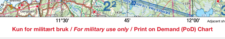
Indeed. Each of those M517 maps are marked with:
In the end, the conclusion is that these M517 maps are the most “suitable” and “current” maps available for VFR flying. Most practical they are not, but that’s another thing. I think a substantial part of this is that the CAA Norway have for a long time, and is, encouraging people to use moving map navigation applications. At the same time there are problems with this, because:
In the cold this winter I have had my pad shut down twice for instance, even with 50% power left. Not much heat in the cockpit (Rotax ). Heated up in room temperature, it works fine again. What they have said is everyone should use moving maps in general, but a fool-proof backup should also be carried. Exactly how that fool proofness is to be done? That PoD (Print on Demand) probably is a clue Practical ? not very, but doable.
Cool! Thanks for sharing.
I think they are only “official” in the sense that States are “recommended” to produce such maps by ICAO annex 4. Quotes on recommended because we all know how some states interpret recommended as almost mandatory and others as loose suggestion.
Airborne_Again wrote:
I see what you mean by the term, but from a regulatory point of view there is no requirement to use any “official” charts. The only requirement is that the charts are “suitable” and “current”. Ref. NCO.GEN.135(a)(10) There is also an AMC, but that also only explains how the terms suitability and currency should be understood in practise.In the end, these charts are not in themselves authoritative sources of information – the AIP is. (Also, you can argue in what sense a military chart is “official” for civil aviation.)
Thanks for mentioning NCO.GEN.135(a)(10). I found it interesting to learn about the requirement for aeronautical charts to be ‘current and suitable’. I think it’s important to be clear on what’s needed regarding these charts. I use the app WTF (Wings Taking Flight) to understand regulations, they’re good at simplifying things. I also found ICAO Annex 4 interesting, especially the general requirements in sections 2.1.3 (The presentation of information shall be accurate, free from distortion and clutter, unambiguous, and be readable under all normal operating conditions.), 2.1.4 (Colours or tints and type size used shall be such that the chart can be easily read and interpreted by the pilot in varying conditions of natural and artificial light.), and 2.1.5 (The information shall be in a form which enables the pilot to acquire it in a reasonable time consistent with workload and operating conditions.), when thinking about electronic maps and whether they fulfil this criteria.


