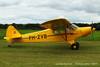
Those of us who are in charge of a grass runway may want to make it easier to find by planting grass of any color other than green:

(The grass on the picture is Imperata cylindrica, which is said to be quite hardy, though I don’t know how good it is for a runway).
Sounds like a very good reason for an overhead join
To me it sounds like a good reason to place some proper markers around the runway…
On all the grass airfields I used, there always were some markers at least at the runways corner. (I learnt to fly on a grass runway) This would definitely be the sign that you’re in the correct field. Aren’t there always such markers?I’m afraid not
It should be mandatory. At least 4 markers at the corners. I’m now surprised that there are not more mistakes.
The late Ann Welch, who had been an ATA pilot amongst many other accomplishments explained to me once how she had found airfields during WW2 ferry flights. Bearing in mind that she was doing it usually non-radio, and as often as not the airfields were camouflaged.
Ann said she’d try and find four easily found landmarks – towns, churches, road junctions, whatever: which formed a cross with the airfield at the centre. She would fly to whichever was the most convenient of the four, and then fly direct towards the opposite point of the cross whilst monitoring either side of the aeroplane for the other two points. When directly between those two points, she knew she was directly over the airfield. I’ve tried it, and it works for me as well.
That said (and I do fly to obscure grass strip airfields quite a lot) I tend to do something subtly different. I’ll generally look for an easy to find landmark that is reasonably close to my destination, and has a line feature going to the strip. I’ll then fly along that line feature on the stopwatch – I should know my groundspeed accurately enough for a quick bit of reliable mental arithmetic. If I’ve missed it, go back to the landmark again, and repeat.
(Similarly with Ann’s method, if you get to the far point of the cross, turn around, and do it again in the opposite direction).
Occasionally I have to fly back and forth a couple of times to find my destination, but both methods work reliably for me.
As for actually seeing them, use the chart and the topography to make sure you know exactly what to look for. But it does eventually get easier as your eyes calibrate to spotting grass runways. Once you’ve managed that, it’s amazing how many airstrips you keep spotting on your travels that you didn’t know where there.
G
I very rarely fly to grass or dirt strips, but if I do, I first check them out on Google Earth. It helps enormously having a visual of the area and the approach in your mind.
It does get easier when you have a few more hours.
As a newly qualified PPL I once flew from Nottingham or East Midlands with the intention of going to Netherthorpe. I flew around the area for about 15 minutes, never found it and went home!
I have subsequently managed to find it many times over the years, and now I seem to spot it passing at 5000’ and 250 kts now. 
To state the obvious its best to offset your track to the right, so that the airfield should appear just off to the left. Its very hard to spot an airfield that is under the aircraft. Otherwise I use line features and other nearby easy-to-find places to locate the field. Oddly I don’t find GPS all that useful because it takes you to where the field ought to be – and then you can’t see it. Pre-planning from a chart, or Google Map, works much better.
Oddly I don’t find GPS all that useful because it takes you to where the field ought to be – and then you can’t see it.
I always use the OBS function on the GPS to display an extended runway line to the airfield.
Works quite well. It gives me a heading to fly and a distance. By checking the “off track distance” I can figure out where downwind is.
I don’t have any problem navigating to either the extended centreline or to some “downwind” position (using the GPS moving map) but often the runway is still not visible.
There is however another class of airfields – ones I can’t go to anyway, for the most part – who don’t want to be visible. Even a windsock attracts unwelcome visitors, and runway markings are out of the question.
Good thread with some good suggestions. Fortunately at SC speeds finding a grass airfield is not too difficult, I use DR and line features and my NY resolution for 2014 will be to leave the trusty Garmin 196 at home when in the SC.
Had a good run from Andrewsfield to Cromer and back, today, with several grass airfields along the way. Cromer/NorthRepps International is very well maintained and in a beautiful location – very friendly crew, although only by ’phone as they were away from the airfield this afternoon.