
Some advertisement for my employer. Will this reach our modest SEP world before we are too old to fly?
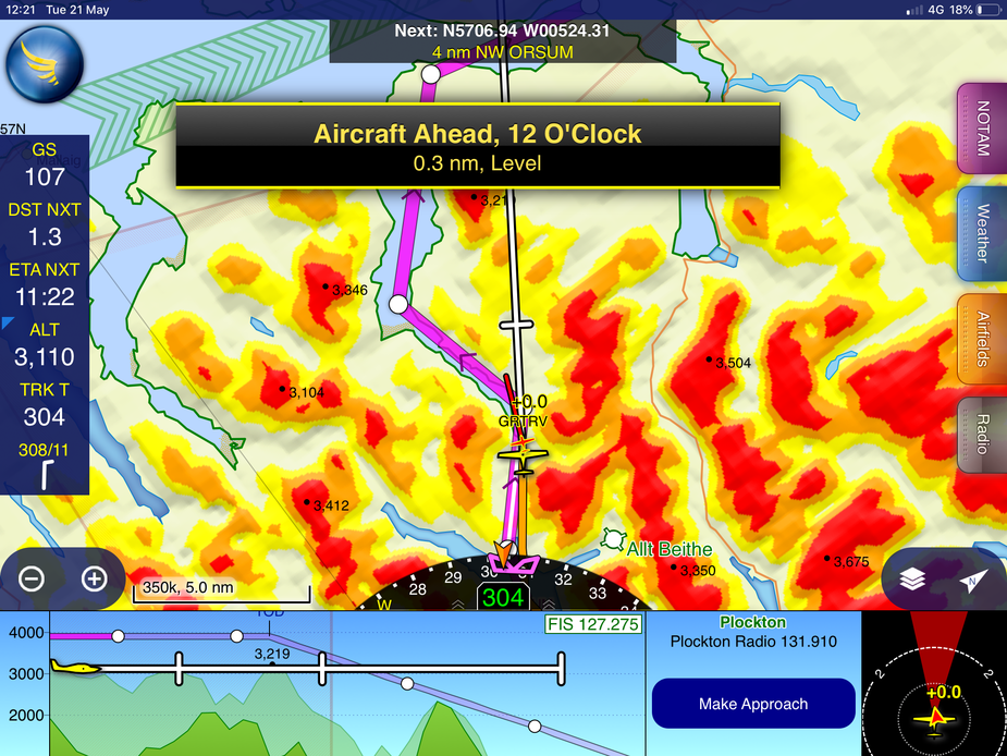
Tomw posted on 4/1/2020. The magenta line goes down Loch Hourn. I’ve flown that, VFR, a few times.
I’ve also got more experience there in a canoe, and a 30’ fishing boat, in poorer weather. Strong SW wind forecast, loch calm in the narrow bits, sudden squalls, hitting the surface and raising spray. Maintaining altitude ( and attitude) in GA aircraft on the downdraft side would be impossible.
( The post order in this thread is mixed.)
You can. Foreflight have had it for a long time. But to be effective you need an AHRS source.
Screenshot of FF with AHRS.
Peter wrote:
The whole SRTM package for X-Plane came on several DVDs
One of the big things with the SRTM package is that it needs massive post processing before you can use it for this kind of thing. And then it depends what resolution you want and there are loads of ways to reduce data quantity without loosing resolution, all of which are very big programming tasks. e.g. you can eliminate a lot of grid points in flat lands, in valley bottoms e.t.c. or on mountain slopes where they form a near straight line e.t.c, but this is high science to do. There are several products out for flight sims which all have required lots of work to implement. I know one where they actually manually corrected scenery around airports for hundreds of locations. The result is fantastic, but whether this kind of resolution can go into a tablett or let alone SV is questionable.
Peter wrote:
What I don’t understand is why we cannot have really good SV on a tablet.The whole SRTM package for X-Plane came on several DVDs (when I bought it, maybe 15 years ago, when the kids were small) and today’s tablets routinely have 128GB so ~100GB of data storage. And plenty of CPU power, too.
You can have X-Plane on a tab since many years. It should be possible to feed it GPS data (in theory, from the tab or elsewhere), and you have a really good SV. Maybe someone already has done it?
Peter wrote:
What I don’t understand is why we cannot have really good SV on a tablet.
You can. Foreflight have had it for a long time. But to be effective you need an AHRS source.
To @Snoopy’s points earlier though, it is going to be hard to add the tablet to an actual IFR scan while going missed in mountainous terrain.
https://foreflight-www.s3.amazonaws.com/assets/eu_synthetic_vision_600x440.jpg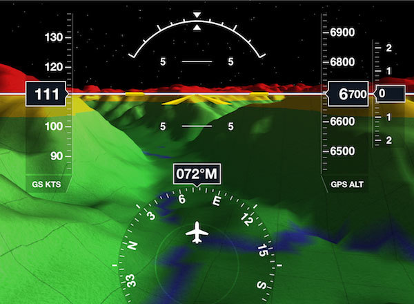
What I don’t understand is why we cannot have really good SV on a tablet.
The whole SRTM package for X-Plane came on several DVDs (when I bought it, maybe 15 years ago, when the kids were small) and today’s tablets routinely have 128GB so ~100GB of data storage. And plenty of CPU power, too.
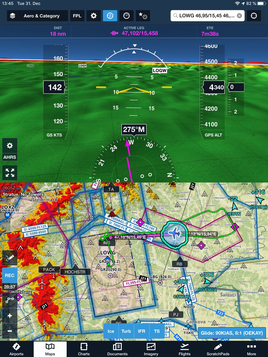
Its not what I would call synthetic vision, but this is the SD mad display flying down a valley. High terrain is coloured. BTW I’m flying with the aircraft shown on the display. What I would call synthetic vision is more what is shown in Jason’s post. FF will give that sort of display on a tablet, if its driven by an ADHARS.
And I’ve just realised I was looking at the wrong post above by Mooney. Sorry I misunderstood.
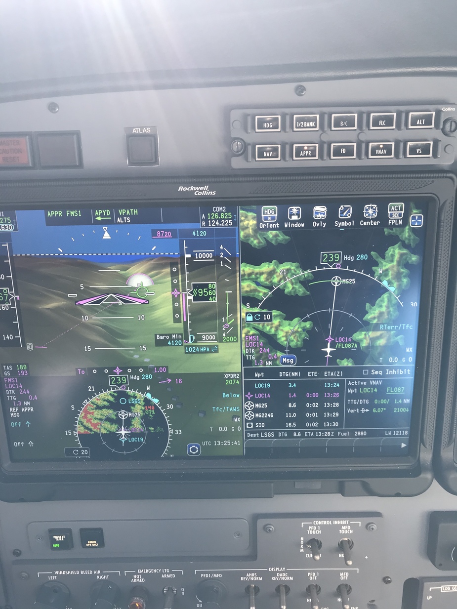
Proline fusion PFD. SV, Terrain on HSI and relative terrain on map. Into Sion.


