
@Snoopy
There might be a lot of truth in what you are saying regarding information overload.
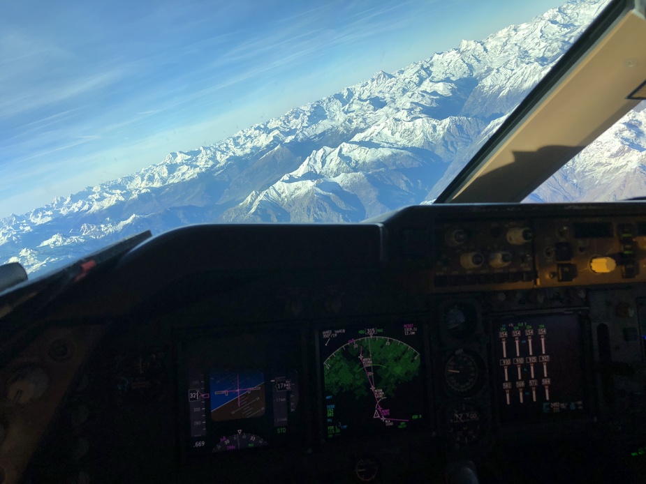
For comparison a B747-8 sample of the TERR mode on the ND on departure in ANC:
Well obviously this had to do with the Zell thread, yet I would like to explore it a bit outside that envelope too.
It would be interesting to see for instance what the display and the real world outlook looks like in side-by-side shots.
I agree, to fly using the terrain display only would need training, but to my knowledge that is not allowed anyway so far.
yet, looking at the accident, i would have thought that SVT if present would have shown the way “out” pretty clearly? It would be interesting to actually see what the display would show there.
So far I do not have SVT in my Aspen but I have been musing about paying up and getting it for a while. It costs USD3k to unlock however and for VFR I never felt the need. If I flew IFR over the mountains, then I guess it would be a very valid step.
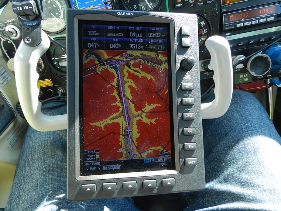
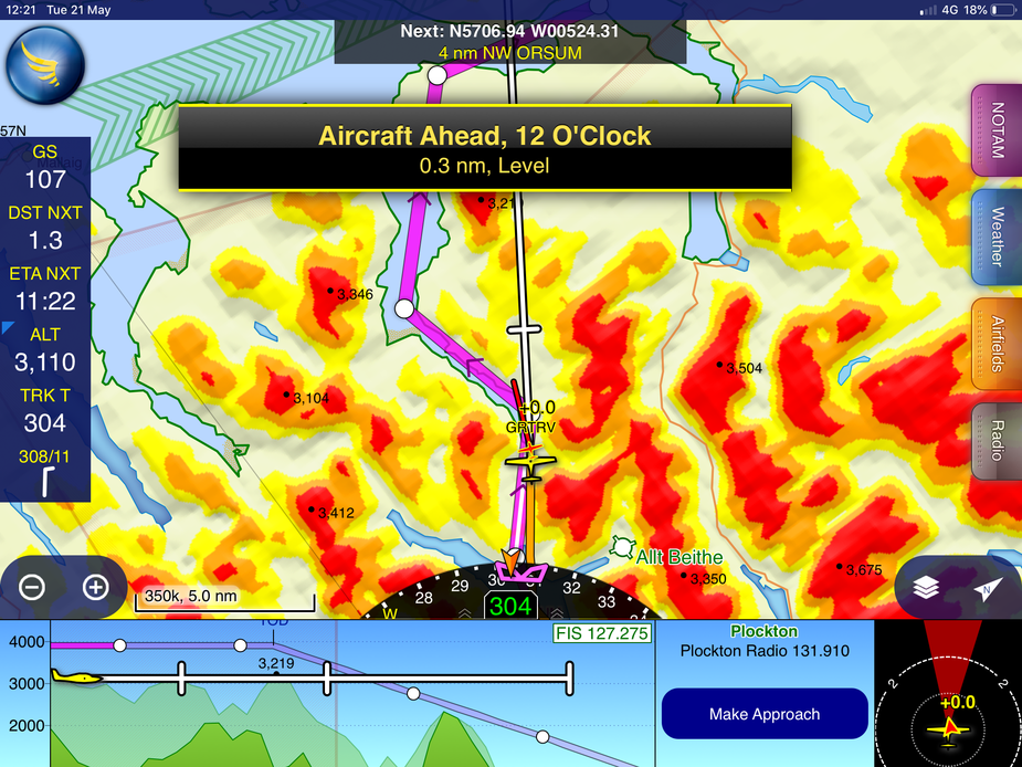
This is what I see on the 695 flying out of Samedan. No question it would be helpful in case we lost outside reference at this stage. I suppose SVT would be even more so?
I suppose SVT would be even more so?
I think if I needed to use typical GA SV for terrain avoidance I would have one foot in the grave.
The “high resolution” terrain database in Garmin Pilot is 5 arc seconds or 500 feet. The GTN650 North Atlantic terrain data is 2.5 arc second resolution.
When manoeuvring VFR to land in the hills we may need to pass within 30 feet of terrain, for which purpose neither of the above is much of a substitute for being able to see out of the window.
For en-route IFR situational awareness in complex topography I do sometimes use the Garmin Pilot 2d terrain chart (although the GTN’s terrain data is higher resolution, its 3-colour terrain legend is not SERA-compliant). For this purpose I find the 2d chart much better than SV, which doesn’t really show the available corridor width.
SV is somewhat more useful for practicing zero/zero landings and take-offs on big runways, because the navigation databases are several orders of magnitude more accurate than the terrain databases.
These are all based on the Space Shuttle SRTM data which was generated by NASA in the 1980s. The accuracy varies according to where you are. There is much online e.g. here and in some parts of the world it isn’t very good. I also recall that some (basically 3rd World) countries objected to the publication of this data and got the accuracy reduced.
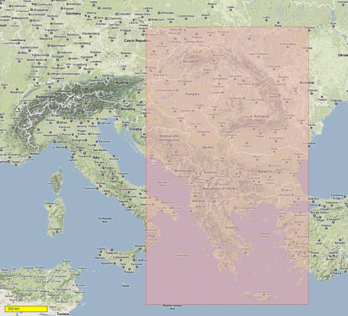
For “emergency escape” purposes (basically, an engine failure above the Alps, with a layer of IMC below) I fly with this 2D representation when crossing the Alps
which was DIY captured from Google Terrain some years ago, using MOBAC (Mobile Atlas Creator), to produce a data set which just for the Alps came to about 50GB. After processing for display on the Oziexplorer generic GPS moving map program (comes in Windows and Android versions) this reduced to about 5GB. e
I also have another data set for this region east of the Alps
There is no way to run the above on any panel mount product. And it isn’t 3D, so not really “SV”. You can capture 3D data from Google Terrain, I think, but it would be a lot bigger.
Google (and everybody else serving online maps) has been gradually implementing the blocking of bulk data downloads and they may have blocked this by now. However if anybody wants it, I can mail them a DVD, etc.
Posts merged into an existing thread on the same topic.
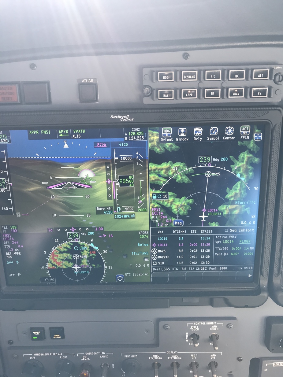
Proline fusion PFD. SV, Terrain on HSI and relative terrain on map. Into Sion.
Its not what I would call synthetic vision, but this is the SD mad display flying down a valley. High terrain is coloured. BTW I’m flying with the aircraft shown on the display. What I would call synthetic vision is more what is shown in Jason’s post. FF will give that sort of display on a tablet, if its driven by an ADHARS.
And I’ve just realised I was looking at the wrong post above by Mooney. Sorry I misunderstood.
What I don’t understand is why we cannot have really good SV on a tablet.
The whole SRTM package for X-Plane came on several DVDs (when I bought it, maybe 15 years ago, when the kids were small) and today’s tablets routinely have 128GB so ~100GB of data storage. And plenty of CPU power, too.
Peter wrote:
What I don’t understand is why we cannot have really good SV on a tablet.
You can. Foreflight have had it for a long time. But to be effective you need an AHRS source.
To @Snoopy’s points earlier though, it is going to be hard to add the tablet to an actual IFR scan while going missed in mountainous terrain.
https://foreflight-www.s3.amazonaws.com/assets/eu_synthetic_vision_600x440.jpg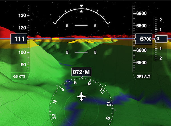
Peter wrote:
What I don’t understand is why we cannot have really good SV on a tablet.The whole SRTM package for X-Plane came on several DVDs (when I bought it, maybe 15 years ago, when the kids were small) and today’s tablets routinely have 128GB so ~100GB of data storage. And plenty of CPU power, too.
You can have X-Plane on a tab since many years. It should be possible to feed it GPS data (in theory, from the tab or elsewhere), and you have a really good SV. Maybe someone already has done it?


