
and the funny thing is that the wind direction would not change much even later
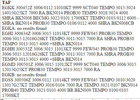
Here is the MSLP
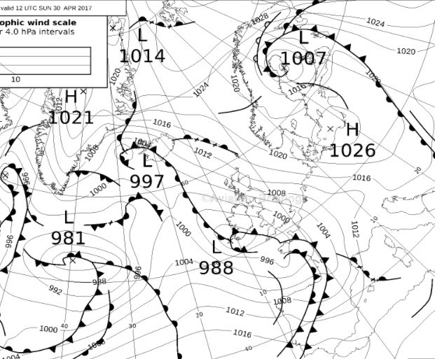
MSLP is obviously consistent with radar. Surface winds are determined with pressure difference between high and low while Coriolis force influences winds at hight combined with system of lows and highs resulting in moving front. That’s how I understand this 
I must be missing something. To me, the reported and forecast surface winds seem consistent with the MSLP.
I think it’s not all that rare. On a recent-ish flight from LFAC to EDDN smoke and wind turbines indicated a surface wind of 5-10 kts on the nose. Meanwhile, at FL70 I had a (much appreciated in a Maule) 20-30 kt tailwind – almost 180 degrees opposite to the surface wind. This was over a flat-ish part of Belgium.
I don’t recall whether this was predicted, but at risk of drifting this thread, why don’t we do PIREPs for wind and cloud base/tops in Europe?
Peter.
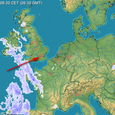
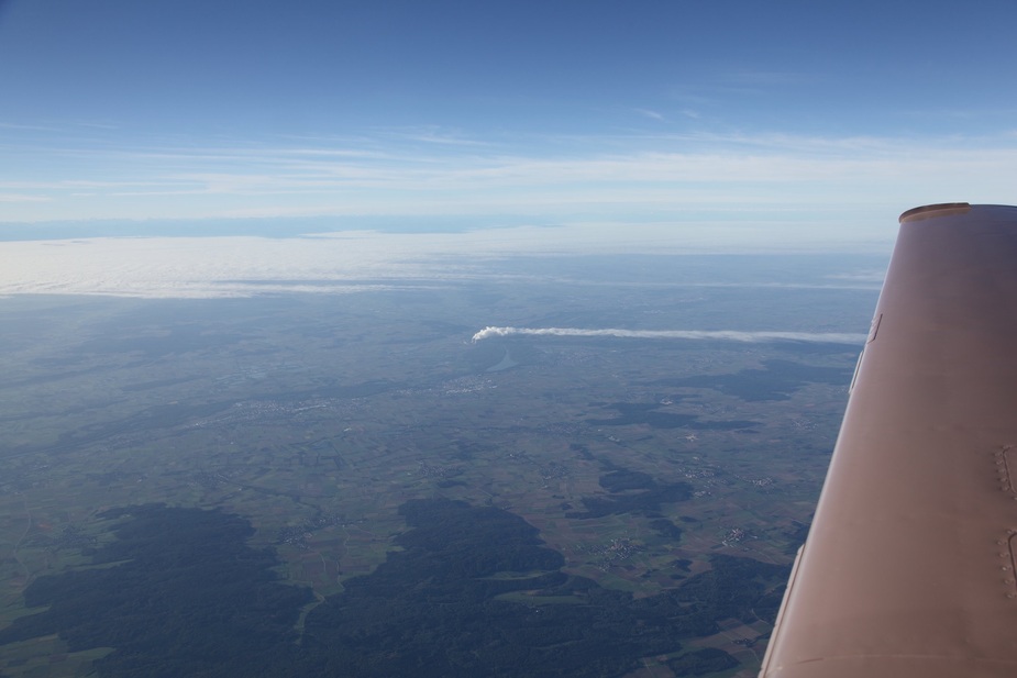
This was four years ago, I think. We had a nice little tail wind of 15 knots:
But on the ground wind was directly opposite:
I still remember the climb was quite bumpy without any clouds.
Fairly common where I fly.
Makes for great round trip times! Go low one way, high on the way back. Always in a tailwind.
Clearly this does happen but what is the mechanism for producing opposite winds across just a few thousand feet of altitude?
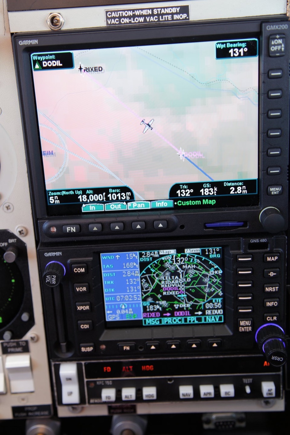
Obviously a veering Wind:
This happens often in coastal areas with a hot hinterland. Typical is Casablanca Anfa. In the afternoon a cool westerly sea breeze of about 15kt undercuts the prevailing north easterlies of 20kts-30kts. The line occurs often about 2500ft a change from a 20kt headwind to a 30kt tailwind with a temperature increase of as much as 15deg. If you don’t know what’s happening it is quite alarming. The effect peters out about 20 miles inland.
Another classic example is the Rhone valley where surface mistrals differ from upper air wind, although not 180deg different.
Sure; I have seen this often on the beach, seeing an offshore cloud motion and onshore wind, etc.
What surprised me in this case is that it was over such a wide area – the whole southern UK I think.