That is simply the way European culture works. When it is about flying, and about which buttons need to be pushed when, and where you (and your pax) could theoretically die if you do this the wrong way, then this can’t be fulfilled by some informal, voluntary training “as you go”. It must be in the form of a strurctured rating, qualification, or endorsement.
Peter wrote:
I don’t have a SUSPEND button…
Neither do I. The box suspends itself automatically. You UNsuspend by pushing the appropriate button.
If the KLN94 Pilot’s Guide is to be believed, you do this by pressing the Direct-to and ENT buttons in sequence.
boscomantico wrote:
When it is about flying, and about which buttons need to be pushed when, and where you (and your pax) could theoretically die if you do this the wrong way, then this can’t be fulfilled by some informal, voluntary training “as you go”. It must be in the form of a strurctured rating, qualification, or endorsement.
For the record, I’m not arguing for PBN training at an ATO. What I’m arguing for is that pilots should read up properly on PBN operations before attempting them. As GA_Pete notes, it is clear from this discussion that not all do.
Maybe I look at it slightly differently because nearly all my IFR flight is in an aircraft without an autopilot
Nothing to do with autopilot, it’s the navigator sending VLOC/GPS to your HSI/CDI and you are flying what is there
Of course, you can fly without all of that (as you do in NDB with ADF while reading paper plates or HDG in SRA/PAR while ATC is watching for you), you can even legally descend bellow MSA to some MDH, let’s say 500ft above highest obstacle in 25nm radius if 0.3nm needs training and/or courage and climb from there again on any random heading you like, using whatever magical tools you like: compass & stopwatch, or flying one single heading, or SkyDemon or crystall ball…in the big scheme of things, if you know what you are doing with these magical tools, it’s probably way safer than attempting to blindly follow PBN guidance without proper read/training on how to setup/execute and RNP, historically, people failed to fly sensible heading after they badly setup and/or executed an RNP approach, maybe it has to do with lack of tech mind? or old age? so everybody will now have to see an ATO to learn about flyover/flyby…
The question: would you call any of this “flying EGBJ RNP Rwy27”? we have to look really hard to find someone who would consider “flying altitudes & tracks from paper/tablet plate” the same thing as “flying RNP on navigator”, even if we all agree the two are the same during flight execution…for start you will check database against plates, read your minima and throw plates paper and/or tablet away 
For the record, I’m not arguing for PBN training at an ATO. What I’m arguing for is that pilots should read up properly on PBN operations before attempting them. As GA_Pete notes, it is clear from this discussion that not all do.
As usual, I agree with you.
However, even if you get this generic PBN knowledge, it will still not be sufficient. On top, you still need a lot of navigator-specific knowledge to competently and safely fly RNP procedures in minimum conditions. If not, then the generic PBN knowledge will not help much. And since it is impossible to mandate/structure equipment-specific training, this will always be lacking amongst private pilots, rendering the generic PBN knowledge useless, to a degree.
So do I.🙂
Being proficient with PBN is equipment specific mostly I think, having an EHSI or still classical HSI or not etc…I am very good in handling my KLN90B on an LNAV approach put me in a G1000 or even IFD I would struggle to say the least….This suspend or unsuspend is a very bad terminology IMHO of GARMIN to indicate sequencing or NOT. On the old KLN you have the missed approach but you need to restart the sequencing (selecting the missed point and enter, enter etc… :-) after missed ….depending on your AC climb performance…
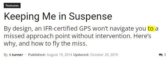
Great article:
https://www.aviationsafetymagazine.com/features/keeping-me-in-suspense/
And me :-)
But what is actually useful in the theoretical material (the PPL/IR manual contains loads of interesting stuff, but most of it doesn’t need to be known) is quite limited. It’s mostly a case of know your kit. If you know your kit then you’ll generally be fine, regardless of your grasp of the theory. Knowing the theory but not knowing your kit is a recipe for a mess. Rather like what @boscomantico is saying. Being something of a geek, I am now reading the PPL/IR manual in full and have watched all of the video that @RobertL18C posted.
Ibra wrote:
it’s navigator sending VLOC/GPS to your HSI/CDI and you are flying what is there
Well, there are actually different ways to fly using a GPS beyond following the command instrument (whether a ‘real’ one or the one the box creates on the screen). Some people look at the moving map, with or without a course-projection line, others look at their track (course-over-ground, or track-made-good if you’re from a sailing background.)
For an enroute leg of non-trivial length in the TB10 (GTN650Xi, G5) I have actually found that the easiest method (for me, YMMV) is to, upon beginning the leg, steer so that the DTK and TRK fields read the same value and then just concentrate on flying wings level. I then scan those values fairly often and if the TRK value deviates from what it ought to be (by only a single degree) I nudge it back with the lightest of touches on the controls. Having experimented, I find I can fly a very accurate course this way much more easily than I can by reference to either the HSI (G5) as a command instrument, or the graphical command instrument in the GTN.
Since we got the new avionics fitted, I am a little surprised to find myself not really using the G5 as a primary navigation reference (in HSI mode) while enroute, but that’s the way it’s worked out. Analysing tracks in SkyDemon shows that my adherance to course is far, far better when referencing the course/track as a number on the GTN that when following the HSI. The primary benefits of the G5 (for me) are now when flying an ILS (or RNP :) and just to have a heading reference that doesn’t drift like crazy. I often switch it to PFD mode when enroute.
In the Vagabond where I have only SkyDemon, my preferred reference is the the projected-course pointer – I just look to keep it pointing straight down the magenta line. Though in this aircraft I am not often flying in a fashion that demands adherence to a particular course.
Ibra wrote:
The question: would you call any of this “flying EGBJ RNP Rwy27”? we have to look really hard to find someone who would consider “flying altitudes & tracks from paper/tablet plate” the same thing as “flying RNP on navigator”, even if we all agree the two are the same during flight execution…for start you will check database against plates, read your minima and throw plates paper and/or tablet away
Of course, that’s the question. Much like we used to say we were ‘flying the NDB’ when really we’d loaded the GPS overlay on the 430 and were flying that. If I do what I described (not entering the waypoints myself, but just positioning per the plate – the whole thing can be done with nothing more than DCT EGBJ entered) then I may not have ‘flown the RNP’ as we would now describe it, but I have certainly passed all the right points at all the right altitudes just as surely as if I’d activated the approach and flown with reference to the command instrument. How does this really differ from what we used to do with NDBs?
Airborne_Again wrote:
just remember to set the CDI scaling to 0.3 NM
You don’t really even need the CDI. Those of a certain generation are quite comfortable with nothing more than a moving map, and of course you do need the scaling on that to be appropriate.
Airborne_Again wrote:
As you suspected, it is illegal in more ways than one.
Interesting – is there a reference to where in regulations it says you must load the approach in the box and use the various features? I thought the point of PBN was that it was just a concept of navigational accuracy/reliability standards and it wasn’t so prescriptive about how you met them?
In the Vagabond where I have only SkyDemon, my preferred reference is the the projected-course pointer – I just look to keep it pointing straight down the magenta line. Though in this aircraft I am not often flying in a fashion that demands adherence to a particular course
Next question: does one need tailwheel vagabond + skydemon training if they fly tri-cycle TB10 on G5/GTN HSI+AP 
How does this really differ from what we used to do with NDBs?
As I say, the result of execution will be the same heading & altitude but how you prepare, setup and fly is different…