
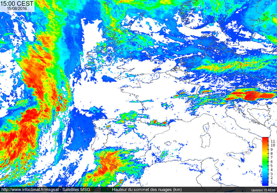
You don’t have to go by the URL, you can use their interface to click through the images:
http://www.infoclimat.fr/cartes-meteo-temps-reel-images-satellites-infrarouge-visible-haute-resolution.html?i=ch
I have to go back about two hours at the moment to see anything useful though. Which is written below: “Ces données satellite peuvent être indisponibles la nuit.” – This satellite data may be unavailable at nighttime.
Today, around CPT, UK, the cloud tops were about 5000ft at 12:00.
On 13th, they were about 7000ft on the flight EGKA-EIWT. That doesn’t look right. But there may have been high level cloud too – I can’t remember.
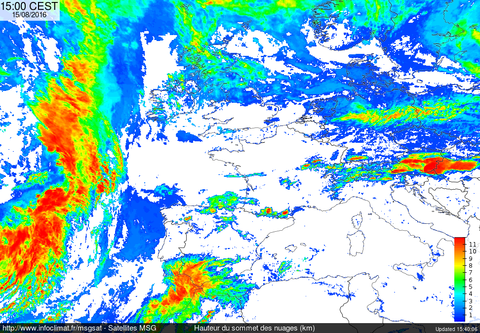
I found another site here (sorry, still french):
“Infrared Images”: http://www.meteo-mc.fr/satellite-infrarouge-europe.php
This time the colors represent temperatures. I sent an email to the site to ask whether these are real temperatures or ISA related colorizations.
I’ll keep you informed.
Update: Their answer came immediatedly: it’s just a copy of the above Infoclimat.fr site. So I sent them the same mail with my question…
Peter wrote:
I wonder what the source data is?
It says it on the tin: MSG = Meteosat Second Generation (so Meteosat-8 through 10; 11 has been launched but AFAIK is not operational, it’s kept as a replacement).
I received an email from Infoclimat saying that the color scale is derived from an estimate of the image source. So there is nothing very specific.They strongly do not recommend using this in the preparation of any flights.
Done. Waiting for the answer…
Got the answer :
He’s telling me that he has no additional information to share over the last time as the estimate is not scientific.
Seems to be more guessing though even if it may be with some more general meteorological knowledge.
Thank you Flyamax…
IMHO this guy is being deliberately unhelpful and probably making the point that he has better things to do – because anybody who actually cares about doing their job can easily walk down the corridor and ask whoever wrote the code, or email them, etc. I get this in business all day long…
So, my guess is that they googled for the temperature lapse rate and found it is 2 degC per 1000ft and used that. Same as every other “cloud tops” site actually.


