That’s really good:
Funny that they even get a non-US airport!
Noe wrote:
Funny that they even get a non-US airport!
Are Jepp US charts not already looking somewhat like the new enhanced version ?
Doesn’t look like it:
http://www.fly-sea.com/charts/KJFK.pdf
Do they have the STARs to scale? I remember when doing the CBIR theory that the STARs were not true to scale.
That’s an extremely good point.
If they are to depict terrain, they will need to redraw them to scale, IMHO.
It should also make it possible for sids/stars to be georeferenced in moving map products.
Jepp charts contain colours already on some/the approach charts.
Peter wrote:
If they are to depict terrain, they will need to redraw them to scale, IMHO.
Yes, this is highlighted as one of the differences in the e-learning session.
you can also see it in the intro video at the bottom of the page.
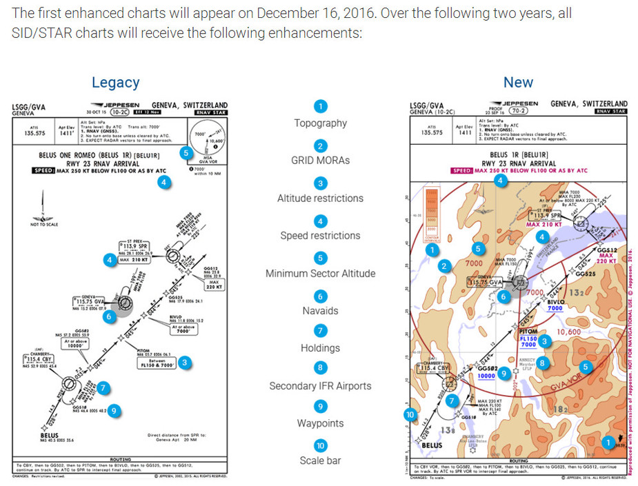
these charts will be to scale
That SID’s and STAR’s will be to scale also means that they will be georeferencable. I am looking forward to see “ownship” on the plates after the next update. A very good help in maintaining situational awareness at busy times of a flight in ususally busy airspaces.