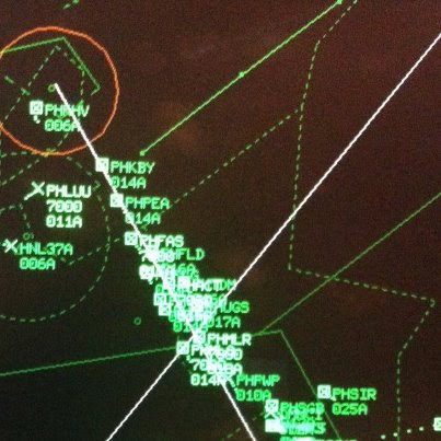
I've done Sywell for the last two years. First year I thought 'heck', how does all this work. I put the four corners of the 'hold' into the Garmin and made it part of my route. Don't think I saw more than one or two AC in this so called 'hold' and I don't think any actual 'holding' went on. I (approaching from the North) flew the southbound and eastbound legs of the 'hold' and peeled off to land.
The second year the approach/land was a none event.
Think it's more a case of 'getting the ducks in-line' then a hold!! and there weren't many ducks at that.
But 22 pages!!!!
The UK CAA occurences report for March 2013 shows (my count) 46 airspace infringements, out of 139 events.
This is perhaps 15 years into the "GPS era".
Any suggestions?
Perhaps it is due to
I agree that Sywell is not a huge problem in reality but I would still want to get there very early 
Any suggestions?
I dont think the word "GPS" alone is the simple answer. I think infringments comes down to poor pre-flight planning and lack of monitoring in the air, and actually what kind of GPS you have.
I have a GNS430W. Even though it seems to have all of the airspace alarms turned on, the warnings hardly ever show up, nor highlight in any way the affected areas. Thats a £5,0000 + bit of kit, fantastic for absolutely everything except warning you about airspace and helping you avoid it. One could argue that it tells you where you are, and from various instruments you can see clearly what your altitude of Flight Level is, and perhaps with a external chart of some other kind, you just shouldnt be busting airspace. That wouldnt be unfair. But unless you actively monitor / cross-check, infringments can easily occur, especially in complex areas like the southern half of the UK.
Where a GPS does help is when you have a cheap external GPS (NATS Aware, SkyDemon, and so on). As GPS units they do warn you clearly what you might be about to infringe, with suitable warnings and other information (like lower and upper limits, frequency to call etc...).
I did a flight (VFR) to Welshpool the other day, and I planned a route zig zagging here and there using various IFR waypoints to allow myself to set a maximum altitude OCAS of 5,500 and be able to stick to it for the majority of the route. Enroute, even being 0.1 NM north of the Daventry VOR would have meant I would be limited to just 4,500 instead of 5,500 0.1 NM south of it, and its a PITA going up and down at each little section of differing airspace, which my pilot friend had to do on the return flight another way round the Birmingham zone with all of it's let down areas.
I love the GNS430, however, its the NATS Aware and the SkyDemon that I use for monitoring and cross-checking and ultimately keeping me out of trouble.
I love the GNS430, however, its the NATS Aware and the SkyDemon that I use for monitoring and cross-checking and ultimately keeping me out of trouble.
Apart from the GNS430 I am not familiar with these devices. Do the also warn you of TRAs? And if so, how do you keep their databases current? (Some TRAs are established on short notice...)
I ask because my only infringement so far has been a temporary military airspace while doing aerial work which is a serious (and expensive!) offence.
I did a flight (VFR) to Welshpool the other day, and I planned a route zig zagging here and there using various IFR waypoints to allow myself to set a maximum altitude OCAS of 5,500 and be able to stick to it for the majority of the route. Enroute, even being 0.1 NM north of the Daventry VOR would have meant I would be limited to just 4,500 instead of 5,500 0.1 NM south of it,
Be very careful using a GPS to avoid an airspace by just 0.1nm. I understand from postings elsewhere that not all flight planning/GPS software uses great circles which could make a difference when you're talking about such small seperations.
I ask because my only infringement so far has been a temporary military airspace while doing aerial work which is a serious (and expensive!) offence.
I don't believe a GNS430 does warn about TRA's but I'm not very familar with them. You'll probably know better.
EasyVFR by PocketFMS certainly does. It keep its database updated through an internet connection with live NOTAMs from EuroControl. In most cases this will mean a quick download preflight as most people can't get an internet connection while in the air.
I believe SkyDemon does something similar.
However EasyVFR takes it one step further and allows you to hide NOTAMs that are of no interest to you. This helps to declutter the screen so that only NOTAMS that you deem relevant are shown and warned about. If you don't want to see a NOTAM about kite flying or a new crane, then you can hide it and it won't be shown on the map or in your briefing.
Taking this even one step further, this allows you to brief for your flight a day (or even more) in advance and hide all the rubbish that makes up most of the NOTAMs. You can do an update download just before the flight and only have to go through your short list of NOTAMs that you already deemed relevant to your flight plus the new ones that came out since you last sorted them.
Likewise if you fly in the same area a lot, hiding the rubbish NOTAMs can save you a lot of time on subsequent briefings for flights in the same area.
Or course you can reset the hidden NOTAMs any time you like.
I'm not aware of any other system that allows this control over you briefing.
Of course you can print the NOTAMs from your tablet (or Phone) (no special printer required) or make an electronic copy in the Cloud just in case you need to explain yourself later ;)
As for the 22 page document, I think this might say more about someone with an inflated sense of importance who wishes to control everything. Perhaps a FISO who would like to be ATC. Or perhaps it could simply be a case of someone thinking that if they don't tell everyone what to do that they are failing in some duty of care and could be putting themselves at risk of a claim.
In either case I think 22 pages is way over the top and nobody is going to be able to take 22 pages in unless it's stuff they know and would do anyway.
Colm
Be very careful using a GPS to avoid an airspace by just 0.1nm
My flying isnt that accurate ;-) But I did have it on autopilot at the time, using the OMNI mode, but near the VOR I did switch to heading mode and gave it a wider berth.
Apart from the GNS430 I am not familiar with these devices. Do the also warn you of TRAs?
SkyDemon does and (if you keep up with any updates/downloads), it depicts and notifies any change in airspace or other NOTAM'd event. The NATS aware I have is an an old device, which is generally only updated whenever the charts are updated, so therefore is more and more outdated over time.
However, the Texel show says it has ATC. I suspect what scares a lot of UK pilots is having to work out what to do in the absence of being told what to do by ATC. I find that quite difficult too; not because I don't know how to navigate to some runway and land on it, but because I have no idea who else is around and where they are and what they are trying to do.
Re GPS, I have never considered any of the IFR panel mounts to be any good for VFR nav. The ancient King / Honeywell KMD150 (which is not actually a certified IFR unit) is perhaps the best, as is its MFD incarnation (KMD550) which is what I have, dirven by a KLN94. The IFR units are just-usable if you can manage to relate the CAS shapes on them to the ones on the map, which is often hard because of the tendency to not show UK Class A on the Jepp data. The IFR units are fine for flying a route which was preplanned on the VFR chart, via navaids / IFR intersections, and loaded as such. That is how I have always flown when VFR - except on trivial local flights where I run the VFR chart as a GPS moving map.
However I suspect that most CAS busts are not done by people with GNS etc boxes! Has anybody seen any analysis by equipment type / pilot time on type, etc?
Another good bit here...
Sywell, for the show, has published this Notam
J0090/13
Start    : 2013-05-31T08:00:00
End      : 2013-06-02T17:00:00
Schedule : 0800-1700
Lower    : 0
Upper    : 30
Location : Northamptonshire(52.3,-0.8) - Radius 4nm

Code     : QRTCA
Traffic  : IV

E) RESTRICTED AREA (TEMPORARY) AT NORTHAMPTON/SYWELL. RESTRICTION OF
FLYING REGULATIONS MADE UNDER ARTICLE 161 OF THE ANO 2009. AIC
M008/2013, WHICH INCLUDES A MAP, REFERS. NO ACFT IS TO FLY WI AREA
BOUNDED BY CIRCLE RAD 4NM CENTRED AT 521822N 0004732W EXCEPT ACFT
FLYING IN THE SERVICE OF THE CHIEF CONSTABLE OF NORTHAMPTONSHIRE,
OPERATED BY THE HELICOPTER EMERGENCY MEDICAL SERVICES, OR FLYING WITH
THE PERMISSION OF THE SYWELL AERODROME FLIGHT INFORMATION SERVICE
UNIT. AUS 13-05-0012/AS 6
i.e. this is a Restricted Area, not just some warning...
The last sentence is a "bit of a problem", since you are not supposed to make radio calls until turning final:
When number one on finals, make the only required transmission 'Aircraft Type,
(page 4 here)
Obviously this is not intended otherwise nobody could arrive in accordance with the instructions but why publish a Notam which is self evidently nonsense?