I don’t believe the Garmin product shows the old VFR corridors, for example along the coast under Fiumicino.
Pocket FMS/easyVFR appears to show some green lanes, but when you drill down the airspace menu doesn’t give any detail.
Perhaps other products still show them?
Have tried to access the ENAV AIP but the registration process defeated me.
Having dealt with ENAC on student licensing issues it makes the CAA appear the most customer friendly regulator possible.
That’s what the PC version of SD shows :
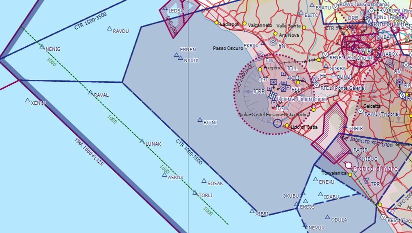
Is the green dashed line the corridor you refer to ?
EasyVFR does provide airspace info, similar to other airspace “tags” – a coloured block with the airspace class in it followed by a rectangle with the altitudes. For these routes, the block is green and contains the text “VFR Route” and the box has the altitudes similar to C or D airspace blocks. An alternative is to click on the route and then the airspace icon in the yellow box that appears. In some other countries, such as France, these routes may have VFR waypoints associated with the routes, in which case they also appear on the map.
Interesting though that the SD VFR route in the above screenshot doesn’t appear on the EasyVFR map and there is a VFR route on the EasyVFR map that doesn’t appear on the SD screenshot above. The common element is that these particular VFR routes seem to be defined by IFR waypoints, although this isn’t the case for all VFR routes in Italy & elsewhere.