
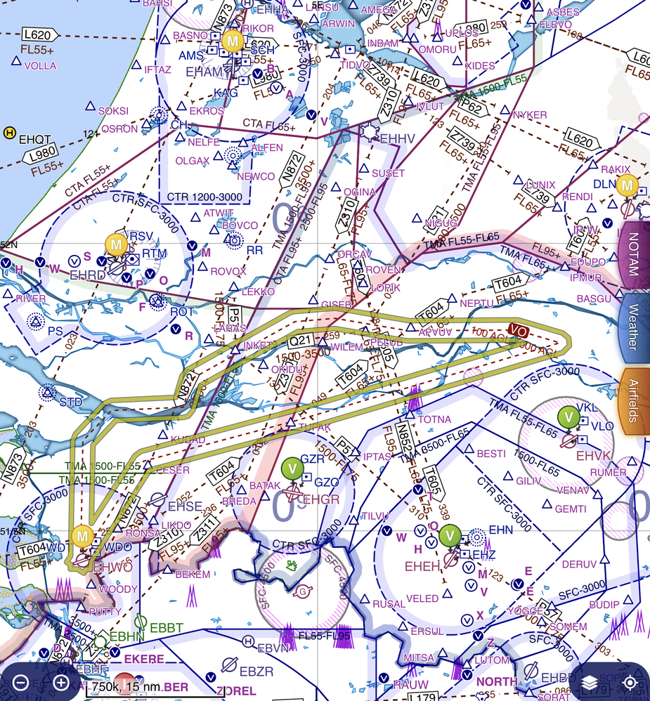
I have flown to Breda EHSE few times, I recall seeing these routes somewhere in AIP or Notams once, I just checked SkyDemon on airways IFR mode and it show these as “Military Low Flying Airway” but I doubt they are used for IFR? just a “parsing error” from AIP on SD side
There are no NavAids attached to them (geometry & size still looks like VOR/TACAN airways) with +/-5nm and extending from 100ft agl to 1000ft agl (but I doubt reception will be good that low), if it’s the case, are these supposed to be flown in clouds at 500ft agl? 
The MilAIP suggest it’s on GPS coordinates
https://en.lvnl.nl/media/4153/ohd__millowflyroutes__route-vo.png
ENR 5.2 seems to imply the routes are only flown VMC
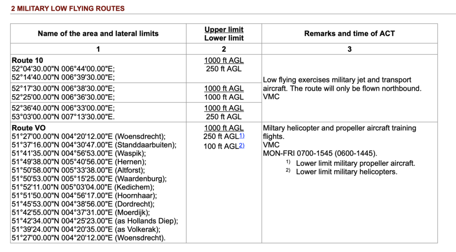
Thanks for the reference, seems to solve the mystery
UK had flights low level in cloud in the Highland Restricted Area from 15.00 local till, I think 23.00, 4 days a week. Now only active when NOTAMED.
Buccaneers and later Tornadoes used it as well as other NATO aircraft. Their navigation did not depend on beacons, as it had been suggested the Russion ones could not be relied on by aircraft delivering nuclear weapons in war.

