Just installed this and going to see tomorrow with a few others to see how the traffic info pans out
How is the data transmitted?
Mobile phone network.
So I did a formation flight yesterday with one other ship. It’s not bad at all, but it looks like you are at the mercy of a good GSM coverage. It regularly needs to update, I guess that has to do with changing to a different ground antenna? I purposely flew to an area with a marginal GSM coverage and then lost the signal.
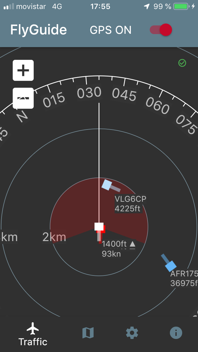
Once with a stable signal the data of the traffic is pretty accurate. It shows its GPS-altitude and the position depicted is correct.
I did not realise that it separately feeds-in non-app using traffic as well. Well, I suppose that Vueling and Air Afrique on the picture weren’t fumbling with this app 
In the pic, the speed and alt position shows my aircraft. The formation traffic in red, very near behind, and its’ altitude is not shown, it’s blinded by my own data, once a little further away it starts showing.
It’s something that we as a GA community in Mallorca should look into. It does not replace A/A comms nor looking outside, but it helps. @antonio what do you think?
Have to try it. I’m not sure a stand alone app is very practical though. Maybe as a feature in SD or something?
True, but that would mean people having to pay for SD. This app is free so no excuse..