Saw it, looks nice but would require a dry run for night landing with Synt-Vision 
Does EASA have something similar to NORSEE? the closest I can think of is CS-STAN list and few portable devices installs…
https://www.easa.europa.eu/sites/default/files/dfu/EASA_Proposed_CM-AS-007_Issue_01_CRD_PUBL.pdf
For an Experimental, a vehicle reversing warner, which increases bleeping as an obstacle gets nearer, might work.
With a maximum height range of 100’, it’s only a substitute for the visual assessment of small heights – one of the most essential skills for every pilot. I think it’s a bit like outrigger wheels on a motorcycle that extend automatically as the speed drops to zero: may save your bacon when you are old and frail, but of dubious usefulness otherwise. Also, for just a little more money, one can get a full-fledged radar altimeter with a 1600’ range and altitude reporting via RS-232 and ARINC 429.
Ultranomad wrote:
Also, for just a little more money, one can get a full-fledged radar altimeter with (…) altitude reporting via RS-232 and ARINC 429.
Interesting in principle, but the webpage is quite low on details. No price, no STCs, no ETSO? No claim of install on any common light GA plane? Does the RS-232 and ARINC429 capability meant it can display on e.g. Garmin glass?
The only connection I know about is to the audio panel to allow the height call-outs. It is not an alternative to a radio altimeter, which is a different tool at a higher price.
Is this optical or radio?
A KRA10 radio altimeter costs ~10k to install.
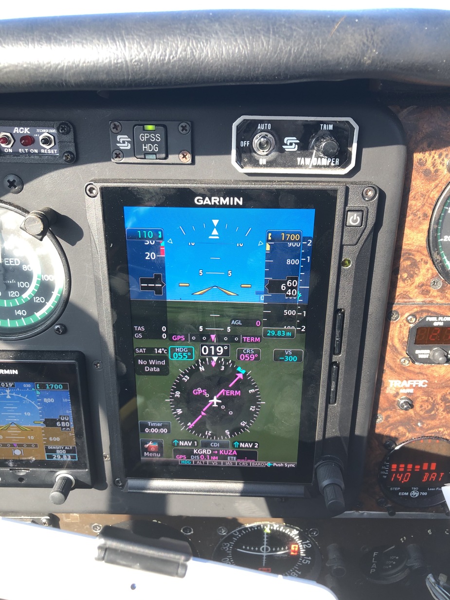
In the latest software version of the G500txi you get a GPS height indication with quite astonishing accuracy
How does that work?
It displays a GPS altitude above ground level when lower than 2500 feet. The indication is to the left of the altitude strip. See the picture of my G500TXi PFD, I was on the ground at the time. The values are in increments of 20 feet. It is in the same position on the PFD that a radar altimeter would display if I had one.