
I do all my planning in FF on an iPad Mini 5.
For IFR I input the departure and arrival airports in the ‘flights’ tab, then check the route advisor (don’t know if this is available in Europe), select a route I like and file. Done.
For VFR I start in the FP tab of the map page and rubberband as desired.
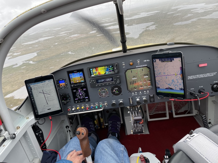
Then it depends on the aircraft I’m flying. In the club Cessnas (almost always a C180 for me), I send the FP to the panel, check that it imported correctly and go flying. Here, the iPad is mounted on the yoke and is used effectively as MFD. Traffic and wx data come from the panel via Flightstream.
In the Baron there is no place to mount any iPad, so it lives on my knee secured with a knee strap. The Baron also doesn’t have a datalink, so I have to input the data manually in the 530/430 combo. Traffic and ADS-B wx come from a portable Stratus III in this setup.
In 10 years of flying with iPads I had one overheat event and that was years ago when I put an old iPad (I think second generation) on the dash in full sunlight. It probably helps that I mostly fly Cessnas where the cockpit is relatively shady.
As an aside, I would not recommend the Stratus III, this thing very easily overheats. It has to be mounted on a side window, on the dash it overheats very quickly. AFAIK the Garmin equivalent is much more heat tolerant.
As an aside, I would not recommend the Stratus III, this thing very easily overheats. It has to be mounted on a side window, on the dash it overheats very quickly.
Oddly enough while my iPads have overheated on the hottest days (over 100 F or 38 C) until fan cooled, my Stratus 2S {singular) is Velcro’d full time (never removed) on the top of the dash under a bubble canopy and has never overheated in simultaneous service.
Gallois – the main use of a tablet in Europe is because most/all panel mounted (certified) avionics contain crappy VFR charts, and you need a VFR chart to not bust CAS, DAs, etc. So most people fly with satnav apps like EVFR, SD, or your FR-only products.
For IFR in CAS you don’t need this because you are under ATC direction all the way and it is a WPT to WPT job all the way, so a tablet is used for the terminal areas if VFR, and/or to carry airport charts.
You need only one tablet for all this, but they are so unreliable with the heat shutdowns that some people carry two. But also when you rely on a tablet 100% you need a backup one. In the UK for example flying without satnav running a VFR chart would be suicide – unless you plan the flight at home on the VFR chart and execute it per the plan which is what I do when going somewhere for real in the UK (and often flying 1.5x further to do it safely). My backup tablet is an old Samsung one (T705) running CAA charts from 2021. I have those on the Ipad Mini also, but the Samsung has really handy stuff e.g.
which is not AFAIK possible to do on an Ipad, or FF (unless paying loads of £££).
@gallois and @Inkognito
There are probably a zillions of ways organising oneself for, then conducting a flight, in any regime (VFR/IFR)… besides providing some entertainment on EuroGA 
The picture below, taken over some inhospitable countryside North of the Hudson Bay, shows my long-haul config, e.g. an iPad on the LHS (a 4) and another on the RHS (a 5). For shorter flights around EU only the RHS iPad will be installed.
I spent quite some time to find what I think is an ideal cockpit configuration, for me only that is… yes, the homebuilt category gives plenty of freedom as to install what, where, and when. According your financial resources too 
Flight planning
Can be done at home, completed/altered on the go (in flight), or during any stopover. I use the iPads for it all since it permits route planning, FPL filing, Notams, PPR form filing, weather check, DABS (Swiss graphical military info), special approach plates, etc.
Enroute
The right iPad is running SkyDemon and is used mainly for navigation. The left one, running FlightplanGo in this instance, usually display the approach plate(s), either VFR or IFR. The GNX375 navigator/ADSB xpdr is used as the main guidance to fly actual procedures (mainly LVPs), whilst the left iPad would be used to monitor progress whilst flying the approach. It is also used to find one’s way for taxi once landed, the more so on the bigger US airports.
When using some of my external cameras, and if all goes well (…), I can remote control them using the iPad, for instance using the Insta360 app using wi-fi (never managed to bind that Ghost Drift though).
Debriefing/Paperwork
The flight completed, the flight times as given by SD are used for my pilot’s logbook, as well as for the airplane’s journey log. Looking at the log of an individual flight and using the “Explore in SkyDemon” function sometimes helps in finding the precise location of such or such picture, if any were taken during the flight.
The iPad also holds copies of my pilot’s logbook, copies of my passport/ID, licence, medical, and more. An Excel file contains things as a running logbook (useful to extract engine/prop/airframe/equipment hours as required for our tech documents here), a W&B spreadsheet, a Time Limits sheet (another thing our FOCA loves ), a QRH for maintenance tasks (commonly used torques, etc), a record of all compressions for trend monitoring, etc.
The iPad also contains all the aircraft’s checklists, all manuals (AFM, AMM, etc), so the only required real paper in my steed is the aircraft journey logbook.
Non-aviation Stuff
Plenty… hundreds of ebooks, ecomics, movies, 2 games only (Chess & Pinball HD) etc, etc.
In short, there is many a way to make best use of an iPad, or any capable tablet, on the flight deck. I’ve been using iPads for longer than I care to remember, and can’t imagine flying without.
Peter wrote:
most/all panel mounted (certified) avionics contain crappy VFR charts, and you need a VFR chart to not bust CAS, DAs, etc.
Dynon Skyview would natively display the EasyVFR chart, which is… good enough. It would even show the FIS frequencies.
The missing feature on the Dynon side is the vertical airspace profile though
Thanks all for the tips. As the Super Guépard is a club ULM it seems I need to consider what exactly I want from portable equipment..Tablet with a phone as back up running Skydemon or SDVFR is a good start..If I put a data sim card in the tablet it woulf be handy for Safesky traffic as well (at least for much of the flight below 5000ft)..I might even get weather radar. But that’s where a 2nd tablet might be useful. Is it possibĺe to get an AI on a tablet?
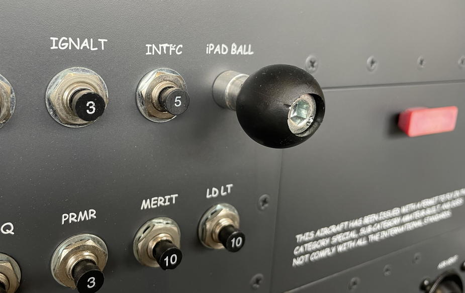
and theee ball
I had a Mini 4, that I sold only because 16GB was really tight. It was completely fine running SkyDemon if it had been exclusive for flying, but I have only one unit for everything.
I switched to a Mini 6 about a year ago, now with plenty of space to store maps and plates and whatnot. It’s quite bit more snappy than the 4.
Didn’t find a decent Black Friday offer, yet. Meanwhile the 7 is expected summer next year.
@Inkognito… thinking about it, Black Friday might fall on a, err… Friday, right?
This is what I just read online: Black Friday falls on the Friday after Thanksgiving each year. In 2023, Black Friday is Nov. 24.
I’d give it another go right on Black Friday
OTOH if your source is correct and the 7 is only expected in the Summer 24, I’d buy a 6 (or a -6.9i ) right now. First I’m not sure the 7 will be any better than the 6, second, it’ll be Summer, so 1/2 of the “season” gone already, and the 8 will be on the horizon.
One thing not to forget, these devices are consumables, e.g. to be used for a while, and then exchanged for a new one.
Remembering when I started flying, using real paper charts for basically the whole of EU (5 for Germany alone) and later the Bottlang VFR flight guide (or whatever the 4 or 5 binders covering EU were called), was more expensive than an iPad + all the flight guides for the same year. Plus one had to do all the 15 day revs, chore which I really don’t miss…


