Tropical Trip – PHOG/Maui and PHNY/Lāna’i
We found ourselves in Hawai’i owing to some American friends of ours getting married. Given the distance and ballache getting all the way to the other side of the world (about 36 hours of airports and airliners with seats which were basically upholstered concrete – I don’t think I’ve ever sat in a harder seat than in the A380 we had on the way back), we had to make the most of it – so amongst other things, that meant we had to find somewhere that’d let us have a plane for the day…
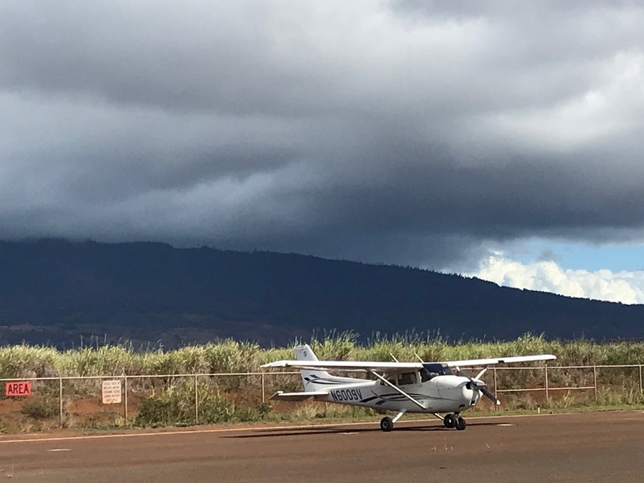
Unfortunately, there’s very little choice if you want to fly in Hawai’i. The island we were actually staying on for our friends wedding (Kawa’i) didn’t have anywhere that would let you just take the plane, only tours. Kawa’i itself is about 100nm from the next island so it probably just doesn’t lend itself to that kind of thing. Maui has two places you can rent a plane. It’s expensive (significantly more so than the UK) and you can’t take the plane overnight. The climate is absurdly hard on light planes there – the 2006 C172 we hired (the newest plane I’ve ever flown) really showed signs of it. The salt water problem is actually worse than the Isle of Man, probably exacerbated by the warmth speeding up chemical reactions. The choice of planes was a C172SP from Maui Aviators (at around $300/hr wet), or a Cirrus from another outfit (at around $450 hr dry. I’ve hired twins for less than that, wet!). The 172SP we had might have looked more dog-eared than most of the planes in the UK GA scene, but it flew very nicely – trimmed out well and flew hands-off nicely. I took turns with my wife flying, so we both could get some time to look around at the scenery and take some pictures.
But given it’s unlikely we’ll be in Hawai’i anytime soon, if ever, we could justify the spend. I didn’t get into GA to save money, after all…
The general area where we were:

There’s a lot more islands than this – the most populated island is off to the west (as is Kawa’i), and the big island is to the east (with a huge volcano whose summit is over 12,000 ft above sea level). Oddly, the big island is actually outside the ADIZ, so if you want to fly there you’ll have to file a Defense VFR flight plan, or you’ll get to enjoy a formation flight with a military jet.
I got a check-out with Maui Aviators instructor (basically the typical stuff, go to the practise area and do a bit of airwork, then 3 touch and goes at Maui). The instructor provided a “cheat sheet” for the things to request (and expect) from HCF departure/approach (Maui’s class C).
The route we took looked like this:
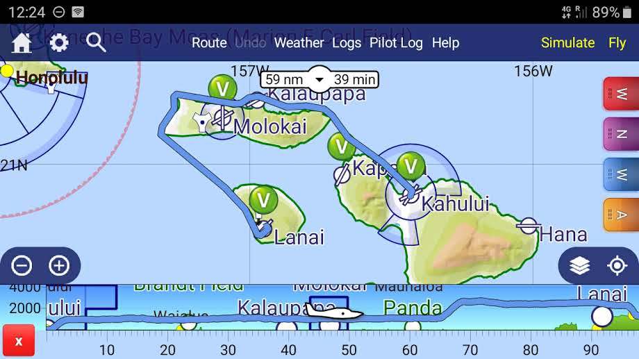
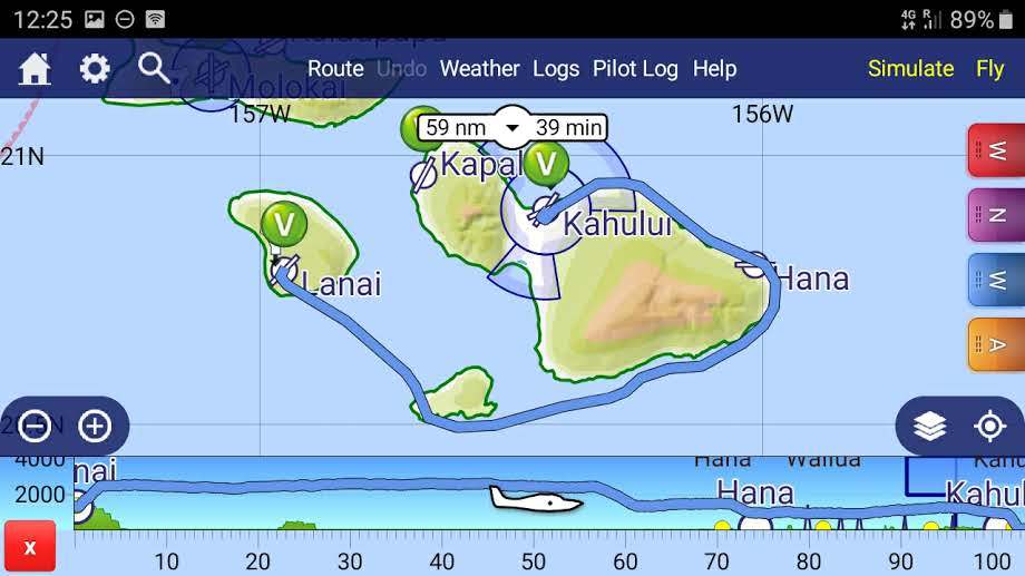
Navigation is pretty easy, the islands mostly have colossal volcanos on them (topped with clouds) and can be seen from 50nm away. Airspace is pretty simple with the class C at our origin (Maui/PHOG) and a class D airfield part way along our trip along the coast of Moloka’i, and not much else unless you’re going to Honolulu (in which case you’ll have the class B).
There is a position self-announce frequency surrounding the islands – there’s quite a lot of tour traffic (helicopters and light aircraft) in certain parts, although we got a bit off the beaten path of tour traffic. There’s also a Hawai’i specific set of altitudes due to the high density of tour traffic, below 3000’, you’re expected to fly on the thousands if you’re westbound, and five hundreds if east bound. We left NW bound towards Moloka’i, so at 1000’.
Most days you’ll be flying quite low – large mountains sticking up into the Pacific tend to attract cloud. The instructor also advised that in case of engine failure, most times you’re better off ditching than trying for land, as the land is usually very rugged and volcanic and has few places to land out. The waters close to the island are, however, warm (although the swell can get up quite a bit).
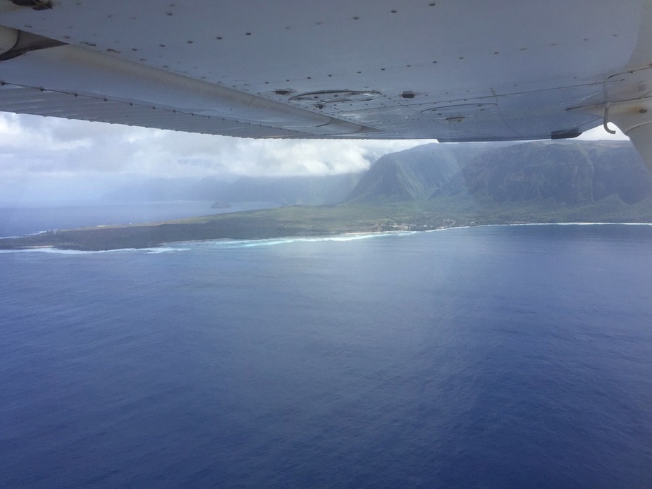
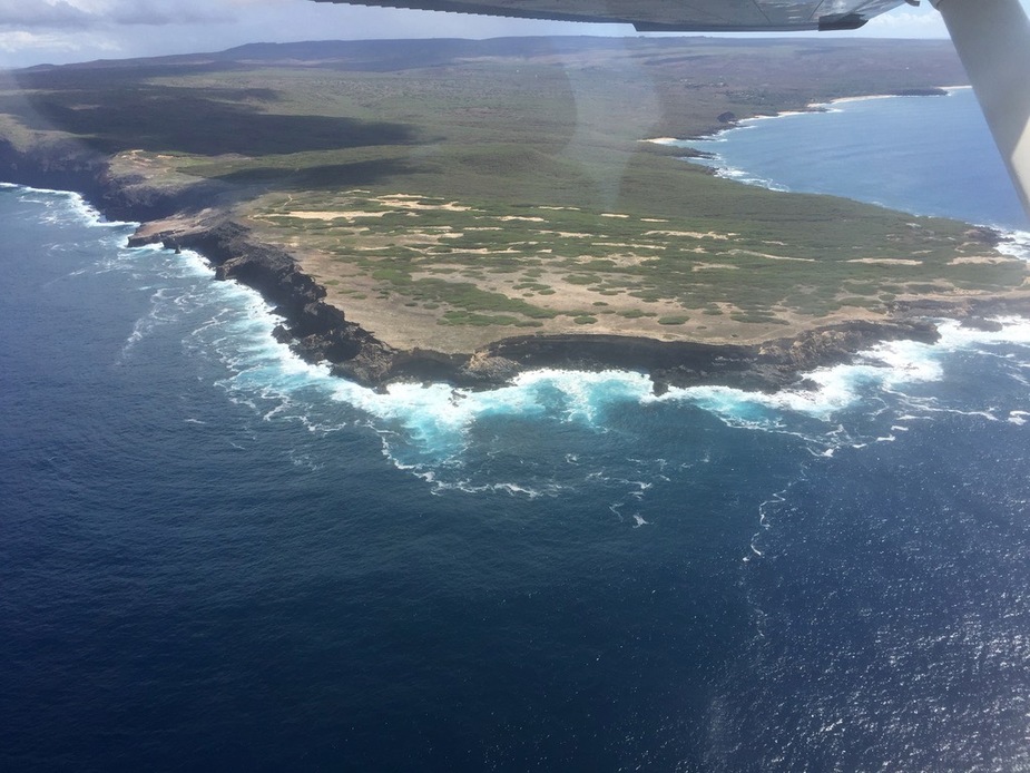
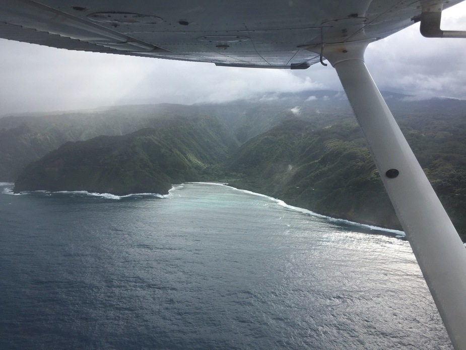
Moloka’i has a pretty spectacular northern coast:

…before you approach a flat piece of land just before you enter the Moloka’i (PHMK) class D airspace. This spit of land also has a small airfield (Kalaupapa Historic National Park), but you can’t stop there without prior permission (although they don’t mind you doing a touch and go), and you need to avoid low flying over the national park, so either just off the coast or climb up to about 3000’.
Transiting the PHMK class D is easy, just tell them you’re going along the coast westbound at 1000’. We continued on to the western tip of Moloka’i, which in contrast to the cliffs covered in tropical vegetation on the north eastern coast, more resembles a mild desert biome, with much sparser brush like vegetation.
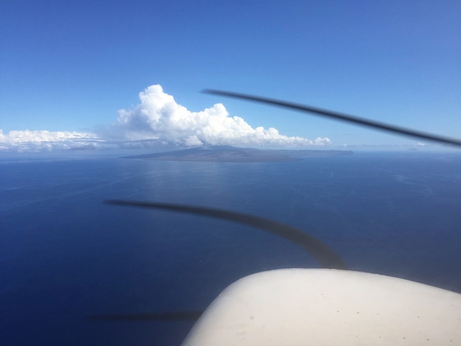
We departed this island at Laau Point on the south west, and headed for Lāna’i, with the intention of a quick rest stop to look around. The airport (PHNY) is non-towered, but as we found does have airline service which unfortunately complicates things.
En-route to Lāna’i
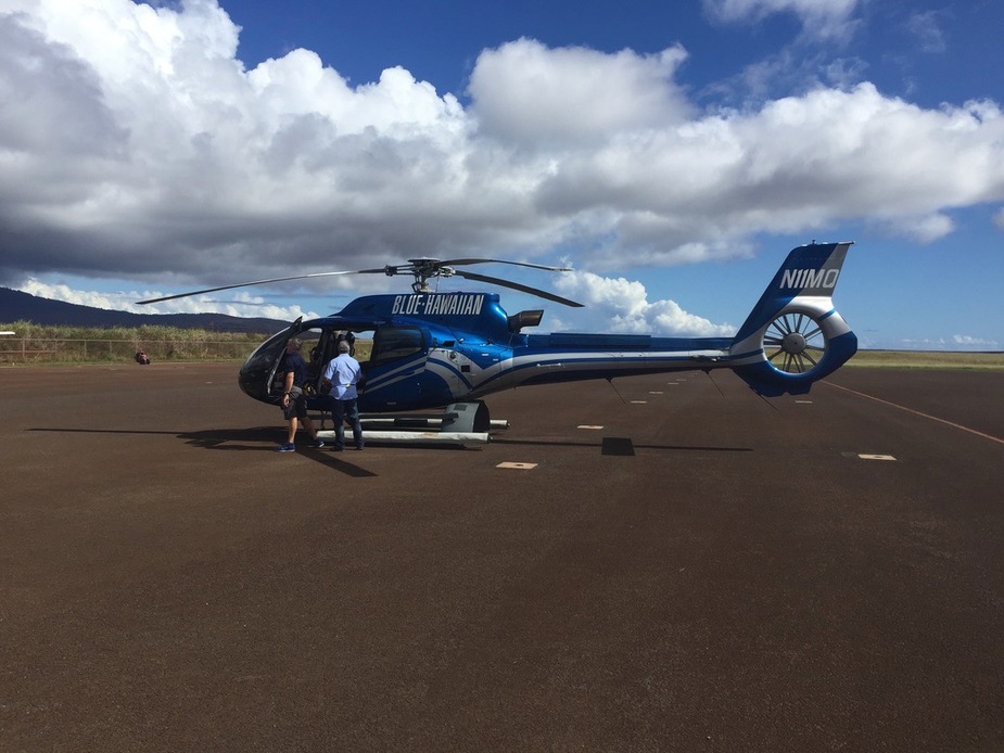
Helicopter tours go from the airfield…
As does an airline with an ATR-42
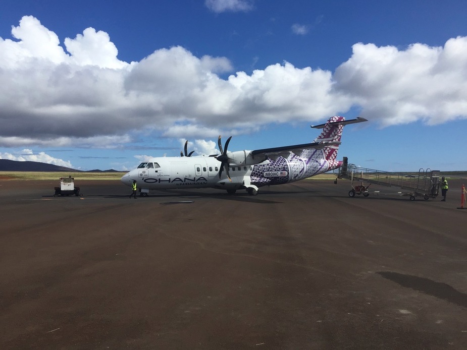
We were hoping for at least a small FBO, but apparently they have no idea what to do with transients (although they do have a clearly marked transient parking area). Unfortunately we arrived just before the airliner, and the people on the apron seemed rather displeased to see us (the first guy we met had zero idea what to do with us and took some convincing to believe that flying in with a light plane was even a thing – “that’s our Cessna over there, that’s how we got in!”, his boss pointed out a gate we could go out of, but getting back on the airfield would have required calling a phone number that neither of our mobile phones could call, so we didn’t want to risk it, or worse, getting mired down trying to explain to the TSA what this “general aviation” thing was. We could probably have gone out and into the airline terminal and found a café but I had to make do finding a bush to relieve myself instead!)
At Lāna’i:
After that we took off and went down to Kaho’olawe, the smallest island of the 8 main Hawaiian islands, which has no permanent population. It was used as a bombing range from WWII until 1990. Today Kahoʻolawe can be used only for native Hawaiian cultural, spiritual, and subsistence purposes. It has no fresh water sources, and looks very much more like West Texas than a tropical island. Cliffs meet the sea, with clear strata that make it look more like it was formed by sedimentary rock than volcanic activity.
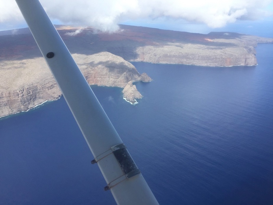
The whole island is a reserve so either fly off the coast or at least a couple of thousand feet AGL.
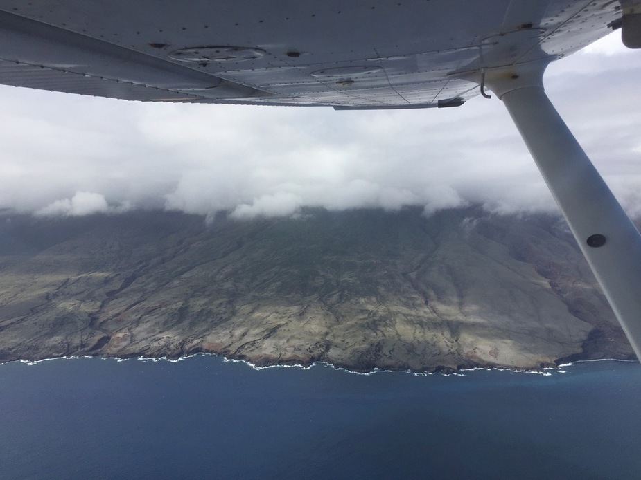
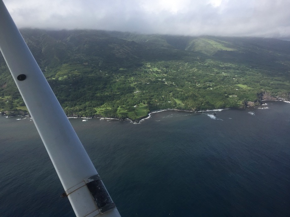
After this we returned to the island of Maui, flying along its south coast. Unfortunately we couldn’t see much of the 10,000’ high volcano as it was shrouded by cloud (this is quite normal). The landscape contrast is stark as you fly around it, as the dry side resembles mild desert, and the wet side a rain forest.
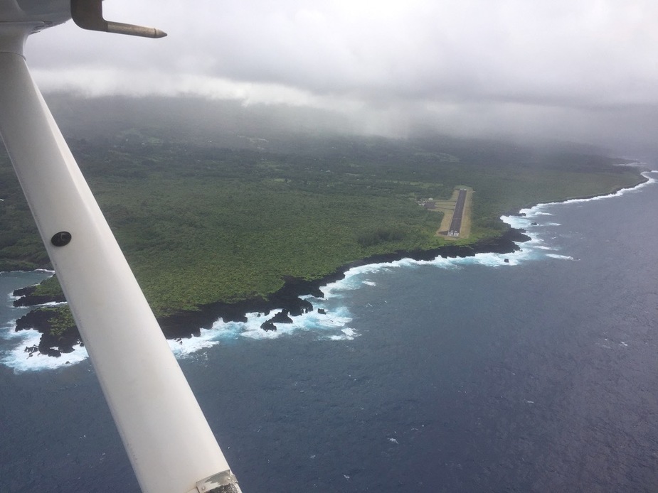
Another small airfield, Hana (PHHN)
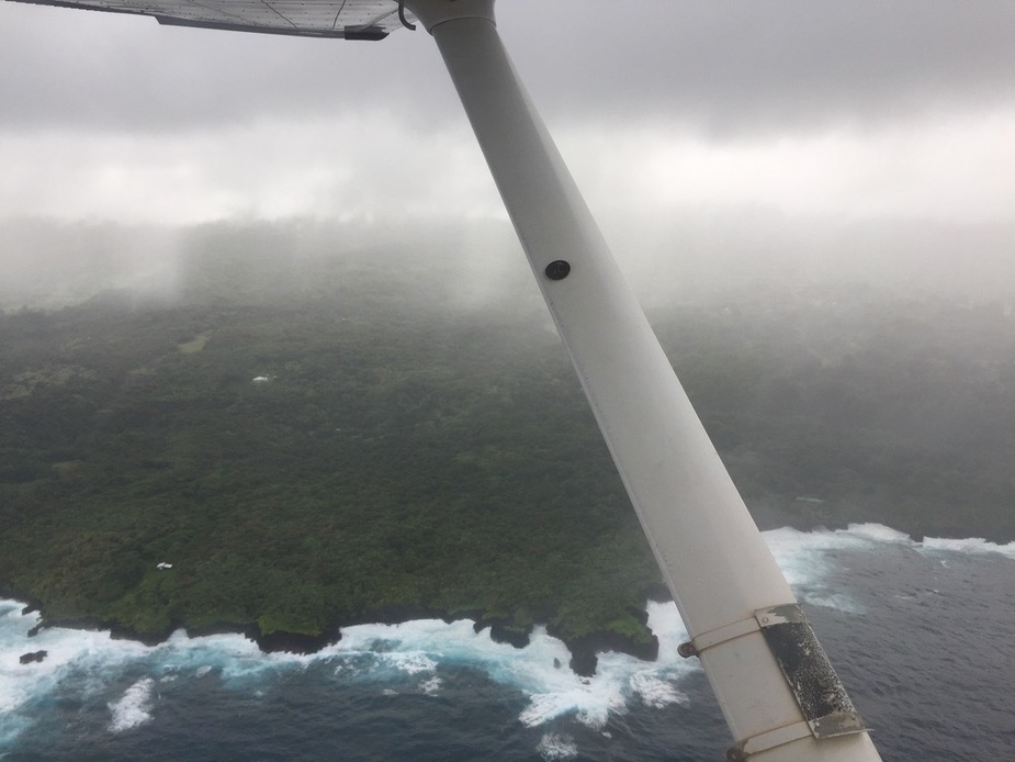
We also got rained on:
Approaching the Maui class C, you can’t really get any communications until you’re almost in it due to terrain (or you have to go out to sea a bit).
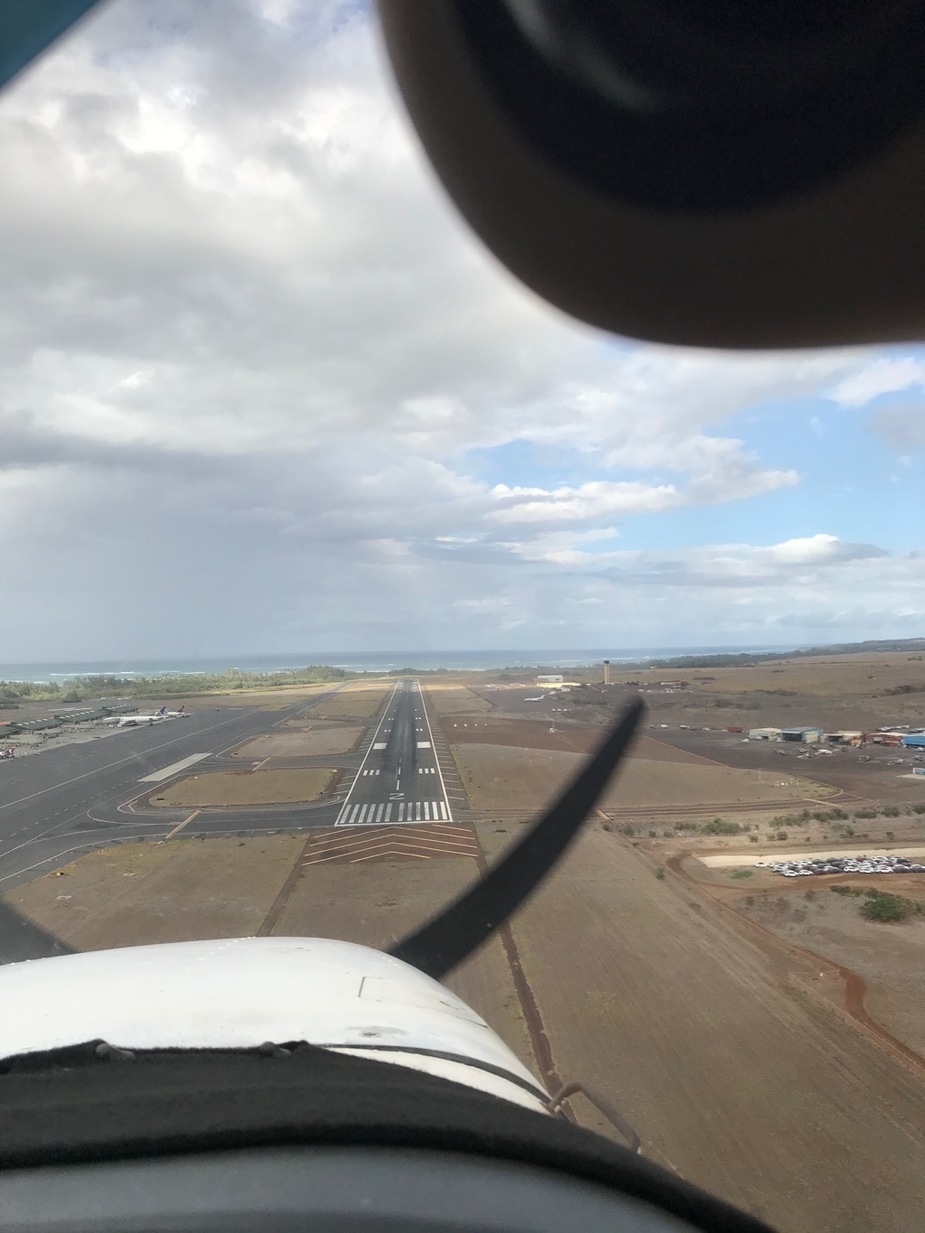
We were cleared to land about 4 miles away from the airfield, as we arrived back during a quiet spot.
In all we probably did about 3 hours of flying, very expensive but worth it!
Looks amazing! Thanks for sharing.
Thank you I worked on a project on the big island over 30 years ago – Honolulu had not changed much from the Hawaii 5-OH days.
Good report, thanks! Has given me ideas for when I take my C182 there next spring!
Really scenic place!
Great you took the chance and hank you Andreas, that brings back fond memories of our trip two years ago. I also rented at Maui Aviators and took the (other) C172 to HNL, including touch-and-go´s at Kalaupapa and Lana´i. One of my more memorable days of flying, the pictures are in some long forgotten thread here.
Amazing!