
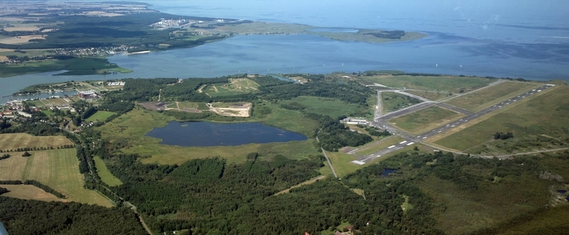
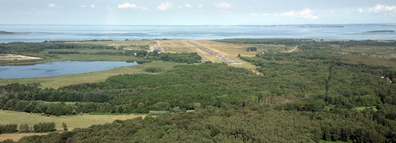
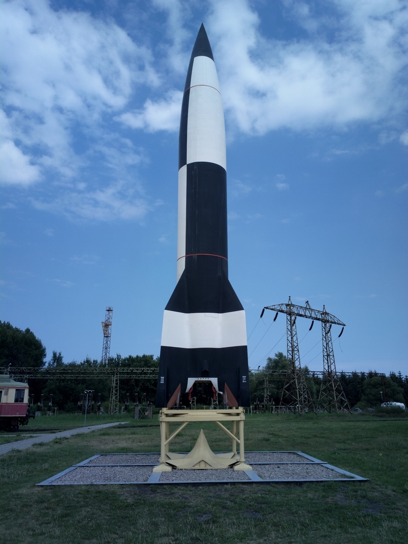
Peenemunde is the site of the German V1 and V2 rocket development in WW2. There is an airport there, with a large runway.
It has no Customs so a stop was planned at Heringsdorf EDAH which is about 20nm to the south. Because the flight from Shoreham to Heringsdorf is about 4 hours, it would not make sense to fly out and see Peenemunde the same day, so I planned to stay at Heringsdorf for 1 night first.
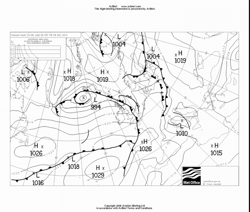
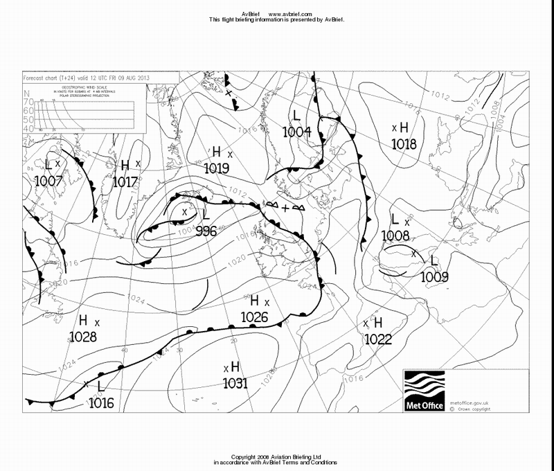
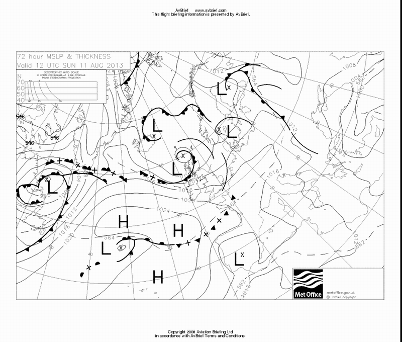
The weather was far from perfect, with a lot of instability around. The 0600 and 1200 MSLP charts for the day of departuresuggested a lot of cloud and possibly some TCU/CBs activity.
I was hoping to depart from underneath the really bad weather and leave it quickly behind but I got delayed by work in the hangar and departed 2 hours later. This turned out to be quite a fortunate move because now I had plenty of bits of blue sky at the airport and would have to outclimb any buildups enroute which is generally the better option, not least because it avoids flight in IMC with unknown stuff inside it.
The forecast for the return flight was about the same. The forecast for the following day was better, which is always a good thing to have, just in case.
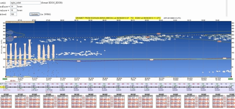
The GRAMET plot for the departure (for the original earlier time) is
The departure surface weather data was
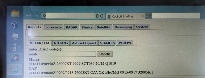
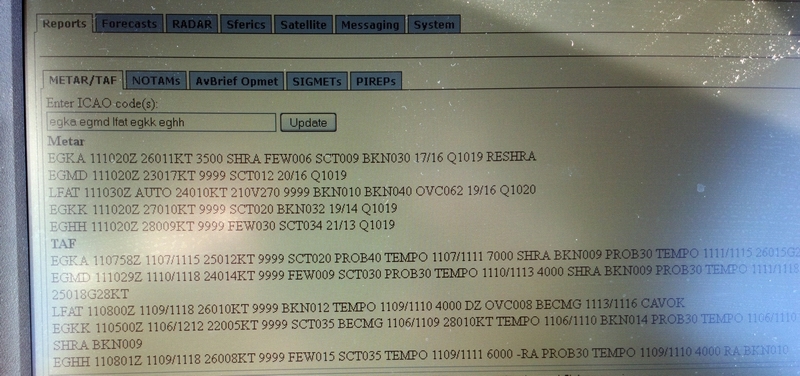
METAR
EGKK 110520Z 22004KT 9999 FEW040 15/13 Q1019
TAF
EGKK 110500Z 1106/1212 22005KT 9999 SCT035 BECMG 1106/1109 28010KT TEMPO 1106/1110 BKN014 PROB30 TEMPO 1106/1110 7000 RA SHRA BKN009
which made sense looking at the MSLP, with the front passing through early in the morning.
The IR image
suggested cloud tops in the "medium" range i.e. about FL150. I have always found this to be very reliable as an indicator of whether the flight is feasible VMC on top in the TB20 which can go to FL200 if necessary so greater accuracy is not needed.
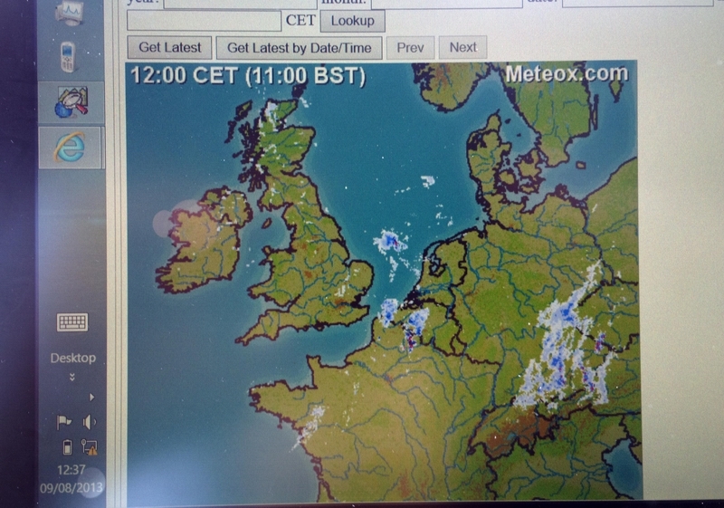
This is the radar picture taken earlier in the morning, which accurately depicted the locally visible weather
The sferics (lightning) image was clean
The filed route was
F100 EGKA WIZAD M140 DVR L9 KONAN L607 KOK DCT COA L179 HELEN N873 GRONY M105 EEL N125 WSR Z102 UDAXI EDAH
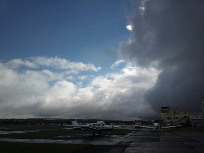
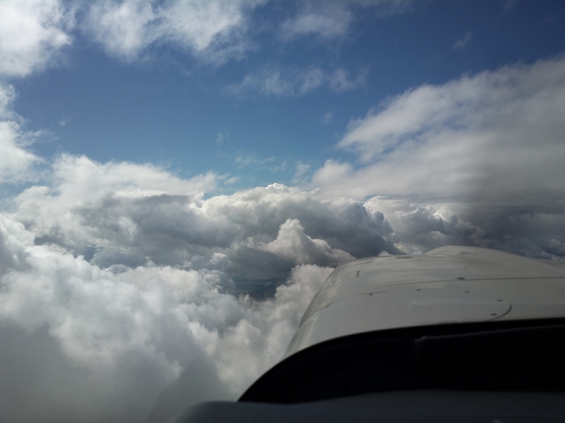
After the 2-hour delay the local weather had cleared up a bit but there was a lot of convective weather around
but it was easily outclimbed by heading for one of the holes before calling up London Control. Soon I was on top at FL080 and shortly after I got cleared to the filed FL100
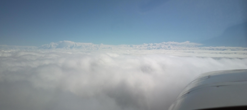

Later on, the tops grew higher and higher and soon I was at FL160.


Obviously the GRAMET plot was no more accurate than what was blindingly obvious by looking at the MSLP chart...
The TAS was 148kt at 9.1 USG/hr, at -8C. There was about 15kt of tailwind most of the way.
The mother of all shortcuts - 203nm

Destination weather, obtained over the Thuraya satellite phone, looked good
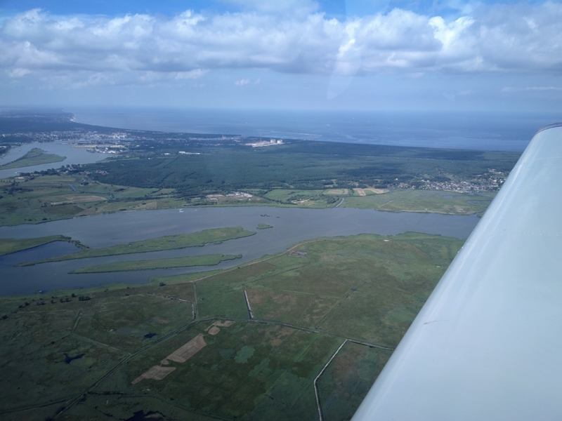
With about 100nm to run the weather cleared up a bit and I started a continuous descent all the way to Heringsdorf. GA cannot get airliner-style continuous descents; the best one can do is a slow descent say 2000ft at a time and hope they will allow the next one before you reach the last one. It is a useful fuel saving technique.
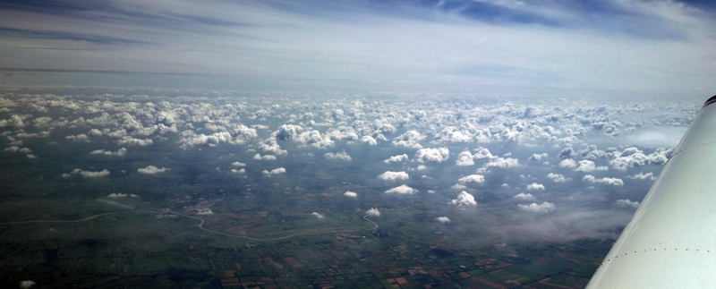
A bit of cloud to descend through
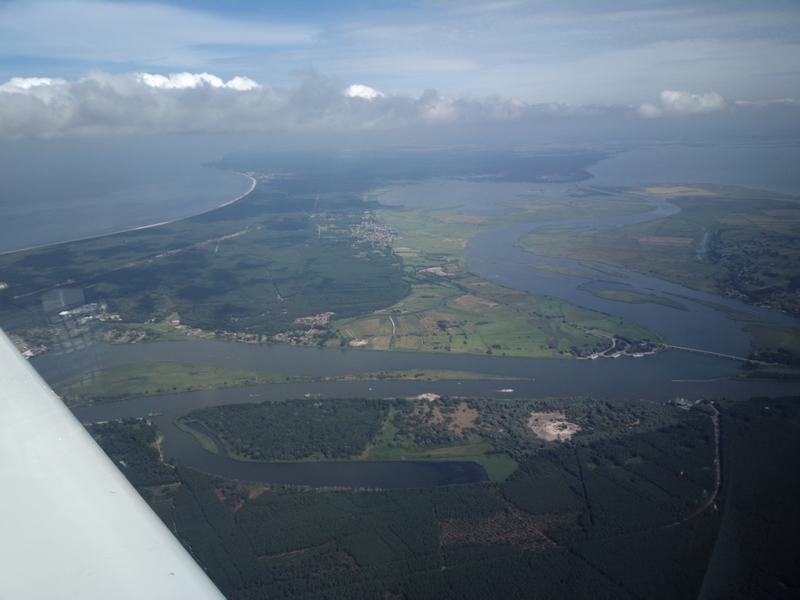
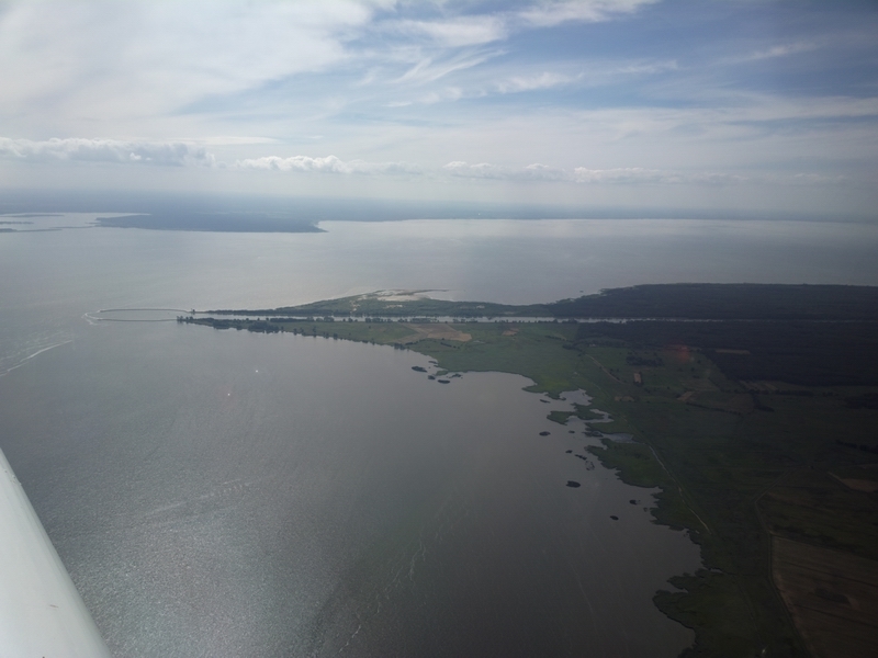
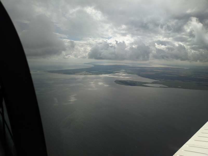
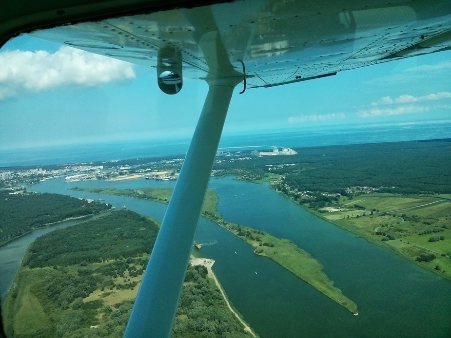
The Baltic coast is very scenic
Most of the EDAH ILS flight path is in Polish airspace. Apparently German ATC is not allowed to vector traffic in Polish airspace, so the Heringsdorf ILS is procedural-only. They call it "standard ILS" which I had not heard before


Final approach

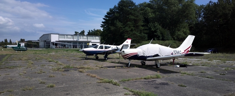
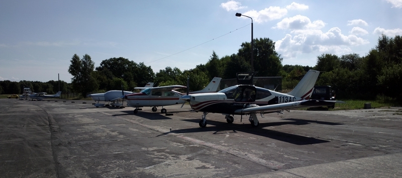
Some interesting aircraft are based there
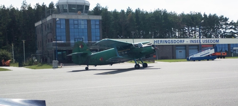
along the usual GA types
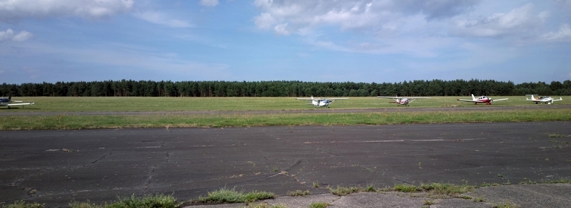
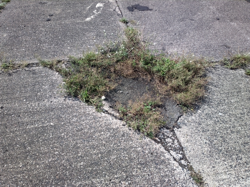
Heringsdorf airport looks like the typical ex Soviet Bloc setup which I recall from my time in communist Czechoslovakia, with loads of bits of old concrete. As usual, I asked for and got hard surface parking but one had to survey the surface rather carefully! The ex Soviet Bloc concept of a "hard surface" is perhaps more suitable for a tank
The airport is 24hrs Customs PNR but as is usual in N Europe (except airports frequented by big airlines) nobody looked at any papers; you walk through a hut (just visible behind the Rockwell Commander) where a man takes a bit of money from you
Fuel was about €2.65/litre. Landing and parking for 1 night was about €20. The taxi to the town was €20.
Heringsdorf is in a fashionable part of Germany where a lot of Germans go for a holiday. There are also many Poles - unsuprising since it is only about 2km from the Polish border. The hotels are pricey (I paid €170 at the Ahlbecker Hof) but the standard seems high.
One big problem I find with Germany and apparently particularly this part of the former DDR is that it can be very difficult to find healthy food. It is even worse than the UK, though the obesity levels in the two countries are probably comparable. For very short stays this doesn't matter much, but I found there was very little that looked even edible. Almost all the food I could find outside the hotel was stodgy greasy sausages. The hotel had no less than 3 restaurants serving variously fancy and fatty food but with the help of the receptionist to translate I managed to get a fish and some basic salad - lettuce, tomatoes, cucumber.
They have interesting "devices" on the beach which you can rent
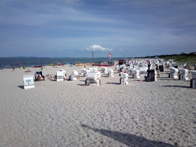
It's very pretty; a bit like an upmarket Bognor Regis except the food is probably similar
The VFR flight next morning to Peenemunde was trivial - no flight plan and about 15 minutes airborne time and that included a long orbit to get some photos of the place.
I had the "real" VFR chart running as a GPS moving map and the chart depicted what looked like vast restricted areas, which may have been bird sanctuaries. Using the GPS I carefully flew through gaps between them; they turned out to be mostly the water areas.
The airport, which looked dead, is FIS (not ATC) and the FISO sounded like I woke him up. Hard surface parking was no problem.


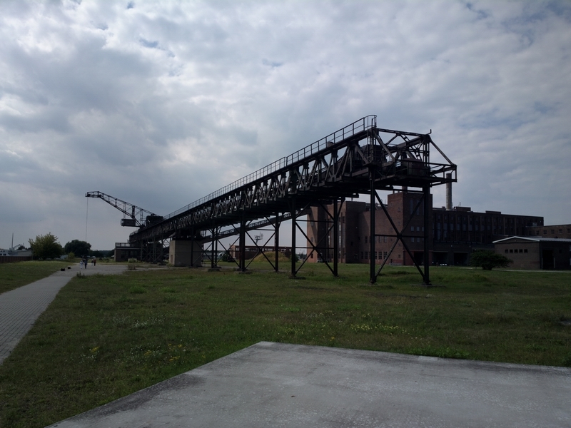
This is Peenemunde airport, with the rocket museum just visible on the left side of the pic

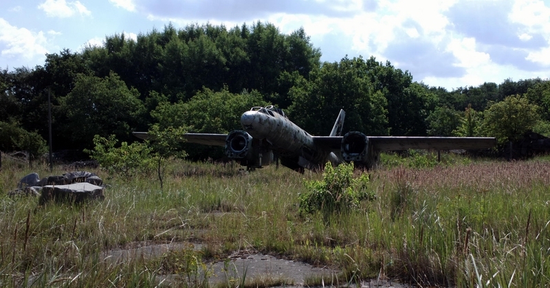
Some of the many pieces of ex Soviet Bloc aircraft left lying around

Left base, 800ft AGL
Final - out of focus

The "C" is actually crossed out, with a metal bar screwed across it; the real "C" is a little hut at the far left of the picture above

The airport has a tiny cafe serving sausages and ice cream, with a glass of water for €1.50.
This has the cockpit of a jet but the wings and engines of a turboprop, and looked like it's CofA had expired but nobody bothered to deregister it
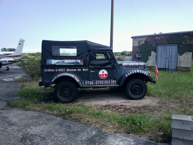
The company car. The red flags on the front are those of the long-defunct USSR
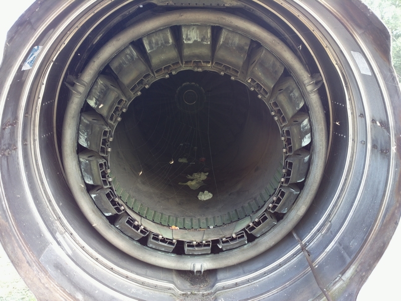
An apparently unmanned aircraft of an unknown type, with an engine amazingly still inside

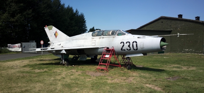
A complete Mach 2 jet, with the engine and probably the ejector seat cartridges still inside

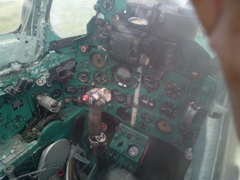
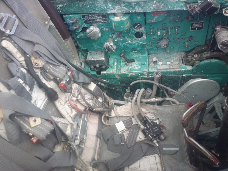
I got my IR revalidation done while I was there so the ADF certainly worked

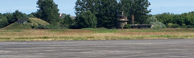
The original WW2 control tower, with a bunker next to it for the rare occasions when the Allied bombers managed to navigate to this part of Germany
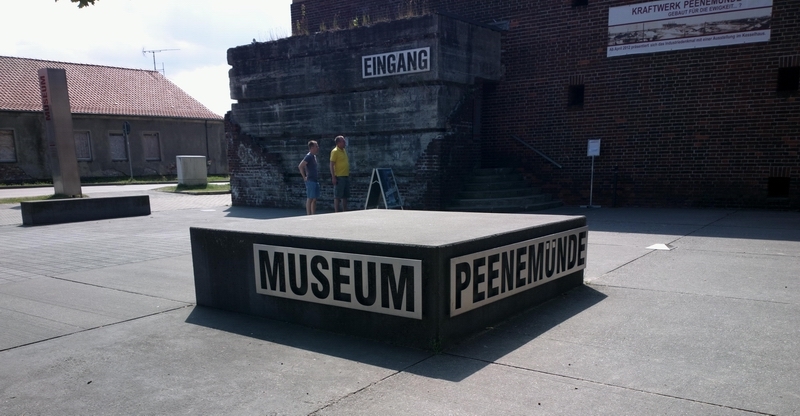
My colleague Achim arrived shortly afterwards in his C182RG and we went off to the Peenemunde museum. I rented a bike (about €7 for 24hrs) and Achim had a super high tech collapsible bike which is obviously a super thing to have for GA travelling

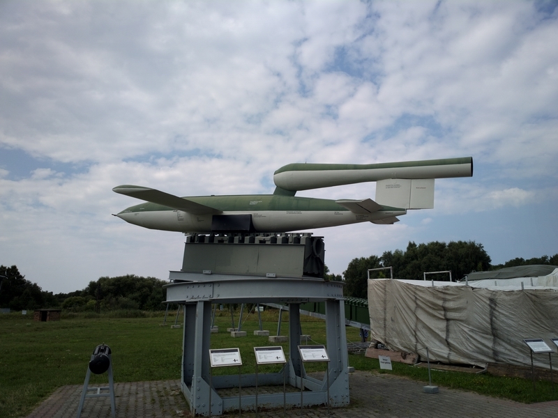
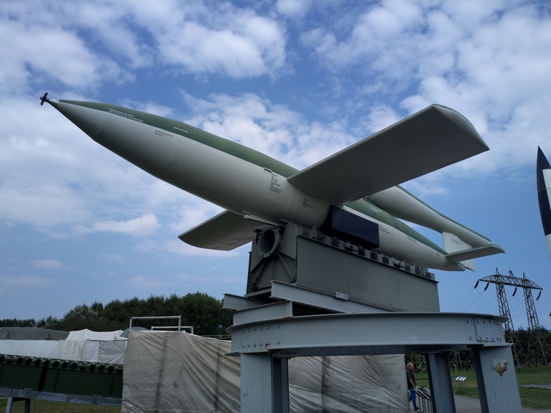
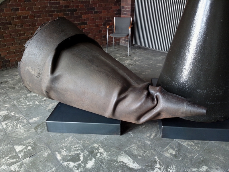
There is not a huge amount to see as far as the WW2 rockets go. Almost everything of value was carted off to USA, the USSR, or to Britain, together with as many German scientists as they could find. There are mockups of the V1 and the V2
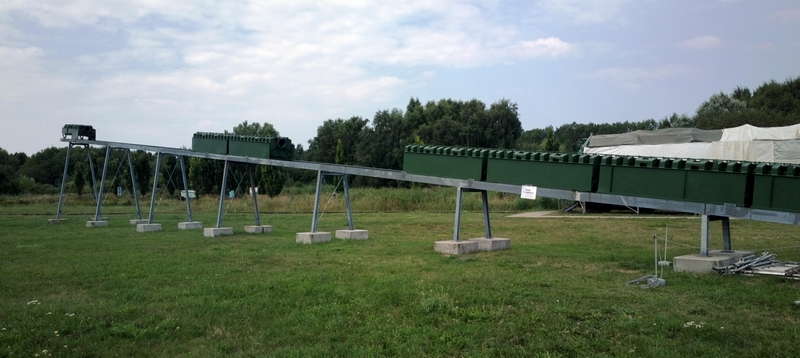
Remains of the many V2s which didn't fly very far
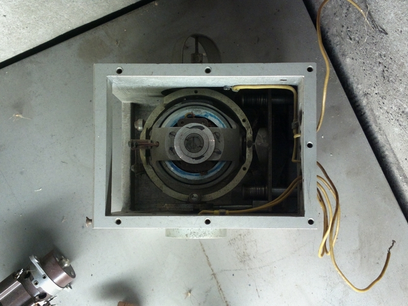
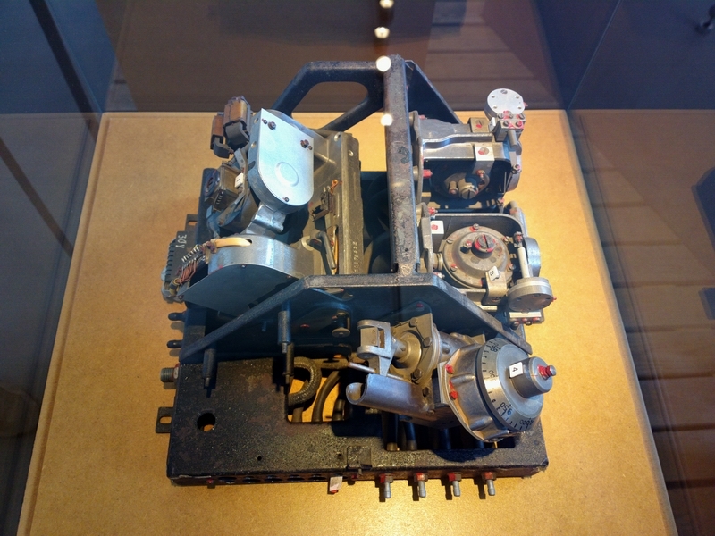
This is a two-gimbal gyro, probably from a V2. I was tempted to buy it and send it to Mid Continent Instruments for an overhaul; I am sure they would not notice anything because it looks exactly like current GA models
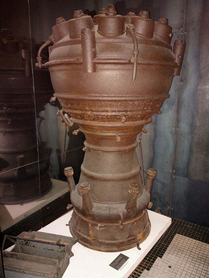
The V2 rocket engine, with the complex nozzles which mix the fuel (alcohol) with liquid oxygen - a nontrivial technology which takes a huge amount of R&D to get a stable combustion
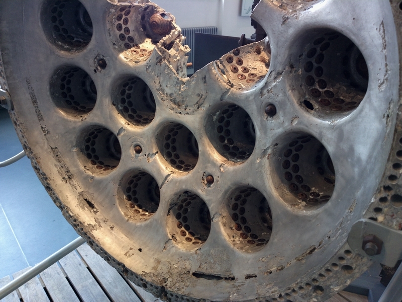
A close-up; the liquid oxygen is injected in the middle and the fuel around the periphery

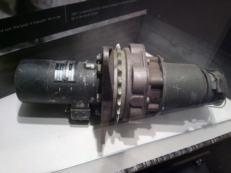
A really nicely engineered turbo fuel pump. The exhaust gases drive the centre turbine and the two outside sections each pump the fuel components into the engine

The guidance package from a V1. The technology is instantly recognisable, with a 2-gimbal gyro for an AI, an altimeter with an altitude preselector, and a couple of other gyros presumably for heading and yaw stabilisation
The point at which the V1 would fall to its target was apparently done with a timer which was a separate box.
The complete V2 engine - about 1.5m high
This is a hydraulically assisted autopilot servo; probably much more reliable than the electric ones which Honeywell turn out today
There was some other stuff; this is the drive train from a ship. A twin turbo diesel engine at one end and a prop at the other end

The whole place was thoroughly bombed during WW2 and the power station and a bunker for observing the rocket launches are about the only buildings still standing.
The whole area is full of Russian military installations, left behind when Germany re-unified and the Russians were given a year to move out. There are signs everywhere around the edges of the forests that the area contains dangerous munitions. There will certainly be huge quantities of unexploded WW2 bombs because the area was heavily bombed and a good percentage of the bombs didn't go off.
We cycled to the hotel and during the 1hr ride - mostly along really nice bike tracks in the woods - got caught in a lot of heavy rain. This is the MSLP for the day
which shows a trough in just the right place...
The return flight was again filed with a Schengen stop for Customs. This time I picked the old easy option: Le Touquet LFAT.
The GRAMET plot for the return flight is here
The surface weather forecast was as expected
Metar
EGKA 111020Z 26011KT 3500 SHRA FEW006 SCT009 BKN030 17/16 Q1019 RESHRA
EGMD 111020Z 23017KT 9999 SCT012 20/16 Q1019
LFAT 111030Z AUTO 24010KT 210V270 9999 BKN010 BKN040 OVC062 19/16 Q1020
EGKK 111020Z 27010KT 9999 SCT020 BKN032 19/14 Q1019
EGHH 111020Z 28009KT 9999 FEW030 SCT034 21/13 Q1019
TAF
EGKA 110758Z 1107/1115 25012KT 9999 SCT020 PROB40 TEMPO 1107/1111 7000 SHRA BKN009 PROB30 TEMPO 1111/1115 26015G25KT
EGMD 111029Z 1110/1118 24014KT 9999 FEW009 SCT030 PROB30 TEMPO 1110/1113 4000 SHRA BKN009 PROB30 TEMPO 1111/1118 25018G28KT
LFAT 110800Z 1109/1118 26010KT 9999 BKN012 TEMPO 1109/1110 4000 DZ OVC008 BECMG 1113/1116 CAVOK
EGKK 110500Z 1106/1212 22005KT 9999 SCT035 BECMG 1106/1109 28010KT TEMPO 1106/1110 BKN014 PROB30 TEMPO 1106/1110 7000 RA SHRA BKN009
EGHH 110801Z 1109/1118 26008KT 9999 FEW015 SCT035 TEMPO 1109/1111 6000 -RA PROB30 TEMPO 1109/1110 4000 RA BKN010
The radar image was relatively clean
The sferics image was clean
The route was filed as a "Z" (VFR to IFR) flight plan because Germany bans IFR in Class G and they got Eurocontrol to reject "I" flight plans to/from Class G airports. It is hoped that under EASA they will have to stop this practice.
F100
EDCP LABES IFR M725 MASOR Z130 RITEV T299 GEVNI Z102
WSR N125 EEL N872 NIK DCT MAK L607 KONAN DCT LYD LFAT
I started up but forgot to pay, of which the chap on the radio reminded me... He takes cash only - another €20 or so.
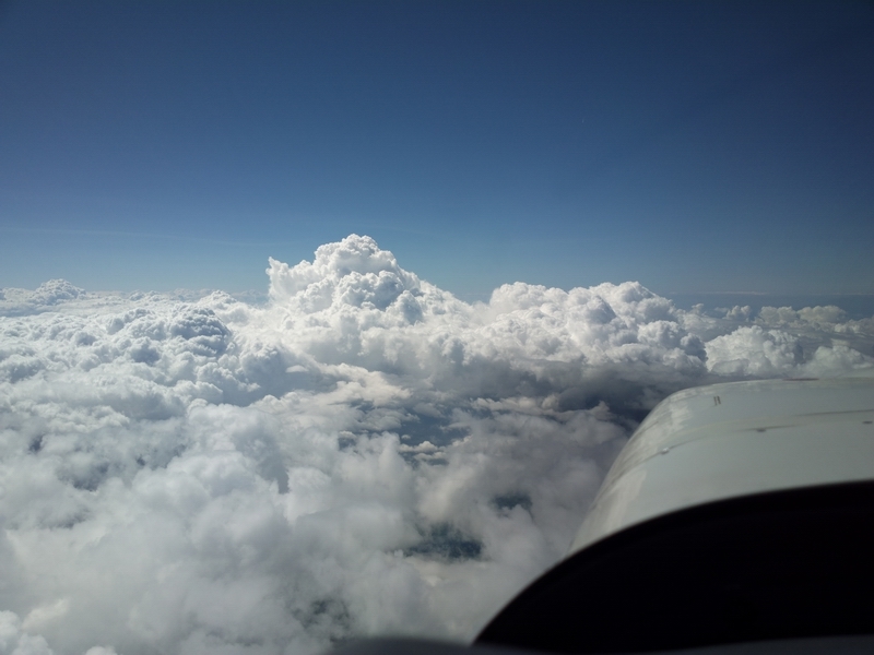
There was a lot of heavy weather still around from the previous day
The departure from Peenemunde is VFR, remaining outside controlled airspace (which means you really need the VFR charts even though it is a Eurocontrol IFR flight) and you call up Bremen Radar for the IFR clearance, which took about 2 minutes to come through and was straight to the filed FL100. I had to head for some blue holes for the first 50nm or so...

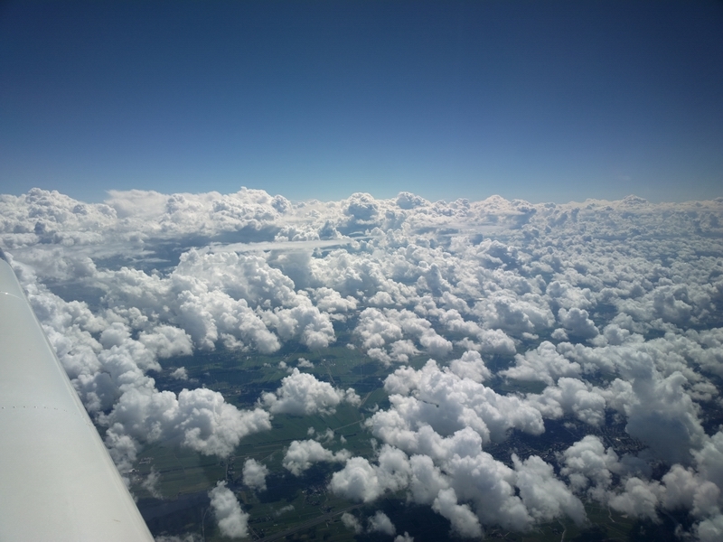
The blue holes would usually close by the time I reached them so some zig-zagging was involved
I soon climbed to FL120 to stay on top. In this respect the GRAMET was not far off.
The weather for the possible destinations was again obtained over the satellite phone and while it was not great it was above minima at all airports of interest
With a 25kt headwind, the return flight was a tedious 4:45, FL120-FL140 most of the way and only just keeping above the buildups at times
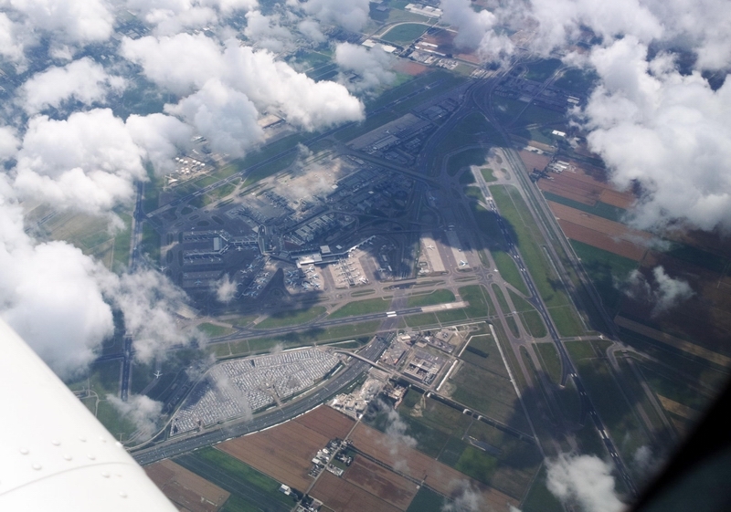
This is Schiphol airport from about FL140
There was plenty of convective stuff back home
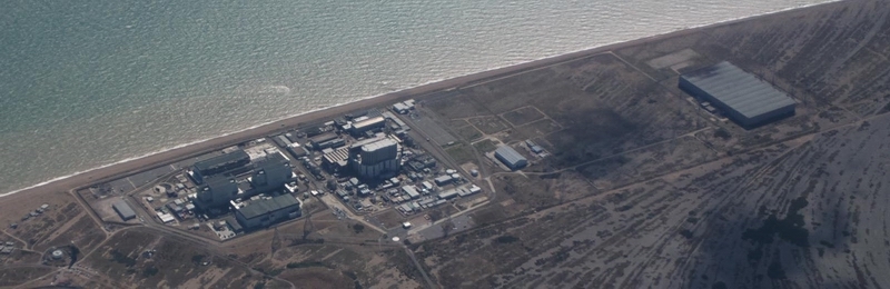
This is the nuclear power station near Lydd EGMD, with a danger area up to 4000ft
No traffic was ever seen (visually or on TCAS) at anywhere near my level, until back over the UK when I saw a number of contacts on the TCAS, either below me or Mode A (altitude unknown) which had to be kept at a distance.
The GRAMET for the return flight was not far off, though its forecast tops were about 4000ft lower than actual.
This trip demonstrates how "light IFR GA" can be used for flights in less than great weather, avoiding hazardous weather, provided one has the unquestioned access to airspace which is possible only by having the full IR. The 0C level was often in the cloud so icing would have been virtually guaranteed in IMC.
Picture wise, this is the best of all of your reports, I would say. Amazing :-)
I chuckled when I saw your term "device" for what we call a Strandkorb - a symbol of german beach culture!
Re your comments on food...if you had had ome local insight, you would have found loads of good restaurants whose quality is unheard of in the UK - two differnt worlds, really.
What did the airport officials say about your noise certificate?
Great report
I wasn't asked for the noise certificate by anybody so I forgot all about it...
Apparently German ATC is not allowed to vector traffic in Polish airspace, so the Heringsdorf ILS is procedural-only. They call it "standard ILS" which I had not heard before
German ATC is allowed to vector over Polish territory (there is an agreement) but German ATC regulations require a MRVA (minimum radar vectoring altitude) to be defined for vectoring. The Polish do not publish MRVAs for this area which then in turn prohibits German ATC from vectoring. That's what the guys on Heringsdorf tower told me. Interestingly, the guys are not employees of DFS but of Autrocontrol, the Austrian CAA/ATC. Apparently with the EU open skies treaty, any ATC unit can operate in every EU country and Austrocontrol made a more attractive bid than DFS. I think that's great, competition is always a good thing, especially for DFS!
Regarding the "standard ILS", I just read boscomantico's page on IFR in the UK and there he says that the Brits call that a "procedural ILS" which is just as odd to us as the standard ILS is to you 
Fuel was about €2.65/litre.
I paid 2.52 € including tax which is quite good for Germany. Fuel at Peenemünde was a whopping 2.99 € and the reason given was that demand is small so the price is high. Hmm, maybe the airport manager should rethink his logic on that one. I therefore flew 6 minutes to Heringsdorf and got my fuel service done by the staff there.
The Heringsdorf control zone was turned off on Sunday afternoon and when ATC (who were operating on an AFIS capacoty) were told that I was planning to depart IFR, they asked me to come up to the tower where they convinced me to do a VFR departure with an IFR pickup so they didn't have to turn on their control zone. Well, the weather was good enough for that so I of course agreed.
In Peenemünde the noise certificate made a difference of 2 € or so which is to be expected because it is a private airfield in a mostly unpopulated area so there is not a lot of incentive to discourage noisy aircraft.
Last but not least a picture of Heringsdorf with a wing strut.
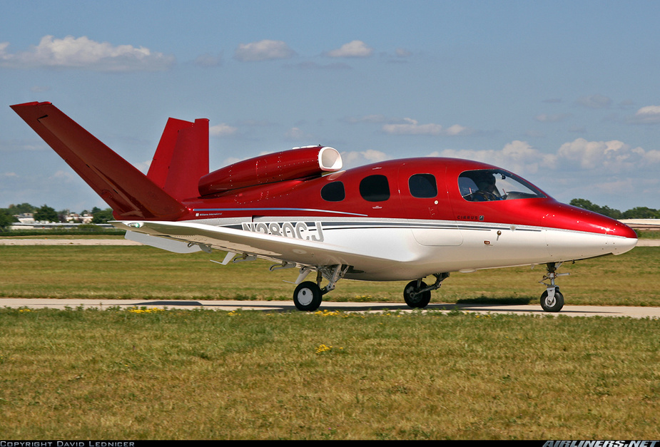
Peter forgot to mention that the Peenemünde museum is sponsored by Cirrus. They bought the type certificate of the V1 and are planning to restart production with a new paint scheme under the name SF50 Vision.

Many thanks, an excellent trip report - very entertaining!
Peter,
I googled a bit and there are two Greek restaurants in Heringsdorf. One called "Rhodos" the other one "Akropolis". Both in Seestrasse ( #28 and #72)
When I go back for my SE IR revalidation I will remember that - thanks
I wonder if doing an IR reval in that Mig would also grant you HPA privileges?


