
The Canyon!
It’s still extraordinary to me that the Canyon itself was only explored, by John Wesley Powell, in 1869 – just 149 years ago. Especially as I reflect that I first flew there in 1970, my first flight in any small aircraft, in the right seat of a tour Islander, only 100 years after Powell’s momentous expedition. Since then I’ve returned many times, never for a moment losing my fascination for the place.
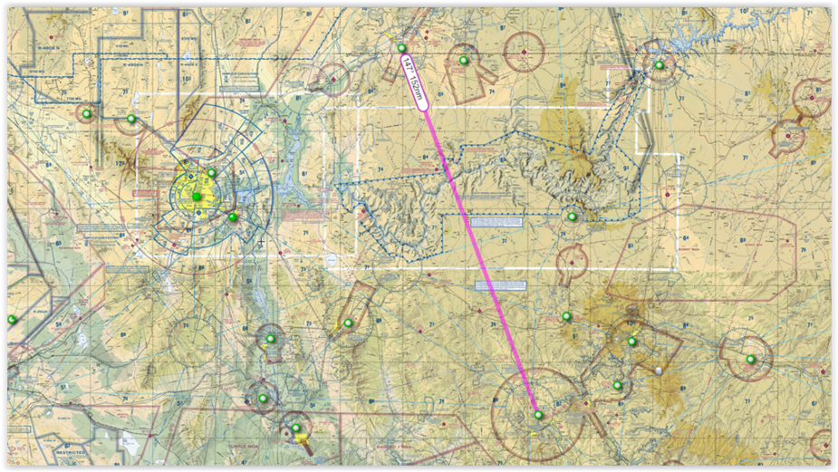
Today, my route from Saint George, Utah, KSGU, takes me South East to the Canyon Rim and then bounding across the vast chasm into Northern Arizona and onward to Williams, Az and thus home to Prescott KPRC. This flight takes me a little less than 2 hours, but crosses half of Earth’s geological history along the way. And I’ll make a small diversion en route so that I can illustrate some other parts of the Canyon.
Before continuing, a word about recent tragic events. No matter how cocooned we are in our comfy cockpits, the Canyon landscape is a wild and untamed wilderness. One of the things pointed out to me by the Islander pilot was the never recovered wreckage of the United / TWA crash in 1956, the one that led more or less directly to the modern ATC system. I’ve personally witnessed two fatal accidents at the Canyon, and locals tell me that they average around 70 per year, rather than the dozen or so admitted to within the confines of the National Park. In one case, a young boy climbed out on a ledge marked by warning signs, fell, and lay a pathetic crumpled form for most of the day until a helicopter could winch his body away. The personal grief and tragedy involved in this episode, and the recent helicopter accident can scarcely be imagined by the rest of us. The Canyon has to be treated with utmost respect. And the only way that you can respect the Canyon is by going there, and seeing it for yourself.
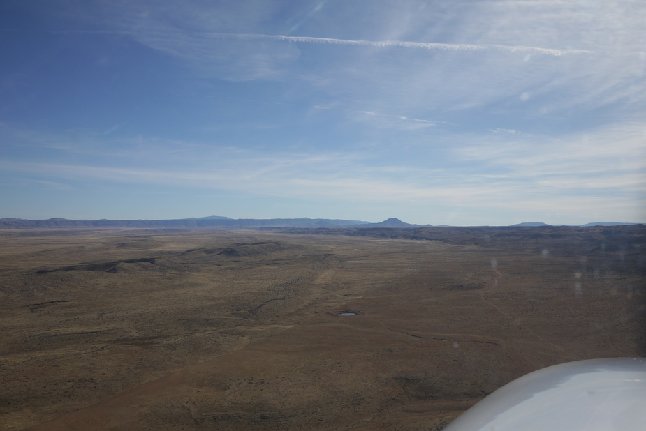
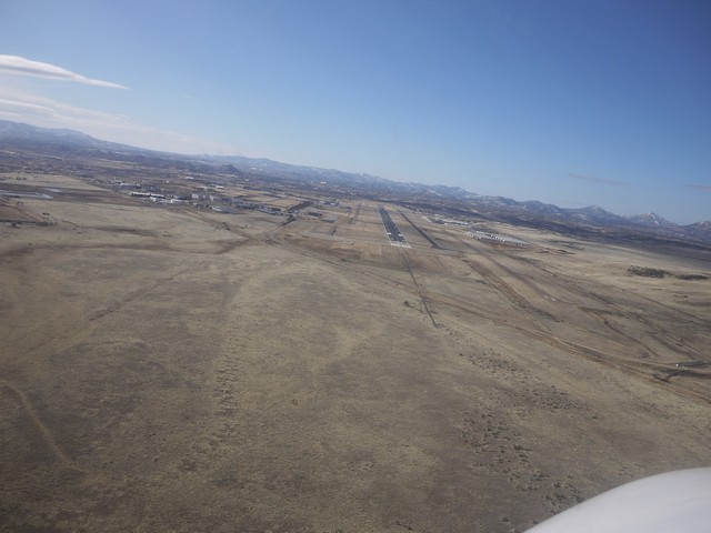
South of Saint George, broad low valleys sweep away toward the unseen Canyon Rim. I love flying low along these valleys, navigating by the bulk of Mount Trumbull, anticipating the scenic wonders that lie ahead.
All too soon, we have to start climbing. Climbing to get over one of the deepest trenches on Earth? Well yes.
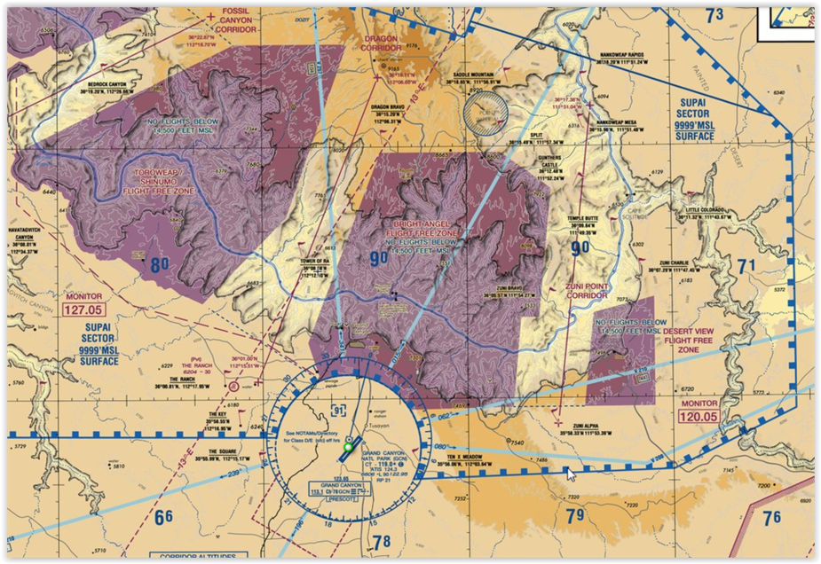
Most of the canyon airspace is covered by special flight rules, and divided into a number of ‘No fly’ and minimum altitude sectors. All this is described in a special Grand Canyon sectional which has remained current for many years. Indeed, my own copy has survived many trips and is held together with liberal amounts of tape! If only other aeronautical charts had last so long! Even after the advent of Foreflight, it was still necessary to carry the paper chart and despite the fact that today Foreflight zooms directly into the special chart, the paper copy still flies with me.
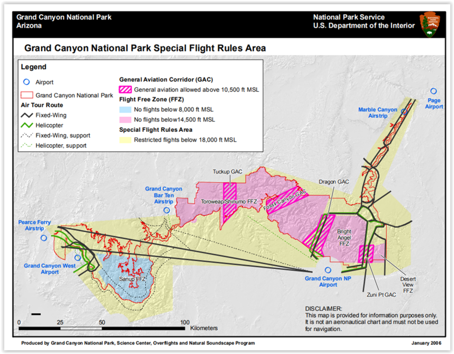
Ahead is the Diamond Creek sector with a minimum altitude (for airplanes) of 9000’ msl. But only just to my left behind Mt Trumbull is the Toroweep ‘Flight Free Zone’, where the minimum alt is 14’500’. (How often I’ve heard this designation mis-spoken as a ‘Free Flight Zone’. Not it isn’t – and unlike the polite request to remain 2000’ above in most National Parks, here it’s the law, and vigourously enforced. Apparently.)
As I climb through 9000’, far below is the airstrip at Bar Ten Ranch, a place I’ve never visited. I’ve called them a few times, but they’ve never sounded very keen. Maybe the British accent puts them off, and it’s not a place you’d want to get a flat, or a ding in the prop.
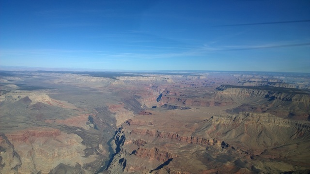
Anyway, there are other places you can get into the Canyon without breaching insurance conditions. More of that later. For now, the astonishing grandeur of the Canyon opens up.
This might be a point to note the weather conditions up here. Even fine days can produce strong winds, and this means turbulence, The winter is lovely time for flying because high pressure days mean clear, stable air and superb flying conditions, unlike the mist and fog that so often accompany winter highs in our maritime climate. So much of my flying in the SW involves timing my route to co-incide with high pressures predicted by the Prog charts. As highs drift away, wind gradients get up and throughout the mountains and particularly the Canyon you have to be very careful about any wind above about 20kts, where turbulence can be the limiting factor long before even considering rotors, lenticular clouds and drown drafts.
In the summer, daytime heating invariably stirs up strong turbulence even on calm wind days, usually starting before midday. While you may be able to withstand hours of prolonged bumping, your passengers (even other pilots) may not be so keen! And then there’s the afternoon thunderstorms. The closest I’ve ever been to a lightning bolt was at the Canyon, flying under an overhanging shelf when wallop! a shaft of lightning leapt 5000’ of clear air about a mile ahead.
To get the big weather picture, nothing beats the Weather Channel on TV, but only in the mornings – in the evening it’s nothing but reality TV shows. I look at where the Jetstream is and where the storms are coming from. The winter storms are not flyable in the 172 VFR, or IFR either because of strong winds and icing. But they pass, and you just have to have the time to wait them out.

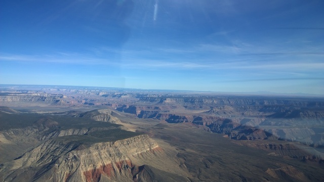
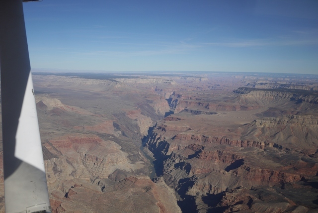
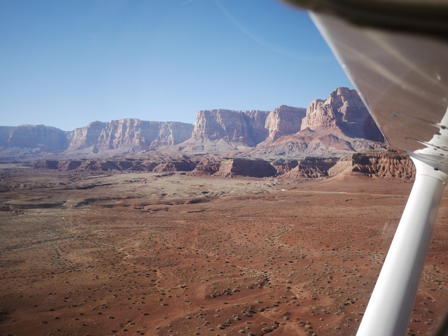
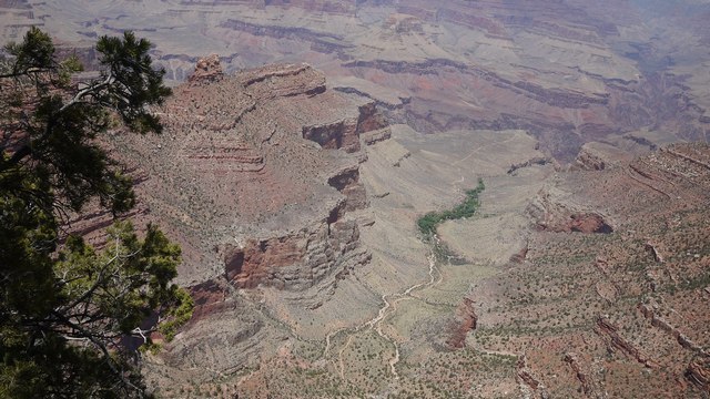
Down there, somewhere, is the river at 2000’ cutting through the hardest rocks in the Canyon, laid down almost 2 billion years ago. And above these oldest rocks has accumulated layers of sediment 9 miles thick. But hold on – we are in clear air only a mile and a half above the river! The answer is of course that 8 of those 9 miles have washed away since, mostly down to the Gulf of California, where along the way they have made up the land mass of Southern Arizona. So here comes the River:
The vast Colorado, completely contained now by the Glen Canyon dam at Page, Arizona, is still a raging torrent. But perhaps not quite the raging torrent it was when John Wesley Powell came through here in wooden boats. Indeed, right at this spot, two of his crew deserted and tried to reach safety along a side canyon. They were never heard of again.
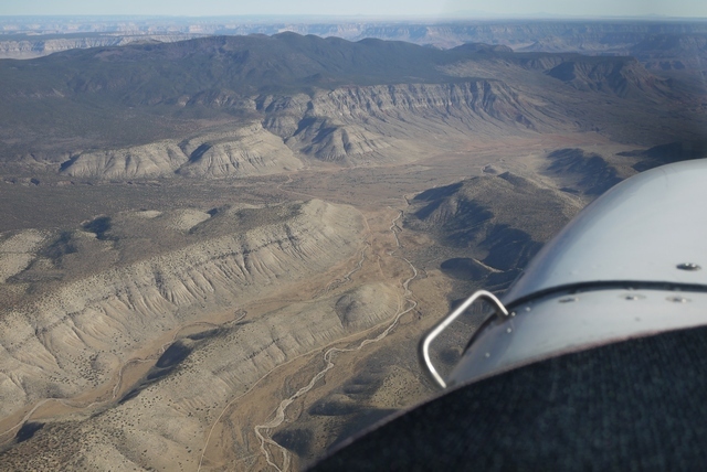
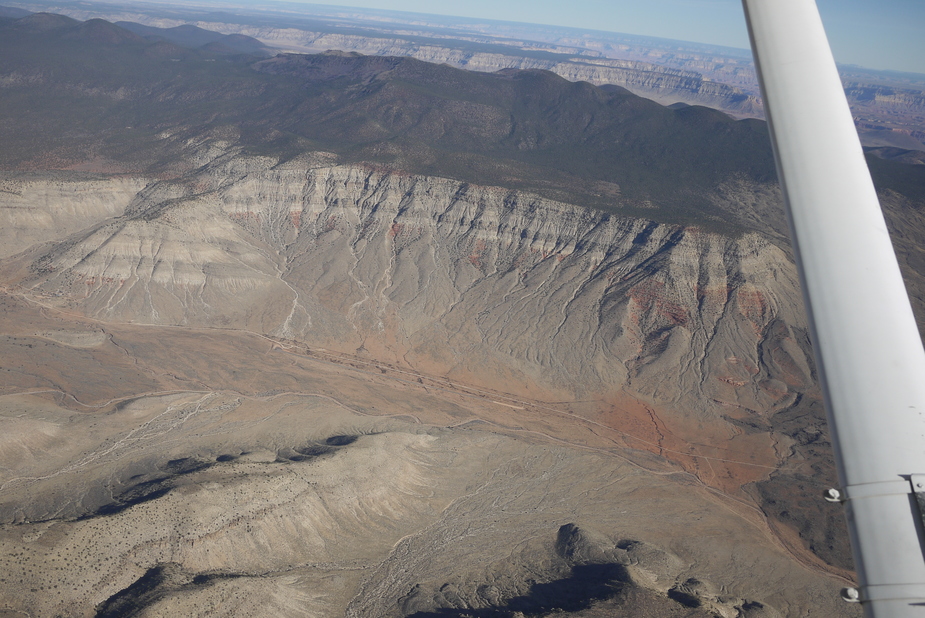
This landscape is young. By young, I mean geologically young – only 10 million years or so. During that time, the collision of the Pacific and North American plates has pushed the land up into a vast dome and the river, which was already here, has simply cut down to retain it’s path. But long before that, the land was eroded away, and relaid in the form of alternating layers of white and red sandstone. You can see these layers in the photograph:
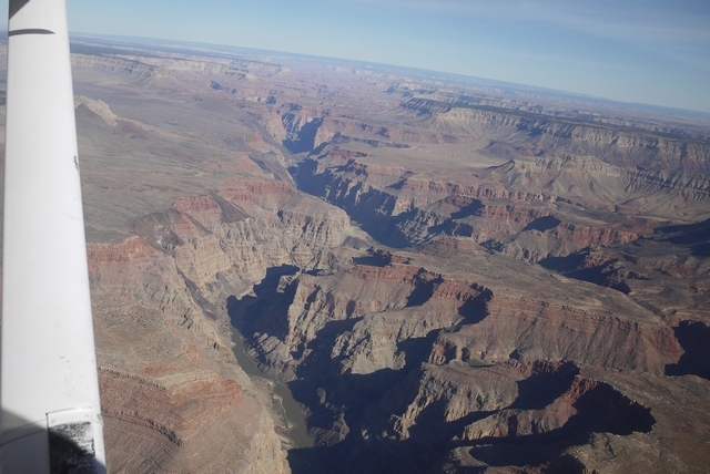
(The thin, alternating layers in the cliffs on the left). Each of these layers marks an epoch of perhaps 50,000 years, where the land became parched desert and shallow sea time and time again through Earth’s long and unwitnessed history. Maybe these layers are related to the our present epoch of glaciation, and tell us something about when the Glaciers will return?
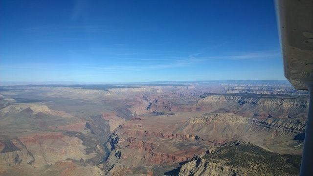
A curiosity about the Canyon is that there are no dinosaurs here. Surely, with such a vast span of time, the dinosaur layers must be in those cliffs? Well actually no – the erosion has washed them all away. All the rocks in the Grand Canyon are far older than the earliest dinosaurs. But even then, the rocks we see in the Canyon walls now are much younger than those at the very bottom, because many miles of ancient sediment above them have vanished, and further accumulations of sediment have taken their place. The point, above which great mountain ranges once rose and then washed away again, is called “the Great Unconformity” and can be seen in Scotland, and somewhere close to the river in this picture. It’s also rather more accessible at the foot of Frenchman Mountain in Las Vegas where a geological field stroll makes a much nicer alternative to the jingling casinos. When first noticed by James Hutton in the sea cliffs north of Berwick on Tweed in 1788, the Great Unconformity gave the first true picture of the age of the Earth and the vastness of Geologic time.
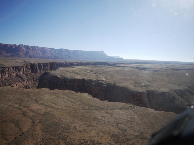
Looking away to the East, we can clearly see the domed formation through which the river cuts.
A little detour around the Canyon
Now, we’ll take a little detour 100 miles or so East, to make a landing inside the Canyon itself! Pictures in this section are from earlier years.
50 miles away on the Right, or Southern side, is the Grand Canyon Village and it’s airport, KGCN. And on the Left, the much less visited North Rim. There are no airports on the North Rim, with Saint George being about the closest place where you can rent a car for the drive to the summer only North Rim Lodge. It’s 70 miles off the highway on a narrow winding Park Service road to the North Rim lodge and made the trip very early one November morning, arriving at the deserted North Rim Lodge just in time to catch the sun coming up over the Canyon.
Photos in the bag (on film in those days before cellphones) I set off back to civilisation and breakfast, the only human being in that extraordinary and silent place for many, many miles. The North rim is higher than the South at around 8000’ and the road consists of dense forest alternating with beautiful, expansive alpine meadows. And as the road emerged from the trees into one of those meadows, I saw a figure standing in middle of the highway. But not a human figure – I was alone out here – but that of a huge wolf, maybe 4’ at the shoulder. I slowed to a crawl, fumbling with the clunky old SLR film camera, trying to get a shot. All the time, the wolf just looked at me, curious and master of all that he purveyed. I fancy we made eye contact and (No hunting here at the time anyway) he knew he had nothing to fear from me. Still fumbling with the camera, the majestic animal became bored, shrugged his shoulders (quite literally), and trotted off. By the time I’d got the recalcitrant camera to work, he’d reached the treeline, and vanished in an instant.
So once again, I’ve no photo to prove this episode ever happened. Sometimes now, flying the Arizona strip country out of Page which runs parallel to the North Rim, I go down low outside the special rules airspace along the road hoping to see a black spec or maybe a family of black specs, trotting along. But I never have.
Further East the airspace steps up, so that to cross near the airport in one of the VFR corridors requires a minimum altitude of 10,500’. The corridors are a doddle in these days of iPad and Foreflight, but before GPS it was a challenge because VOR cross cuts rarely made sense out there. The saviour was an FAA publication about the routes which included full page B&W photos taken from each entry point looking across to landmarks on the other side. I still carry it now, although the pictures have faded to light grey on white. Once, crossing northbound in a 152 at 11,500’, a voice came over the radio: “How’d you get up there?”. Good question!
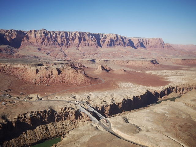
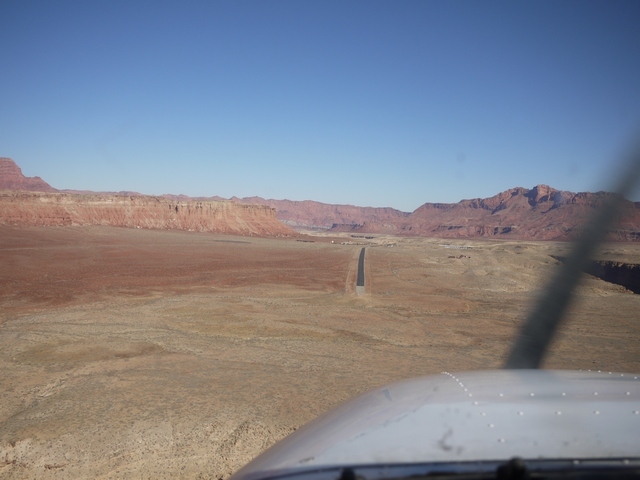
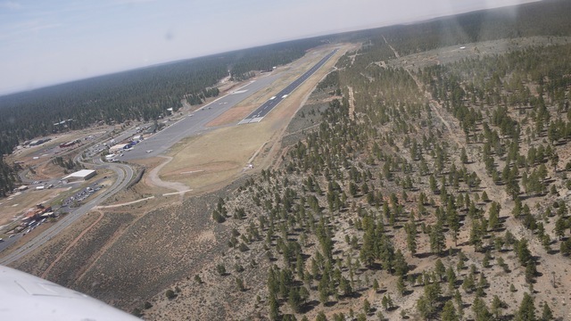
But there are places in the canyon where you can go down low. After the Canyon village, the Canyon turns North-East toward Page. And here, right in the canyon itself, is the Marble Canyon airstrip L41.
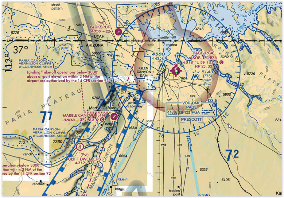
Here flight is permitted below the rim within 3 miles from the airport.
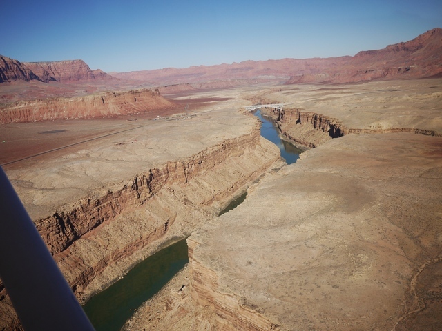
(Photos taken in 2017. Runway at Left.)


The power plant at Page, Az is at top right and Navajo Mountain 100mi to the NE. The runway at Marble Canyon is narrow but long. This didn’t help one twin driver who managed to stick his nose in the side of an RV in the parking lot at the far end! You can see how it might be tempting to land into this runway, with it’s kink, hump back, narrow width and scruffy condition at the approach end. In a 172, no problem at all: but in a faster twin, the lovely airport at Page is only 20 miles away.
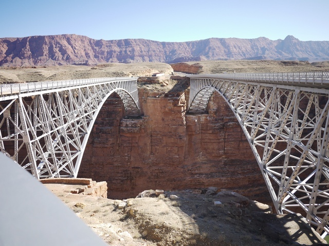
On the ground at Marble Canyon there’s a pleasant enough cafe and fairly basic motel. It’s just a short walk down to the bridges, which feature in many movies. The left hand bridge is retired from motor traffic and pedestrianised, while the seemingly identical but much more modern twin carries the highway. Just to the North is Harper’s Ferry, the spot where John Wesley Powell entered the river on his 3 month trip down to Las Vegas.
Turning South now from Page down toward the Grand Canyon airport KGCN we find the entry point to the Dragon corridor southbound at 11,500’. The corridor is 5mi wide. Note the San Fransisco Mountains at Flagstaff in the distance.

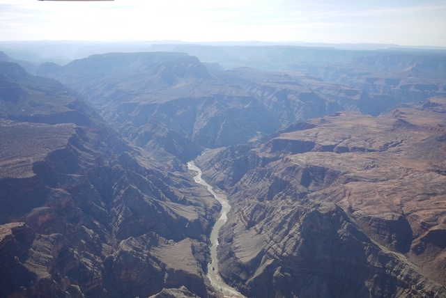
Out across the Canyon now at it’s widest point, unbelievably the river is 2 miles below!

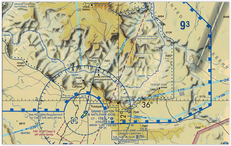
The Canyon airport is in class D airspace and the controllers are helpful as ever in the US system. (But not so helpful as to permit a downwind departure out over the rim!) It’s a good idea to make early contact for a landing here, because you are mixing with seriously intensive tour traffic. But the approach and landing is simple enough. Ground will direct you to parking and if you’re not familiar, to the hole in the fence where you can exit the ramp. From there, you are on your own, because while there are taxis at the Canyon, reliability is not their by-word. The best plan is to stroll up the approach road and through the woods to the village at Tusayan, where you can buy a park entrance pass and combined bus ticket, about a mile.
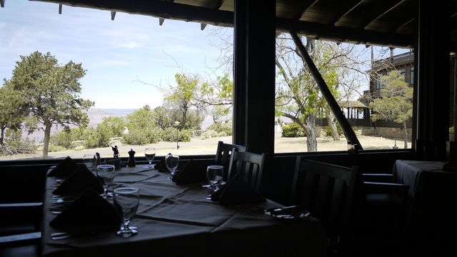
From there it’s a 30-45 min frequent shuttle bus ride to the Canyon village and the El Tovar Hotel, which is the place for lunch in a Fred Harvey dining room overlooking the South Rim. (You might need to book this stuff – my visits are always out of season, but other times might not be so easy). You can see that a lunch stop at the Canyon is a 3-4 Hr exercise! The walkway outside the El Tovar has a special place in my heart, because it was here that my baby Daughter, then 8 months, said her first word. We were walking her in a McClaren stroller (pushchair or buggy in English) and American parents having never seen such a contrivance before would lean over to look at it and say “Hi” to the tiny occupant. So her first word was of course “Hi”, with a perfect American accent!
The El Tovar is at the head of the Bright Angel Trail, which leads right down to the river a mile below. You might think a quick stroll down there would be a good appetiser, but my experience is not so casual. After many short trips down the trail, and noticing that most people pretty quickly turn back, I resolved to do better and leaving the plane at GCN one November set out to see how far I could get. It’s essential to have water, because there’s none down there. The trail is very narrow and heavily loaded with hikers and, unbelievably, Donkey trains. The Donkeys, like their cousins everywhere, have very forceful personalities and know that they want to walk on the inside. You as a mere human don’t get a choice in the matter.
As you go down, you walk past the bands in the rock, which are maybe 50’ apart vertically, 50,000 years or 10 centuries to the foot. It’s quite stunning to see how constant and orderly the Earth was for countless millions of years with nothing break up this regular cycle.
So how far did I get? I know young people who’ve done the whole trip, down and back up, in a single day. Not for me. There’s a plateau and a shelter building halfway down that’s visible from the El Tovar, standing out on a promontory into the Canyon. I’m proud to say that I got there, but when I did I knew beyond any doubt that was my limit! The trip back up was tiring, and at the end I was stopping every 50 yds or so to rest. So much so that several passers by asked if I was “all right?”. Hmmm. So that’s my record on the trail, a personal record that I’ll never break. And the view down there? Stunning, breathtaking, worth every step.
There’s fuel at the Canyon airport and hotels at Tusayan as well as at the rim. But nothing at the Canyon airport happens very quickly and any stop there should be for at least a day, though I have several times made a long lunch there. And one more train story: There’s a train station at the rim, built by the Santa Fe at the turn of the century to bring tourists to the Fred Harvey establishment. The line closed after the war and re-opened about 30 years ago. In the early days they ran steam locomotives and on one occasion I was able to blag my way onto the footplate. It’s a 64 mile trip down to Williams, Arizona and during the run (on a massive Alco 2-8-0, for those who know) it got dark. To my surprise, the fireman opened a little door in the front of the cab, climbed through it and right along the handrail to the front of engine, where he lit the headlamp!
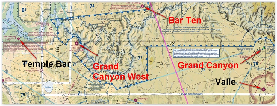
There are other Canyon airports. The Grand Canyon West airport 1G4, destination of many tour flights, is on tribal land and permanently rammed with traffic and tourists. The heavily scratched transparent walkway out over the Canyon rim is scarcely worth the $100 landing fee and this is not even in Europe! Much nicer is Valle 40G, about halfway to Williams, which has a superb auto and aviation museum run by really nice people. Far to the West on Lake Mead, the Lake formed by the Hoover Dam, is my personal favourite in Canyon land, Temple Bar U30. Parking is right outside the Marina restaurant with superb views across the Lake. But I’ve not been for a while, because nowadays I like to think I fly a better class of Aeroplane and the owners are likely to notice little dings and chips caused by loose gravel! And all the time there’s wonderful Page KPGA, a delightful little town built on a Mesa overlooking the Glen Canyon dam and Lake Powell with really helpful FBO’s and hotel transport. I use the Holiday, where you can get a room overlooking the river and the set of the film ‘Evolution’, filmed entirely in and around Page.

Well, the day’s drawing on and it’s time to return to my route to Prescott. I make a lazy orbit, taking a long view of the Canyon receding behind me, and set course to the South with, every time, very mixed feelings. I’m looking forward to being back in Prescott, and then home to England. But I’m sad to be leaving this excellent little Cessna, which hasn’t missed a beat in 2500 miles of arid desert, snow capped mountains and geological wonders.Oh well, there will be another time – I hope.
I resolve to make a respectable landing, remember to cancel my flight plan, park the aeroplane neatly and remove the accumulation of junk from the interior (Including several gallons of free FBO water bottles). And that’s it – until next time.
If you have been, thanks for reading!
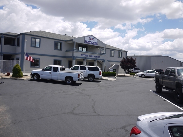
Below: Northaire (shameless plug!) and downtown Prescott, outside the Hassayampa Hotel.

Simply wow….thank you so much for taking the time to write down your adventure.
Thank you so much for reading it!
What great photos and write up, many thanks and a great ambassador for GA.

