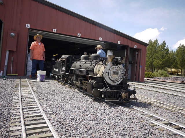
Chapter 4 – Friday at last!
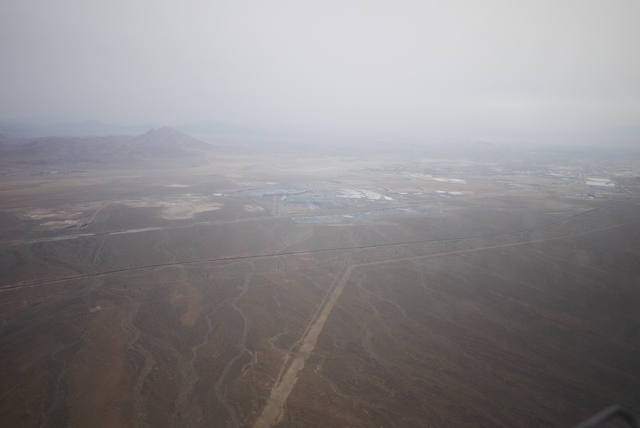
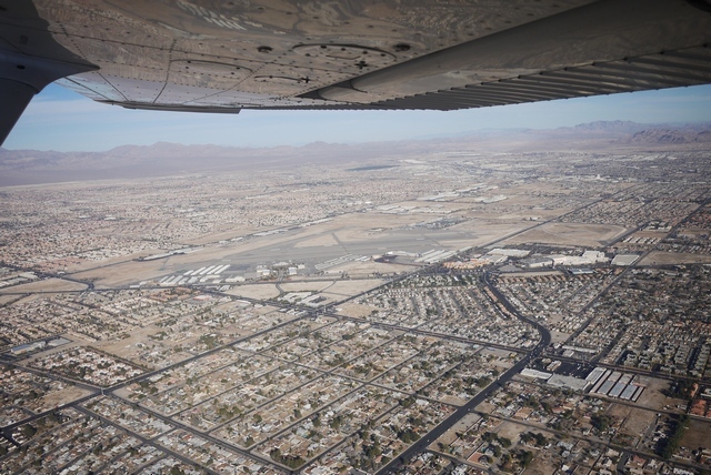
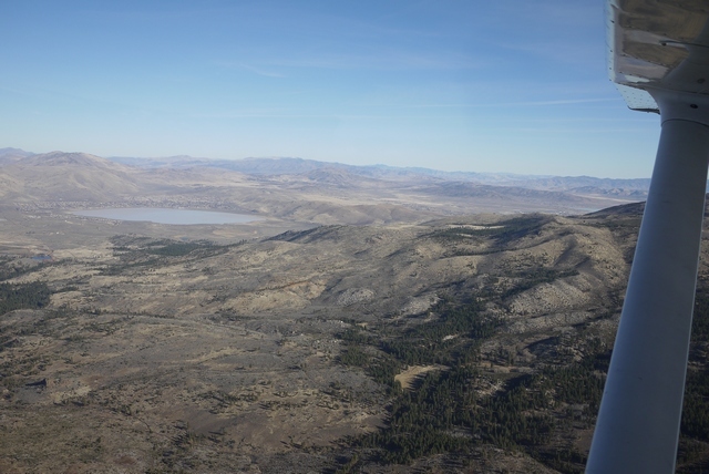
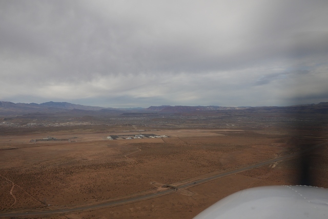
First a correction – what I said about being stuck in the hold at McCarran for 50 million years was absolute drivel, obviously. In practice, you’d only have to have been there for 10 million years to see Frenchman Mountain come marching up from the East, forming the basin that is now Lake Mead behind it. The geology in this part of Nevada is really quite young. Here’s another view of Frenchman mountain, Nellis AFB just off to the L and downtown Vegas away to the R.
CES this year will be memorable as the ‘year of AI’. I already mentioned in the ‘flying without GPS’ thread that the type of AI coming soon to a cellphone near you will make mincemeat out of visual navigation, and all without access to the (computer) cloud. Unlike human pilots, who frequently have trouble telling one mountain range from the next, tomorrow’s cellphone will take one peek and nail your position 100%. So long as it’s not raining, or cloudy, or dark etc..
I actually believe this because of what’s happened with VFR navigation out here in the West. In the beginning, there were printed sectionals covering about 500 mi E-W, which involved some complex joggling when your route crossed the border between one sectional and the next. To get over that, you had a ‘Jet Chart’, covering the entire country, and used that to transfer track lines to the sectional. (And you had to pack an 18" ruler). Then came Runway Finder, an iPad mash-up that allowed route plotting without having to find a hotel with a 10’ chart table in the room. By the time poor, wonderful Runway Finder was closed down by evil patent trolls, there was Foreflight, ready to go. The transformation in pre-flight planning that these tools have allowed is nothing less than astonishing.
Yes, I do still mark up paper charts! Here’s that elusive hotel plotting table, used to draw track lines from Foreflight. It’s a nice day in the morning this Friday.

CES winds up on Friday and by luchtime even the Chinese are packing their displays away. Anyway, I’m really not able to walk further. I make for Northtown. This CES has been phenomenal, truly memorable, and a year that I think we will come to look back on as a turning point from dumb accessories to AI.
(Just to mention that there are other airports in Vegas: Henderson KHND to the South, a nice place a little further out than Northtown but with a good approach clear of the Bravo if you are coming from LA. And of course McCarran itself. Unfortunately, the FBO’s there are inconveniently placed on the wrong side of the field and are always busy ferrying real high rollers. Very pleasant though, if you don’t mind paying $8.00 for gas. Yup, that’s £1.50 / Litre – almost Euro money!
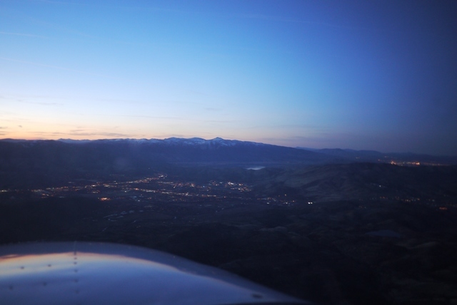
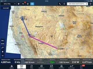
It’s 2.00 pm before I start up and my flight up to Carson City KCXP, Nevada will take the best part of 4 Hr with a modest headwind. It’ll be getting dark…
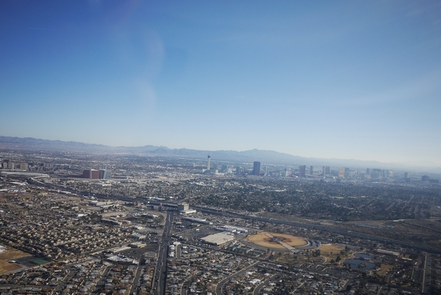
Taking off to the SE, the Stratosphere (with it’s roller coaster on top) is at centre, downtown Las Vegas to the L, and the strip to the right. Here, we are right under the Class ‘B’ and any further ahead would require a clearance. Northtown (and many other towered airports) has a separate frequency for clearance delivery and will give you an onward frequency for departure (depending on direction) along with a squawk. So it’s perfectly feasible to take off and keep straight ahead, knowing that tower will tell you to “call approach” in time to get a clearance into the Bravo before you actually get there. Or even tell you “Cleared into class ‘B’” before take off. Don’t try that at home!
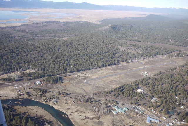
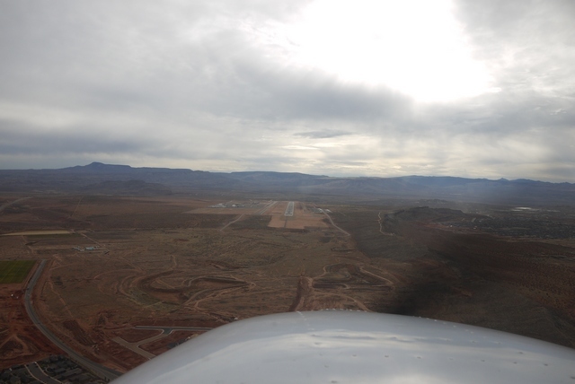
A normal routing will take you down the strip, over McCarran and out of the Bravo near Henderson following the freeway toward LA. But it’s perfectly normal to ask for, or even be offered, a ‘Strip tour’, down to the airport boundary and back again. Not today, though. I swing away to the NW, never entering the Bravo, and set course toward the distant Sierra Nevada mountains. Here’s a last glance at wonderful Northtown, where the terminal building cafe is now open again after a long sojourn. (The lack of a cafe was a major reason for wholesale desertion down to Henderson). Gone with new decoration are the hundred’s of pilot’s signatures that once adorned the walls (including mine) but I suspect it won’t be long before someone starts that up again…
Left of track is 10’000’ Mt Charleston, and at the top a superb ski lodge with a colossal open hearth fire in the middle of the lounge, all within sight out of the windows of Las Vegas, but a million miles away in every other sense. On the Right, just beyond the highway, is the restricted airspace of the Nevada Test Site and way out there, Groom Lake, aka Area 51.
I suppose most pilots have their own UFO stories, and mine concerns late one night, driving down off Mt Charleston, on the long straight highway the faces due E toward the test site. High up I notice a fast moving brilliant green light apparently falling vertically toward the ground. I’ve never seen, or heard of, a green meteor and this maintained a constant brightness as it fell from the high overhead toward the horizon, where it vanished behind the nearest mountain range. This put a minimum range on it of 10 miles and in the unrestricted visiblity it easily could have been 100 miles away. So what’s bright green and falls vertically from the sky in 5-10 seconds in a secret test range? Answers on a postcard, please.
After half an hour or so, I round the Northern tip of the Charleston Mountains and, clear of the restricted airspace, finally set a direct course. 20 miles back, Vegas departure said I was going out of range and cancel my flight following, which I used to keep me clear of traffic leaving Northtown and up through their practice area. I change to the FSS frequency, and request activate my VFR FPL “off of Northtown at (time)”. And that’s it – no more radio contact for 300 miles. Far away on the Left is Death Valley, a nice little day trip from Northtown, with it’s unattended runway and phone kiosk, where you have a choice of “The Ranch” or “The Inn”, both of which will pick up from the airport. Before the phone box (and cell phones) it was a long and ill-advised walk. Amazingly, the maximum distance that a person can walk out here (in daytime, no water) is seven miles.
This terrain is a geologic wonderland (did I mention that?). Here, a cinder cone breaks through the surface, looking for all the world like it formed yesterday. And in geologic terms, it did. The San Francisco mountains near Flagstaff were active only 10,000 years ago, and one cinder cone, Sunset Crater, was actually inhabited by Indian peoples at the time. Now, the volcanoes are silent – or are they?
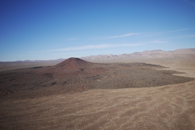
Each ridge line is a gateway to another vista, a gateway to another world. In my dreams, I can say that I’ve been to Mars, because some of this terrain is indistinguishable from the rover Opportunity’s images.
I’m keeping low because of the headwind (and I like the scenery) but the transponder light never goes silent like it does in Scandinavia. But if the engine stopped now? Much of this terrain is land-able and I keep cruise speed on so that, if anything faltered, I have a bit of kinetic energy to choose a spot. In the sidewall pocket is my PLB, and of course the Cessna has a panel mount ELT. In the back is a survival kit and two gallons of water, plus numerous free bottles handed out by FBO’s along the route. If I survive the landing, I might last long enough to be rescued, so long as I keep to the cardinal rule: stay with the plane.
Of course the engine could stop, but the primary reason for that – fuel exhaustion – is much less likely because a) The Cessna is on ‘both’ and crossfeeds and b) because at every stop, the FBO rushes out to fill her up before someone else gets there. And in this simple observation is the key to operating a Cessna in the US: you don’t need your own stepladder, or far less need to balance precariously on the flimsy feeling step, one hand supporting the heavy fuel hose and the other hanging on to – err something – like grim death. This single reason, IMHO, explains Cessna’s success in the US market while in Europe the PA-28 is your only defence against the baleful expressions of ‘refuellers’ who sit in their tiny heated huts watching you fuel the plane yourself.
It’s this fuelling enthusiasm that lies behind my ‘always top it off, every flight’ philosophy. On my own, I only have to worry about DA, and the Cessna POH makes that very simple. A few higher airports have a DA display at the hold and all mention it in the ATIS, but will it fly? I once had mushy takeoff at 7000’ elevation, requiring me to fly in ground effect for almost the length of the runway to get climb speed, and that taught me that technique matters as much as the book. Rotate too early and it can be hard to build speed at high altitudes and temps. Wait for the speed to reach 60 on the ground and she’ll fly, regardless of the runway you’re using up. After all, runways are long out here (Grand Canyon’s is 9000’ at 6600’ elevation) and they don’t charge by the length of ground roll!
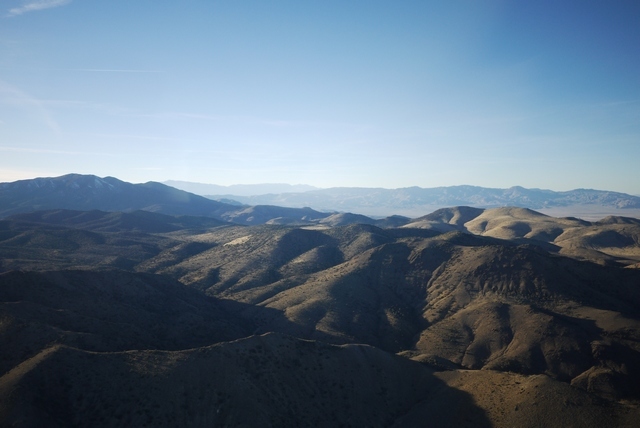
Now the shadows are forming and the horizon forms a most beautiful apparition.

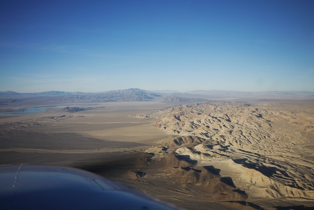
Still 70 miles to go and my “always a diversionary field” philosophy starts to break down. There are runways out here sure enough, but none with hotels, restaurants, etc.. Anyway, I’m night current, I’ve checked the lights, iPad is illuminated with Foreflight, so what can possibly go wrong? It takes a long time to get dark, perhaps because the air is so clear, as the sun sinks remorselessly behind the Sierra Nevada mountains not so far to the West now.
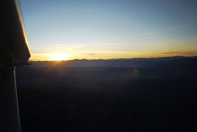
My only concern is the tall ridge that stands between me and Carson City, so I stay high (11,000’) and in the evening twilight, I can still see the terrain clearly enough. The valley beyond is an inky black bowl, and right where it should be, Carson City. Just then, a voice comes on the radio “Lake Amphibian, landing Carson City” and in response, not even the ‘click click click’, the lights come up and there’s the runway!
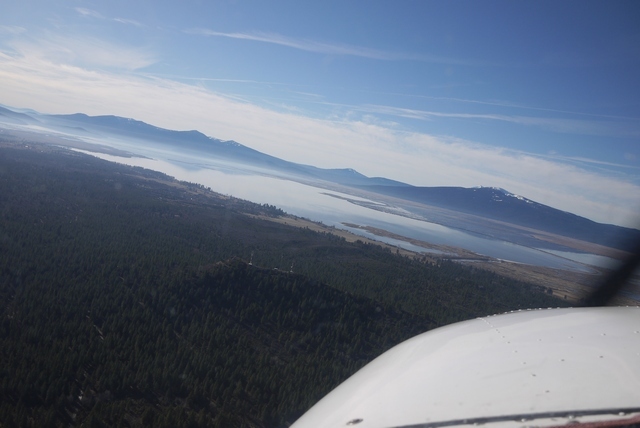
As I descend into the bowl of darkness, keeping the Lake Amphibian in sight, the fallacy of my pre-flight comes to, er, light – the light in the ASI doesn’t work! Well, no problem, I can fly without an ASI. And I can angle one of the map reading lights to cast a glow over it. Now, I’m spiralling down into the valley, 11,500’ down to 4,000’ bringing the power back in stages to avoid shock cooling (which is reputedly impossible with an IO-360 anyway, but I don’t want to be the one to find out). The view out of the window is truly glorious, and the outline of the jagged mountain ridges still discernable, but a comfort is Foreflight, so I’m not guessing what I’m descending over. At this point, the camera runs out of exposure (It’s a fixed focus wide angle setup) so I can only offer one more, a view of Lake Tahoe peeking through a gap in the Sierras, and it’s time to land.

Next time: The Oregon trail.
Just the pond to go now?
Yeah, but somehow it appears bigger the closer you get 
QuoteAre you at Intl? I’ve been at Smyrna and John C Tune, neither very well connected to the city. Just interested in the experience at Intl since I’m going over there again soon.
Yes, we‘ve been to KBNA. We didn‘t rent a car, so the better connection was the reason for us to go there. The FBO provides free transport to the hotel cluster which is a mile or two north of the main terminal. We had booked room there. From there there is a public bus to downtown every half hour, taking 20 minutes. Albeite there are quite a few restaurants near the hotels there is not much else but it’s OK to visit the city for half a day.
Fuel was OK with Signature and service was excellent but we payed 80 US for two nights. But anyway, transportation is probably more expensive from the smaller fields so one can’t save much.
Thanks for that info Terbang. You’re right, the taxi from Tune is $30 and from Smyrna $50 and both take best part of an hour. I’ll try haggling with Signature (Yeah, right!) as I’m there for a few days. Didn’t know about the bus. Good luck with the pond – a mere puddle for a team of your capabilities!
Chapter 5 – to Oregon!
A beautiful morning and an early departure. The local casino picks up from the airport, using a regular cab and refunding the driver. I tend to choose airports on the basis of having hotels nearby that pick up, because anything else can involve unpredictable cab rides or even car rental to get to someplace suitable for the night. And hotels that pick up always seem to have some special rate with the FBO intended for aircrew, which I sort of am.
The crucial tool in hotel finding is Airnav which lists both FBO’s and hotels. Once upon a time it used to list ‘Hotels that pick up’ but sadly that fell foul of some problem or other, and so nowadays they just give distance from the airport. Still pretty helpful, but you end up calling the FBO and asking them. But often they ask “can I make a reservation for you” which I always resist, because one of the worst things in flying out here is press-on-itis, driven by a paid for hotel reservation.
Behind the airport, the Sierra Nevadas tower majestically. The mountains present a bigger obstacle to small airplanes than the Rockies because although the are lower (12000’ vs 14000’) they are much deeper at around 30 mi for a crossing, meaning up to half an hour at 14000’ in the 172, right on the FAA and my personal limit. And in the winter, all the valleys up there are full of snow, and the roads closed. A forced landing might be problematic.
As it happens, if I turn left just now, I could fly through one of the few low level routes in the Sierras at Donner Lake, leading through to Sacramento at just over 7000’. This is the place where, in 1846, the the now eponymous Donner Party had the same idea and in 1867 the Central Pacific drove the first transcontinental railroad from ‘sea to shining sea’. But not for me the joys of California on this brilliant winter morning. My course is North to Oregon!
Today, the same pass carries the I-80, a superhighway that runs almost 3000 mi from San Fransisco to New York – nearly. Actually, having beaten the Sierra Nevadas and the Rockies, it kind of disappears in the suburbs of new York where planning objections became too virulent, a familiar story on this side of the Atlantic!

Ahead is Reno and it’s Class C airspace. The difference between class D and class C? Both require 2-way radio contact, neither require a clearance, but only class C has a transponder requirement. Yeah, I didn’t know that until recently either. Reno’s a busy airport that in UK would involve all kinds of airspace shenanigans, but here just a polite request from approach for me to “route along the west side of the valley” which is my intention anyway. Just try entering Solent Class D just with 2-way radio contact and see what happens!
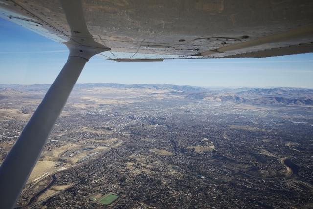
I have to say that I’ve never actually landed at KRNO Reno. The idea of a mini Las Vegas, having just escaped from the real thing, jut doesn’t appeal. But I expect they have plenty of hotel choice and the experience of Atlantic (the only FBO) might not be too punishing. But it’s interesting that under FBO’s on Reno’s Airnav page,Mountain West have a big ad saying “come to Carson City instead, only 20 miles!” Hmm. This question of exclusive FBO’s is a real hot potato at the moment, with one of them (KJAC Jackson Hole, Wyo) being shown the door recently courtesy of AOPA agitation.
(When I landed at Jackson Hole a few years back, I made some remark about it “feeling just like home” to which they were silly enough to ask in reply “in what way?” so I told them in the way of their $20 landing fee. A very polite discussion ensued, during which I explained the corrosive effect of landing fees on UK GA which genuinely surprised them. And they are right in Yellowstone National Park, so they have some little justification in terms of limiting demand at what is seen as a ‘challenging’ airport).
Just to NW of Reno is Reno Stead, home of the famous air races. Not quite my cup of tea, but one of the few places where you can see a bona fide engine failure / forced landing on demand! In my case, a P51 whose deadstick landing ended perfectly on the main runway. The amazing thing (to European eyes) about Stead is that, from the stand, you can see the entire 8 mile course, right out to the furthest turning point. For me, the best part about the air races was flying there in a 172 from Boundary Bay, Canada, but that’s a whole other story).
Reno Stead right centre.
Ahead now, the volcanic cone of Mount Shasta peeks above the horizon. Shasta, at 14000’, is the first of the Pacific Cascade volcanoes which march in a straight line Northwards toward Canada. These mountains form the final barrier to the sea and contain the best known American Volcano, Mount St. Helens. At least these volcanoes make navigation up here easy (on a good day) and no sooner has Shasta drifted astern than the next one, Mount McLoughlin, comes into view.
Incidentally, the volcanoes are here because this marks the spot where the Pacific plate has dived down far beneath the North American plate and reached a depth (about 50 mi) and temperature high enough to form Magma plumes. It’s these plumes, rising back to the surface, that emerge as volcanoes and explains why they form a regular line about 100 mi inland from the coast. It’s believed that the entrapment of seawater and organically formed sediments in the subsiding seabed allows these fluid plumes to form, which suggests that surface geology has a lot to do with ancient life entrained far beneath our feet!
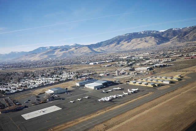
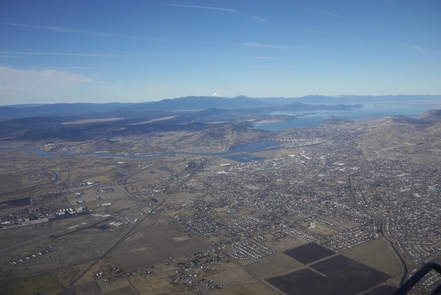
In the foreground is KLMT Klamath Falls, a place once only known to me as the name of a sectional chart. (The other one was ‘McMinneville Radio’, the callsign of the FSS radio station up here. “Where the devil is McMinnville” we would say, but now it is the new home of the Spruce Goose at the Evergreen Air Museum near Portland and justly famous).
Klamath Falls is a very nice hometown airport in a beautiful setting, but it is not my destination today. That lies further north along the shores of Klamath Lake at the tiny town of Ciloquin.
Klamath Lake opens up before me and I stick to the shoreline, following the highway which would be about the only place to land out here. On the horizon, jagged peaks of the Cascades line the skyline, and amongst them dead ahead, Crater Lake. More of that later.
And now, my destination for today, K2S7 Chiloquin State, slides into view. (We should be a little careful about these airfield designators. ‘K2S7’ is not a real ICAO designator because presumably there are too many secondary airports like this for them all to be listed. Type ‘K2S7’ into the KLN-94 and it won’t know it. In real life, it’s just ‘2S7’). It’ll catch you out once or twice until you get used to it.
Chiloquin State is an unattended field, 3,700’ at an elevation of 4,221’ MSL. It has no facilities and certainly no snow clearing. Every other time I’ve been past here it’s been snow bound and so this winter is exceptional, not only for the lack of snow but also the 60 deg F temperature on the ground. I don’t expect any traffic but nonetheless keep a good look out and make all the usual calls on the CTAF. There’s no reply.
The wind is light and the slight upslope on the 35 runway makes for an easy decision. On the passenger seat I have the ‘AFD’ (Airport Facility Directory) for the NW, page folded back for 2S7. This is the bible for airport info, and at $7 a throw, I buy new editions covering my trip every time. OK, the same info is in Foreflight and Airnav, but what if the battery dies? Etc.. Anyway, one crucial bit of info is the pattern (circuit) direction and if it says ‘RH’, I draw curved arrows on the page to remind me in case I’m getting punchy at the end of a long flight. No such stipulation for Chiloquin however.
Normally, you would approach a field like this with a ‘45 deg’ join. In this case, that would mean flying out NW of the field and making a RH teardrop back toward the runway and joining from 2 mi out at 45 deg to the downwind. That’s right, right hand turns for a L pattern. We’re not in UK now! In this case, I’m happy that there’s no conflicting traffic and I want to fly the runway centreline to have a good look anyway, so I continue directly to the airport.
Turning downwind, the view is stunning.
Turning base, I notice a train wending it’s way along the forest edge just R of centre. Bit of a clue here! Notice the base turn is fairly close in. The pattern is flown fairly close in here, none of the ‘bomber circuits’ we are so familiar with in UK. A mile from the airport is considered about right. Doubtless this has a lot to do with complainers in UK and the proximity of villages to many of our WW2 airfields.
And now on to final.

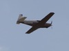
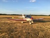
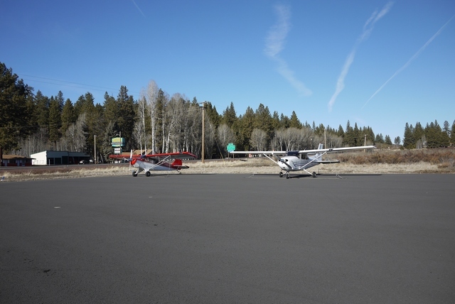
And to parking, right outside Melita’s restaurant. Surprisingly, there’s another plane here! And, as at even the smallest fields, adequate and robust tie down points. In this country, you don’t walk away from your plane without tying it down first!
Next Time: Train Mountain!
Train Mountain
A long time ago, I stopped over in Klamath Falls KLMT. On departure, the very helpful FBO guy said “Say, did you get to Train Mountain?”. Since my Son and I run a miniature steam locomotive in UK, this certainly got my attention. “Sure, he said, they’ve got a whole mountain covered in railroad tracks up there”. Well, no I did not know about train Mountain, and my schedule would not permit the 60 mile drive to see it – that time. It was with a heavy heart that I departed back to Arizona, wondering if I’d ever pass that way again.
Well, needless to say I have arranged that contrivance of ‘passing by’ quite a few times since, but 2018 was the first year that the runway at Ciloquin State 2S7 has been clear of snow during my trips along the West Coast. And Chiloquin State is across the road from Train Mountain!
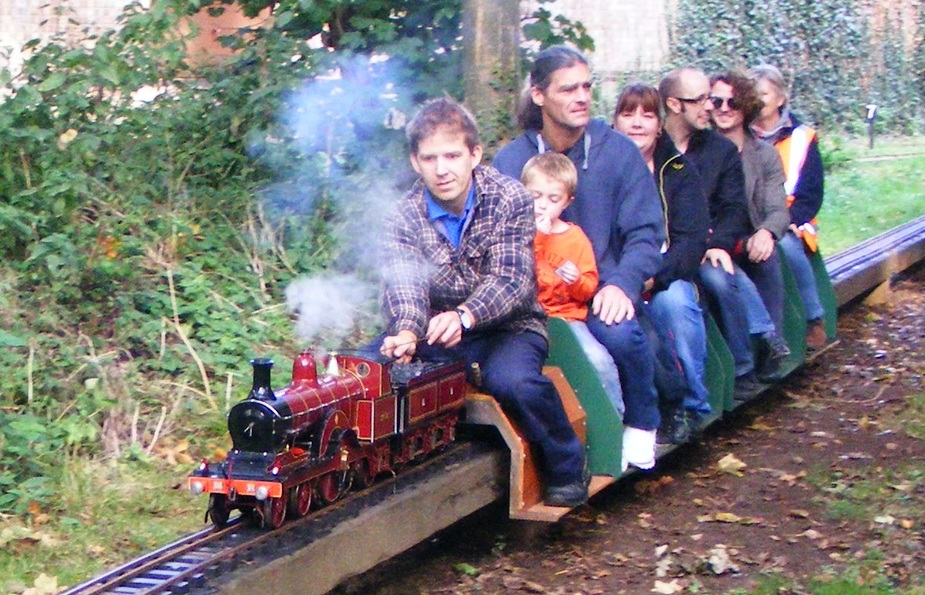
Well, I know this isn’t a train site and that not all of you will share my love for the muckier, or steamier, side of life. So I hope this picture says it all:
This loco is a 1/4 scale model of an engine running on the Silverton & Durango line in Colorado (Where I was last weekend!) and weighs almost 2000 lbs. You might wonder where there would be a miniature railway big enough for such a model, and Train Mountain is just the place. Because they have 37 miles of 7.5" gauge track! Yes, that’s 37 miles.
Well that’s enough train stuff. My route today goes back to Klamath, and then onward to Saint George, Utah KSGU. But before departing, here’s a view to the North. (In other years, I’ve continued along the coast as far as Seattle and Bellingham, Washington. I’ll write up that part of the route separately if Peter doesn’t tell me “No more, Please!” in the meantime).
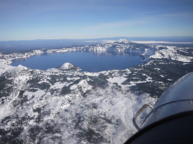
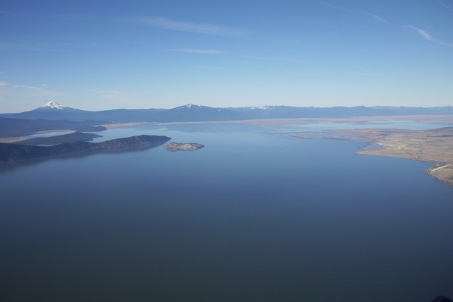
Crater Lake is just 25 miles NW of Train Mountain and this picture, taken in 2017, shows the fairly harsh terrain to advantage. The mountains in the rim stand 2000’ above the lake, which is 7 miles in diameter and itself is at 6000’ elev. Crater lake is itself a National Park and so the “not below 2000’” request applies. But in winter, even the Ranger station is often deserted…
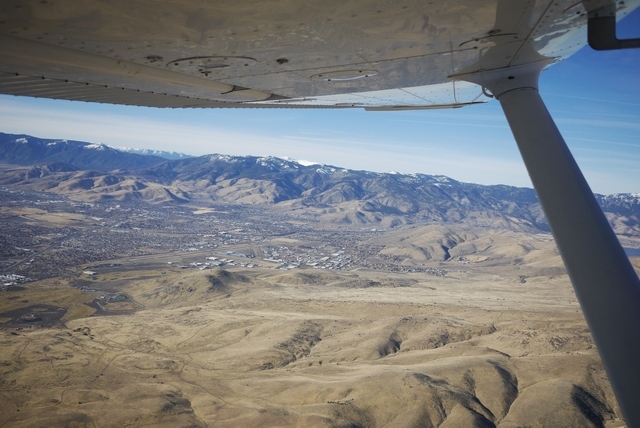
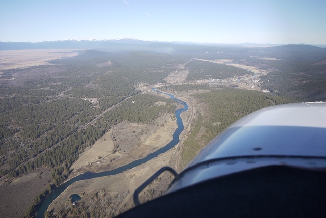
Back in 2018’s much milder winter, Klamath Falls lies just around the headland.
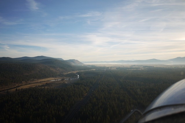
Soon, Klamath’s long runway opens up. This is a towered airport and the controller deftly sequences my straight in with other traffic in the pattern.
That evening, I step across the street to the local multiplex where “Darkest Hour” is playing. I don’t know what to expect from the movie, or the local audience who seem to be a broad cross section of the community. So it’s intriguing to hear them reacting to some of the more moving scenes in the film. Even the one where Roosevelt tells Churchill over a scrambler phone (not invented until 1942) that he can tow the P40’s he’s ordered across the Canadian border with horses. At the end, many stay behind as I do to watch the credits and file out of the theater deep in contemplation.
(I once had a remarkably similar experience, back when the movie ‘Memphis Belle’ came out. That time, in a local Las Vegas cinema far from the strip down on Eastern Avenue, the audience consisted mainly of boisterous teenagers. So it remained for the first 15 mins or so, but as it became apparent that the crew were of a similar age in the film to the modern audience, they became quieter, and then silent. When in it that seminal scene the landing gear goes ‘clunk’ just as the tyre scrubs the tarmac, they let out a collective sigh of relief. I fancy that those youngsters learnt something that night. For me, watching the green fields of England slide by beneath the aeroplane (even if they are criss-crossed by modern tramlines) was surreal, sitting in that cinema so far from home).
On Monday, the next Pacific storm system is pressing from the North West and I need to move on – otherwise, I could be here for some time. My route will take me across the desolate heart of northern Nevada and down into Utah.
But the weather is not so pressing as to preclude a little excursion across to Mt Shasta.
This 14000’ peak towers above the landscape and reminds me of the time when the children were young that i brought my family here. We drove to Mt St Helens, just a year after the eruption, and toured the devastated mountainside with it’s countless square miles of flattened forests. They still describe it as “one of the memorable moments of their childhood”, or to put it another way, what kind of lunatic would take small children to a place like that? Now, looking at the tranquil slopes of Shasta, I’m aware that “it merely sleeps, perchance to dream”.

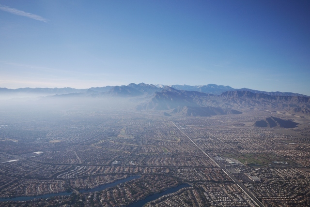
A last look back at the Sierras. It’s one of those “Mountain obscuration, VFR flight not recommended” type of days. The Pacific weather is already spilling over the ramparts of the mountains, only 50 miles away.
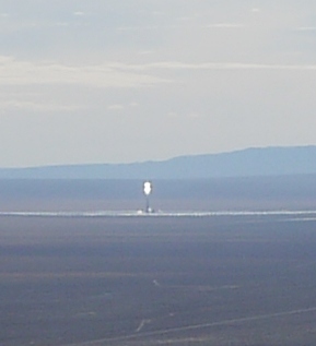
But ahead, all is bright! Especially at centre of this pic, where a science fiction solar tower stands out like a vast lighthouse in the desert near Tonopah, Nevada. This rather run-down desert community could certainly benefit from the boost that unlimited free electricity could provide, but I’ve not been there recently to find out if it has had any positive effect. And I don’t plan to fly any closer to this extraordinary power station either!.
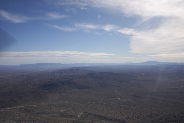
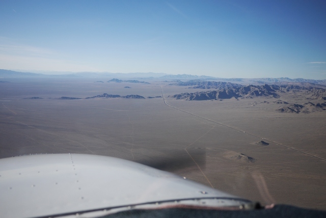
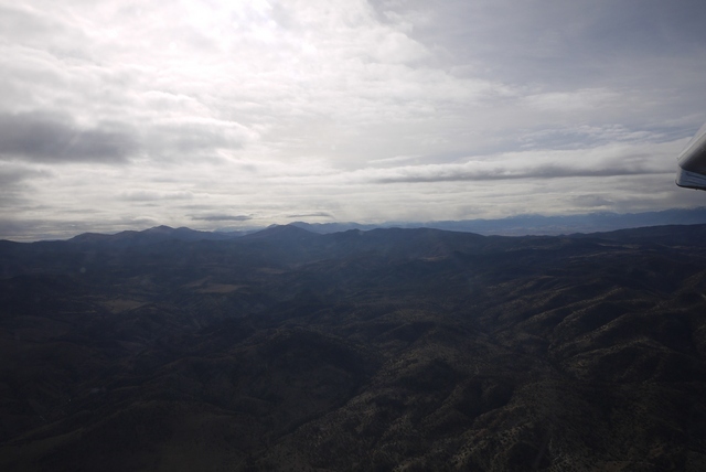
Ahead, the desert valleys roll on relentlessly. I know some people find this terrain monotonous, but to me it’s always fascinating, with some new vista or geological wonder just around the next corner.
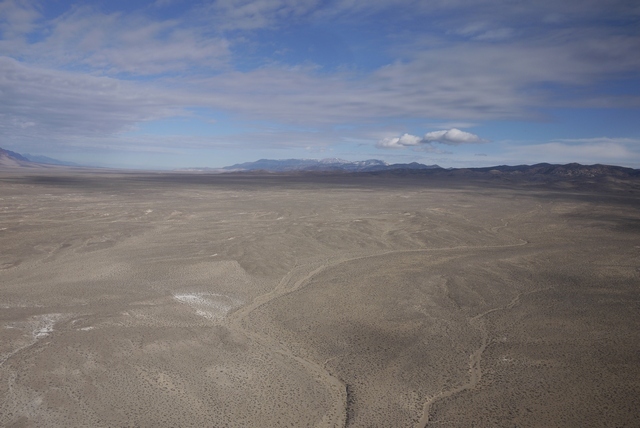
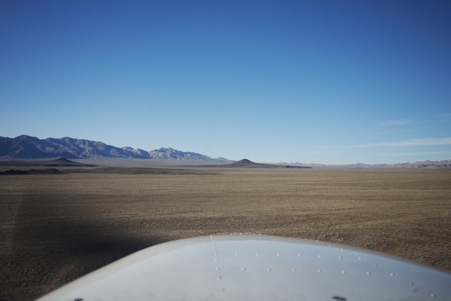
Geologists refer to this landscape as a ‘Basin and Range Province’. The ‘basins’ of course are formed from countless centuries of erosion, the mountains washing down into the valleys in layers of sediments miles thick. Indeed, this area is known as the ‘Great Basin’ because moisture running off the mountains here has no outlet to the sea. This land was virtually impassable until the railway came through just north of here in 1869 and there are landscapes here that were first seen by western eyes just over 100 years ago. And now I’m sweeping through this vast unforgiving landscape in armchair comfort in my magic carpet Cessna, the sum total of my childhood dreams made real.

Of course, you have to consider the outcome of forced landing out here. There are intermittent pieces of flat terrain that might be landable, and there are occasional roads. But I’m not in contact with any FSS in this remote corner of Nevada. If a forced landing was successful, I have my ELT and trusty UK PLB that might help. And, in 2018, the cellphone might work. And if the landing didn’t work out? Well, Mr Fossett’s crash site is not far from here. So I have that VFR FPL activated leaving Carson City and my transponder light never stops blinking, even low down in these remote valleys. Although I’m not flying a squawk, I’d guess that there are not too many returns out here for my time and route of flight.
Now I’m entering a MOA (Military Operations Area), a bit like one of our AIAA’s, where on the chart it says “contact Nellis approach” or some such, none of which frequencies are available out here at VFR levels. I’ve queried the MOA status with flight service prior to departure and established no activity outside of published times, but it’s a weekday now… A great feature of Foreflight is that you can tap in the MOA and it will show the times and frequencies, which can only be got from the margin of the paper sectional. MOAs do not require clearance, and the blinking transponder light shows me that military ATC must be aware of my presence even if I can’t contact them, so I proceed with a very good lookout. Unsurprisingly, in these thousands of square miles of empty landscape, I see nothing. One time, when I did have radio contact, ATC said “look out for a CH-53 helicopter refuelling a C-130 passing down your right side 1 mile same level” and there they were, perhaps the most extraordinary aerial combination I’ve ever seen. My camera remained firmly on the passenger seat!
Once, flying from Tonopah to Saint George, I thought I’d push my luck and ask for a clearance through the restricted airspace that forms a vast block from here down to Las Vegas. This restricted airspace contains the famous Area 51 and I was quite surprised when I thought I heard the response “Cleared to Enter”. I read back the ‘clearance’, only to receive the anxious reply “negative negative. remain clear” which is obviously what I’d heard over the scratchy radio the first time. So sorry, no photos of Area 51 in this blog.
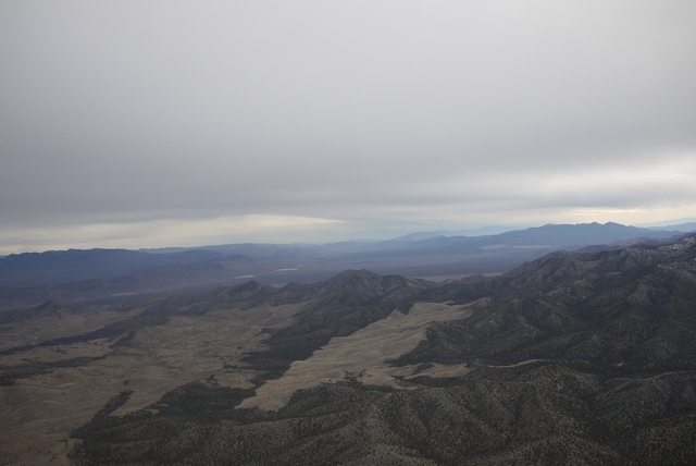
Three hours have passed, seeming like only a fraction of the time, and the rugged red cliffs surrounding Saint George line the horizon.
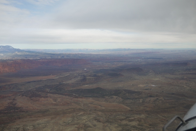
Behind the city, the Hurricane Cliffs stand out in the landscape and above them, the little English village of Hurricane. The layout, the architecture, the place and family names all resonate of England and the residents can trace their family lines directly back to the old country less than 200 years ago when they came here. On arrival, they were faced with the prodigious task of creating with their own hands a 20 mile aqueduct in order to make the land fertile and upon which they still rely. An extraordinary community, still intact after almost two centuries and most welcoming to a stray Brit who happens upon them. Hurricane even has it’s own airport, nestling right up against the base of the cliff, a truly scenic spot to land.
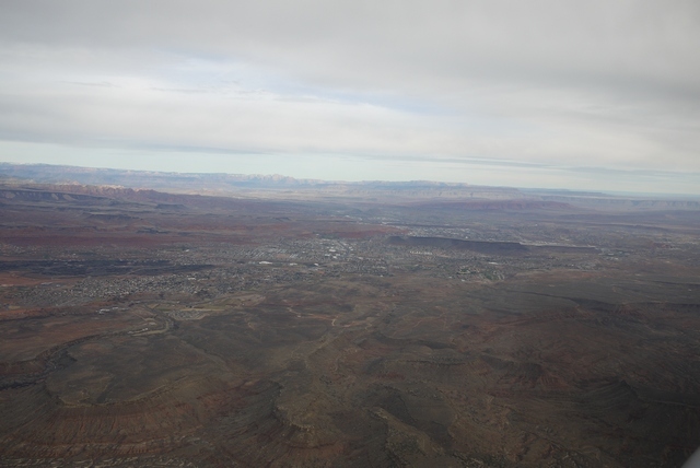
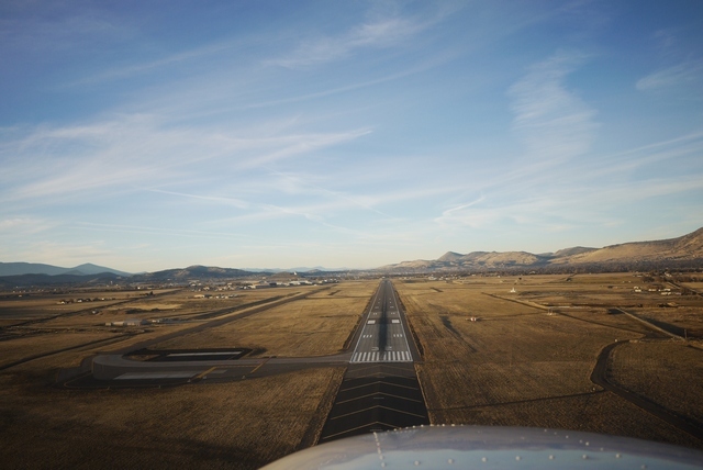
Soon, I’m overflying the ‘New’ Saint George KSGU to make a left 45 join for the 19 runway and while I’m doing so, several pieces of faster traffic sweep in and land ahead of me. Despite being uncontrolled, this airport has frequent commercial traffic from Salt Lake and Las Vegas along with tour flights and private GA. I make a close pattern and base following traffic while the other traffic fits in around me, one item being a private L-29 doing touch n’ go’s. It’s wonderful how well an airport works when pilots talk to each other, rather than some invisible third party.
As the wheels touch the tarmac, I’m conscious that this is the last overnight stop of my trip. That Pacific weather is close behind, and while tomorrow’s forecast is OK, the winds will be getting up and I still have a rather large feature to cross before getting this excellent little Cessna safely home again.
Next time: The Canyon!
Great write ups, thank you. I would have liked to mention Brian Lansburgh’s operation Tailwheel Town at Sisters Oregon, he is on my list to visit next time am close to Oregon. Beautiful state, Oregon that is.
Keep the story and pictures coming….beautiful!
Thanks for this one 
Since my Son and I run a miniature steam locomotive in UK
I know it’s not a train forum, but waht do you mean, you run a miniature locomotive?
Amazing report and pictures !
I am thinking about flying across the deserts of the US SW (AZ,NM,UT,NV) next winter. Is March a good time for this as a pure VFR guy ? I am looking for good weather but not too much heat.
I actually don’t have any experience of flying in March. However, be aware that the snows stay until late May and places like Yosemite are pretty much closed until then. But you do have the SW, San Diego etc which are nice year round.
You are right about the summer temperatures. The thing to remember about the summer is to stay on European time, so that you can depart really early in the morning. Airports are always open! Arizona actually has a monsoon season July – Sept with afternoon thunderstorms that are best avoided, but morning conditions are nice, not too bumpy and cool if you go 10,000’.
Regarding the train, not quite on the scale of Train Mountain!
5" gauge Midland Railway ‘Spinner’ (1898), built by my Father c.1990, reboilered by us 2008 and runs at various Model Engineering clubs during the summer. Driving learning curve similar to flying!
Thanks for the comments – very much appreciated.