
Ah, the good old SOP vs trusting judgement thing… you are in the wrong industry.
Just for fun, I had a look at my first logbook. I was surprised how different that was from how training is conducted today. A bit more than 35 hours (airborne time, so probably 40 block) to the PPL skill test. My first solo cross country was my second cross country flight ever. The so-called QXC was a route I had never flown like this before. And the return leg went through the gap between Cologne and Dusseldorf CTRs. No GPS. No radio navigation at all, now that I think of it. The aircraft did not have a AI or DI. Shocking. I am surprised I am still alive.
And no – I don’t think I was extraordinary. It was just a different attitude by everyone involved. On occasions a student got lost. This was mostly a source of amusement, not an area of deep concern. Guess what – they all were found, eventually.
boscomantico wrote:
I am an instructor myself. And sure I would like to decide myself, based on the route and the capabilities of the specific pilot. But those overly high limits imposed by the HT or whatever are illogic. Reality is just different, and I am not talking about really bad weather, which of course stops (and should stop) a purely VFR pilot.All that talk of “minimizing exposure” is just terrible.
Instead, get real and teach the student how to use the GPS in case he gets uncertain of position.
In this case you are touching the heart of the matter. PPLs are trained in a way that makes then believe IFR is required for anything less than 10k viz and clear sky. The truth is that VFR with a GPS can be flown down to minima with no problems whatsoever, but that is never teached. Does it have to be teached? Well, the core of the matter is that VFR can be flown down to minima without a GPS with no problems whatsoever, but if a pilot feel comfortable flying down to minima is an individual thing. As with everything else in life, I don’t see it as a school job to explore the individual limits of each pilot. A school shall only teach what is needed for each individual to explore these limits on their own. At that particular point (creating an attitude of exploring to widen the individual skills on your own), is where all the schools misses in favor of safety usually.
Martin wrote:
That’s the difference between pilotage and dead reckoning. Both have their uses and can complement each other.
I am not all that familiar with the english terms, and I don’t think there is a 1:1 translation of what I am used to. We call it bestikknavigasjon (pilotage?, but there are several forms or “levels”), visual navigation (dead? reckoning), and astronavigation (several forms including pure visual navigation).
For aviation (PPL) we learn the “PPL version” of pilotage with map, compass, speed and a (stop) watch. Traditionally pilotage is only used when there are limited or no visual clues on the ground, or when better pin point accuracy is needed. Pilotage is not the main navigational tool. The main navigational tool is dead reckoning or visual navigation (knowing where you are, and where you are going, based on visual clues). For VFR this is combined into something that is often called call “VFR navigation”. VORs and NDBs were also part of this, and were as good “visual” clues as any other, if the plane was equipped with it. You must be somewhat crazy to fly VFR “on top” without VOR/ADF, even though it is (and was) perfectly legal.
With GPS, the pilotage bit is redundant, because a GPS will always be more accurate than pilotage. “Legally” however, the GPS is only a “visual clue” in the same manner as ADF or VOR. In practice, a GPS combined with a moving map, has become everything. Moving map and a GPS has become THE (de facto) VFR navigational method. It is dead easy to use, accurate and reliable. But, there clearly is something wrong here. What is wrong is not that the pilotage bit has become redundant. Removing a manual, inaccurate and error prone navigational method (pilotage) and substituting it with a highly accurate, reliable and dead easy moving map/GPS system can only be a good thing. What is wrong is that the GPS/moving map system also removes the need for dead reckoning, a skill that IS needed, but it is also easily learned and easy to practice. A GPS is after all only one single “visual” clue, and it is not even a real visual clue.
In my opinion (for whatever it’s worth, not much but anyway), what should be teached and trained much more is dead reckoning. They should be able to fly solo on moderately longer trips without any navigational equipment or tool except a map and a compass. Free flight dead reckoning VFR following roads, coast lines etc. The pilotage bit should be removed altogether and replaced with proper use of a moving map/GPS system on a pad.
“Legally” however, the GPS is only a “visual clue” in the same manner as ADF or VOR
I’d like to see a reference for this bit 
Peter wrote:
I’d like to see a reference for this bit
Good point. It probably does not exist in today’s regulations. It is rather interesting to see how regulations changes. When I got my PPL, focus was on using whatever tools available to determine the position. I also learned something I have never practiced since; asking for “QDM”. Today it seems that everything is to be micromanaged through detailed regulations to a point where the main objective is totally lost. ie you asking for a reference of the legality for a pilot using a particular technology. Such a question would be void of relevance 25 years ago.
There has never been a regulation (in the UK at least) specifying how one should navigate under VFR in private flying.
There has been much pilot forum nonsense (on the other sites especially the two UK ones ) claiming GPS cannot be used for “primary navigation” (whatever that means) etc etc. It is only in the last few years that this nonsense has more or less stopped… probably because the people who kept posting it stopped flying and left the forums.
There are regs about how the PPL is to be taught and GPS cannot be used in some of the exercises, and maybe not in the checkride, but it can be used through the rest of the PPL.
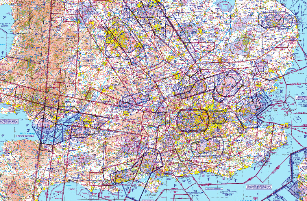
I think many new PPLs have been put off flying because they read on some aviation chat site that GPS was illegal. Accordingly, they never got the confidence to do anything beyond a short local trip. This I find understandable, when looking at say the UK map and how the hell can you visually navigate around that, with certainty??
If it had not been for GPS I would have never started flying. It would have been too much hard work to be enjoyable.
LeSving wrote:
I am not all that familiar with the english terms, and I don’t think there is a 1:1 translation of what I am used to. We call it bestikknavigasjon (pilotage?, but there are several forms or “levels”), visual navigation (dead? reckoning), and astronavigation (several forms including pure visual navigation).
Simply put, dead reckoning is about calculating your position relative to last known position (which you can do from course, speed and time), pilotage is visual navigation (using features, landmarks, that sort of thing).
Isn’t one supposed to combine the two methods (when trying to emulate the WW1 pilots  )?
)?
Between the features which you plan to navigate via, you dead reckon (fly a wind corrected heading with a stopwatch). Then you use the feature to make a correction, maybe also correct the forecast wind aloft, and fly the next leg.
Peter wrote:
I’d like to see a reference for this bit (“Legally” however, the GPS is only a “visual clue” in the same manner as ADF or VOR)
Um, the label saying “For situational awareness only” and “Use in VFR day only” as required by CS-SC052a called “INSTALLATION OF MOVING-MAP SYSTEMS TO ENHANCE SITUATIONAL AWARENESS”?
As with everything else in life, I don’t see it as a school job to explore the individual limits of each pilot.
I obviously agree that everyone shall find his own personal limits.
But we are talking reasonable, and most of all very common conditions here. In a place like the UK, surface winds of 15 knots, ceilings of 1500 feet and isolated showers are simply very common, normal weather. Not training for these, and cancelling 9 out of 10 lessons (never heard that anywhere else than in the UK) is simply stupid, and a good way to make sure that the student, once he has his license, will get really scared once he’s out there on his own, flying in the real world. His is also likely to give it all up soon (but this is irrelevant to the school, they seemingly are interested only in minimizing their “exposure”).
BTW, I did my PPL solo cross country in conditions between 6 and 10 km vis (at a school which was otherwise shite).
Peter wrote:
There has been much pilot forum nonsense (on the other sites especially the two UK ones ) claiming GPS cannot be used for “primary navigation” (whatever that means) etc etc.
That is nonsense. Because there is equipment approved for that. But that doesn’t mean that anything with a GPS receiver can be used like this. It’s no coincidence that there are “toys” which are “for situational awareness only” and “not to be used for navigation”. If it’s only used for situational awareness, it can be pretty rubbish and no harm is done.
Peter wrote:
Isn’t one supposed to combine the two methods (when trying to emulate the WW1 pilots )?
You can, but don’t have to. Pure pilotage is doable (depends on where you’re flying). And these days you can use GPS instead of dead reckoning and combine that with pilotage.


