But with the member of airspace busts in the UK being by non UK registered aircraft. Would a unified vfr chart reduce this statistic?
I navigate primary VFR and primary with Sydemon but I do like a back up paper copy. I see that Air Million have expanded their coverage to include a fair chuck on Europe. Including areas where VFR charts are apparently hard to find eg Greece
Isn’t this a continuation – with expansion – of famous Mr. Bossy, from France?
I saw it too, I have 3 extra on my list since yesterday. I really like those charts and they are a nice back-up. The only thing I am still missing is IFR waypoints on VFR charts.
I think this one goes back a while
Jan_Olieslagers wrote:
Isn’t this a continuation – with expansion – of famous Mr. Bossy, from France?
Well not completely…. I understand that Mr Bossy had an argument with Air-Million. He now publishes his cards on his own.
You can directly order these on his site http://www.cartabossy.com/
When you purchase the paper version you also get an electronic version.
While Air-Million continues to publish cards which remains very inspired of Catabossy…
Vieke wrote:
The only thing I am still missing is IFR waypoints on VFR charts.
I can imagine, that at least the million-chart is hard to read on that large scale, if all IFR waypoints were printed. Also I think, that it is not necessary when navigating primarily with SD, since I only regard the paper chart as a backup.
My 2 cents
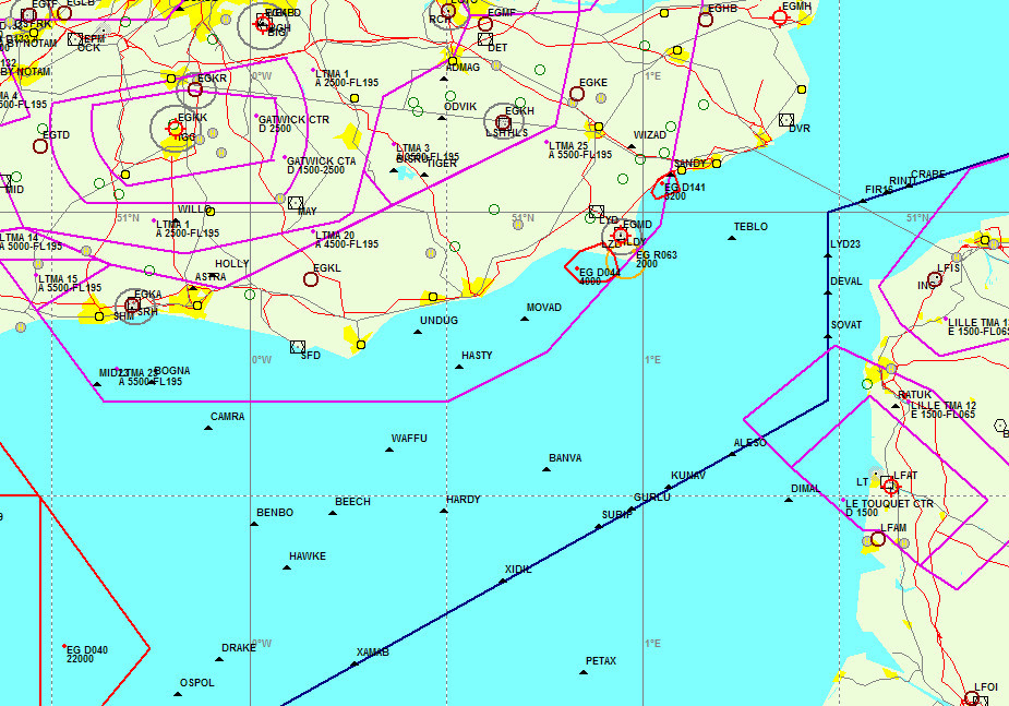
IFR waypoints are very dense e.g.

You could disregard the ones with numbers in them (they are parts of sids/stars) but there is still a lot.
The UK charts show some of them e.g.
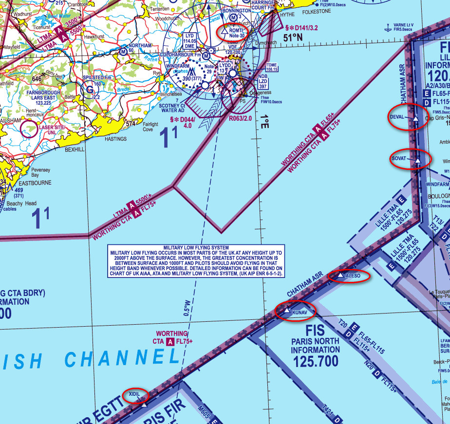
but mainly on the FIR boundary with other countries – presumably to assist an easy way to specify the time at the boundary, for VFR flight plans.
When I did a lot of VFR I used Navbox for this
Note that IFR waypoints include navaids i.e. VORs and NDBs.
All this can be used in VFR flight plans and is a great way to specify a route, which can then be easily loaded into a GPS.
The only drawback is that ATC in some countries (IME, France and Italy) liked to forcefully make the point that VFR traffic should not use these, pretend they don’t know them, and make you go to a VRP 
I wonder if that has changed in recent years?
Peter wrote:
The only drawback is that ATC in some countries (IME, France and Italy) liked to forcefully make the point that VFR traffic should not use these, pretend they don’t know them, and make you go to a VRP
I wonder if that has changed in recent years?
I think that changed, because I almost only use navaids and IFR-waypoints in my VFR FP and neither in Italy or in France they had any problem with that, this or last year.
It was never an issue on the flight plan. I found it a problem when arriving, and talking to the airport tower.
You can put more or less anything (in waypoint names) on a VFR flight plan. The only time I recall anybody looking at my route was c. 2005 when flying past Montenegro; they didn’t like the route and wanted a slight detour, so they sent back an AFTN message to the departure airport (Trieste). I had just started up when they told me