I don’t see how any satnav app helps with avoiding IMC and freezing levels.
For traditional UK VFR (what way over 90% of UK pilots do) you stick to Class G, need a transit of Class D, cannot get into Class A, and get busted for touching D or A without a clearance. Then there are some obstacles (towers, mainly, sometimes hills). If you are in IMC you are still a “VFR flight” for all practical purposes regardless of whether ATC know you are IFR, so you still fly as if you were VFR.
Now how would one transplant that operating procedure to flying in Alpine canyons?
BTW I have emailed the Swiss investigating agency with this thread.
Peter wrote:
I don’t see how any satnav app helps with avoiding IMC and freezing levels.
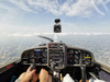
In SD set “reference terrain red color” to clouds base/freezing altitude, -500ft, -1000ft…and check how many VFR/IFR scud running routes you can see?
Same for avoiding CAS, sometimes it is much easier to filter by a fixed ref altitude and look for easier routes than having to change altitude along the route to remain OCAS…
What does GAFOR stand for? (I guess it’s an acronym?
LeSving wrote:
What does GAFOR stand for? (I guess it’s an acronym?
General Aviation FORecast.
Peter wrote:
It is a key point on strategy that one should climb to the safe altitude well before reaching the terrain that requires it.Exactly, I’ve been learned that you have to be at a safe altitude overhead the upcoming mountain pass before entering that regarding valley. In this case, the pilot had to be in 8.300 ft overhead Brig, which is the recommended minimum altitude for the Simplonpass, or at least at 7.600 ft (pass + 1.000 ft). This is just a basic rule of course, but quite effective if you stick to it, especially in an unknown environment.
Now how would one transplant that operating procedure to flying in Alpine canyons?In the beginning, it can be uncomfortable to realize that the way how flying in your own country works, isn’t the way how entire Europe works. At least, that was my experience. In the Alps, there isn’t much need to worry about CAS. To get a clearance for class D is mostly just a formal act. Just be in contact with someone, ATC or FIS.
Just as a caution, I knew a guy some years back with a Cirrus who was headed for the Brenner pass (a bit further east of the Simplon). He entered the valley leading to the pass from the south at the appropriate safe altitude. The trouble was that there was a wind blowing from the north coming over the pass and into the valley to the south, causing a strong downdraft south of the pass. This chap applied full power and was climbing as fast as possible. The downdraft drove him into rising ground. Luckily the robust cockpit “cage” of the Cirrus saved his life, but the plane was smashed to pieces. Mountains must be treated with respect.
In the Swiss alps you are in E until FL130 (FL150 if mil off)
And in G until 2000 AGL
Buckerfan wrote:
The trouble was that there was a wind blowing from the north coming over the pass and into the valley to the south, causing a strong downdraft south of the pass. This chap applied full power and was climbing as fast as possible. The downdraft drove him into rising ground.Sure, those up- and downdraft aspects are also very important to realize. It should be clear that mountain flying cannot be summarized in a few forum posts, I just wanted to put out one basic and important rule to confirm Peter’s statement. As far as we know now, winds didn’t play any role during the Simplon accident.
Airborne_Again wrote:
General Aviation FORecast.
Then what has this to do with roads? Are these “routes”, or whatever it is, called GAFOR in Switzerland also, or is this something SD has “figured out” ?
Peter wrote:
I think it would be useful to analyse how this accident could have been avoided, starting from the position this pilot was actually in:
Pretty simple – by looking at a map. Hey, any roadmap will tell you that the pass is at 6600 ft (rounded), so you need to be at the very, very least at 7000ft (not that I think that would be clever, but it illustrates the point) and ideally at around 8500 ft.
No SD, GAFOR, GPS, iPad, whatever required. Only a pair of eyes and a piece of paper.