https://aviation-safety.net/wikibase/347535
https://www.flightradar24.com/data/aircraft/d-esfb#32ad8c34
The FR24 track is missing on the significant distance from the crash site,
possible only Mode S installed so FR24 multilateration was not possible, flight on lower level.
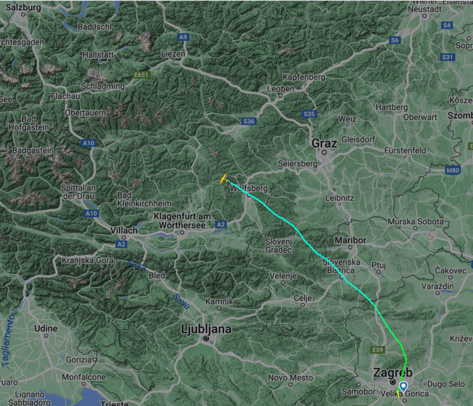
From FR24 looks like VFR flight. Departure is, after airborne from RW22, to K4 then PETOV, GOLVA (seems on autopilot) and then continuing more-less straight line across Slovenia and Austria (looks like hand-flying) over the Alps in general direction of LOWS. Crash site is I guess at 3700 ft or so but it’s surrounded with high peaks and their cruise altitude was 11500 ft. Judging yesterday’s weather it looks like VFR to IMC, possible icing, followed by loss of spatial orientation and whatever happened after that.
What’s puzzling is very low GS having in mind souther wind because from what I see from yesterday’s weather, it was supposed to be some 20 kts from south-southwest direction at FL120 in that region.
Weather was not good, strong winds, low cloud and rain.
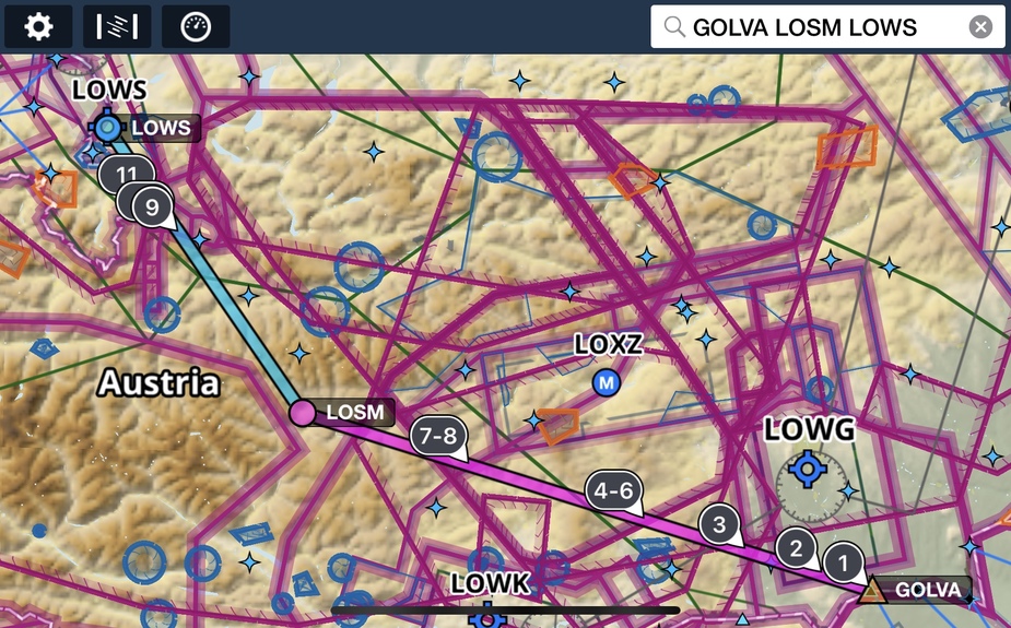
Crash site appears to be pretty close to Mauterndorf (LOSM) so possibly they were looking to divert there.
It should amaze me how many pilots in crashes didn’t get the weather before flying, but it doesn’t.
The ASN report says
The airplane was recently sold to a new owner.
It was fully loaded with 4 people.
Probably a sad case of a new owner bring lots of friends and family in their new pride and joy while they were getting used to it themselves. Nothing exactly wrong with doing that, but the period after becoming a new owner is probably a dangerous period in one’s flying. You’re flying an aircraft that you probably don’t know really well.
Here’s ADL weather image 2 hours before their departure when the weather on their route was still acceptable and there was possibility to fly it VFR, probably with some small avoiding. The aircraft is at LDZA and LOWS is in the upper left corner while their route was more-less straight between those two.
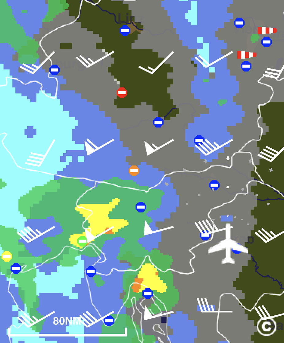
Later on the weather worsened significantly with those two cells connecting cutting their route. At time of their departure (1300 UTC) VFR departure was still possible but further on I doubt any VFR across the Alps was feasible.
Here’s broader weather view at 1100 UTC – unfortunately I didn’t take later images because I didn’t plan to fly on stopped following weather.

You can easily imagine what weather was on their route with this system moving east-northeast direction.
Mooney_Driver wrote:
Crash site appears to be pretty close to Mauterndorf (LOSM) so possibly they were looking to divert there.
I doubt this looking at the profile and knowing that cloud base was pretty low in the area – that would be absolutely impossible to fly without very likely CFIT.
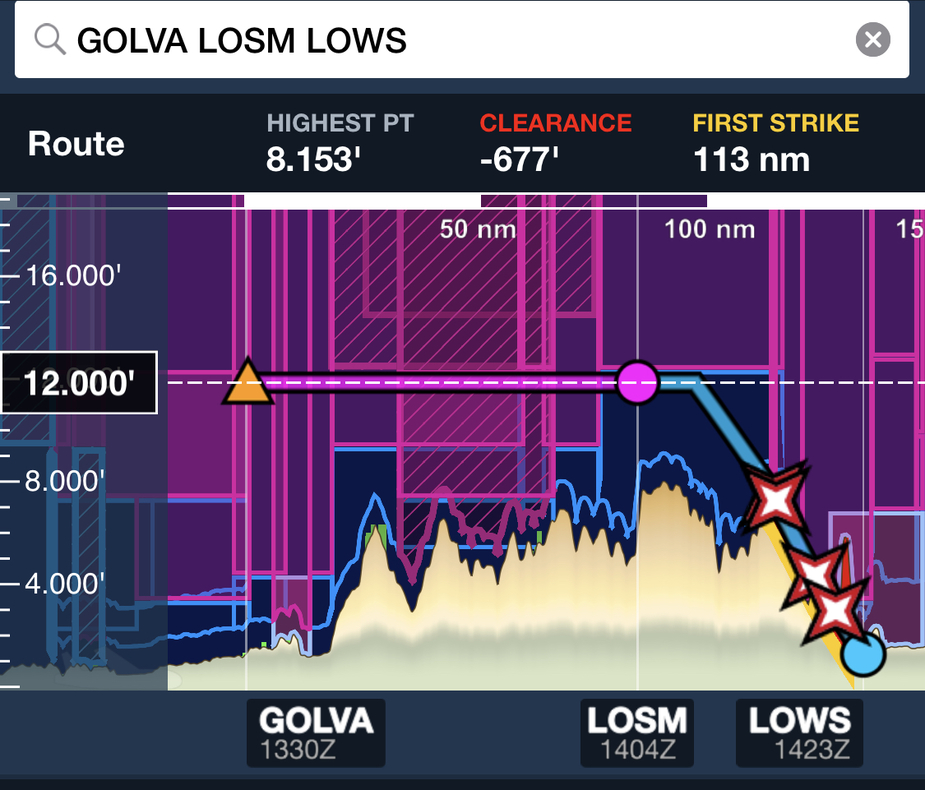
And finally this is the image of their flight as recorded at FR24 – it doesn’t go all the way to the crash site which is in that general heading close to Obertauern.
Emir wrote:
Here’s ADL weather image 2 hours before their departure when the weather on their route was still acceptable and there was possibility to fly it VFR, probably with some small avoiding. The aircraft is at LDZA and LOWS is in the upper left corner while their route was more-less straight between those two.
Sorry for the off topic but may I ask what software you used for this weather briefing? I’ve never seen it before.
Bartek_Aviatek wrote:
Sorry for the off topic but may I ask what software you used for this weather briefing? I’ve never seen it before.
That’s not weather briefing; that’s actual weather image (satellite and radar) downloaded with Golze ADL.
Emir wrote:
That’s not weather briefing; that’s actual weather image (satellite and radar) downloaded with Golze ADL.
That’s very interesting, thank you!