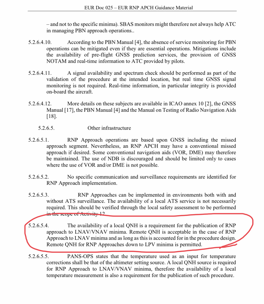
The one strange things that remains is why this lack of local QNH only affects the LPV minima, but not the LNAV minima
I think someone lost track on this again by confusing RNP approach with it’s operational approach LNAV, L/VNAV (with SBAS or with baro), LPV (with SBAS) and mixing their minima
As you said, 3D signal of LPV is there and does not move with QNH:
- LPV (SBAS) should allow remote QNH (with some adjustment)
- LNAV should allow remote QNH (with some adjustment)
- L/VNAV prohibits operation without local QNH (only relevant for “baro variant” as the glide path fluctuate with temperature & pressure but not “sbas variant” but the two are mixed in one line, “baro variant” has temperature limit and some places put “cold day NOTAM”)
LPV annunciation is accurate that one could use his GPS altitude “to get an up to date local QNH”, put that in his altimeter and fly to his DA !

Germany does not employ the remote QNH concept at all.
Ah, that may explain things but as you said, I would have expected the opposite: they should remove LNAV (rely on QNH for MDH to protect aircraft from under) and keep LPV (does not rely on QNH at all to keep aircraft protection)
Of course the pilot need current & local QNH to decide continue/missed at LPV DA
It’s just CYA, I doubt any PIC needs any QNH equipment for this:
- Nearby QNH from EDBB ATIS and LPV DA+100ft (5ft/mn from PANS-OPS use on flat land)
- GPS SBAS has altitude one can use infer local QNH vs whatever QNH they have already
- Even SkyDemon give current toy QNH from nearest station with internet
One does not fly when QNH vary by more than 1hp per 5nm, I would be worried about mid-air collision risk with flying hangars than RNP minima 
How many bureaucrats does one need in Germany to read a barometer?
Or in other words – how hard can it be to provide a local QNH?
Cobalt wrote:
How many bureaucrats does one need in Germany to read a barometer?
This is Germany after all so we operate on precision ;-). They want fully certified equipment with recurrent checks etc. In general I understand this is an issue and with IFR minima there is life at risk but in the case of EDAZ and EDAY we have fully certified EDDB nearby. It is at the same elevation and no terrain features in between. So any difference of more than 1hpa between those and we would have problems far superior to IFR minima with surface winds tearing apart buildings.
Sebastian_G wrote:
So any difference of more than 1hpa between those and we would have problems far superior to IFR minima with surface winds tearing apart buildings.
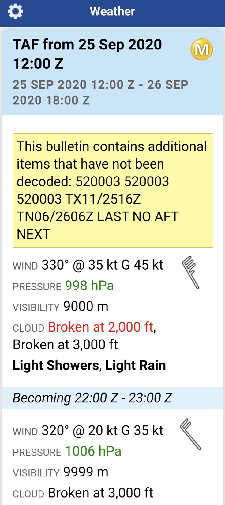
I’m not at all sure of that… I flew in some “interesting” conditions the other week. The pressure gradient was about 1 hPa / 20 NM. This corresponds approximately to 1 hPa pressure difference between EDDB and EDAY/EDAZ.
Winds aloft at 4000’ were 50-60 knots. I spent an hour in a hold breaking in an engine. Trying to fly a hold in such conditions with a 110 KTAS aircraft was interesting, to say the least. It took about three full circuits before I was reasonably established. Anyway, on the ground the wind was only about 10 knots because of an inversion.
I’m not at all sure of that… I flew in some “interesting” conditions the other week. The pressure gradient was about 1 hPa / 20 NM. This corresponds approximately to 1 hPa pressure difference between EDDB and EDAY/EDAZ
Aha, was it with ceiling between 350ft & 550ft? then it won’t count for minima  I think the only way to find +40kts winds with clouds down to surface are two 1/ if you land on a lenticular on top of a mountain or 2/ if you land when a thunderstorm hits the airport (I think it’s less likely in tornado & hurricanes, there is plenty of VMC around, at least what appears to be the case in YT videos I watched online)
Last year, I flew Southend ILS then VFR to North Weald, they had 2hp QNH delta with barely 22nm in good VMC (9km visibility & 2kft ceiling, wind was clocking 70kts at 3000ft, 50kts at 1500ft, 30kts at surface)
I flew from Llabender, they had the best wave gliding conditions in many years, I decided to skip that party in a DA40 and route via the sea we noticed some huge QNH deltas on ATIS day (only a tiny bumpy IMC on arrival), while cruising, I was impressed how GFC700 handles gusty winds on all AP modes even at slow speeds, the Century AP in Archer used to fly used to disconnect on VOR & LOC tracking in similar wind conditions, he gives up and let you do it…


Ibra wrote:
Aha, was it with ceiling between 350ft & 550ft? then it won’t count for minima
No, it was CAVOK. Essentially unlimited visibility. Polar airmass.
Ibra wrote:
LPV annunciation is accurate that one could use his GPS altitude “to get an up to date local QNH”, put that in his altimeter and fly to his DA !
This would not be allowed in the US under any circumstance. GPS altitude and MSL based on QNH are quite different. The error varies with temperature and height above the airport and can be quite substantial, certainly on the order of hundreds of feet and in extreme cases more than a 1000 feet.
If there is a WAAS station on the AD does the WAAS correction include AD ELV altitude delta? or just the lateral Lat/Lon position? AFAIK, AD ELV altitude is a geometric one and should be very close to the earth model, so not sure what is there to correct? (the procedure platform altitude is barometric one and go up & down, the glide slope with WAAS is geometric one)
Yes I agree GPS altitude will not be allowed officially but it’s a good benchmark to enhance awarness of the ground bellow, especially when the static ports are clogged on descents or with some altimeter friction (there are other 9 ways out there to find upper bound & lower bound of AD QNH) but in US you have 6kft airports with LPV guidance, most people who would fly altiports in Europe don’t fly IMC on GPS? maybe it’s an a real issue in Russia with OAT << ISA
I have never seen more than 100ft between GPS ALT and AD ELV on ref point vs regional or nearby QNH but I don’t fly in extreme weather & elevations but I guess any QNH method needs to be tested with differences fully explained but getting QNH from 20nm ATIS or GPS is not what would break an aircraft at LPV minima
PS: I was given regional RPS, local QFE, unofficial local QNH, remote QNH during IFR let-down or approaches in UK, they are not as religious on “local official QNH” as many other places but the land is flat and OAT is near ISA 