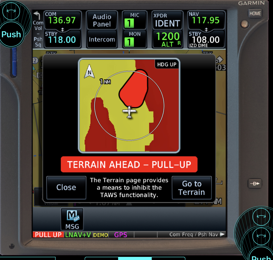
But it still does not answer the question of why a CDFA, which would normally follow on from a NPA ends in a DA/DH.
The way they told me is that on a normal NPA you can “dive and drive”. You descend fast to the MDA and fly level to the mapt in the hope you see the runway before the mapt.
If you fly a CDFA the plan is to fly a continuous descend till touchdown so at the DA you make the decision to continue or go around. (With a bit of margin to obstacles so when making the decision and due inertia descent a bit below DA its not busting the minima)
At work we add 40ft to the MDA to get a DA and fly all our approaches as CDFA.
In GA i can see an advantage to sometimes use the “dive and drive” approach especially with the ceiling close to minima.
If you would level off from the CDFA path you immediately are high on profile thus becoming unstable. (But there is a recent thread on the subject of stable approaches in ga all on its own)
Would a WAAS box have the LGIO RNP Z 32 as a +V continuous glideslope?
I thought all the +V glideslopes were on the same bearing, past the FAF.
In fact would any box give you VNAV on this profile (as well as LNAV which the KLN94 does perfectly)?
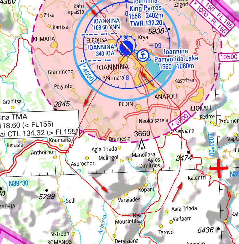
As the faf is around the southern shore of the lake it seems pretty straight to me so i don’t see any reason not to get +v
This is funny.
My wife and I flew into LGIO on Monday on our new Jetprop. Our intended destination was Corfu for a two week stay, but Corfu Skyserv could only give us 4 days of parking so we decided to investigate LGIO as an alternative. This would be my first landing there.
All the way from LSGS Switzerland I had been studying this exact approach chart – for RNP Z 32.
Managing the descent in a Jetprop is quite tricky due to the strict 172 KIAS VNE. This is made even worse if it is necessary to slow right down to the turbulence penetration speed of 130 kts. Sure enough, coming in over the very high southern Albanian mountains there were incipient thunderstorms and TCUs all around, and we had to try and get down from FL160 in less than 15 minutes for landing at Iaonnina. The weather required us to make multiple heading diversions to get around various TCUs until we were finally handed off to LGIO tower about 5 minutes out. The tower controller then proceeded to give me the longest transmission I have ever received in my 20 years of flying including a full METAR report, runway and approach news, a change in squawk and then two complex and different options for joining the RNP approach. For the first time in my flying career I simply said “flying single pilot, too much information to process”, then 10 seconds later to both his and my surprise “overhead YNN, 9,000 ft”. As Ioannina is in a valley, surrounded by high mountains on all sides I suspect it benefits from the same adiabatic warming and drying effects that Sion has in Switzerland, so the whole valley was clear and we were granted a visual approach.
Next time I fly to LGIO I will know that the options include a visual approach, and starting the RNP at various points, either YNN or IO716 I think I was told. I will try and route over the ocean and lower, not high over the Albanian mountains, and get handed over to LGIO tower much earlier.
BTW, its a good 4 or 5 hour trek to get too your destination in Corfu including renting a car, driving to Igoumenitsa, waiting for and taking the next ferry etc.
It does show as LNAV+V, as you as you fly toward the water but it’s not happy if you go off laterally & vertically on descent & climb, the MAP does look funky tough: maybe just Lugano where you are better off putting life jackets and ditching in the lake then swimming to the airport than going missed if you feel something has gone wrong  ?
?
Buckerfan wrote:
My wife and I flew into LGIO on Monday on our new Jetprop.
Can you put some pic of your cockpit in one of JetProp related threads? Year of production, engine hours, any upgrades before delivery?
Would any WAAS box have the LGIO RNP Z 32 as a +V continuous glideslope, all the way from IO711?
Peter wrote:
Would any WAAS box have the LGIO RNP Z 32 as a +V continuous glideslope, all the way from IO711?
I don’t have IFD-W trainer but I think it will do as well, it consumes the same FAS data & GPS geometry as Garmin-W
Obviously, one has to cross-check his altitudes & distances rather than chasing +V, if not comfortable fly higher it’s 3.3deg GP at full scale above +V you will be at 4deg
PS: you are right the FAF(IO711) is no joke, 3200ft is your min segment altitude and the advisory +V cross FAF dead at 3200ft, so you can’t be -0.000001 dot bellow your advisory GP, if that happened 0.0001nm further on final segment you won’t see the advisory glide path in Garmin !
I don’t understand the above.
+V is supposed to automatically be above all stepdown fixes.
I suppose the basic Q is whether +V works only for laterally straight trajectories i.e. past the FAF, where (in GA context) you don’t have a curved path.
Peter wrote:
Would any WAAS box have the LGIO RNP Z 32 as a +V continuous glideslope, all the way from IO711?
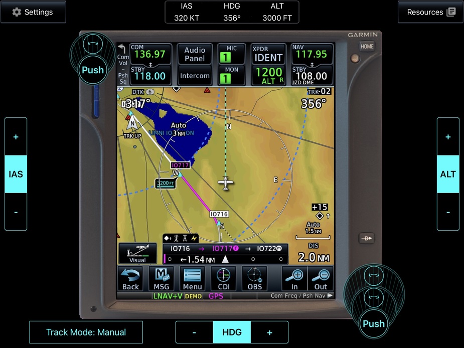
I tried this in Garmin’s GTN650Xi simulator. You don’t get LNAV+V until reaching IO716, but you do get VNAV all the way from YNN.