The option on ForeFlight is MUCH less useful for complex routes. I don’t get routes validating. Only if I look for possible routes first in Autorouter.
I use `add waypoint` all the time otherwise I receive silly proposals. Specifically I add a waypoint close to my DEP AD on a Z flight plan to pick up IFR. If you don’t often your VFR till the FIR boundary….The same for the arrival add an RNAV waypoint close to your arrival to remain IFR as long as possible. It takes sometimes several iterations to find a descent routing. If the airspace is not Free Route it helps to check the directions with Skyvector but even that does not include possible restrictions that are valid that day of OPS.
It does not seem to indicate, or have a slider to select which tolerance for the flyover point is allowed
If you refer to ForeFlight it does not have a tolerance it will try to include the point AFAIK
It does not seem to indicate, or have a slider to select which tolerance for the flyover point is allowed. If it is technically zero, then the routing engine might not find a valid route. 10-15 miles is usually enough.
Peter: thank you! I didn’t know that.
Here is the snapshot
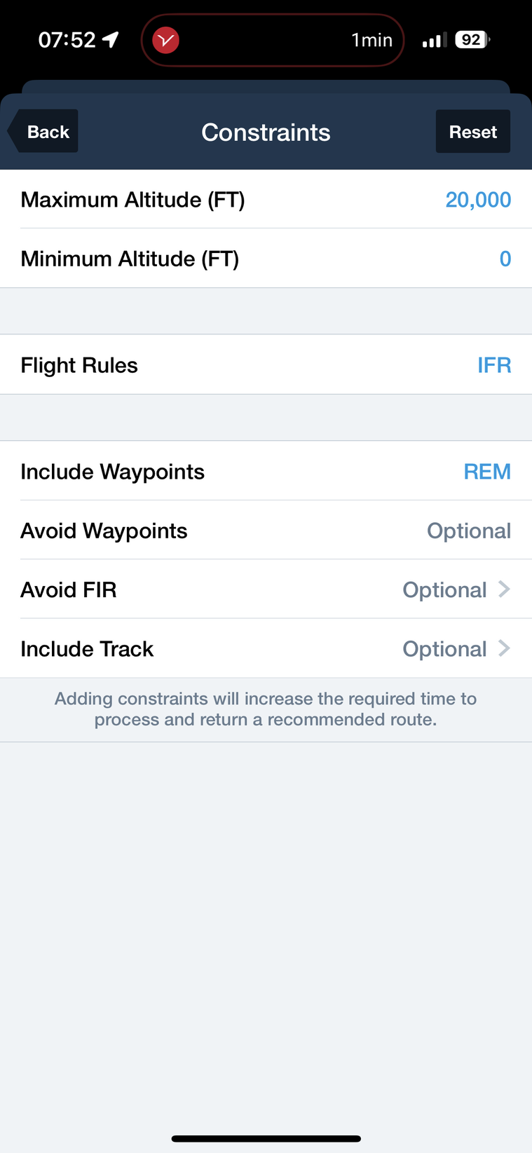
To complete, ForeFlight has similar feature with “Include Waypoints” or exclude waypoints in the route option (can’t post snapshot I am on my phone and couldn’t figure out how to do that on this forum?)
About figuring out waypoints that will work, one trick I use is to find a route to an arbitrary airport in the direction I want, then pick a waypoint on that route to include in the final route, that maximises the chance it will find a valid route.
I have „shaped“ dozens of complex flightplans using this feature. It is easy.
Peter wrote:
It is a handy feature for a crude route shaping
Yes that’s what I need it for. E.g. for a flight to Spain via Switzerland instead over boring mid France.
This AR feature needs to be used with care, because you can easily get no route at all.
Firstly, the majority of waypoints one picks are not valid for getting a valid “through” route, so you need to leave a generous distance to it; say 25nm or 50nm so the tool can still find a route. If you set 0nm, mostly no route will be found.
And how will you be picking these waypoints? It’s easy enough on a PC where you can see the “big picture” easily, on some IFR chart. I have used Skyvector for this kind of thing but the chart in AR is OK too.
Years ago people asked for a rubberband feature on AR. It was thought unviable because most such routes would not validate, plus you have the considerable routing time (can be a minute plus).
It is a handy feature for a crude route shaping e.g. to route around the Alps. You can also achieve that one by setting FL100 max 
FF – I have no idea.