ONC charts
I saw these mentioned in the Albania thread. I love ONC charts!!! Does anyone else share this strange affection? Their scale is perfect for VFR flight planning over long distances. They are so much fun to use than resizing those endlessly versatile versions of maps available on a computer screen. ONC Forever!!!!
Air Million is the modern equivalent, purposefully made for GA.
I like 1:1M scale as a paper back-up to electronic.
However, they are rather thin on airspace detail. Even the US WACs don’t give detail of the vertical extent of class B&C.
Some parts of the world don’t publish VFR charts and the ONCs are about the best you can get. I had sheet C13 for crossing Greenland and plotted on the controlled airspace by hand.
But they have been withdrawn now from public sale, so you need to act soon before all the stockpiles have gone.
Stanford’s in London had a reasonable stock last time I checked and digital is available from some sources.
Many ONCs and TPCs are available in digitized form from Fugawi (as in “where the fugawi?” ;-)
Somewhat older versions are available for free at UTexas library.
Is this French chart site dead?
The owner got killed in a plane crash last year.
I don’t know if it is my browser or something else. Is that site still alive and, if so, how old is the chart on it?
I do know a high res snapshot to a jpeg was made Sept 2015.
It’s dead Peter :( It says at the top:
This page (http://carte.f-aero.fr/carte-aero-v2/) is currently offline. However, because the site uses CloudFlare’s Always Online™ technology you can continue to surf a snapshot of the site. We will keep checking in the background and, as soon as the site comes back, you will automatically be served the live version. Always Online™ is powered by CloudFlare
Does anyone know of any website which carries a current VFR chart for France?
It can be SIA, Cartabossy, IGN, Air Million…
I think the one on the website discussed above was IGN. The last version was 9/2015 and that one now exists as a single graphics file, and as ozf2+map for Oziexplorer. It’s obviously not up to date now, as is evident from some bits of UK airspace at the top end of it which have changed.
It is possible to find it on géoportail (website seems to be french only)
or using Mach 7. Hope it helps.
That’s an awesome find – thank you 
But, is it current?
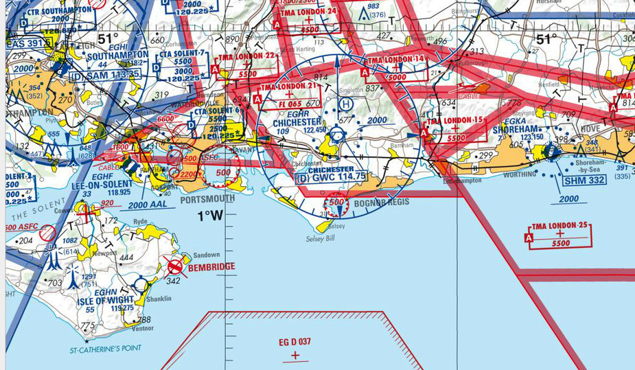
From the above
From the current one:
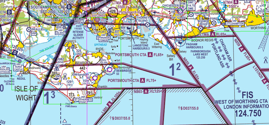
However, the French chart may have different rules for showing FL075+ airspace. I recall the IGN charts showed nothing above 5000ft (AGL) but that was later changed
They say it is the one from april 2016 and from what I can tell, the area around Paris looks current although quite a few restricted areas are missing when compared to the data on Mach 7. On the equivalent paper charts, they usually state “Foreign airspace : published under reserve” so they may not be trusted to fly outside France (and it certainly seems like flying above FL065 with them accross the Channel might be a bad idea).