The bottom line is that a fresh US PPL holder should know enough to fly VFR all over the USA, whereas a fresh UK PPL holder will definitely not know enough to fly all over Europe.>
I think up to a point this is really a UK thing (my bold above). Flying around continental Europe VFR is a piece of cake compared to the UK with its anal airspace structure and ATC. I know plenty of European pilots who happily fly reasonably long distance trips VFR through loads of CAS.
If you learn to fly in the US, the above is very much part of the initial training and also part of the checkride.
Well in theory we have that too (the 'solo qualifying cross-country') but the 'off into the unknown' effect is mitigated because schools and instructors tend to send their students to places they've flown to (dual and solo) previously. With some of the students who find flying and navigating more challenging, the solo QXC is essentially preceded by dual 'dress rehearsals'.
If I recall rightly, the spec for the (UK) QXC is a 150nm flight with full-stop landings at two airports which are not home base. I would add another requirement - that the student must not have landed at one of those airports previously. I was going to say they must be new to both, but I think that make it hard to develop QXC routes and still do dual landaways beforehand.
The QXC is chosen to be dead easy.
They won't let you go in less than perfect vis (10k+++) and cloudbase around 3000ft+ i.e. CAVOK in effect.
I know of students who waited the entire summer to do their QXC, because haze kept the vis just below 10k. Extremely frustrating and obviously expensive because you lose so much currency and have to fly with an instructor all the time.
One pilot I knew, from around my time (2000/2001) waited 6 months for his QXC. Another one, faced with a similar situation more recently, gave up flying for ages... I think he took ~3 years to get his PPL.
I planned my QXC to be done with VOR/DME and just used that, to make 100% sure.
This kind of stuff is what originally got me to start writing up my trip reports, to show that flying post-PPL is really MUCH easier than flying pre-PPL which I found incredibly frustrating due to these restrictions. Waiting 6 months (or even 1 month) for a flight Shoreham - Battle - Southend - Lydd - Shoreham is utterly incomprehensible to anybody who has a PPL - regardless of how they navigate.
I guess I got really, really lucky. I lost my very first scheduled lesson to the weather. Then I rebooked for the following week, and there followed 45hrs plus a skills test with not a single flight lost to the weather. 2011 was a reasonable summer, and the weather in the south east during the 1800-2000 slot on weekdays was invariably excellent.
I don't really recall specific weather discussions prior to my QXC. Nothing BKN or OVC below 2,000ft seemed to be the general rule for most pre-licence flying.
'But I would be uncomfortable for the same reason I would'nt want to drive for 2 hours in the car to a place I had not been to without the TomTom and I had to drive using an internet printout or a national car atlas - its hard work (in modern life).'
Well I have never owned a car satnav but did do 55,00miles travelling from one end of the uk to the other in 2012.
Re-would I be willing to fly without a GPS....Why not?... Flying VFR in the UK isn't rocket science is it!
I think the question is more about whether I would want to fly without a GPS. In a PA-46, no. Could I, yes but it would be painful and it isn't why I bought the plane. And compared to Australia where I learnt to fly, the congested airspace in the southern UK would make GPS-less flying very nerve-wracking.
The age old question 
I think flying should be enjoyable.
In aviation there is plenty enough crap on the ground.
Flying needs to really work hard to compensate for that
I don't ever want to be wondering where I am, and GPS is the best tool for that.
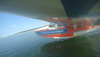
African Eagle's scene would be totally non-navigable (due to ambiguity of features) for a foreign visitor, but probably trivial for a local.
As Peter says - it all depends. The above pic is 100% harmless to a local or, indeed, to someone flying 100 miles downroute. In fact it looks not dissimilar to the SOCAL coastal ranges where I learned to fly - without a GPS.....
Now, would I elect to fly today without a GPS? No. Could I? Yes, although, as stated earlier, depending on the area I would not necessarily do it. YMMV.
I certainly wouldn't do a longer trip without a GPS.
If I was doing a domestic fligh (beyond the local area) I also wouldn't do it without a GPS UNLESS I'd planned it as such.
By this I mean that for most flights, I tend to plan as direct as possible. However if doing planning for a flight without GPS, experience has taught me that it needs to be planned quite differently and taking account the proximity of airspace (to allow a margin for error) and ensuring that waypoints chosen can be seen, even if you are a few miles off course.
More work needs to go into map preparation to ensure it's marked up properly with fan lines/ timings etc. Stuff I have little need for with GPS (backed up with another GPS).
If I lost GPS during a flight, then I'm confident that I could continue it safely, but it would be a lot more stressfull than if the GPS remained working or if the flight was originally planned as non-GPS (which I never do nowadays).
Hello forum,
I guess I wouldn't do the original proposed flight even with a GPS, but then I am not Instrument rated anyway. However, I do not think GPS (as any other form of navigation except the basic skills of pilotage and dead reckoning) should be mandatory for any flight.
I just finished the FI(A) training and flying with some of the colleagues revealed, that many of those who stated they fly mostly with GPS but would do fine without, had no clue where they were and how they would get beck home after a couple of minutes aerial work in the vicinity (not to speak of airspace awareness). But as it is with anything else, you just can't do what you don't practise. For instance, I probably could operate the glider winch, but since I haven't done so in more than ten years, it wouldn't neither be safe, nor efficient. Just because I would be current, it doesn't mean I would be proficient.
Same goes with dead reckoning or pilotage. I for myself am constantly practising navigation by pilotage or dead reckoning because I like it (it is great fun), as an instructor I am supposed to be current and I personally find it quite boring just to engage an autopilot direct to your destination and wait for a couple of hours. Yes, I know this is a rather abbreviated version of the use of autopilots and that there is much more to flying than just pressing a button. Having said that an instructor has to be current in what he's supposed to teach, this goes for any mode of navigation (i.e. radio nav, GNSS based nav, RNAV, usage of autopilots, etc.). But when it comes to preferred methods of navigation, everyone marches to a different beat, I guess. Even within GPS usage there is a great variety of displaying the information, from simple ADF-Like bearing / track display up to a "highway in the sky" format of information display.
This goes for VFR flights, only, since I am not instrument rated (yet), I have no clue about necessities for IFR flying, other than legal requirements.
By the way, other than stated by Peter, dead reckoning is independent from any form of landmarks and works just fine in IMC, as is does in feature rich landscapes, though pilotage does depends on landmarks (or are both terms used exchangeable in the UK?). I always liked the quote from 'Hunt on Red October': Give me a stopwatch and a map, and I'll fly the Alps in a plane with no windows. I remember reading a blog (in Flying magazine, or plane and pilot, I guess) about ferrying a Malibu across the Atlantic using just dead reckoning (and an A/P) and just being off the track for about 10 miles when they crossed the coast.
And this is in my opinion the strongest point in teaching dead reckoning and pilotage: It works. Every time. It involves more planning than necessary when flying with GPS navigation and can't be done between preflight checks and the runup, but it works and to understand the basic principles helps even understanding GPS navigation. On the other hand with that much different GPS devices and forms of displaying all that information, menu structures and possibilities, the usage of GPS would be more prone to be part of differential training for a specific aircraft, rather than specific GPS devices should be part of basic navigation training.
As for the navigation flight in flight training, I flew to two airfields where I haven't been before, one of them being an international airport (EDXE-EDDW-EDVP-EDXE). As far as I know, my instructors handled every student this way and I think I will keep this for my students. After all, the task should be to get along alone, rather than sitting in a plane for a couple of hours, doing what you've done before.
many happy landings, Malte