I still haven’t worked out how to do this. If somebody knows how to, I could send them my list.
CSV is formally comma separated data, but in “modern reality” it is CRLF or LF separated data, with the comma omitted.
@Airborne_Again: try KSMO, LOWW, LEMG
@Peter: send me the file, I’ll try it
172driver wrote:
try KSMO, LOWW, LEMG
Thanks. LOWW and LEMG did work — but not KSMO, so it appears to work differently for different people. Super weird. OTOH, KSNA worked…
Now I’ve figured it out.
If there enough places in the file that My Map doesn’t recognise, it will reject the entire file! Otherwise it will accept the entire file and allow you to edit the place names it doesn’t recognise. Brilliant design. Not.
I haven’t been able to figure out what “enough” means in this context and I don’t think I’ll bother.
I counted 109 airports, about half a dozen as crew, the rest as PIC.
JasonC wrote:
Steve6443 wrote:Bielefeld (once a year to collect the obligatory Mug at Christmas time)
You had me going until this one. Come on, Bielefeld doesn’t exist.
Serious? EDLI? Anyone who lands at this airfield in December gets a mug with sweets and nuts inside it…. I’m not home at the moment otherwise I’d post a picture of the mug….
Airborne_Again wrote:
Thanks. LOWW and LEMG did work — but not KSMO, so it appears to work differently for different people. Super weird. OTOH, KSNA worked…
Agree, this is beyond weird. Fun fact – it didn’t find KSNA for me ! Anyway, glad you got it going.
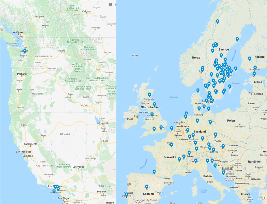
Google doesn’t really work properly. It missed out many European airports.
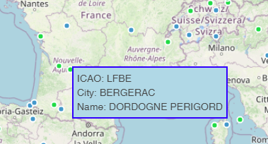
I got a feature put into the EuroGA Airports site which can plot a file containing ICAO codes
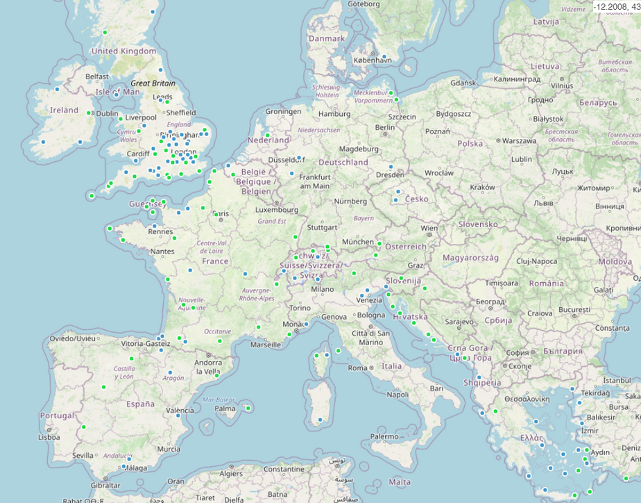
Some are plotted green, some blue. The green ones are where a report exists in the database. So I have a few more reports to do…
Because I am paying the guy, there is no user interface. You have to send me your file and I will run it. If there is enough demand (and donations  ) I will get a proper UI done.
The resulting map can be zoomed, panned or hovered over
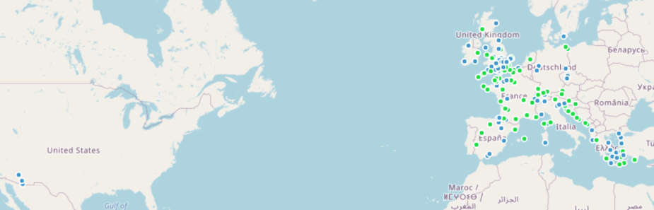
It plots the blobs only in the “European” rectangle, currently. It covers Morocco and Egypt.
I have a new version of the map which shows the US airports used for my FAA IR. The code has been modded to plot blobs worldwide. There are about 15k ICAO codes in the database now, and all but maybe 100 really obscure ones have names. This is much better than the dodgy google feature.
@JasonC – attached a pic of a couple of the mugs I’ve picked up over the years from landing at Bielefeld in December, each year they have different ones. I’ve also got others elsewhere including transparent glass mugs….. sort of provides an incentive to fly there during that month….. not that I need any incentive to get into the air, that is…. any excuse will do