I sometimes use EVS in the Cirrus when on the ground to scan for animals on the runway when departing from a remote strip in France without a controller nearby using PCL. But never when flying an approach. I love the synthetic vision as it confirms my setup from another source than the ILS (well, it would be the same for a GPS approach). Especially when flying at night and/or in IMC to Chambery, it confirms to me that I am flying towards the runway over Lac du Bourget.
I shudder at the idea that SVS helps with low visibility operation. SVS is a NAVIGATION display, using position and heading information to display something.
The challenge in low visibility operations is twofold: Navigation / flight precision down to a minimum, and the much more challenging transition to a visual landing. SVS offers no additional navigational precision over an ILS.
EVS can help, with the transition from NAV —> EVS —> Visual. In a head up display, all of this is combined in one display.
So to be useful, EVS would have to be displayed in the PFD, and you would then either land using the camera display in the PFD, or look up at some point and continue visually. Both of these aren’t easy.
Just seen AeroPlus’ post.
I agree with the usefulness of the SVS in that context; especially when flying non precision approaches where the prevalent regulatory idiocy prevents us from having vertical guidance, it adds safety. For NDB approaches and VOR approaches, GPS is more precise than the approach aids we are supposed to use, and the SVS is a very intuitive display.
I always wondered when flying an ILS whether I have the discipline to fly the needles over flying the SVS… hence my SOP was SVS off when flying an ILS (when I had it, which was some time ago)
Cobalt wrote:
So to be useful, EVS would have to be displayed in the PFD, and you would then either land using the camera display in the PFD, or look up at some point and continue visually. Both of these aren’t easy.
And in order to make it easy, authorities so far only approve head up displays for that. You look in the same direction all the time and the image gradually changes from ILS to infraded to visible. I have not yet had to chance to use such a system but pilots who do tell me that it is totally straightforward and intuitive.
JasonC wrote:
I have never seen a SynVis error so far. Of course one is possible.
This is because you have the luxury to fly a fairly new aircraft  Wait till it gets ten years and older… Synthetic vision is a blend of several sensory informations like attitude and GPS position and velocity. Fail or degrade one of these and you lose synthetic vision. I have had several GPS failures (usually due to antenna connector problems caused by frequent temperature and pressure changes), database failures and occasionally a loss of integrity (RAIM) which in any kind of approved system must remove the synthetic image from the screen.
what_next wrote:
JasonC wrote:
I have never seen a SynVis error so far. Of course one is possible.
This is because you have the luxury to fly a fairly new aircraft Wait till it gets ten years and older… Synthetic vision is a blend of several sensory informations like attitude and GPS position and velocity. Fail or degrade one of these and you lose synthetic vision. I have had several GPS failures (usually due to antenna connector problems caused by frequent temperature and pressure changes), database failures and occasionally a loss of integrity (RAIM) which in any kind of approved system must remove the synthetic image from the screen.
You misunderstand. I am not talking about a SynVis failure leading to it not showing -I have had that when WAAS problems failed it at high latitudes. I am talking about it showing incorrect info while appearing to work correctly. This would tend to be caused by a database error I would expect.
JasonC wrote:
I am talking about it showing incorrect info while appearing to work correctly. This would tend to be caused by a database error I would expect.
Most probably. Or an undetected software error which only shows under certain circumstances. I guess Garmin has some kind of reporting system where users can report occurrences like that. Would be interesting to have a look inside!
I know people here are talking about certified synvis displays, but I thought I’d mention a cheaper solution : I have a Garmin GDL39 3D linked by bluetooth to my yoke-mounted Garmin Aera 795. The synthetic vision from this setup is pretty good and this is the setup I rely upon in my plane in the case of vacuum failure : the GDL39 provides a proper attitude source (but not full AHRS) to the software-driven attitude indicator on the 795 – and to the Garmin’s SVX™ synthetic vision display. Both components have three hours’ battery life. The GDL39 3D can also provide the same attitude data input functionality to other synthetic software systems such as Garmin Pilot on iPad. I have been very impressed by the GDL39-3Ds system’s responsiveness (instantaneous) and I think it’s a neat solution.
There are videos on youtube (posted by other pilots) comparing this GDL39-3D/ Aera 795/796 setup running side by side with certified Garmin glass. It’s an interesting comparison only in so much as the 795 looks like the baby-brother, – it remains perfectly in step with the Garmin certified glass, and shows the same picture.
As for Garmin’s SynVis itself…I am not terribly happy with the depth of field shown on the display. The display gives no real clue as the plane’s height unless there are mountains! Of course the aircraft’s height is shown numerically on the right tape on the display, but the synthetic vision picture itself seems very flat to me, changing only when terrain comes within a warning height difference. I think Garmin could do much better than that and I’d find it very much more helpful if the synvis showed the height or ever relative height better. I wonder why they choose not to make the display more useful in that regard.
Howard i also have the GDL39-3D and while i agree it works well as an AHRS (i think you will find it is a full AHRS but not an ADC), it is a bit laggy vs G1000 synvis. Also it is different from having it on the PFD where it can be seen as part of the instrument scan. But a great backup for vacuum instruments.
As to DOF i guess it is always a challenge on a 2d screen. It isn’t meant to be used for pseudo-visual flight so maybe they don’t want it to be too good.
I have it and am very glad of it.
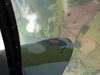
EG 1: Turning finals into a setting sun I have been temporarily unsighted. A quick glance at the SV confirmed that the runway was indeed where I last saw it.
EG 2: Flying VFR at 1000ft my attention was drawn to a red mast on the SV. Most will be aware that with SV, anything that you will collide with on present height and heading is coloured red. No doubt I would have seen it anyway but my attention was drawn to it before I had actually seen it which I consider to indicate enhanced SA.
I’m sure you’ve all heard the audio recording of an SEP incident involving high alt engine failure (charge air pipe disconnected) and descending through cloud to a safe landing.
I use Synthetic Vision on the G600, and as I said in another thread, it can actually be a little disorienting.
The image lacks depth perception and as a result the runway is a certain size, but has no reference to anything. In this case it felt like I was a whole lot lower than I actually was. A little disconcerting! Trust the instruments Archie, trust the instruments…
Otherwise I think it’s great. Certainly combined with TAWS which makes the tops of terrain colored yellow/red if you are within 1000/100’ clearance.
Haven’t used it in anger in mountaneous terrain though…
Yes, the Flight Path Vector is actually awesome. Really helps on final approach. Paint it on the numbers and bob’s your uncle.