what_next wrote:
I see it the opposite way. There is a good reason why infrared based enhanced vision systems are approved for operating to lower minima and synthetic vision systems are not.
We’re actually looking at SynVis as an enabler for SA Cat I, that is Cat I flown to 150 ft rather than 200 ft, with corresponding lower RVR. By contrast, EVS can give you lower RVR for the same DH.
If flying over rugged terrain above an undercast I switch on the SV in ForeFlight. This shows me exactly where the valleys are should I have an engine failure and need to glide down through the clouds.
Is anyone using the SV for the Aspen PFD? I am considering putting it in now as there is a bit of budget left and it’s dead easy to do. Is it worth doing?
What about the database costs, and does it stop working if you stop updating the database?
A lot of people who bought planes with e.g. the Jeppview approach plates displaying on an MFD stopped the database updates when they got their first bill of about €2000 for the next year, and carried on with ad-hoc stuff on an Ipad. The approach plates are blocked 2 months after database expiry.
Terrain and basemaps don’t expire in g1000. Obstacle databases will but I am not sure when.
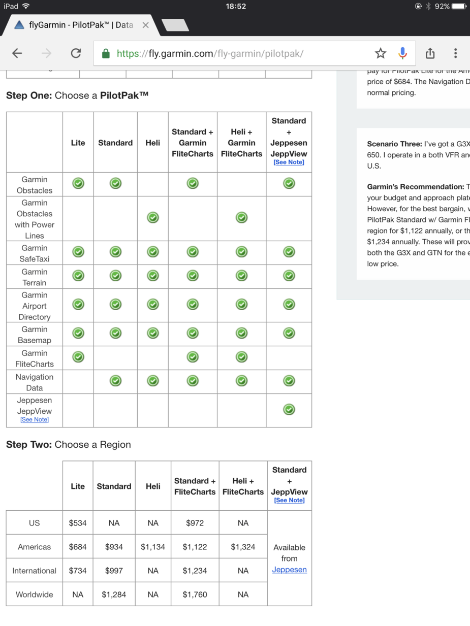
Here are the Garmin packs and pricing. Europe comes under international.
JasonC wrote:
Why would you ever switch it off?
Because it seems to distract me from the outside view. So in nice VFR conditions at the moment I switch it off.
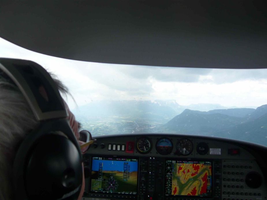
G1000 with SVT is very helpful in mountainous terrain, though it is only intended for VFR. But it maybe save the day if you happen to enter IMC. Here’s a picture taken in Vallée de l’Isère a few years ago, its not very sharp but you can still see the picture. It gives you good situational awareness.
I wonder how accurate this is.
The data has to come from somewhere and there is only one public source – he NASA SRTM data.
For X-Plane, the worldwide terrain database was about 50GB. This was accurate to something like 300ft in Europe (better in the USA and worse in some 3rd World countries who objected to it).
Where there are airports, obviously somebody has had to blend the SRTM data with the properly surveyed airport data, to make them line up. You can’t just stick an airport in the middle of data which shows 200ft above it 
I can only speak for ForeFlight with the US database, but this is definitely good enough to be used as a ‘get-out’of-jail’ card. As I have written here before, I have – so far – never used it in anger, but run it when flying over unfamiliar mountainous terrain and/or above an undercast over mountains. I find it fantastic for SA. The great thing is that it shows you what lies ahead, so you know if that valley ends in a steep cliff or not. As for relief clearance, again there is a feature in ForeFlight that shows you that along your intended route in addition to the SV.
Peter wrote:
There is really not a lot of point discussing SV systems which the accident aircraft obviously didn’t have.
Well, my point was that even basic moving map with a profile view and a terrain database (not necessarily SV) may have saved his life…and that such information is cheap and easily available….and that snubbing such information on the basis that it is uncertified and subject to random failure seems to me to be, well, stupid…
I agree planning to use such information as a primary means of avoiding terrain would be stupid too…