Depends on what you mean “eastern”, sure 
I assume the Scandinavian website mentioned above is northavimet.com. This is what it gives you:
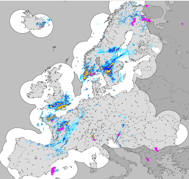
Odd that southern Italy in included in the ADL pictures, but missing here.
Croatia and Bosnia (and parts of Hungary and Serbia) could be easily added to ADL if the agreement with Croatian meteo agency (DHMZ) was reached. Radar data is publicly available at http://vrijeme.hr/aktpod.php?id=kradar¶m=stat
Good news from Poland. After writing many unanswered messages I got this:
IMGW-PIB informs that according to the Act … on the re-use of public sector information (Dz. U. Z 2016 r., poz. 352., … all the data and products produced as part of IMGW-PIB public tasks are subject to a free of charge sharing.
…
According to the mentioned below Act, IMGW-PIB can apply one-time fee for formatting of the product and net price per month for supervision, transfer of the product.
I have no details yet but that sounds like it might be affordable. I will give an update once I have more details.
I took some screenshots of the weather in Eastern Europe this morning from the AeroPlus Weather app showing rain radar, lightning data and/or in enhanced mode additional satellite based weather.

The above picture shows a screenshot of the Balkan in enhanced mode. The rain radar and lightning data is augmented with satellite data. The lightning data is near real-time, so the purple coloured clouds are coming from delayed satellite imagery, but taken together do give you better data than nothing.
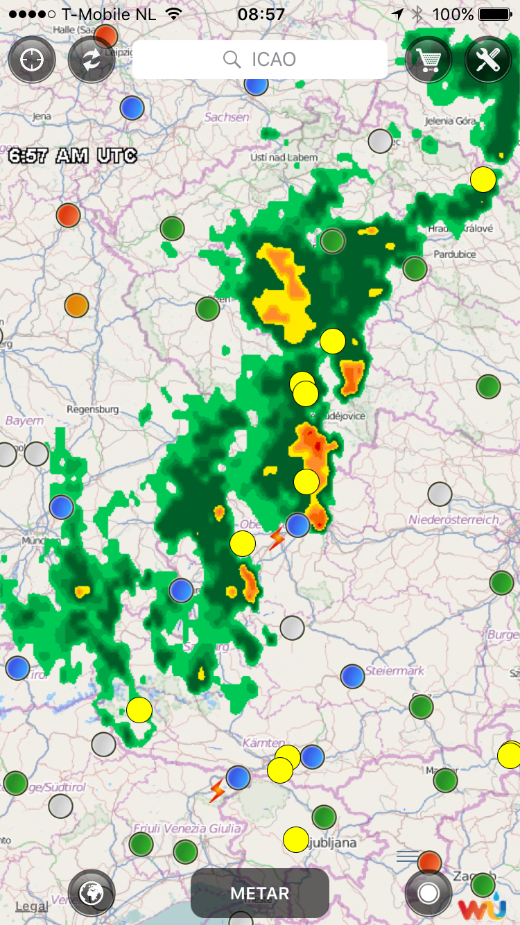
The above picture is the rain radar above the Czech Republic showing rain radar and lightning data. The lightning data also shows in-cloud lightning.

A zoomed in area in the Czech Republic only showing rain radar (by selection of what to show).
We do not shade uncovered areas (at the moment). The difference in presentation between the different rain radar solutions is purely due to smoothening of raw radar data. All solutions or source providers smoothen out one way or the other.
Lately, I was flying over Botswana in Africa at night in a Cessna 210 on my way from Gaborone to Wonderboom and there was no rain radar, but in enhanced mode, I did see the near real-time lightning data supported with data coming from the enhanced mode. It is not perfect, but I was happy to be able to fly around the build-up areas a moonless night over a remote area of Botswana.
“I assume the Scandinavian website mentioned above is northavimet.com”
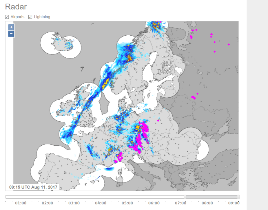
Exactly right. Its an ok website for preflight planning but I doubt it can be used on a slow connection. It has js and animations that even takes time to load on a broadband. I have also noticed with northavimet that radar data can be quite old. The picture attached is taken at 9:47 UTC with radar image beeing from 9:15 UTC.
Regarding the your app aeroplus, I actually did buy a 3 months subscription from you to try it. But I could not make it work. The radar cover as I remember was limited in overage area and also did not clearly show what the coverage area actually was. What is the current coverage area? Maybe a retest of the application is in order. I see it has a SAT mode where there is a menu called “Use Iridium Go!”… As far as I know the Iridum go is a wifi hotspot on using the ultra slow Iridium connection. What about the problem with other apps and OS stealing the connection, how do you address that?
PetitCessnaVoyageur wrote:
Have you read this ?
https://www.euroga.org/forums/flying/6824-worldwide-satellite-rain-radar-and-airport-data
Yes I have and I think Sebastian from the ADL product very precisely describes the potential danger of not having feedback on coverage area.
@THY: We partnered with Iridium and use their API to manage the Iridium network connection ourselves, which includes fail-safe mechanisms to manage the connection over the Iridium satellite network. The Iridium network is still slow for some time (years) to come, even though they are launching new satellites into orbit to provide for better data rates in the years to come. And, yes, the connection drops sometimes, especially if you do not use an external antenna, which can be a window antenna. However, in most cases, it does work or it just rebuilds the connection to fetch the data. Downloading of data takes a few minutes before it is displayed on the map.
The area not covered is not indicated (shaded) on the map at the moment, which I agree would be nice. The rain radar covers all of Europe (except for off coast west and south of France, west of Norway), the US, the lower part of Canada, Central America, the northern part of South America, Australia and many of the Pacific islands.
In almost the whole world, we provide near real-time lightning data including in-cloud lightning data. In addition, for areas and were there is no rain radar, we provide an enhanced mode, which takes the (delayed) rain radar data from satellite sources, which can then be combined with the near real-time lightning data to get a weather picture that is better than no data at all.
It is all far from perfect, but it does work. Since I fly regularly in Africa, I use it there all the time with the enhanced mode turned on in combination with fetching the lightning data. The app allows the download of METAR, TAF and GFS related data as well, such as the winds aloft at altitudes en route, the freezing levels, etc.
Whats the reason you dont use data from http://eumetnet.eu/activities/observations-programme/current-activities/opera/
it seams it could expand the coverage area alot compared to your existing coverage area?