
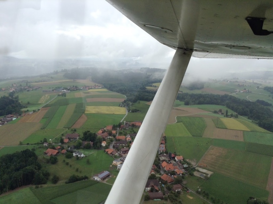
To illustrate Mooney‘s remark on M (marginal) in Switzerland (which is spot-on) this photo was taken on a route which was M at that time. I only could perform the flight because the route took me from an airport with the alps behind me to the flatlands and there was always an escape route (which you don‘t have when flying the GAFOR routes under M conditions in the alpine valleys). Without very good knowledge of the area the flight would have been a clear no-go.
Mooney_Driver wrote:
The ceiling height is above reference altitude
Isn’t reference altitude the highest terrain within the area?
Not in Germany, and definitely not in the alps.
This is the GAFOR area map for Germany, with the reference altitudes. The bits in read are areas above the reference altitude, to prevent single peaks or small hilly areas from having too much influence on the wider area.
Thanks, very interesting learning all about this. The published ‘reference’ altitude should therefore be generally treated as the minimum altitude for any given route. Makes sense.
jgmusic wrote:
Makes sense.
It gets me confused. The GAFOR refers to cloud height above ground. The reference altitude can’t at the same time be the minimum flight altitude and the ground reference altitude for cloud height.
Airborne_Again wrote:
The reference altitude can’t at the same time be the minimum flight altitude and the ground reference altitude for cloud height.
True, but on the basis that the reference altitude can’t be lower than the minimum altitude, one can treat the reference as a ‘minimum’ that’s variable according to wx – ie. the official minimum might be, say, 10k but the reference (cloud base) at the time of flight might be 5k (or lower), so best to treat the reference as a ‘minimum’ for the purposes of the flight?
Airborne_Again wrote:
The GAFOR refers to cloud height above ground.
No. And I agree it can be confusing.
The cloud height given in the code is relative to the reference altitude for each different route or area.
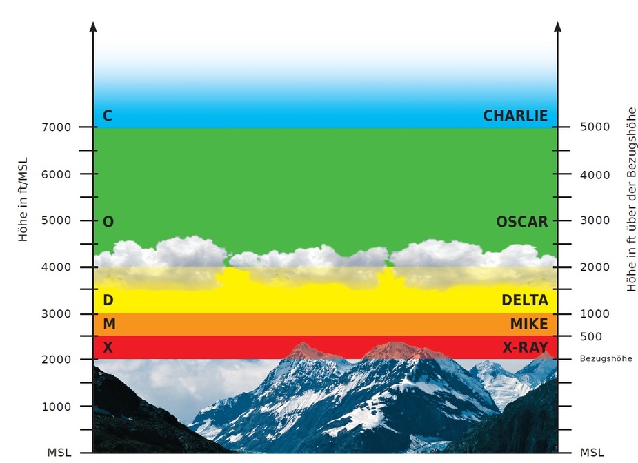
(Picture reference DWD)
This pic shows what this means. The prognosis bases on the reference height. If in an area that one is, say, 6500 ft, then all the cloud base prognosis bases on that, regardless if there is ground down to 2500 ft in that area.
The Germans further define undercathegories where you can see if it is visibility or celiling which is limiting.
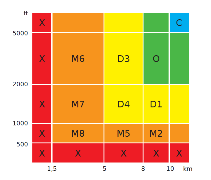
In the routes for the Swiss GAFOR, it is the same thing.
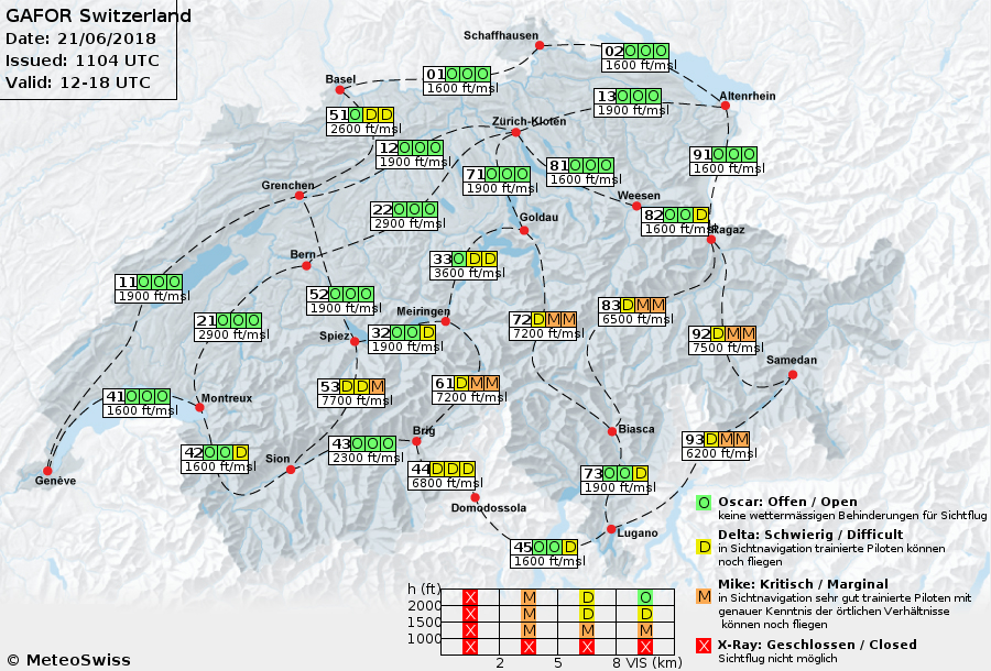
(picture by Meteo Swiss)
Note the reference heights next to each route. That is what the cloud base is based upon.
So let’s say you want to fly to Ambri from Lugano. The GAFOR route 72 is forecast with Marginal, so 1000 ft cloud over reference. 7200 ft is the minimum passing height of the Gotthard, so overflying that one is really tight, however, to fly in the valley to Amrbi (3200 ft) should be possible based on the clouds as the forecast ceiling would be around 8200 ft AMSL.
Mooney_Driver wrote:
No. And I agree it can be confusing.The cloud height given in the code is relative to the reference altitude for each different route or area.
Yes, that’s what I meant, but I didn’t make myself clear. My understanding is that the reference altitude is the highest ground level along a route — or the highest representative ground level within an area. But that doesn’t agree with
jgmusic wrote:
…the reference altitude can’t be lower than the minimum altitude
Which leaves me confused.
Airborne_Again wrote:
The cloud height given in the code is relative to the reference altitude for each different route or area.Yes, that’s what I meant, but I didn’t make myself clear. My understanding is that the reference altitude is the highest ground level along a route — or the highest representative ground level within an area.
For some value of “representative” :)
My understanding now:


