Temperature inversion?
When I climb/descend through such a layer of stratus I often see a significant change in wind direction and velocity. I have not been paying too much attention to temperature, but I would not be surprised if you also observed a marked change in temperature. So it looks like the boundary layer between two airmasses with different characteristics causing condensation.
When you have an inversion you will generally have very poor visibility below the inversion layer, and crystal clear air above. Not the case here. Also there is some convection below which is never associated with a temperature inversion which is characterised by the absence of vertical movement of the air.
How does a “ball” like this form?
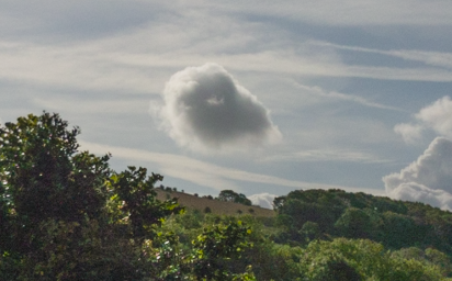
It was actually really round when I saw it and it took me a few mins to take the pic.
Peter wrote:
How does a “ball” like this form?
That is a cumulus cloud on top of one thermal 
Given that is alone in fair weather I don’t think it is from large airmass on that come with a cold raising front
So “to explain” it you may find piece of cold water (e.g. lake) sitting downwind of hot land spot (e.g. parking) or just upwind of a hill exposed to the sun? tough in the morning, they will just pop up with no reason but then you will see load of them after
Tough by the time you get there it will disappear
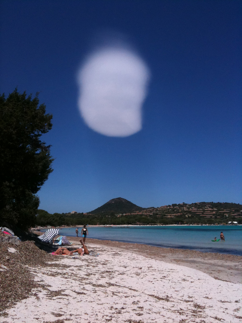
Check out this one, taken in Corsica
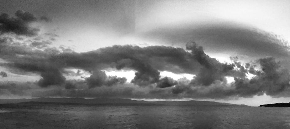
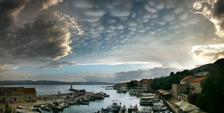
How about this one, from near Brac, Croatia. What could form this? I saw something similar near Zadar, about 10 years ago.
Peter wrote:
What could form this?
Southern wind blowing across neighboring islands forming a mountain wave, so you see alto cumulus lenticularis above some low level cumulus clouds.
Emir wrote:
Southern wind blowing across neighboring islands forming a mountain wave, so you see alto cumulus lenticularis above some low level cumulus clouds.
Agree! Waves can exist dozens if not hundreds of km downwind of the terrain that causes them – so that it is sometimes hard to see the connection – especially if due to humidity, spread, etc. you do not see lenticularis in every “Wavetop” but only in some of them further downwind and the more upwind waves are in the blue…
Really amazing photo taken by Anna Hero at Brac LDSB. This is Bol, under the airport
Cumulonimbus Mammatus?
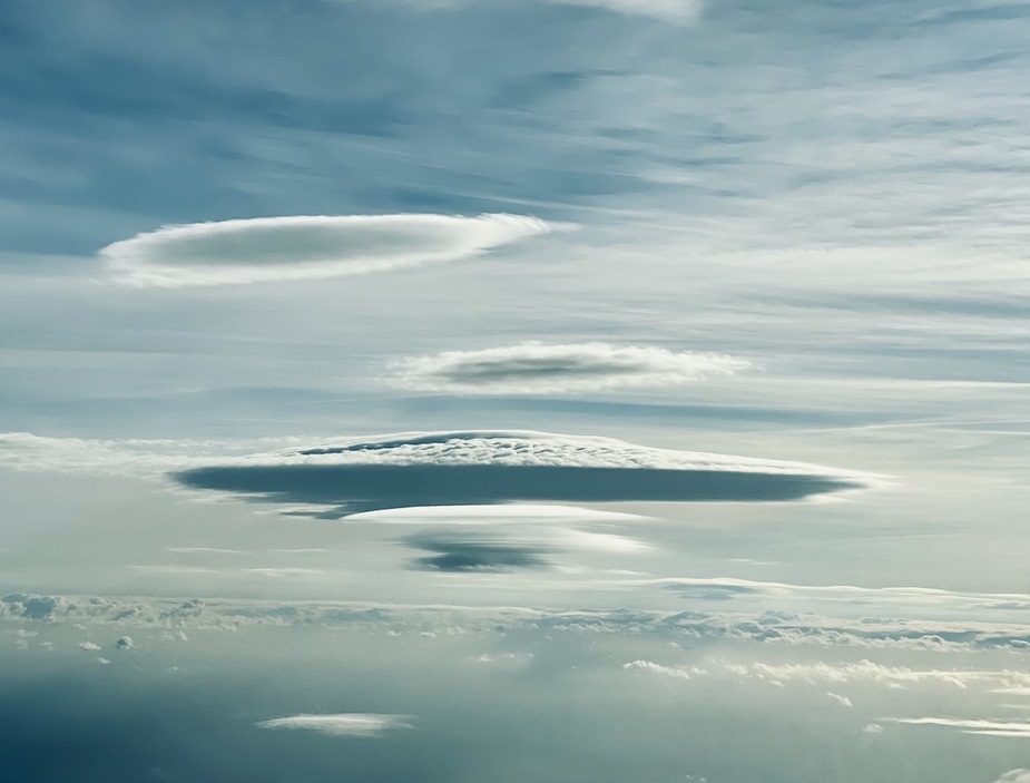
Not my picture but interesting. Is it lenticular cloud in an odd formation?