Bosco, can you show this on SD? Percy didn’t seem to have airspace on.
Here you go. It’s from the surface up to 1500 feet AGL.
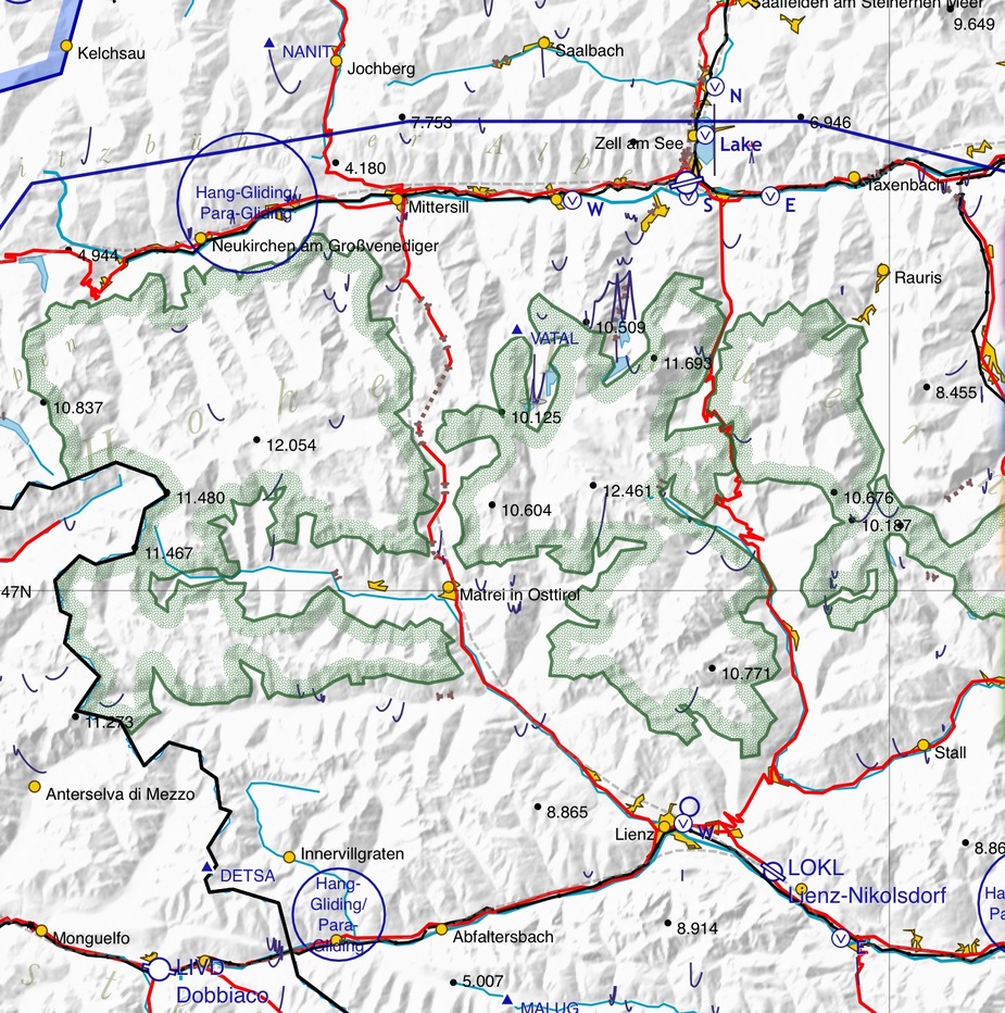
It is the green area?
Yes.
Incidentally, has anyone else noticed weirdness in the GP logbook time zones since the last software update? It seems that my home has been moved to GMT-6, like this:

Maybe I’ll ask Garmin product support. They do always answer questions. And if they could also knock 30 degrees off our latitude, that would make the app worth every penny 
Last year when I was looking at VFR tablet software I was very impressed with Garmin Pilot. It was rock solid, the design was really excellent and the functions were generally comprehensive and very accessible. It felt much more polished than most other products. However, there was one significant problem I found. There was no means by which to display which authority was responsible for a given piece of airspace with a radio frequency for them. Does anybody with the latest version know whether this shortcoming has been resolved?
Incidentally, has anyone else noticed weirdness in the GP logbook time zones since the last software update? It seems that my home has been moved to GMT-6, like this:
No although there is a bug with the ADS-B in changing the call sign of the aircraft in the logbook. They are aware of it. I like the logbook feature and the fact you need do nothing to make it work. No GO FLYING rubbish.
Was using Avare on a Samsung Note smartphone with the Garmin 796. Now switching to Garmin Pilot on a 9.7 inch Samsung Galaxy tablet with the new Cirrus perspective and the Garmin Flightstream 210. The combination was tested yesterday and it works flawlessly. Upload flightplans, download weather and moving map to/from the Samsung.
Just out of curiosity: this “Hohe Tauern” area, is this in the Austrian AIP? While, admittedly, I wasn’t very thorough looking for it, I could not find anything there?
Another GP user and fan here.
It is the only product viable for rest of world outside of the US and Europe, and the worldwide base map for 149 quid is a bargain. I actually found the base map easier to use than superimposing the Europeqn subscription enroute charts when l brought the Jetprop over last year, and l will not bother to renew those. The base Map is really good enough.
I think the UI of JeppFD is actually better, and their depiction of the airways is a more faithful reproduction of the paper charts – showing things like one way airways etc, which GP currently does not, but Jepps outrageous fees for the chart data make it unpalatable, and unjustifiable for a single owner like me. Each release of GP closes the gap. I can see GP eventually eating Jepps lunch for non commercial ops.
Their big edge integrating with avionics is very hard to beat. Flightstream210, which l have previously reviewed breaths new life into the GTN boxes for little capital outlay. I love it.
Peter, l believe EuroFPL are behind the new filing capabilities in the latest release of GP.
E