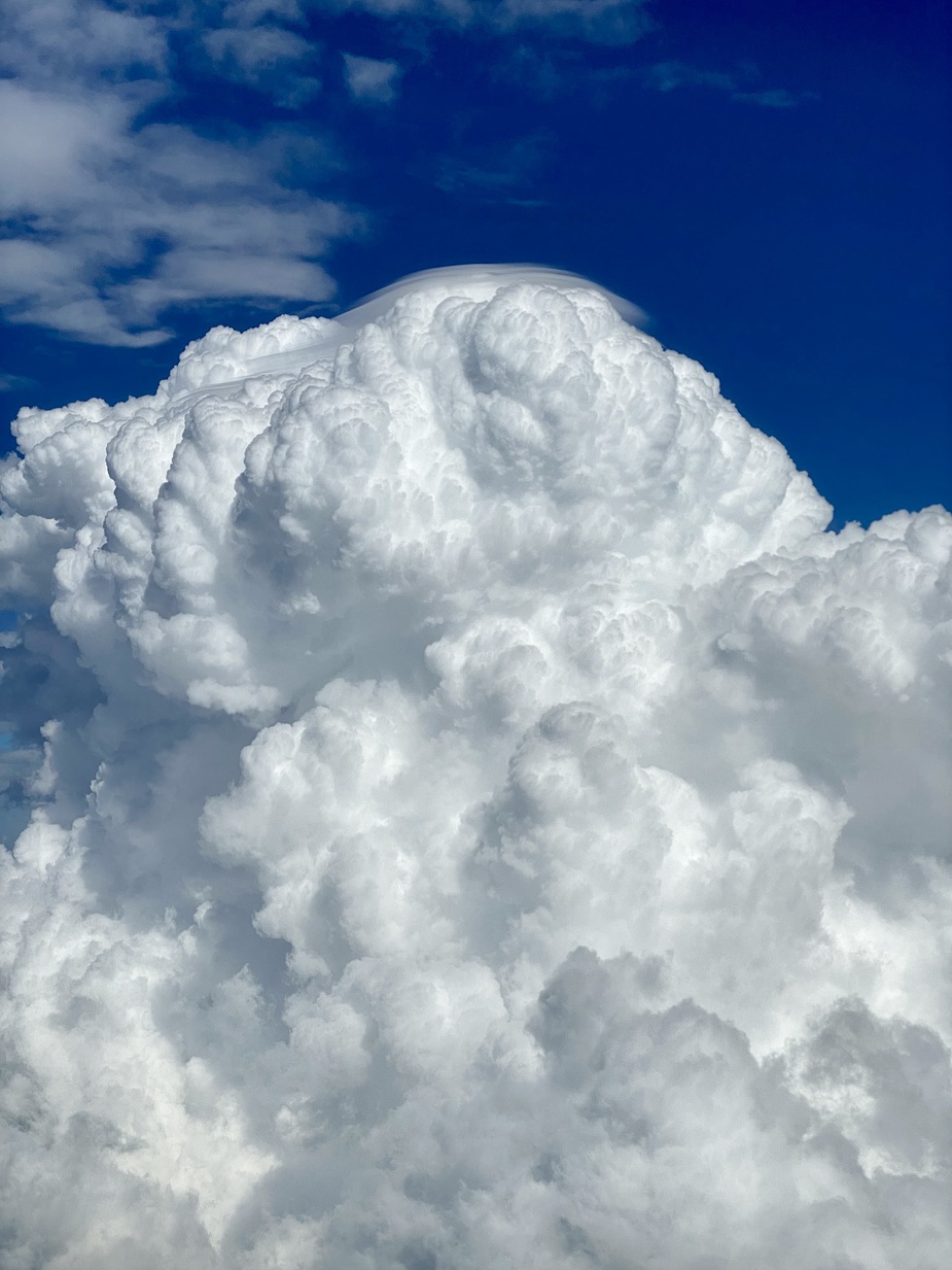
The photo isn’t great but it looked like a lenticularis topping a TCU. We were at FL130, top was probably around FL180. Quite turbulent downwind of it despite staying well way !
That’s stunning. I wonder what the physics is…
Peter wrote:
That’s stunning. I wonder what the physics is…
Gravity waves, again.Wind is flowing over the cloud and going down on the other side.
If you have cloud streets and a wind perpendicular to the rows of clouds, you can even use the lift of these waves to climb higher than the clouds in a glider (without entering the cloud). A once in a lifetime experience, I’m told.
Gravity waves
You mean mountain waves 
That’s not gravity waves, that’s a beautiful demonstration of forces of persistence of an air movement. The cloud has internal wind directions (up- or downdraft) that is other than surrounding – which makes the surrounding airflow to avoid that “obstacle air flow”. So yes, you could say it’s like a form of mountain waves.
For glider pilots that phenomenom is quite known, as @Inkognito mentions already. I (and many others) have climbed in such an updraft in front of a cloud. You have to climb just until the cloudbase below the cloud, then continue staying below but gather as much speed as you can and then pull up in front of the cloud in order to enter that “geostrophic” (cloudostrophic  ) upwind. If conditions are good you can stay there and climb some another hundreds of meter. But it’s not very efficient (read: not a strong updraft), at least to the extent what I have seen. Normally you achieve a higher overall speed without using that, because the updraft below such a cloud is just a lot better. I used it for to cover a long distance against wind with poor thermals.
UdoR wrote:
I (and many others) have climbed in such an updraft in front of a cloud. You have to climb just until the cloudbase below the cloud, then continue staying below but gather as much speed as you can and then pull up in front of the cloud in order to enter that “geostrophic” (cloudostrophic ) upwind. If conditions are good you can stay there and climb some another hundreds of meter. But it’s not very efficient (read: not a strong updraft), at least to the extent what I have seen.
I think it’s not actually what can be seen on this picture. What you described was classical slope updraft on cloud upwind side. The picture above features pileus which is a good sign of cumulonimbus forming.
Wow @Emir thank you! Never heard before of the Pileus cloud
Yes, you’re right, this looks like a Pileus instead of lenticularis. They develop completely different, yet are hard to distinguish. In terms of physics in a Pileus cloud happens more or less the same as in the updrafting part of a lenticularis, however there’s no wind involved for the formation of Pileus. The updraft of the cloud takes care of that.
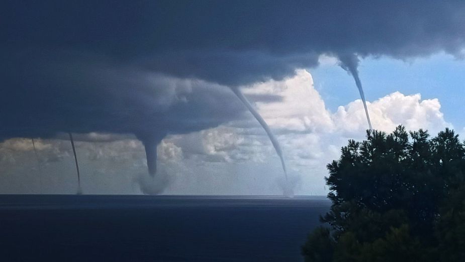
Interesting Cb in development