I am pleased to confirm that I updated the ADL150 firmware from the android phone app today, and it worked fine. Apparently you have to make sure the phone cannot get another wifi connection during this process. The firmware (v8) is contained within the app and the update was done in flight.
Also the KLN94 data processing is now solid.
Some font issues on the android app have also been fixed.
When you say stay away from a high infrared return di you mean blue or light blue?
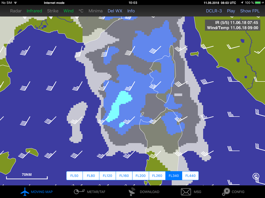
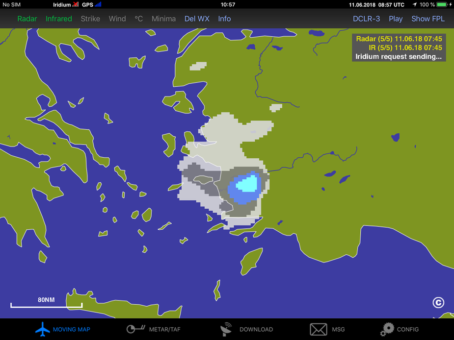
I would not emphazize too much on the exact color = altitude/temperature of the infrared return but more on the general shape. If the cloud it is growing like a mushroom with rather steep borders it is likely to be a CB. Then if there is lightning it is very likely to be a CB. Here are a few sample screenshots I took right now:
West of Sardinia you can see a ver steep gradient in the IR image with a high are North East of it:
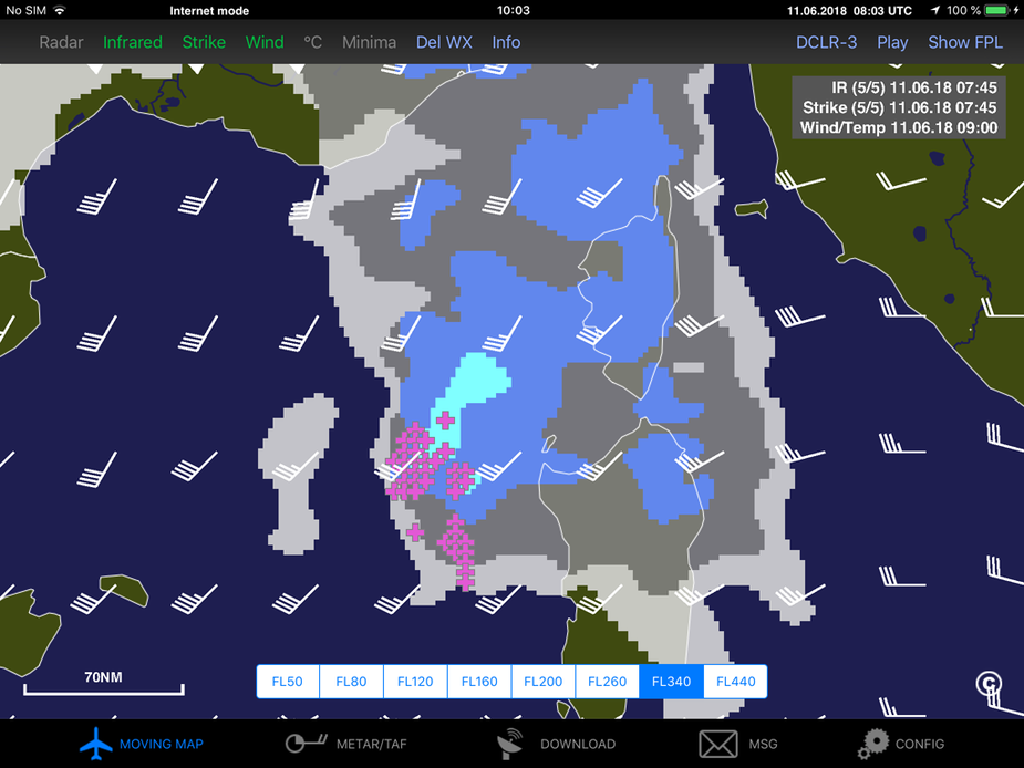
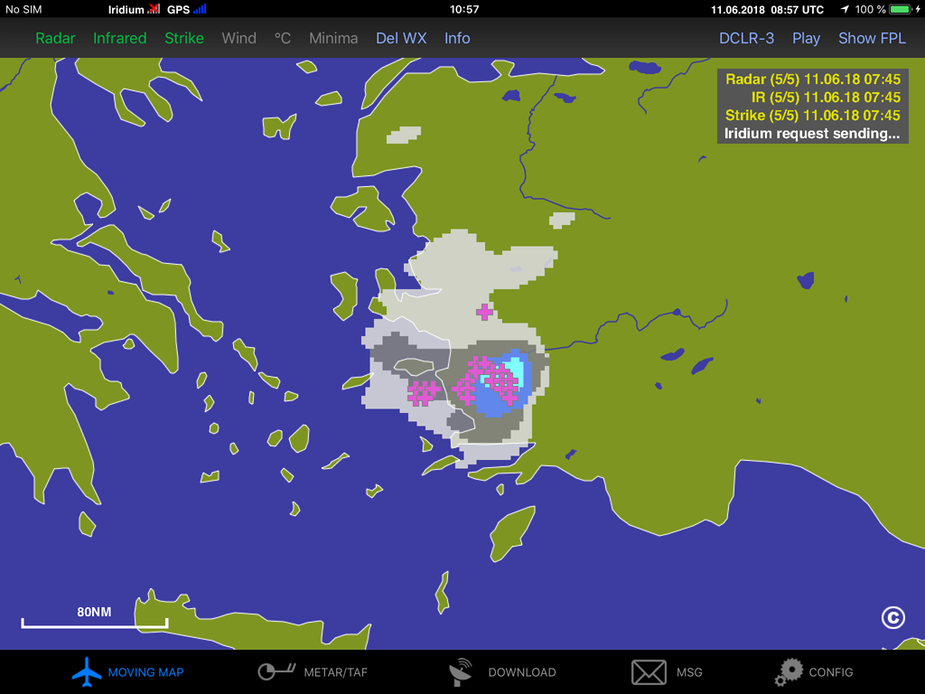
Now I added the lightning:
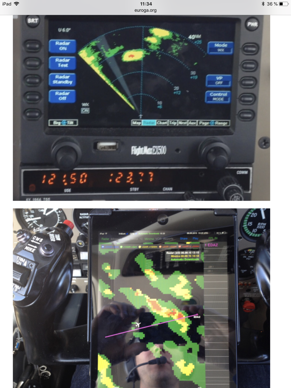
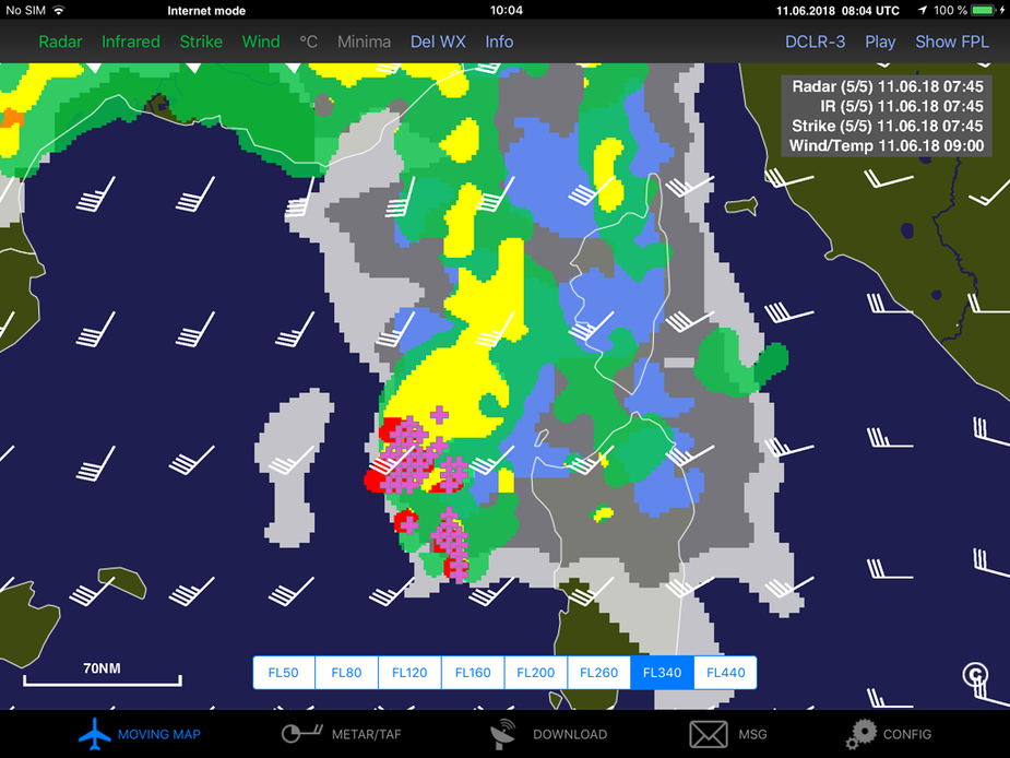
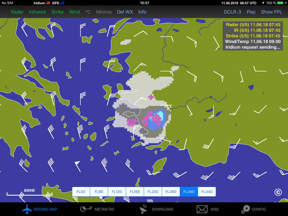
And finally the radar returns for the same area:
Usually I also try to use the high altitude wind as the worst part of the CB tends to be on the windward side of the infrared returns. The wind seem to take up the “smoke” at higher altitude and blow it downwind.
My personal strategy is trying to learn the patterns in areas where radar, lightning and infrared are available in order to be be able to identify the CBs in other areas over the sea etc. where radar is not available.
Sebastian_G wrote:
I would not emphazize too much on the exact color = altitude/temperature of the infrared return but more on the general shape.
Does the ADL software compensate for (actual or forecast) temperatures aloft when choosing the colour of the infrared returns? E.g. does it start to show clouds at the freezing level (FL75 in ISA) or at the actual/forecast FL75 temperature? In Scandinavia we have seen freezing levels up to FL125 (ISA+10) in the last couple of weeks, so it can make quite a difference.
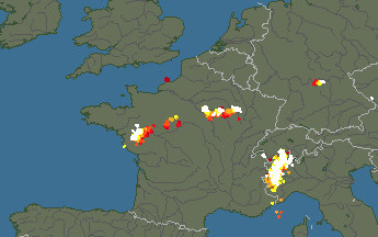
The “steep gradient” on the IR image is interesting. On the real IR image you can see it clearly
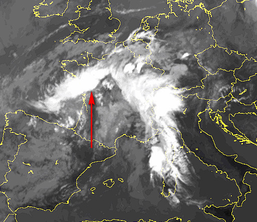
and sure enough here you go, on the real sferics image (w. France)
Obviously this stuff is dead easy to assess before the flight, because you can get these images instantly over the internet.
I moved the ADL-specific posts from here to this thread.
And one more example from today. This is an area without radar coverage but the combined ir and lightning data is very clear. There is a massive stationary cell. Already the infrared image shows there is no significant wind and the wind data confirms just that:
Reporting one more flight with some datas.
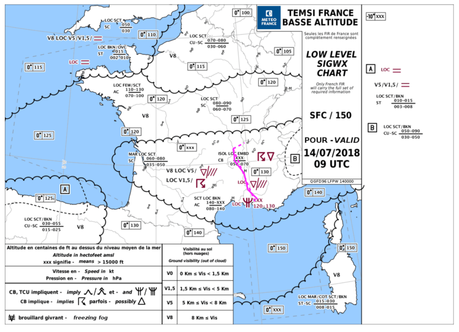
Flight from LFMA to LFMH, not clean TEMSI:
In-flight, weather has been updated through Golze system, cross-checked with on-board stormscope, to detect early signs of electric activity:
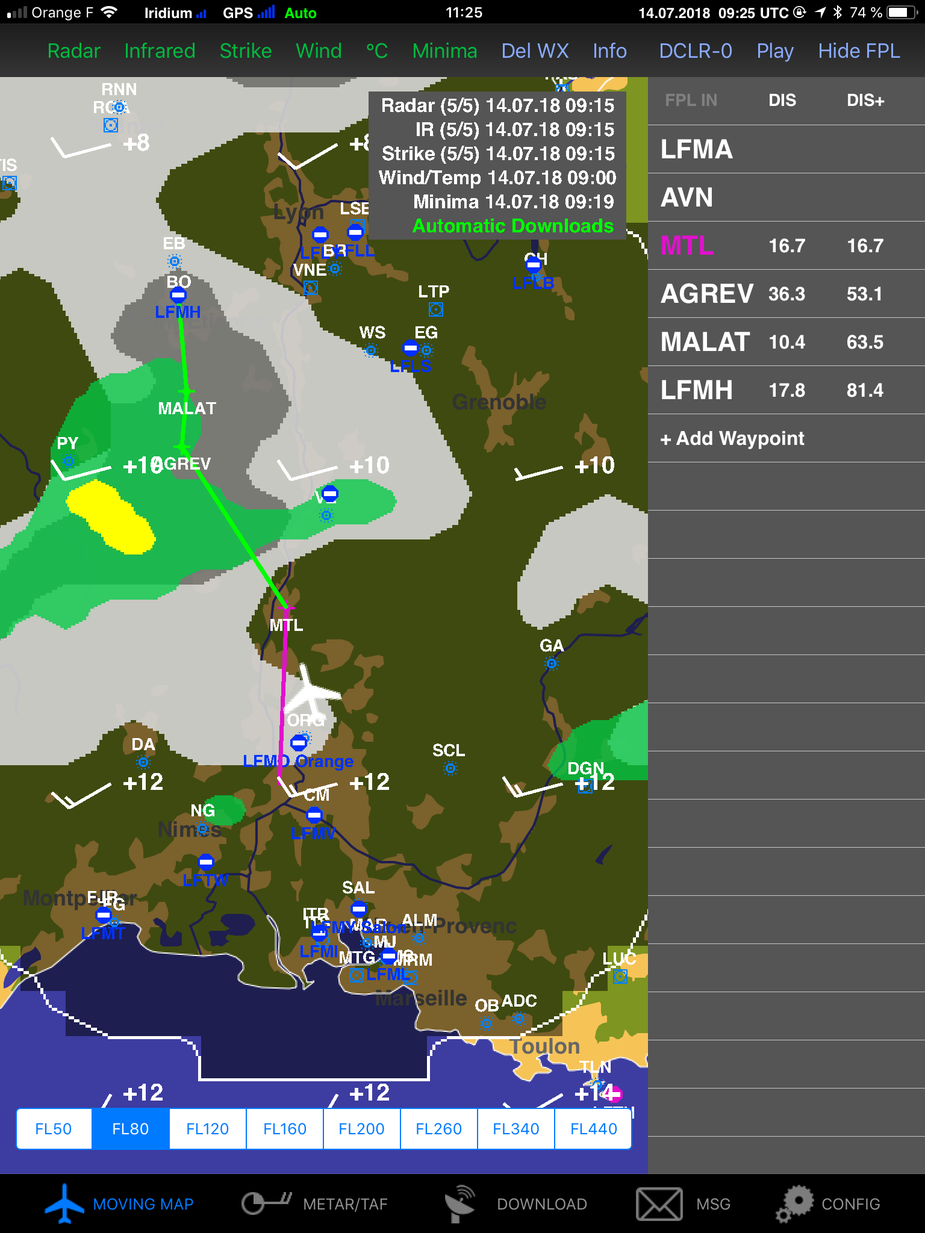
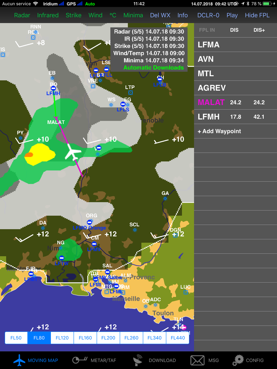
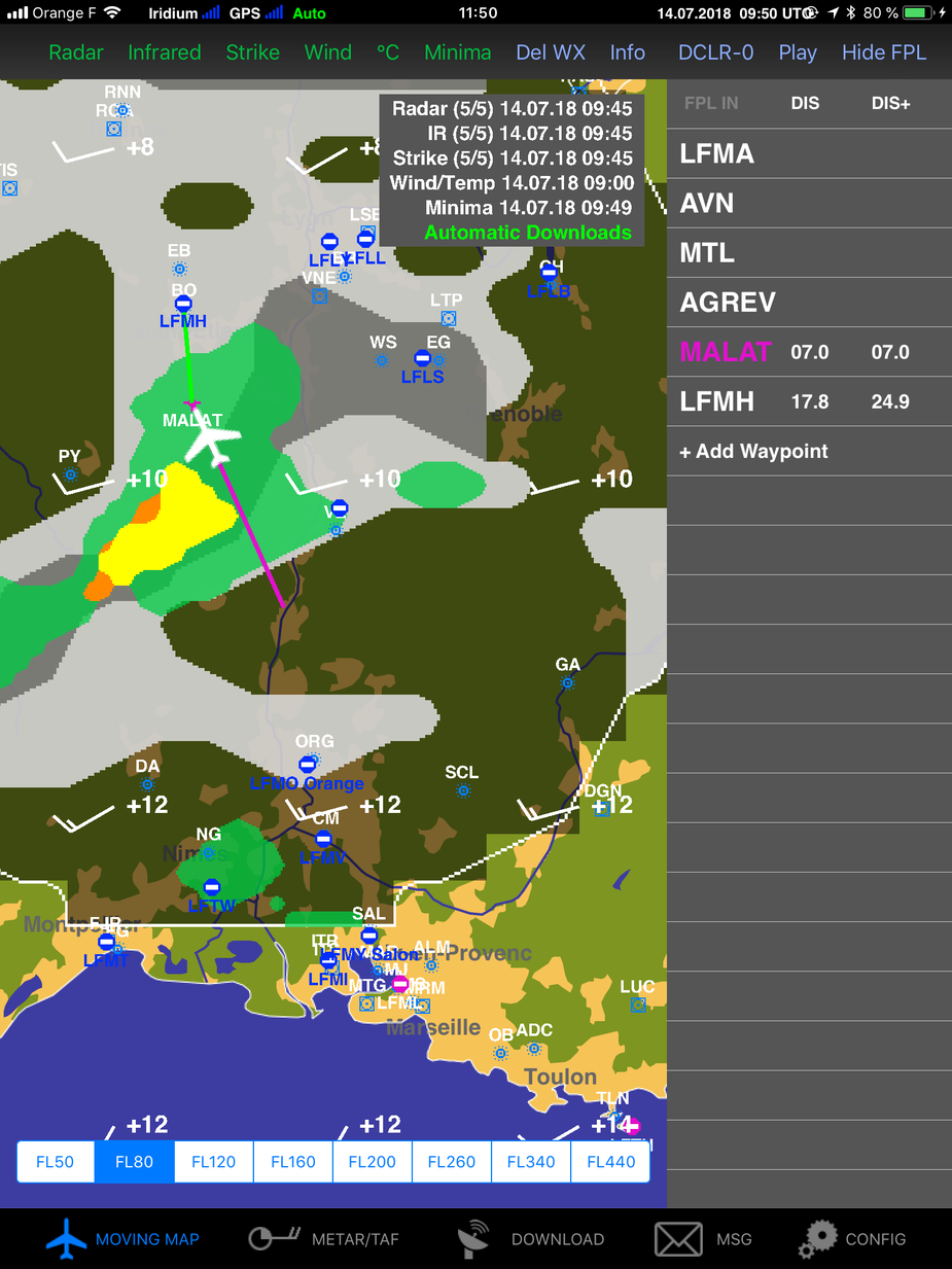
Short insight of the flight around 9:45UTC:
Base of cloud must have been a little higher, around FL100.
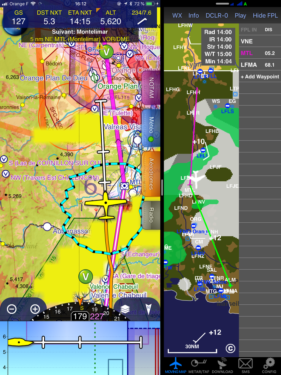
Also, on the return flight, SkyDemon integration:
That is interesting.
There is a lot of convective activity in the afternoons these days. You seem to have avoided any TS. Did you get any turbulence in the green stuff?
From my so far test-only usage of the ADL150, I think the IR image, if used alone, has the same limitation that the SAT24 IR image (which I have used for years to guess cloud tops) has i.e. it picks up all the very high altitude cloud too.
I am flying over the Alps tomorrow so it’s going to be interesting  The wx is convective as hell now…