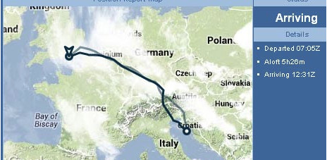
I had seen in the past where a pilot would post a flight with his route shown and weather radar overlaid on the map.
Is there a site where I can find my flight flown and have weather overlaid on it. I had an interesting flight through some weather and would like to see
the radar returns. If such a thing exists. Thanks in Advance.
C210_Flyer wrote:
and would like to see the radar returns. If such a thing exists
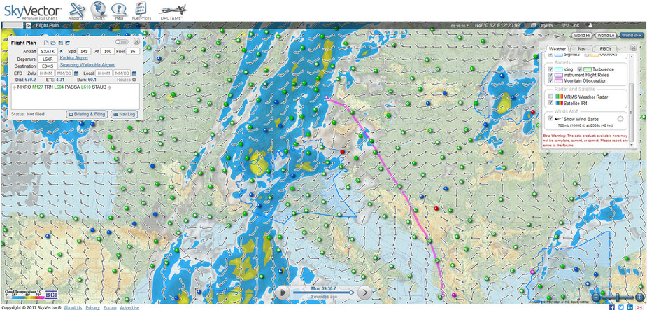
You can see it in https://skyvector.com/ by entering your flight plan and then selecting the proper LAYERS from top right menu.
Its for use with Internet connection though, not possible while airborne.
Sample
Too bad I would have loved to have viewed how I navigated the mess around Vienna yesterday. I only had eye balls and stormscope since I forgot to activate my ADL subscription thinking late afternoon Thunderstorms as per Wx forecasts. Unlike in the US the controllers dont give you guidance regarding radar returns other than deviate as you think best, any deviation approved. Most of the deviation was IMC about 1.5 hrs Very curious to see just how well the SS did by itself.
The Wx conditions were between no rain and heavy rain. Turbulence between light to frequently moderate nothing severe. But occasionally good jolts to slow to 20 kts about maneuvering speed.
Thats my PIREP
You can activate the ADL service with an SMS, you know? Worked in flight for me!
Too bad I would have loved to have viewed how I navigated the mess around Vienna yesterday
You can get historical / archived radar images from meteox.com and probably also from sat24.com for the IR images. These are real hi-res images, not pixellated satellite downloads.
However there is no easy way to overlay your GPS track onto them – that would be quite handy. But the images obviously change during the flight, so to do this properly you would need to play back the GPS track while rendering successive archive images, and render it all into a movie 
Ran into my first problem after registering. Put in departure airport and it comes up as invalid. Well that is not surprising as it is only
locally (in Hungary) known as an airport Jepp doesnt have them in their data base because the owners refuse to be tied down
to an airpot configuration. So they act like an airport, charge like an airport, but are not listed in the International AIP data base.
Welcome to the Grey zone of Hungary.
I was able to use RR and they gave me a Z plan from Tokol to Augsburg for an 0915 Z departure but due to delays wheels up were not
until 0944Z Can anyone access the info and make it work? N6589M
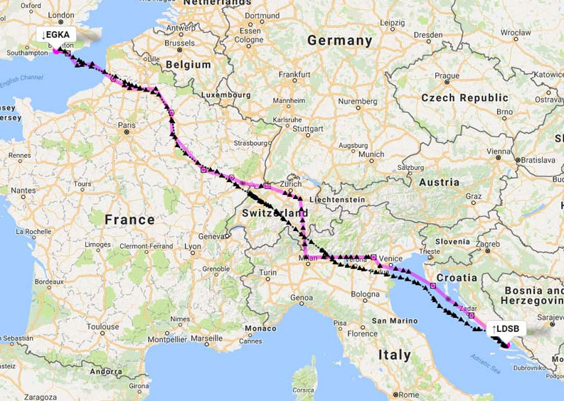
FR24 track perhaps?
Peter wrote:
However there is no easy way to overlay your GPS track onto them – that would be quite handy. But the images obviously change during the flight, so to do this properly you would need to play back the GPS track while rendering successive archive images, and render it all into a movie
Peter unfortunately that is beyond my technically capabilities.
Alexis wrote:
You can activate the ADL service with an SMS, you know? Worked in flight for me!
Im assuming you need to use your cell phone to do that and mine is incapable of sending SMS. (dont ask why) Let it be said that I will get my IPhone back from
those capitalist tricksters in the US after they unlock it.