I did a few flights in this area, VFR flights are with Geneva Information even on the French side over the Mont Blanc so the little bit of flight over Switzerland is seamless. I usually would file IFR right down to the SPR VOR near Lausanne and then no problem flying VFR directly south to the Mont-Blanc staying high above big jets landing in Geneva.
Official French up to date ICAO VFR chart on geoportail https://www.geoportail.gouv.fr/carte but as always requires some French language proficiency.
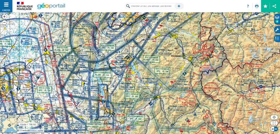
I can also recommand this website https://appli.mach7.com/ for easier flight planning and airspace depiction in France.
And also the R 30 B restricted airspace is only forbidden to ultra light gliders, just tell Geneva you want to make pictures of the Mont Blanc, they are used to it :)
I have been trying to work out a Eurocontrol routing which validates.
DJL A1 SPR is a forbidden route. Only VFR can it be filed:
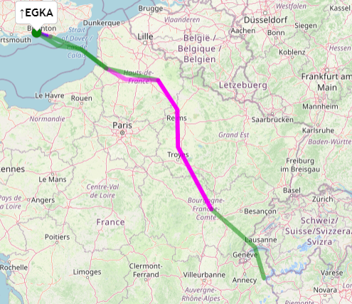
EGKA N0145F040 SFD VFR DCT KUNAV DCT ABB/N0151F090 DCT BILGO/N0151F090 IFR B3 VATRI G40 ARSIL B13 SOMDA A6 DJL VFR A1 SPR MOBLO/N0151F090 SPR A1 DJL IFR A6 SOMDA B13 ARSIL G40 VATRI B3 BILGO H20 XORBI H40 NEBRU/N0150F120 H40 ABB VFR N20 KUNAV DCT WAFFU EGKA
If I try
EGKA N0145F040 SFD VFR DCT KUNAV DCT ABB/N0151F090 DCT BILGO/N0151F090 IFR B3 VATRI G40 ARSIL B13 SOMDA A6 DJL A1 SPR VFR MOBLO/N0151F090 SPR IFR A1 DJL A6 SOMDA B13 ARSIL G40 VATRI B3 BILGO H20 XORBI H40 NEBRU/N0150F120 H40 ABB VFR N20 KUNAV DCT WAFFU EGKA
i.e. IFR all the way to SPR
I get
(R)PROF204: RS: TRAFFIC VIA DJL LFFFUJ IS ON FORBIDDEN ROUTE REF:[LS2509H] LSAGN
sorry I’m late to the party. What I would do (I do this quite regularly) coming back from the UK is cancel IFR at DJL or at any point after that and proceed VFR to LFLP (Annecy) from there, fly over the lake towards Albertville and then tour the MtBlanc from there – there really is no need to be talking to anyone at all (not even GVA as pointed out before). Though we will get the debate again (which we’ve had before about crossing into Italy without being on the radio).
So you could file your FPL for LFLP (to have that as a waypoint) then tell the tower you really would want to do the tour of the MtBlanc and then divert back to Shoreham after your tour.
Knowing the airspace here well that seems easiest to me. (it is what I would do if I was crazy enough like you Peter ;-)).
Thank you. What I am trying to do is to get something filed which is “about right”…
Currently I am getting a weird error
Row 1 column 509 ???
but this is very similar to the route EGKA-LIMW (Aosta) which files fine
EGKA N0152F100 SFD DCT RIBGO DCT RINTI B3 VATRI G40 ARSIL B13 SOMDA A6 DJL A1 LISMO VFR LIMW
I must have some invalid char in the route…
Finally, after a lot of messing about with the AR, I get this one to validate
N0145F040 SFD VFR DCT KUNAV DCT ABB/N0151F090 DCT BILGO/N0151F090 IFR B3 VATRI G40 ARSIL B13 SOMDA A6 DJL A1 LISMO VFR DCT MOBLO DCT LISMO IFR DJL/N0151F090 A6 SOMDA B13 ARSIL G40 VATRI B3 BILGO H20 XORBI H40 NEBRU/N0150F120 H40 ABB VFR N20 KUNAV DCT WAFFU
but not if I do LISMO A1 SPR as IFR. It just says forbidden route. It looks like one cannot route DJL A1 SPR.
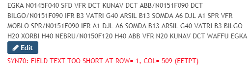
And when I re-open this validated route in AR it says
SYN70: FIELD TEXT TOO SHORT AT ROW= 1, COL= 490 (EETPT)
so something is clearly broken.
HOWEVER, using eurofpl.eu, I get the above route to validate, with trivial edits, as a Y plan
SFD/N0145F040 VFR DCT KUNAV DCT ABB/N0151F090 DCT BILGO/N0151F090 IFR B3 VATRI G40 ARSIL B13 SOMDA A6 DJL A1 LISMO VFR DCT MOBLO DCT LISMO IFR DJL/N0151F090 A6 SOMDA B13 ARSIL G40 VATRI B3 BILGO H20 XORBI H40 NEBRU/N0150F120 H40 ABB VFR N20 KUNAV DCT WAFFU IFR
A colleague gave me a French ATC number +33 (0)5 57 92 60 84. The man was very helpful. He was not familiar with that area but said there is a lot of mil airspace. Also it became apparent that one cannot file a VFR leg across a piece of Switzerland which is what this is
but if necessary I can dogleg to the west of the bit of Switzerland.
A dogleg around Switzerland would mean I would approach Mt Blanc from the west, on a heading of about 100
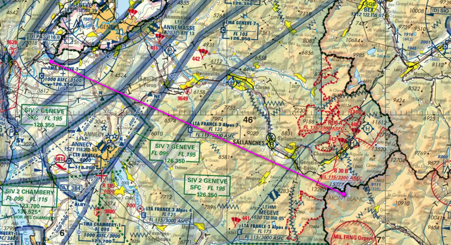
so only R30B would be relevant. @boscomantico where did you find R30B is not active?
The 3300 ASFC is an issue because I will not be 3300ft+ above the summit. I would be ~1000ft above it.
The according to our AIP the R 30 B is for mountain rescue operations, active from July 1st to August 31st and is only forbidden to gliders anyways.
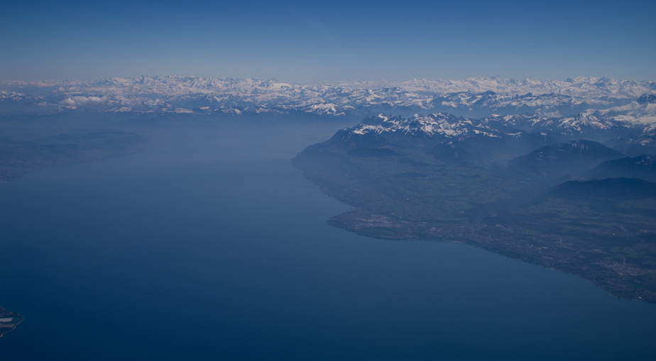
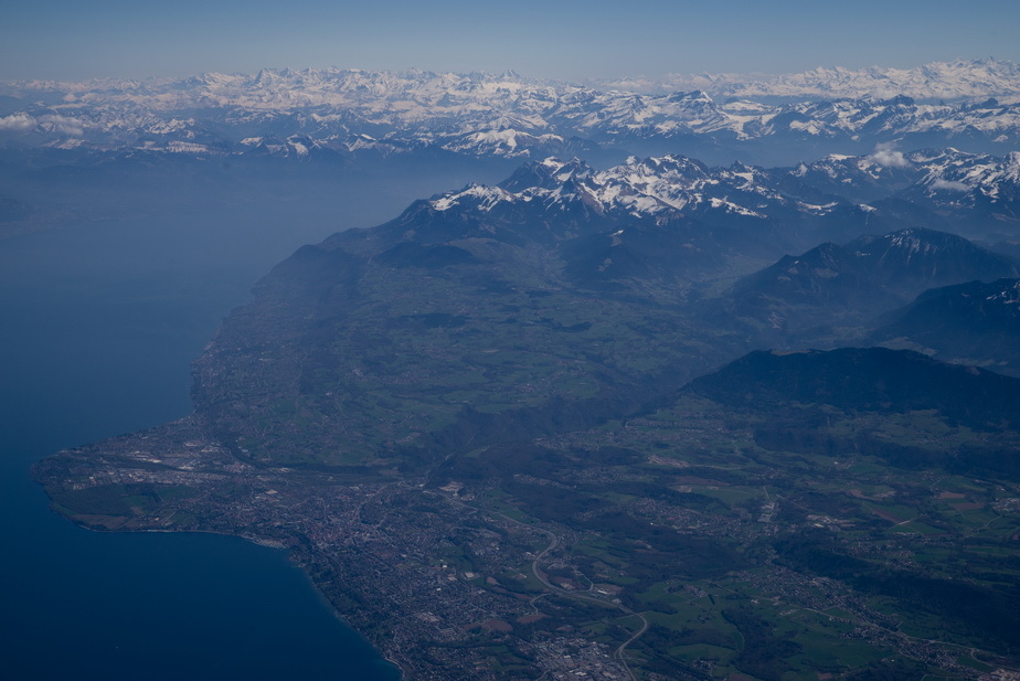
I have also flown the route DJL SPR under VFR sometimes and it works almost exactly the same ATC wise, no need to dogleg around Switzerland. Maybe I could get SPR under IFR because I was flying on Y or Z FPLs to or from an airport in the area, or maybe they just changed the rules recently because it messed with Geneva traffic.
Thank you Alex. I am planning it now 
Ah and finally the reason I preferred to be able to start/finish IFR at SPR was that this way I woudn’t have to plan for the scenario where Geneva would ask me to stay out of the class C TMAs while VFR which would require descending to pass under them over the lake or west of the CTR. Crossing east of SPR would only require descending to 5500 ft which is why I favoured plannig a route that way. Safe flight!
I did the Mt Blanc summit today. 6:30 airborne time. LFOB 18.9 USG. Transferring 150GB of video and a load of DSLR pics
Swiss ATC were outstanding.
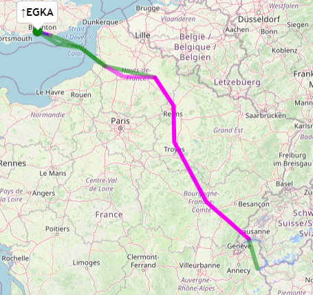
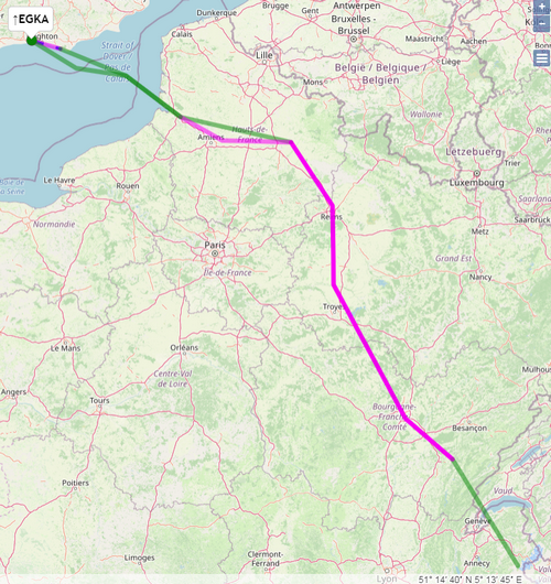
OK here we go. Mt Blanc, nonstop from Shoreham EGKA in a TB20.
Normally I “ration” my flying so I don’t fly on successive days, and the day before took Justine for a day out in Norwich (in CV19 times one is grateful for any getting out ) but the wx was just so totally amazing I could not resist!
Metar
EGKK 230620Z 07006KT 9000 SCT005 04/04 Q1029
EGKA: no results found
EGHI: no results found
EGHH 230620Z 06007KT CAVOK 04/02 Q1027
EGKB 230620Z 10005KT 060V150 9999 SCT006 04/03 Q1029
EGMD 230620Z AUTO 10013KT 9999 NCD 07/04 Q1029
EGJA 230620Z 08015KT CAVOK 08/05 Q1025
LFQQ 230600Z AUTO 03005KT CAVOK 04/01 Q1029 NOSIG
LFSD 230600Z AUTO 01011KT 350V050 CAVOK 07/M02 Q1024
LFLP 230600Z AUTO 04003KT CAVOK 06/04 Q1023 NOSIG
TAF
EGKK 230554Z 2306/2412 10008KT CAVOK PROB30 2306/2307 9000 BKN007 PROB30 2404/2407 9000
EGKA: no results found
EGHI: no results found
EGHH 230555Z 2306/2315 06005KT CAVOK
EGKB 230556Z 2306/2315 07008KT CAVOK PROB30 2306/2308 8000 BKN007
EGMD 230459Z 2306/2315 10012KT CAVOK
EGJA 230625Z 2306/2315 08017KT CAVOK TEMPO 2310/2315 07019G29KT
LFQQ 230500Z 2306/2412 05010KT CAVOK
LFSD: no results found
LFLP 230200Z 2303/2403 VRB02KT CAVOK BECMG 2310/2312 36008KT
IR image clean
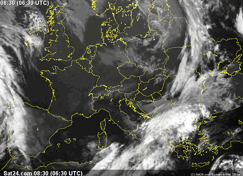
Radar image was totally clean of course.
Winds good – a significant change during the flight too, which is unusual, and one has to watch that
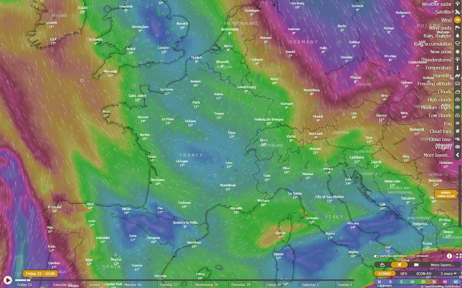
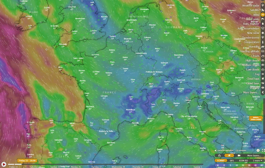
Even the GRAMET was clean. This is often fiction and I rarely use it for decisionmaking re where IMC will be found, but it turned out to be right this time
Shoreham now has longer opening hours – back to normal. 8am to 8pm local. Unlike so many “won’t bother to open when we can’t sell stodge in the cafe, and screw the owners based here; if they sue us for engine corrosion we just kick them off” airfields, it never closed during CV19, and I flew every 1-2 weeks during all the lockdowns, sometimes choosing an overcast day and flying in IMC or above.
The aircraft was left out overnight so I could do an early start; around 8:30 (there is a runway inspection etc). Tanks filled up the very brim. The airborne time was forecast at 6hrs+ but if I had to refuel in France, and something went wrong there (e.g. the fuel man being out to lunch for 3 hrs) then I would need all the time I could get, since an overnight stay would definitely get UK police attention. I carried the full tent kit mentioned earlier in this thread (and nowadays that lives permanently in the plane) with extra Merino layers due to freezing temps at night but even sleeping next to the plane (which 99% of airports won’t allow anyway – see earlier notes) would not avoid a UK quarantine. The only thing I forgot to bring was my liquid fuel stove which can burn avgas, but it is useless anyway unless you bring or can get food to cook I also carry an FFP3 mask in case one had to go somewhere in a taxi or a bus.
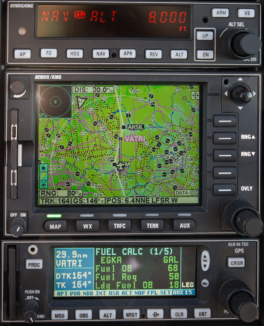
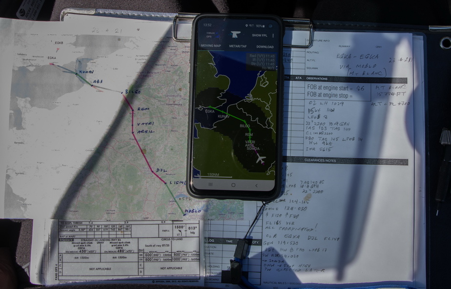
Some hassle with getting a Eurocontrol validated route this time. The Autorouter bombed out due to some bug. It cannot create these circular routes in any useful way so one has to route “something” and then edit that route (by dropping in two separately produced ones) and see if it validates. I did it eventually but had to use EuroFPL (a great free-for-x-plans service) to file the flight plan
EGKA SFD/N0145F040 VFR DCT KUNAV DCT ABB/N0151F140 DCT BILGO/N0151F140 IFR B3 VATRI G40 ARSIL B13 SOMDA A6 DJL A1 LISMO VFR DCT MOBLO DCT LISMO IFR A1 DJL/N0151F090 A6 SOMDA B13 ARSIL G40 VATRI B3 BILGO H20 XORBI H40 NEBRU/N0150F120 H40 ABB VFR N20 KUNAV DCT WAFFU IFR EGKA
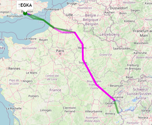
In the above, the start is IFR, the FL040 is just garbage to satisfy the validation system, the level changes are meaningless, MOBLO is near Mt Blanc and handy for ATC who may not know where Mt Blanc is, and the other VFR sections are to shorten the route to save fuel. In particular I departed VFR from Shoreham, 5000ft across the Channel, avoiding London Control who would send me to TRACA which is way to the east, and called up Lille direct. Initially I flew low (5000) due to the headwind, later FL080 for most of the southbound bit, but much later climbed FL160 for the Alps.
Nice day for departure
LFOB showing 13USG. On the last trip (posted earlier in this thread) the “zero wind” figure was about 15, but on that one the winds pretty well cancelled out. On this one I was expecting about 20. So the 7USG shortfall is due to the headwind of about 15kt. In fact the initial LFOB figure was 8 USG due to strong winds over the UK
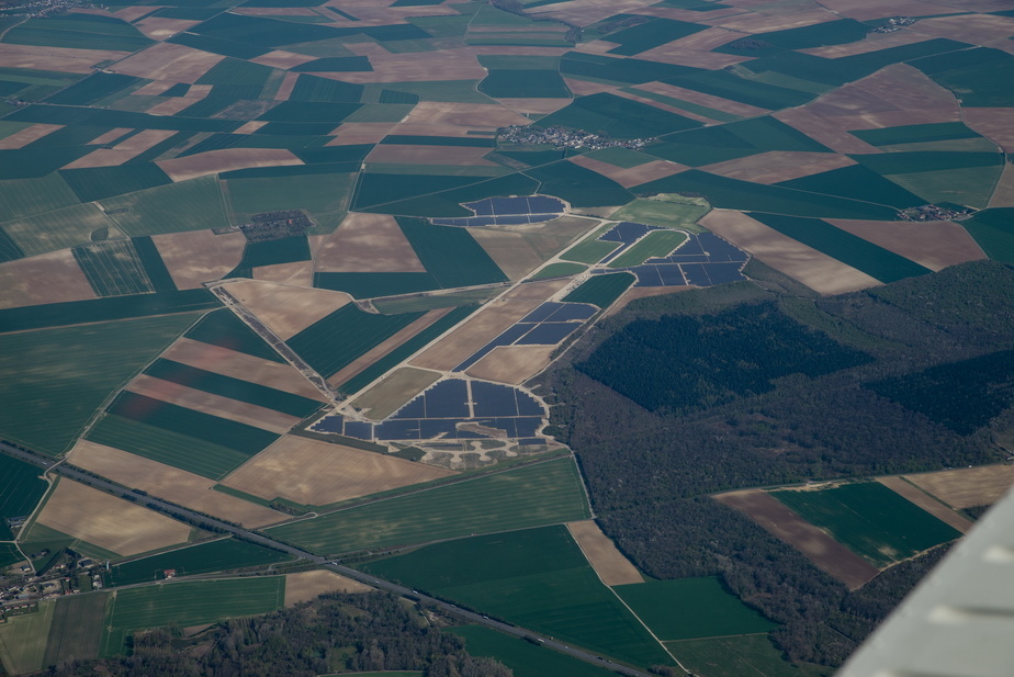
One of many mil or ex mil airports around France, with the parking pads, awaiting the USSR (or British?) invasion
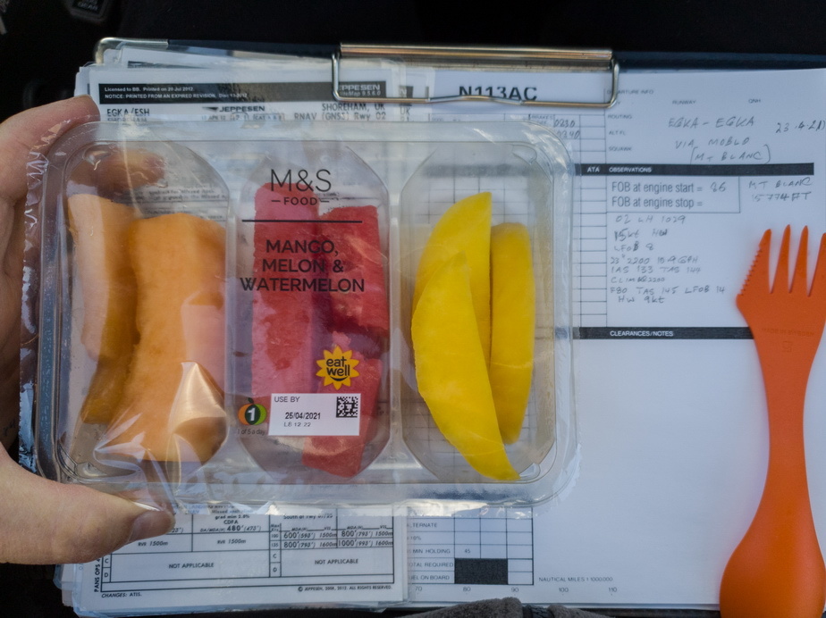
A part of the packed lunch Also had 2 bananas and a flask of mocha
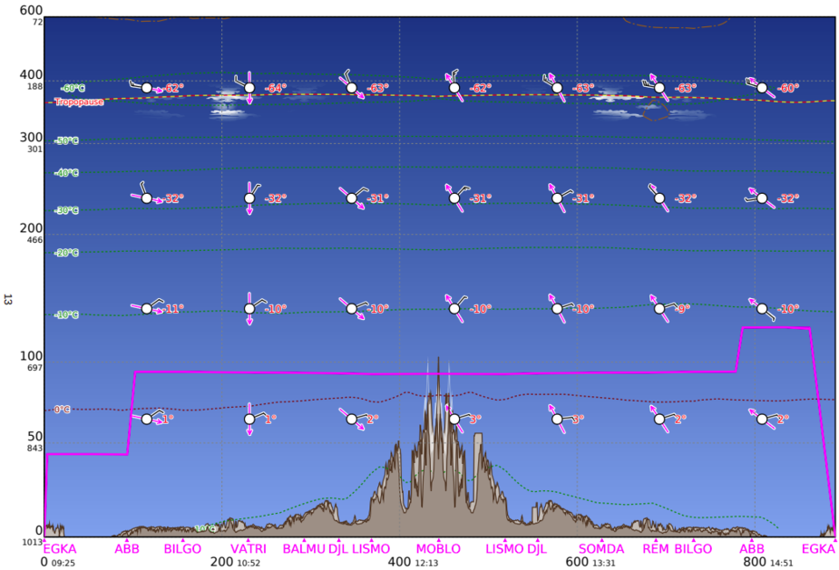
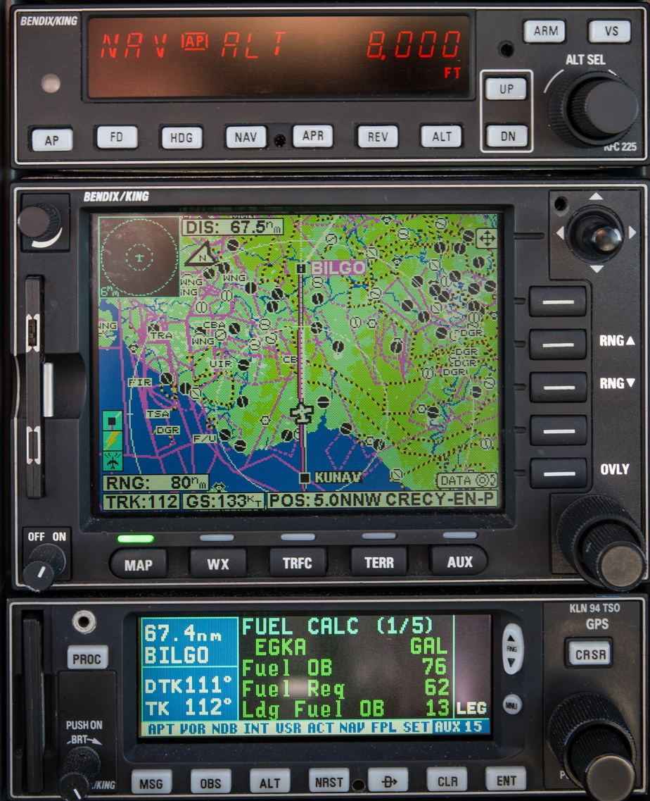
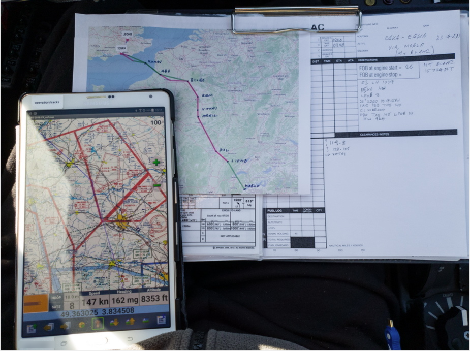
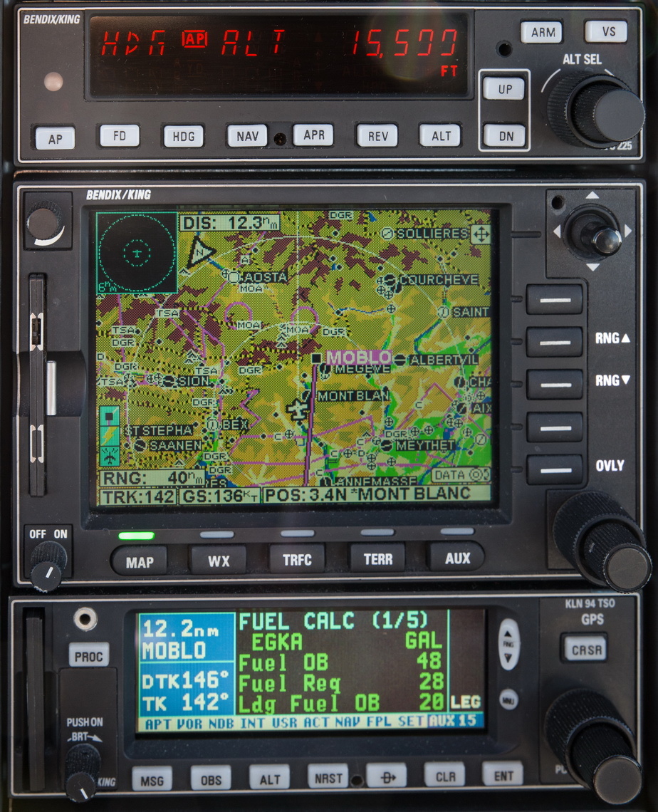
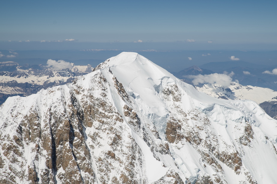
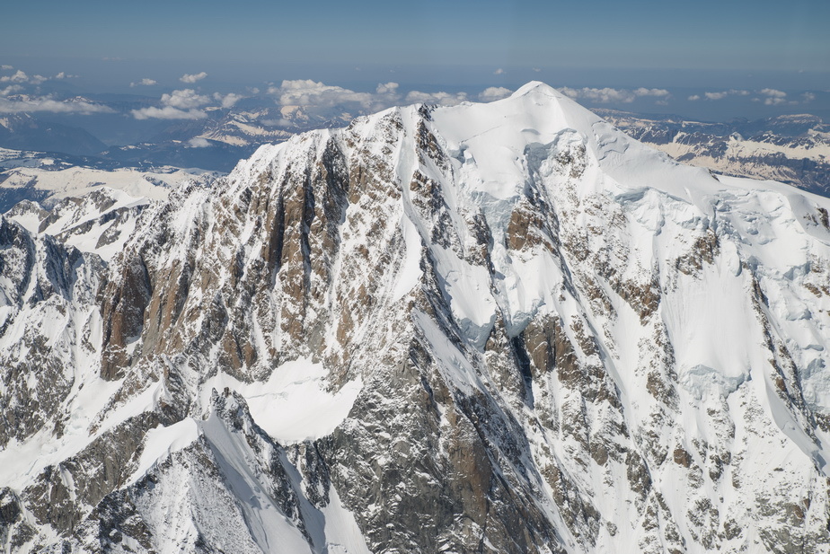
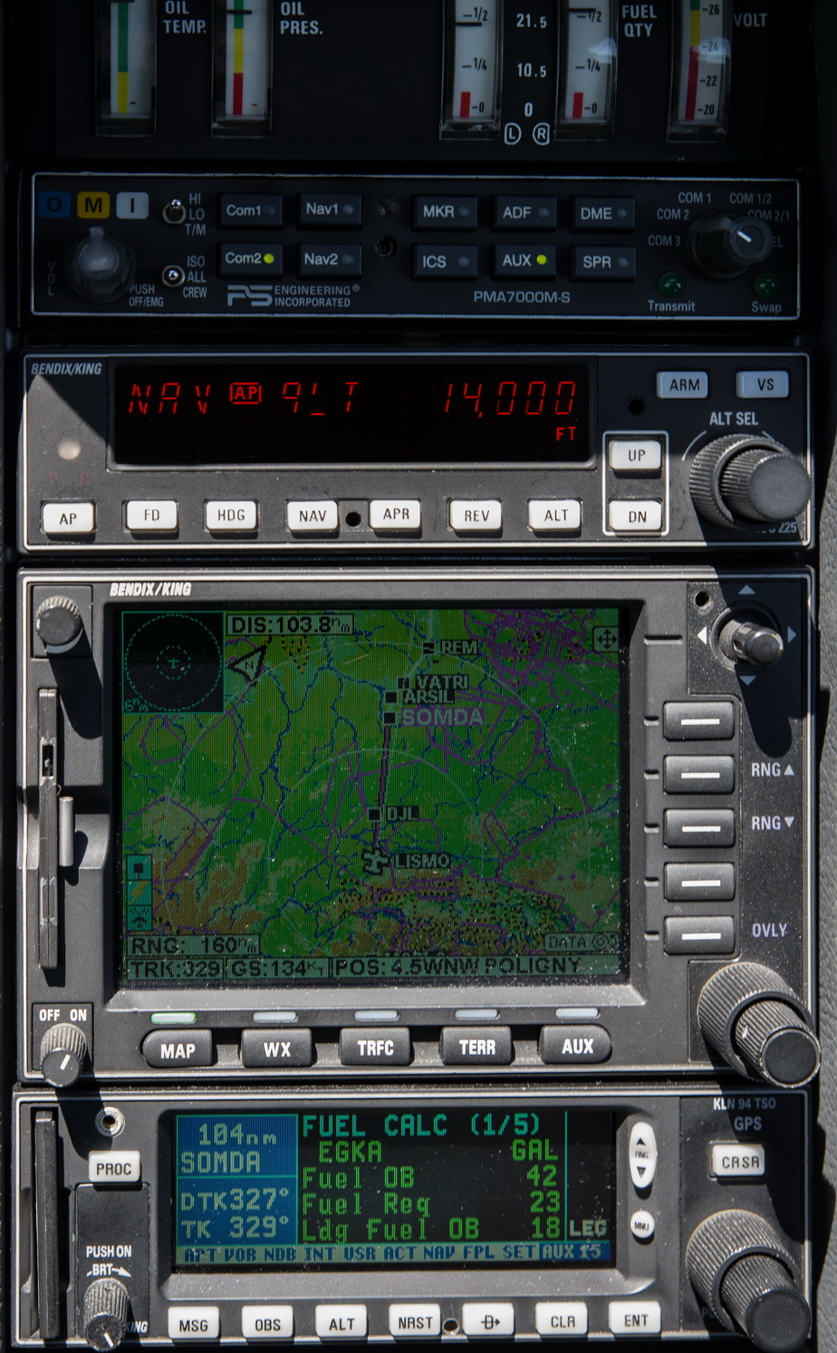
Fairly minimal planning involved here. The French or Swiss VFR chart running on a tablet, under Oziexplorer, for emergency purposes. Obviously 100% GPS… that discussion left the harbour decades ago. The flight was filed IFR but would need a VFR section for the Mt Blanc bit due to being way below the IFR MEA of FL180. The summit is 15774ft, and GPS altitude would be initially used to go ~1000ft above that. FL160 would deliver something like 16500ft (actually 16700ft on the day).
Halfway down, around zero wind, and the LFOB figure of 18USG turned out to be an accurate prediction
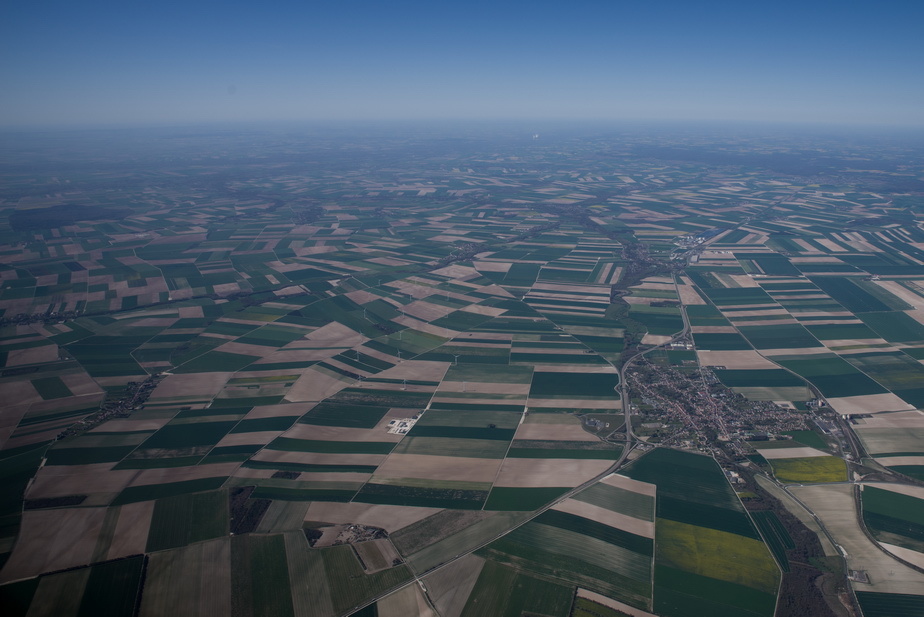
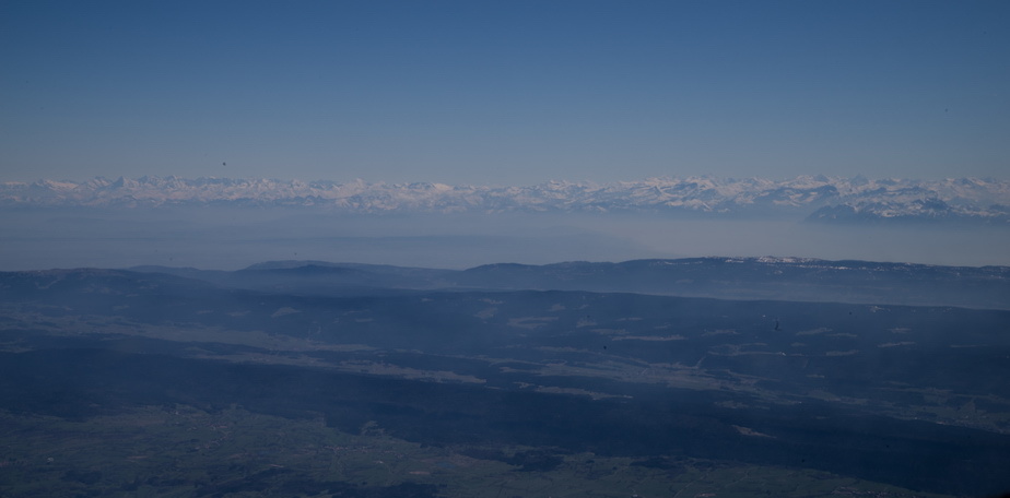
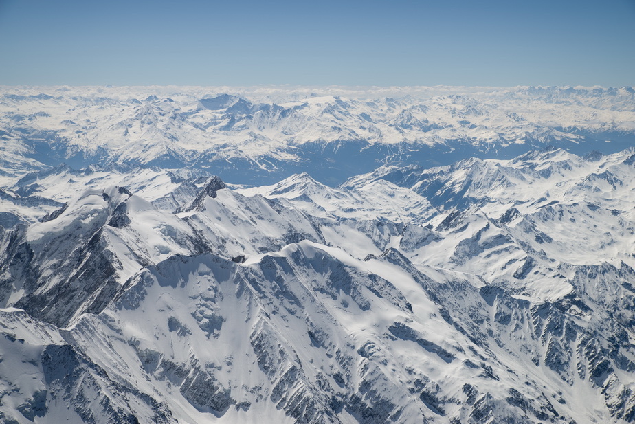
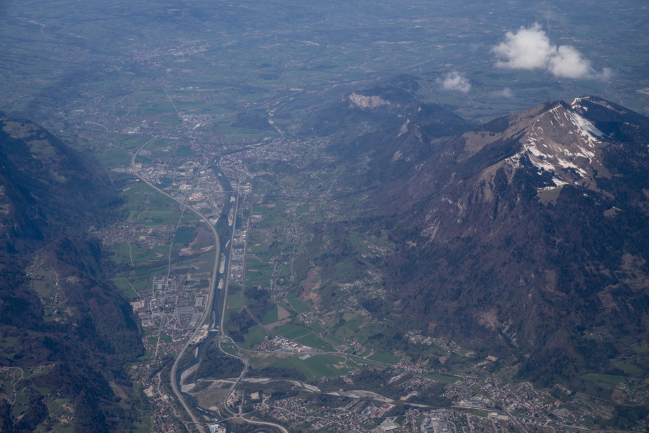
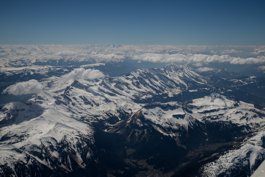
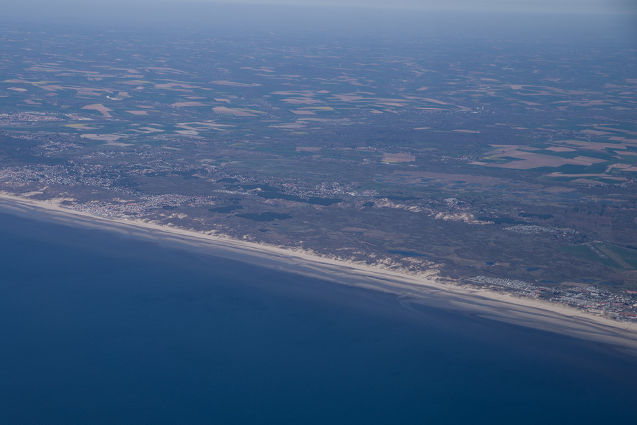
This is what most of the upper 2/3 of France looks like
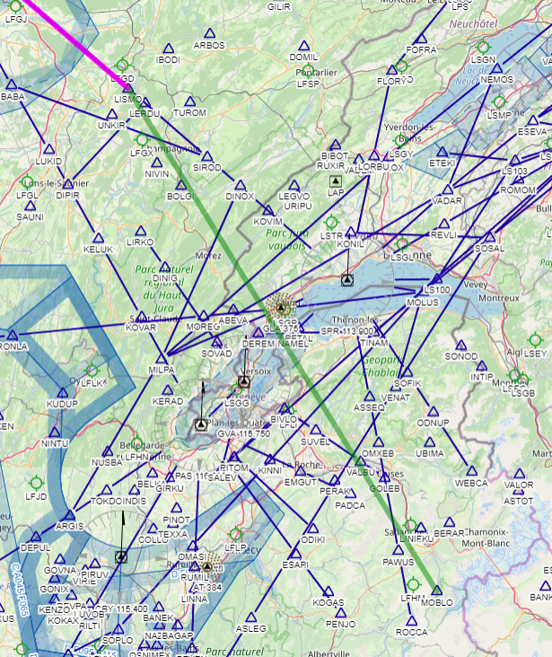
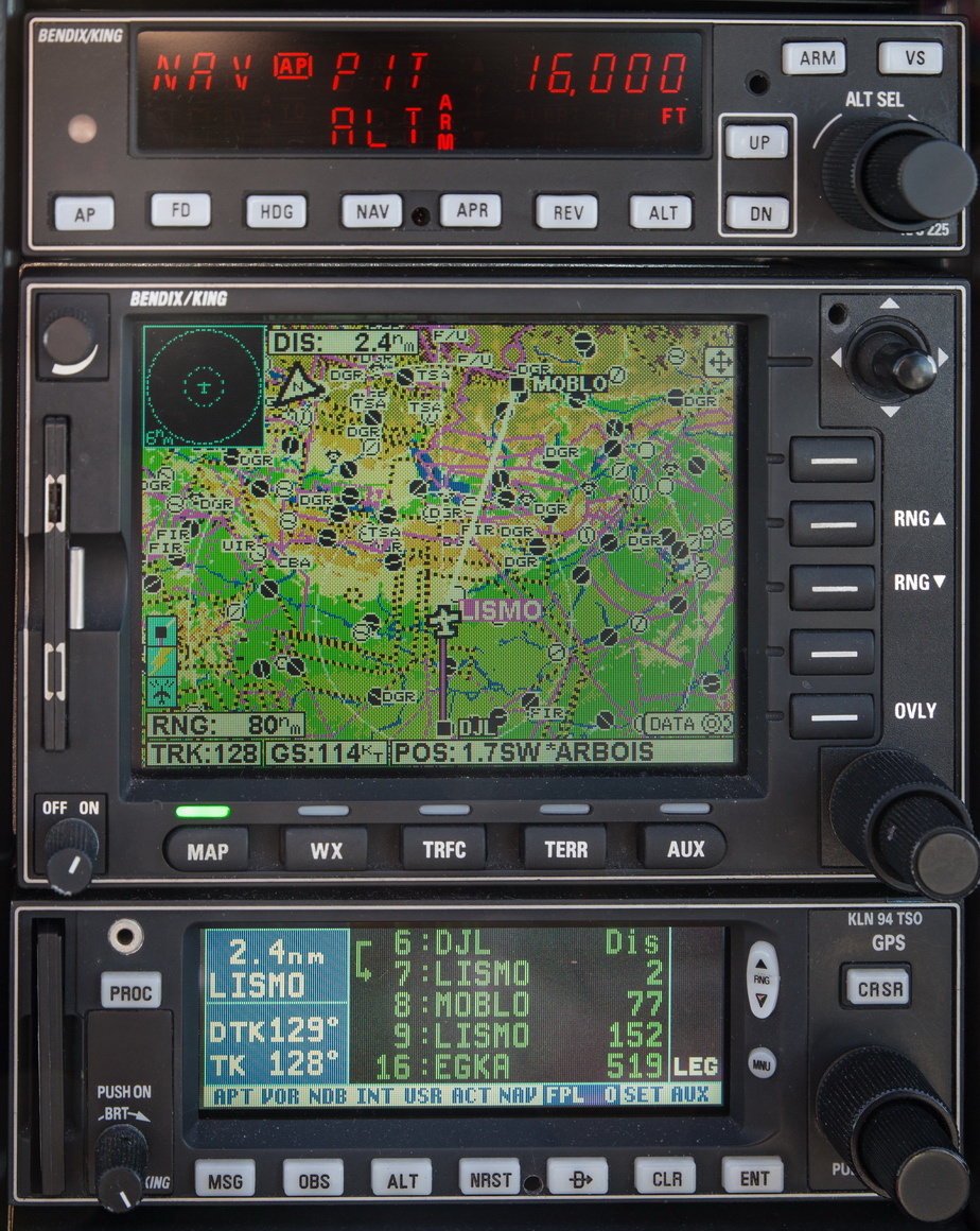
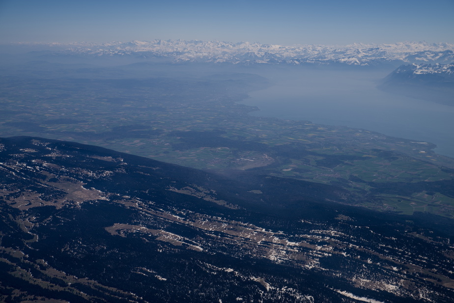
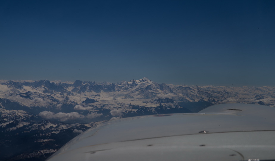
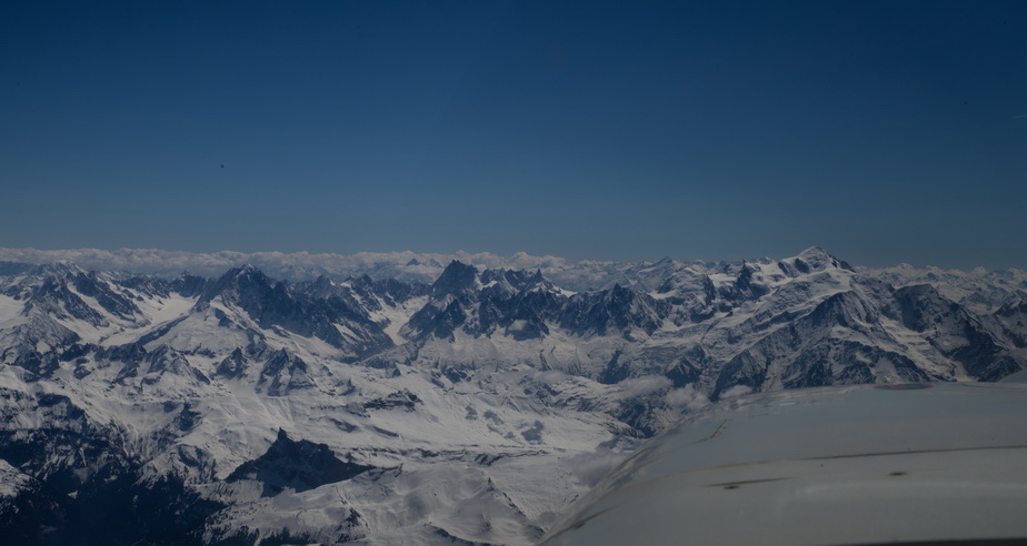
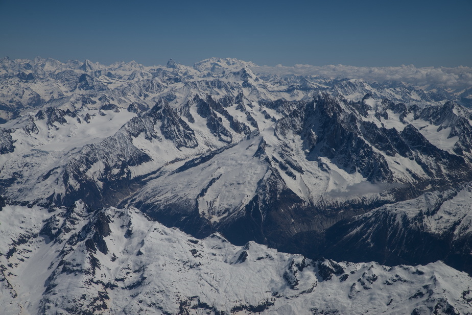
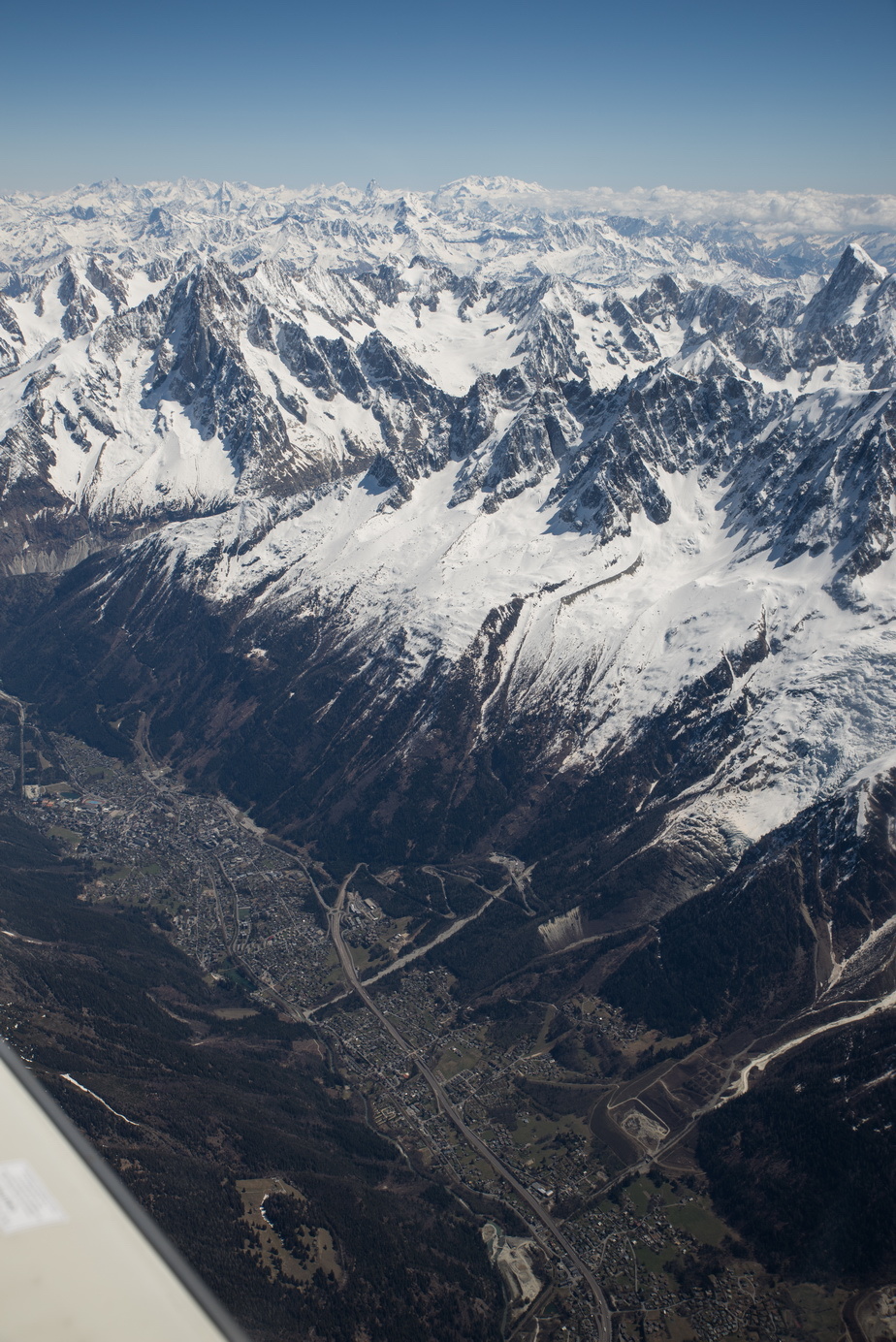
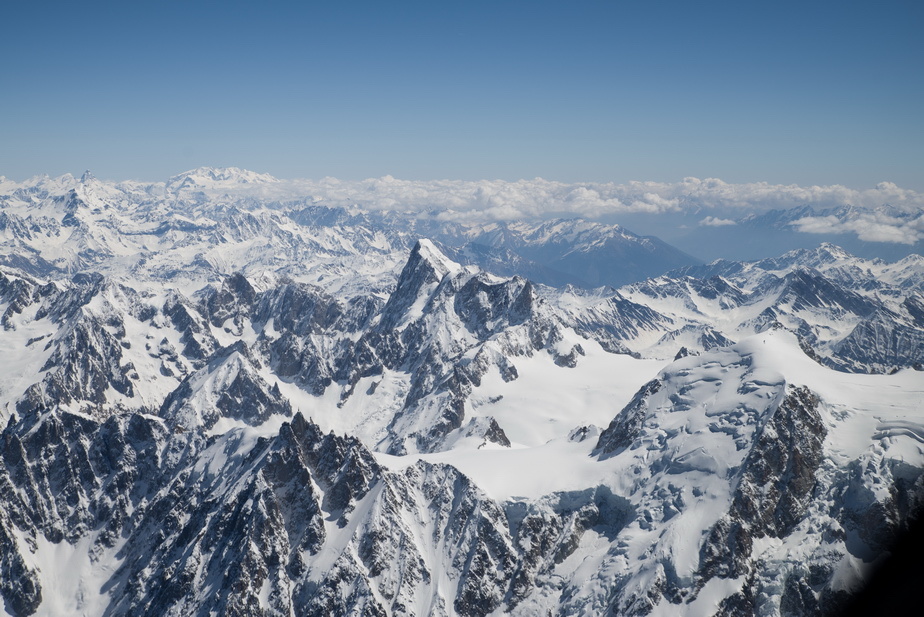
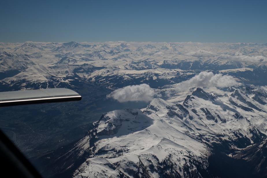
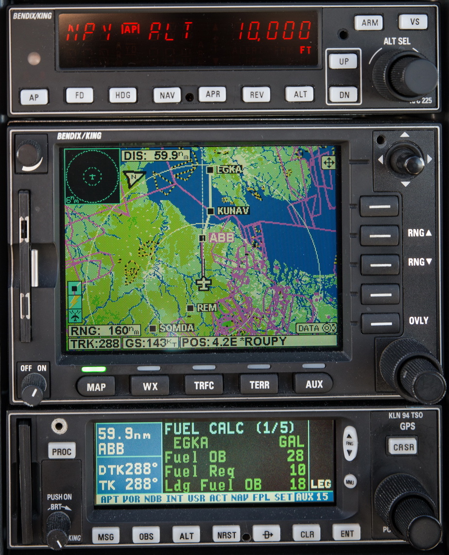
Near the Alps, climbing (in PIT mode) to FL160, and it will be time to cancel IFR soon, but best to to it as late as possible because once VFR, ATC are not obliged to look after you for DA R P etc avoidance. But on this occassion Swiss ATC were outstanding (they are usually very good) and confirmed “everything is coordinated”. Of course I was recording the audio  And the video, with my external X3000 camera – that will be posted later when I’ve had a chance to edit it. The tablet records the GPS track. The video and audio are synced by starting both at the same time (not good enough for lip sync but I don’t film myself ). ATC asked me to not deviate to the right of the track, due to traffic, initially. Mt Blanc is slightly left of MOBLO
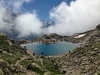
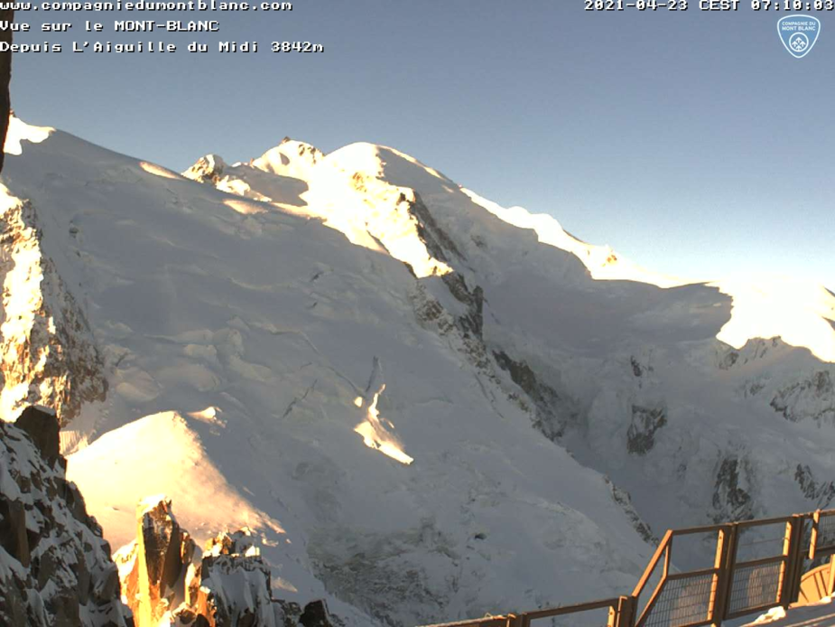
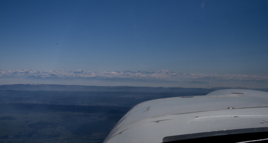
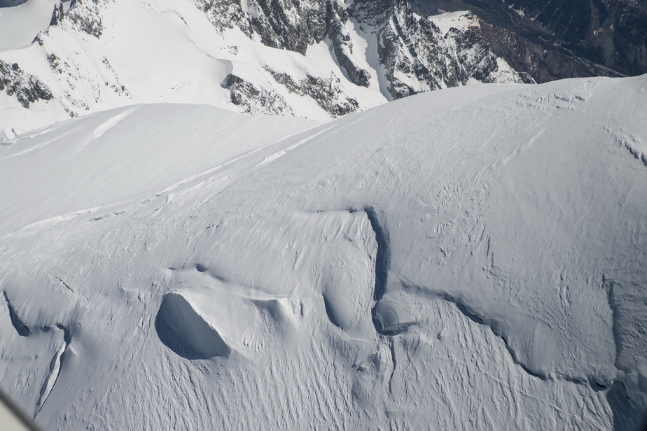
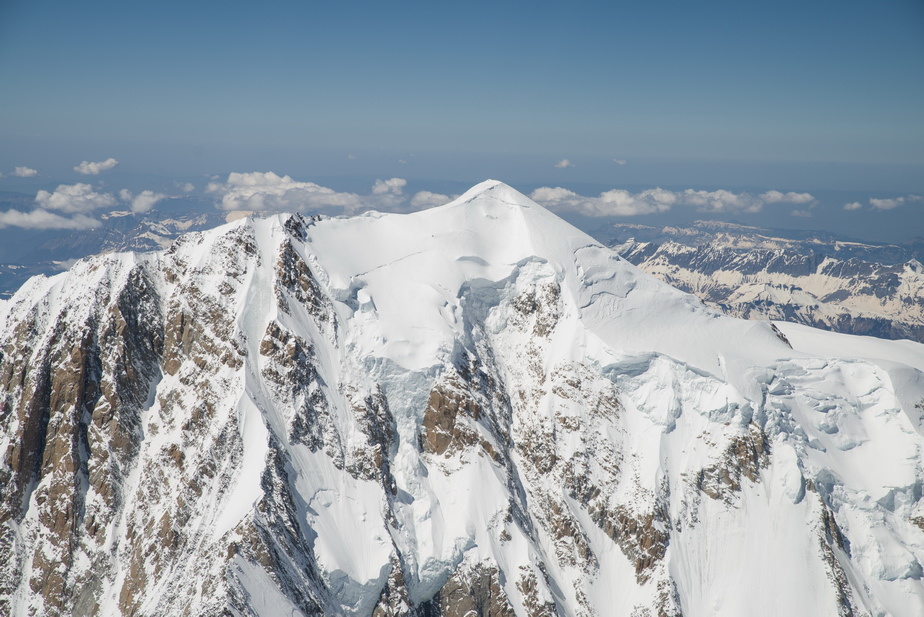
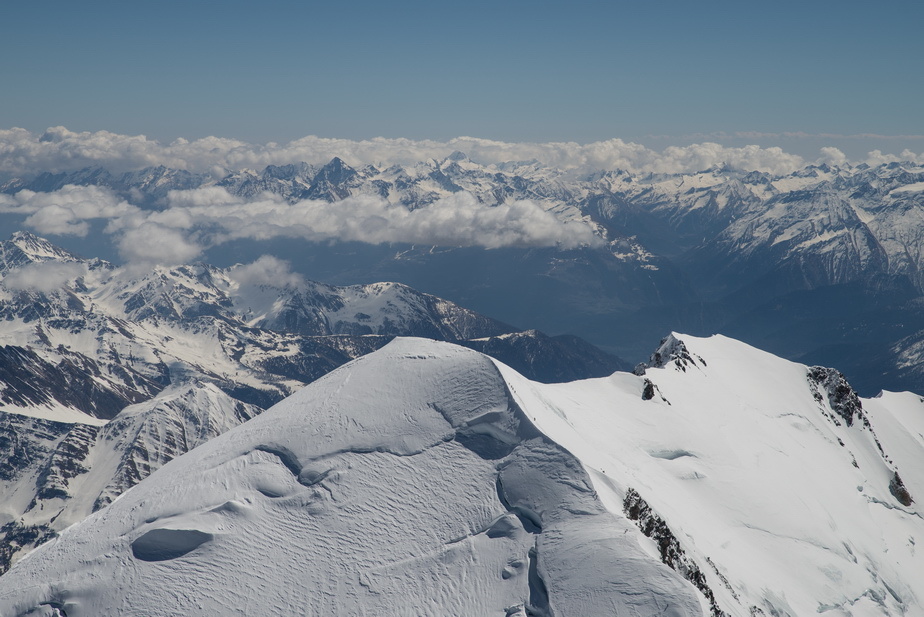
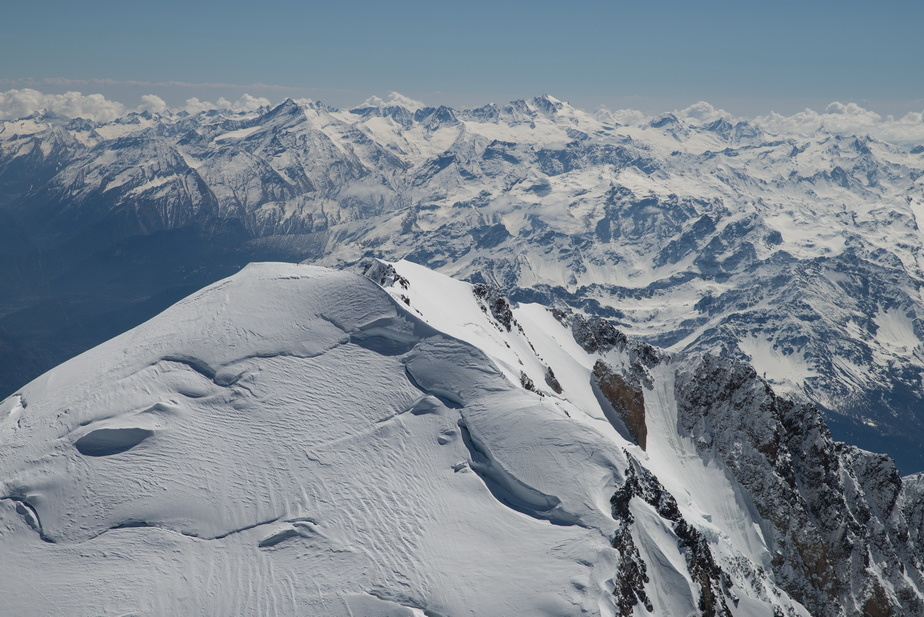
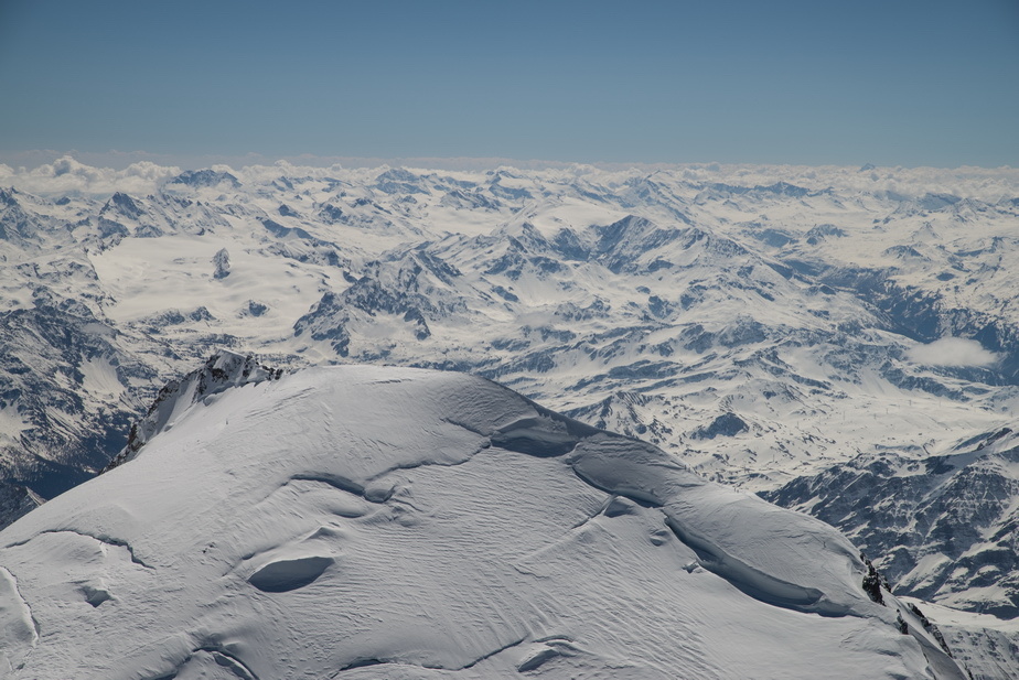
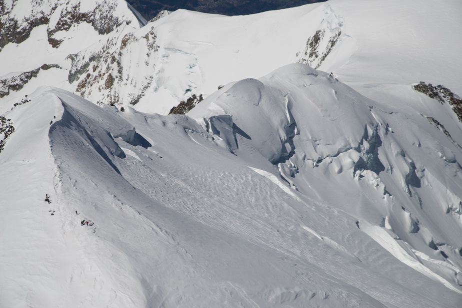
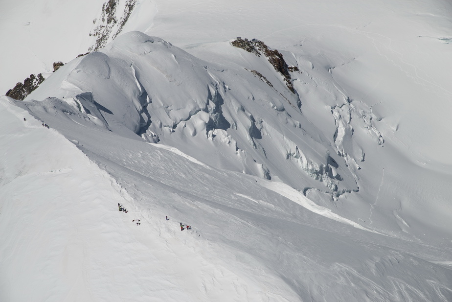
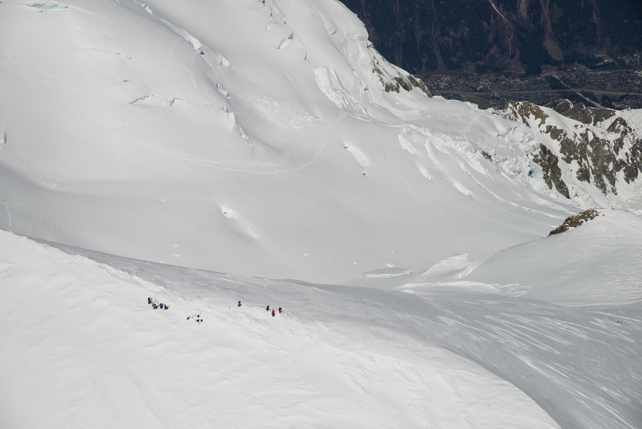
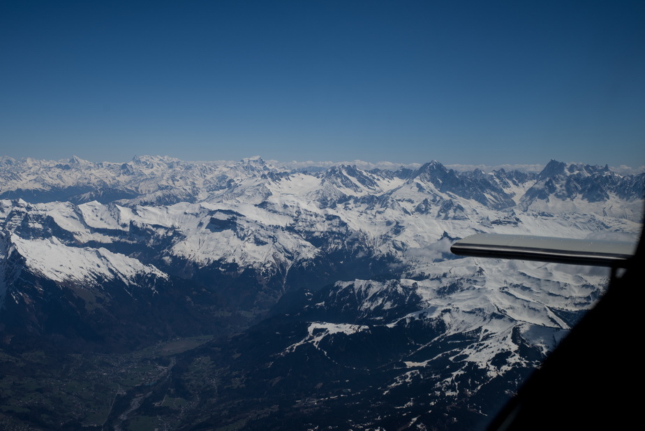
Very obvious where it is
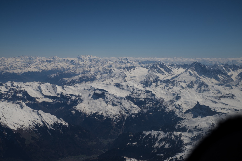
The GPS map was used to get the precise track to the summit, with some crosswind around
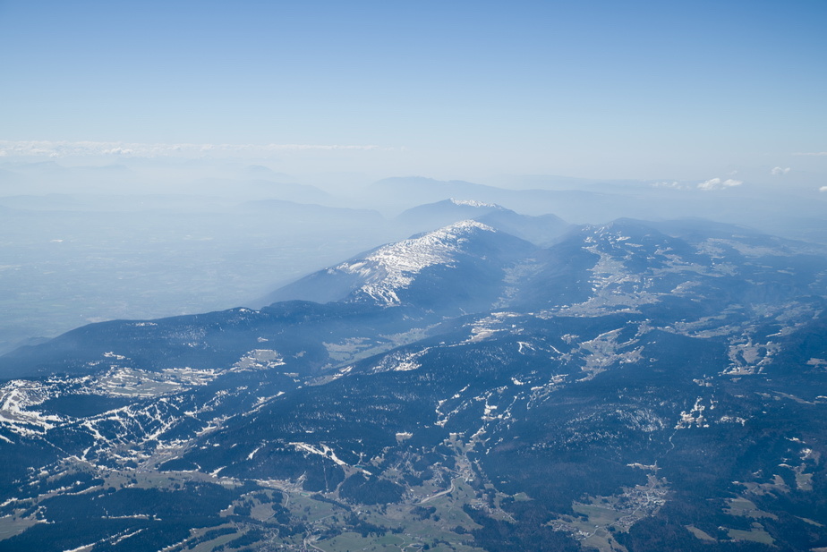
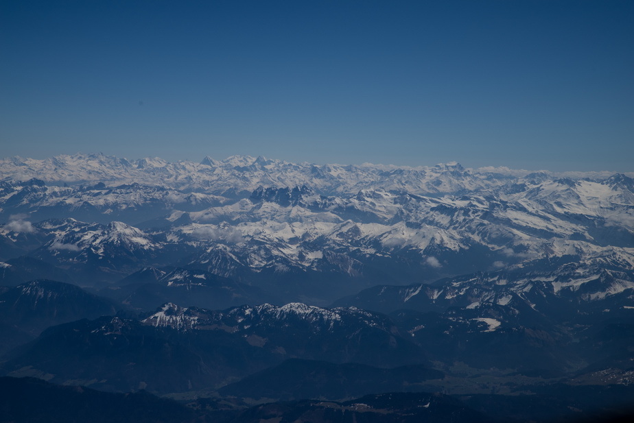
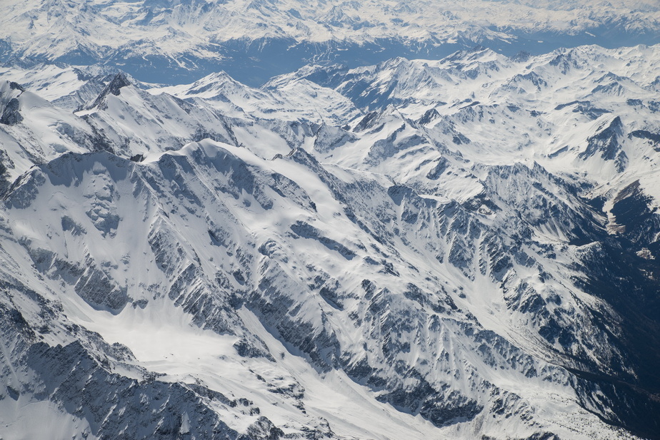
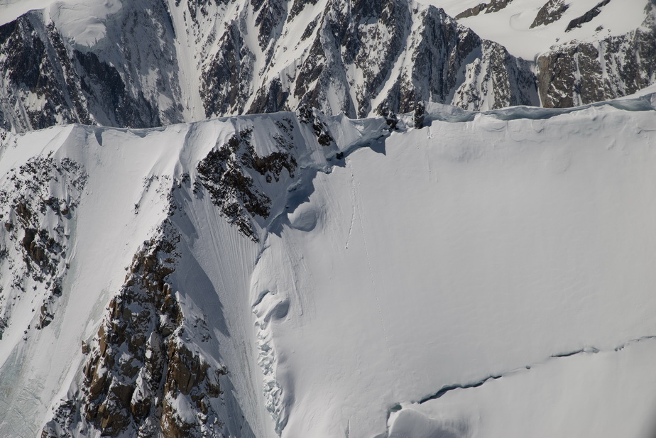
Much of the snow seen a month ago on the Eiger-Jungfrau flight has melted
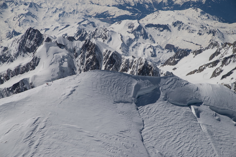
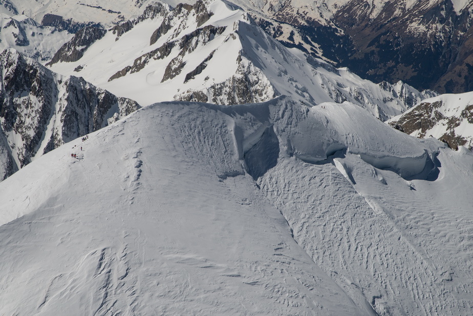
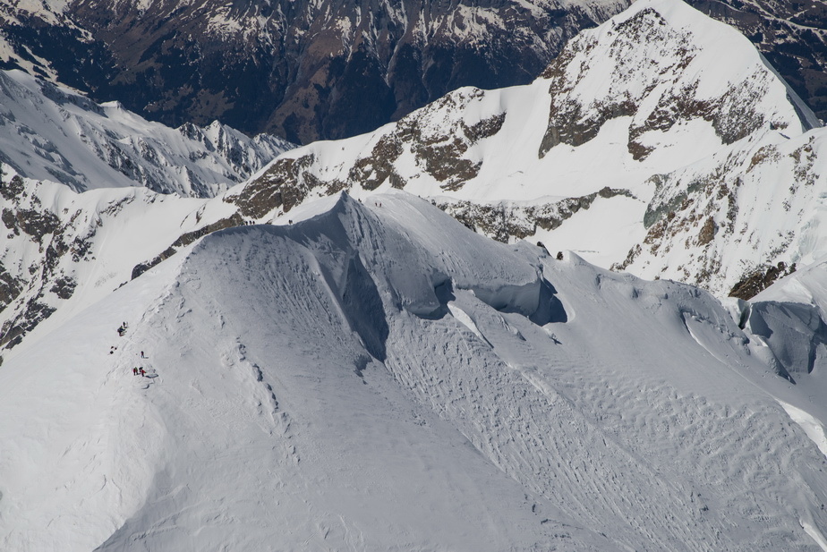
That is actually 16500ft; the display multiplexing is missing a segment, even though I normally use a 1/80 shutter speed. Maybe 1/60 will show everything. Actual altitude is ~700ft i.e. 17200ft which is 1500ft above the summit
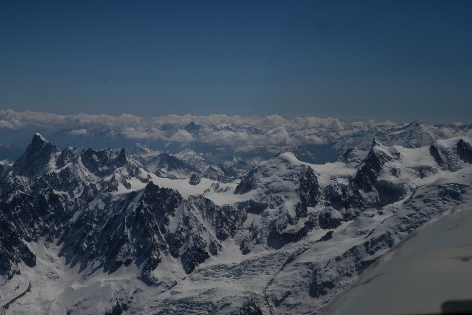
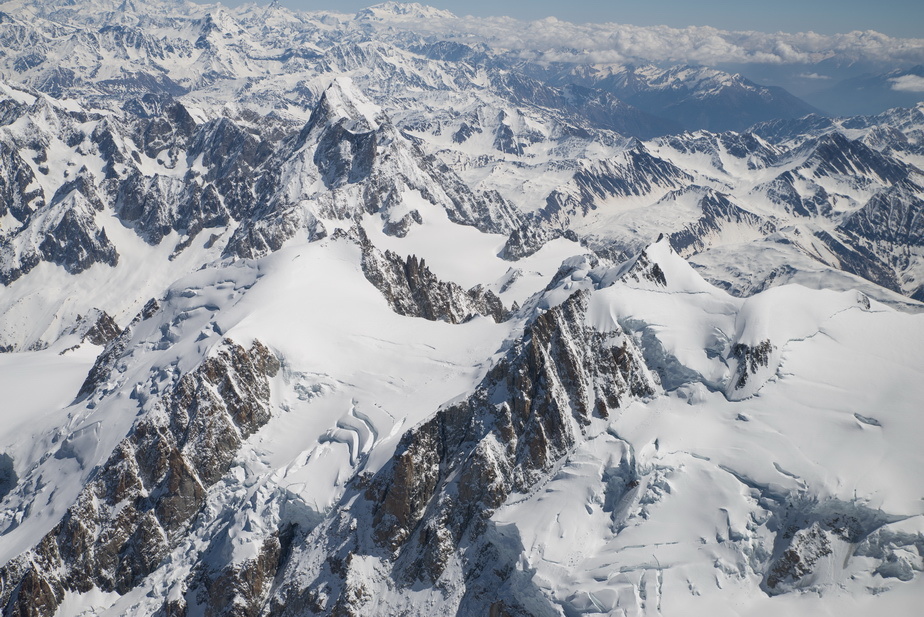
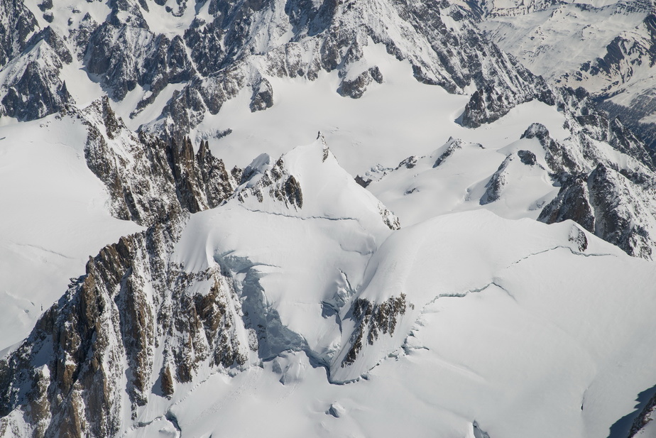
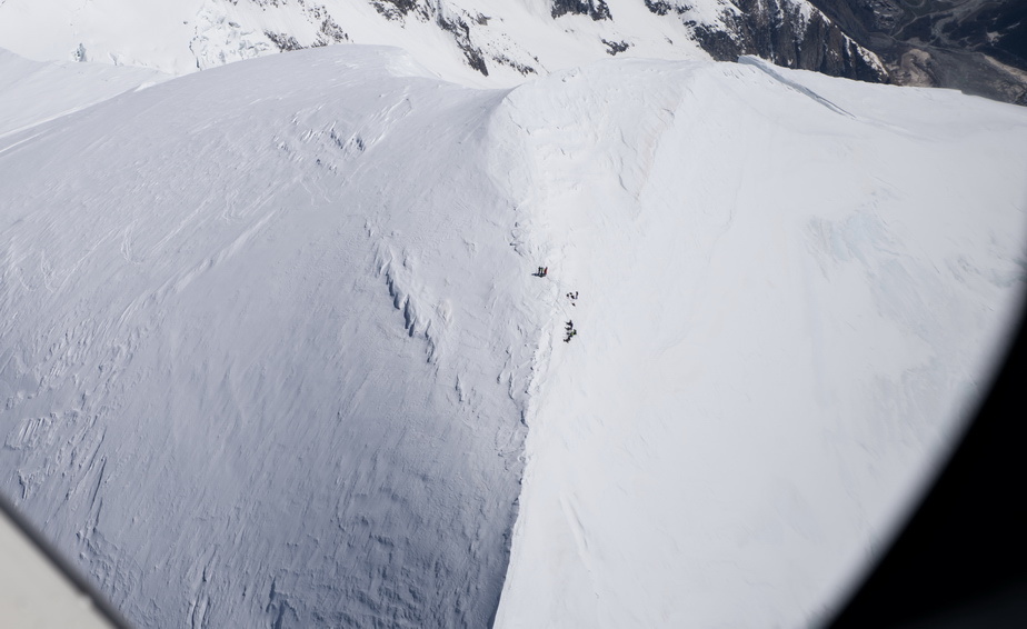
The video will deliver the best summit pics because I could not shoot straight down but here is a series of pics. I crossed the summit twice and then flew around. There were climbers on top
With finite fuel, time to go back home
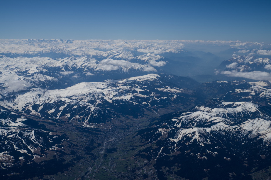
Goodbye Alps!
The winds didn’t cancel out… the earlier headwind wind just dropped a bit and changed direction, so I got headwind on both routes But only 5kt or less. It was forecast to turn into a tailwind later so I stayed at FL140 but it never happened, so eventually I started to descend
No shortcuts allowed by French ATC. Paris TMA totally no-go and all military airspace totally active It is clear that they don’t even bother to check nowadays; there seems to be a “non-relationship” between these units.
With 3G/4G connectivity sporadic at best, I used the excellent Golze ADL150 to get updates on the selection of UK airports. All were CAVOK. The ADL gets your GPS route via an RS232 connection and radiates all the stuff to the client device via WIFI. At €25/month it is the best money you can spend on your plane
Nearly home. Zero wind here, and we are back to LFOB of 18USG.
N French coast, looking back. Lille were quite proactive in telling me I have to descend below FL065 for the UK. The actual airspace is base FL075. I had a little conversation with them on the topics so well known here on EuroGA i.e. a handover to London CONTROL preserves your IFR clearance whereas a handover to London INFO silently terminates it and you get busted by the CAA I think, after 10-20 years, this has finally sunk in and they understand this, but still today a foreign pilot, handed to “London 124.6” would bust the FL075 UK CAS at FL080+ so now, 2021, they are instructing a descent to FL065. I guess [the CAA man who demanded his name removed] looks at whether the pilot is UK based and can thus be sent down to gasco, and foreigners are left alone They must have got a LOT of these busts…
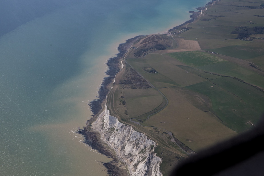
The cliffs at Beachy Head, from around 4000ft
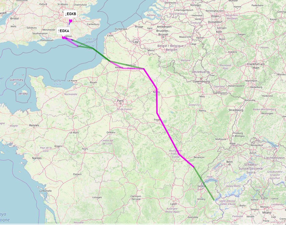
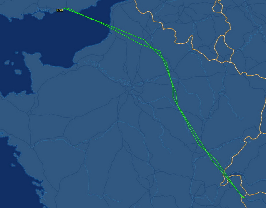
The Flightaware route. It even shows the details of the loops around the summit
Landing LFOB was 17.9 USG. Usable fuel is 86.2 USG. Airborne time 6:25.
Amazing wx. The pressure at Shoreham was very similar to the pressure around the Alps. It reminds me of the great summer of 2003 when I flew Shoreham to La Axarquia (near Malaga) and the pressure was 1013 all the way down. That was all VFR (no IR then) and I had a big box of Jepp paper charts and on a route like that I just worked through them one after the other.
Brilliant trip, and I wish I had bigger tanks. The Matterhorn summit is not safely doable on a EGKA-EGKA flight but I will do it as soon as I can “go somewhere”. Croatia is soon opening up to vaccinated people and the UK will have to lift its quarantine requirement to suit. The govt here is waiting for public opinion to shift on the vaccine passport issue which is being turned into a political football by the civil liberties / anti-vaxxer crowd.
The TB20 is an outstanding aircraft Very comfortable for 7hrs. Oxygen (MH system, two O2D2 regulators) was used all the way and hardly any was used up; maybe 10% of the 48 cu ft composite cylinder.
Video coming up in a few days