Niner_Mike wrote:
I can see how you can be lulled into flightplanning to pass the pass at 6579ft (highest point) or 6800ft (reference altitude GAFOR route)
Actually, I can’t see the big problem here. The pass is at 6579ft, add 500 and Bob’s your uncle. Perhaps not the wisest thing to do, as you won’t know the actual wind situation up there, but doable. I’ve flown plenty in Alpine valleys and it’s no big deal, if (and that’s a big IF) you are familiar with the terrain and know what you’re doing, especially wrt the performance of your airplane. TBH, I’d be much, much more worried about powerlines and other cables and prefer to be high.
So it would appear that poor JG planned to cross the pass rather low(ish), but couldn’t get the required performance from his airplane. or simply waited too long to initiate the climb….
Niner_Mike wrote:
I believe SD should give some more background info on what is “reference altitude”, and might consider adding the minimum crossing altitude to their charts. I wrote them an email.Fully agree, thank you for your effort. The Swiss ICAO-chart is very clear about the minimum (recommended) altitudes on their main VFR-routes (Simplonpass = 8.300 ft minimum). This should also be part of the standard information in SD…
WarleyAir wrote:
Feet and Mitres (reference mainly Swiss charts).
where did you find aviation maps in meters in Switzerland ??
Unless you fly with road maps?
Silvaire wrote:
2000 ft above the highest peak in the area is my preference
That usually means a ceiling way up there (clear blue sky essentially). It is also my preference, or 500-1000 feet depending. The problem is the clear blue sky thing. That doesn’t happen every day, so it becomes more of an ideal than a working principle. In Norway we got the coast with the sea at, well – sea level. You can fly there between mountains using ancient lighthouses to navigate (they are depicted on aerial charts) even at ceiling down to 500 feet. If you were to fly 2000 feet above the highest peak, it would mean 5-8000 feet ceiling. There wouldn’t be much flying with such a restriction.
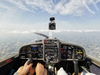
Flying inland is different. There usually is no other safe way than to follow roads and valleys (main roads tend to go down in the valleys), and then you do fly down into them, unless clear blue sky of course. In the Alps there is an additional problem with altitude and performance. Flying above 8000 feet in a non turbo, low powered airplane becomes difficult due to the lack of climb performance. From the top of my head, I would say it’s just plain stupid to fly that high with mountains around, because you have no climb performance left. Climb performance is probably the most important tool you have in the mountains (inland). I would rather go as low as possible than as high as possible. I would probably do like that picture earlier.
I have never flown in the alps though, but unless you have ample performance (turbo and/or a large engine and/or a TMG), I can’t understand why you would fly as high as possible rather than as low as possible.
“I can’t understand why you would fly as high as possible rather than as low as possible.”
You fly straight at 2000ft higher than the peak along the route, then it does not matter which weather you are in or you have a moutain training or what is under unless engine quits,
If you can’t, be aware about claims of other pilots who told you they have flown it under MSA (Brenner at 4500ft), they either know the risks and how to mitigated them or they were just betting too muck on their luck that day….and there is a high element of luck with low flying near terrain, so better done at sea level, preferably with the sea itself on one side
FWIW:
In my experience, mountain pilots in the French Alps (including training flights to glaciers and altisurfaces) often cross ridges at 500-1500 ft (or even below, depending on aerologic and thermal conditions).
Obviously goals are different here (flying within the Alps, as opposed to crossing them), but it shows what is possible to do relatively safely in that environment, with some training and experience. Quite some activity with low-powered aeroplanes (100 hp) … In fact, in my little Jodel D11 I often need to utilize ridge lift or thermals to help my climb rate when flying in summer — and avoid downdrafts.
where did you find aviation maps in meters in Switzerland ??
The glider charts use metres for vertical distances.
See the legend in the documents box at the bottom of this Swisstoto page (link) (pdf link). local copy
LeSving wrote:
I can’t understand why you would fly as high as possible rather than as low as possible.
Having had all my training for the PPL in the Alps and flying there regularly I can’t understand why flying as low as possible could be you choice.
As Gigicret stated: Speed is credit – altitude is cash. In a recent flight over the Aletsch glacier and passing the Jungfraujoch what I look out for a lot is a place to land if the engine quits and if you just keep low your options are fewer, you have less time and surprises in winds can reduce that time even more. And plan climbing accordingly with an escape route. 
Comparing local mountain flying and low level alps crossing while touring is like comparing a 500ft scud running for 100nm vs bad weather circuits, there aren’t many instructors alive who can teach you the former :)
The main problem here is high DA that deteriorates engine and lift performances. If you are confident in your engine, temps are low and wind is fine, you may allow low altitude, 500ft to cross a pass. In our case we are far from it. Weather was clear, but Swiss agency warn for a high DA, but the wind is known at the last moment if you can detect it, and engine management is crucial. And plan an escape route.
I am looking forward for mountain rating but recent changes in the attribution of mountain instructors may be a problem. Lots of them did loose their rating except those located in some alpine places…