You can see such patterns during anti-rabies vaccines dropping but types are more likely to be C172 or similar.
I was told by one such pilot that the vertical tolerance is 25ft and lateral 50ft
Peter_Mundy wrote:
They do require very accurate flying so lots of concentration.
Garmin GTN units support automatic navigation along a parallel-track survey pattern as a paid SAR option. It also includes circular orbits, sector search around a point (roughly like a radioactivity hazard sign), and spirally expanding square orbits. Avidyne mentioned it as well, but I am not sure if it’s already available.
They do require very accurate flying so lots of concentration.
I’ve seen a lot of flights like that on the French atlantic coast, south of Bordeaux – iirc a Cessna 208. I assume it’s some kind of survey. Must get quite boring to fly!
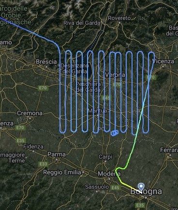
Those are just survey flights. Either aerial pictures or Lidar (elevation data).
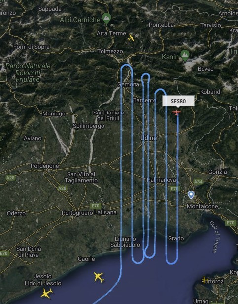
@lukepower looks like floor heating to me. Is this reconnaissance flight? During Covid (when most of the flights were cancelled) the police did some similar flights using a Partenavia 68 over the Frankfurt area to do some new measurements to improve GPS approach accuracy. This went for weeks.
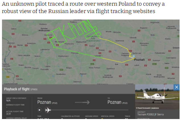
This is a good one